


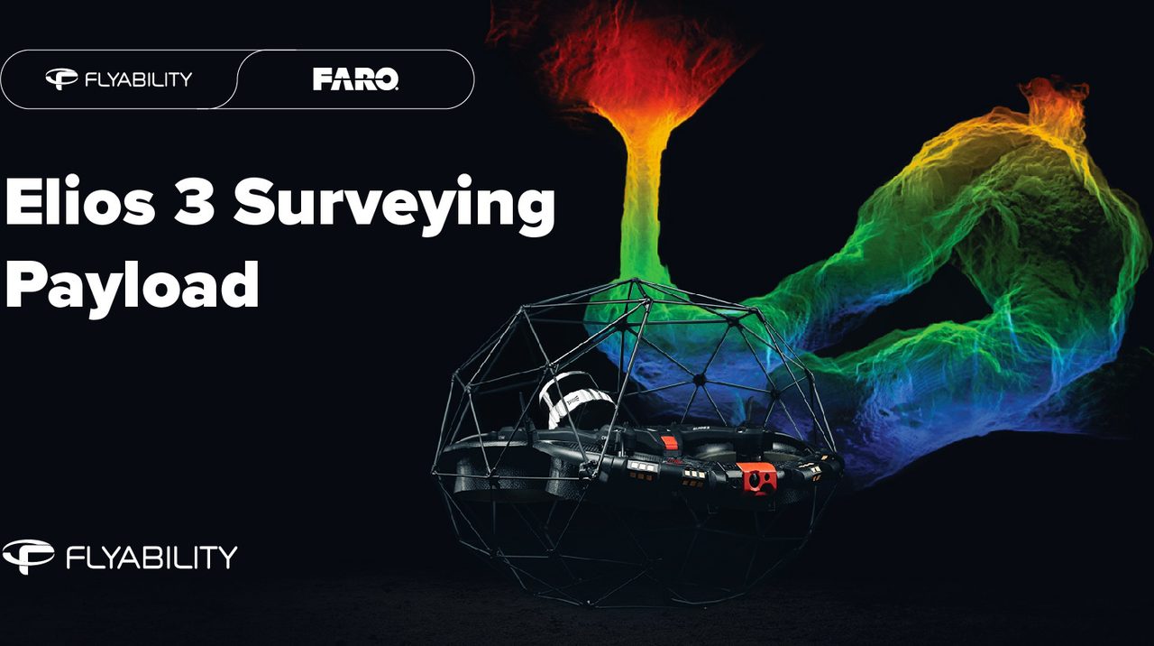
Flyability Elios 3 Surveying Payload
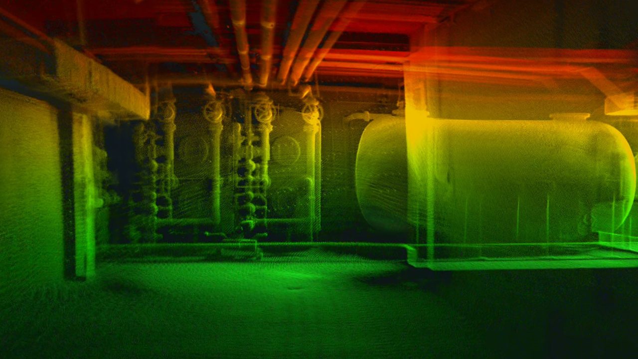
The Elios 3 Surveying Payload turns the Elios 3 into a flying mobile scanner that creates centimeter-accurate 3D scans of the most inaccessible spaces. Combining the high-resolution Ouster OS0-128 Rev 7 LiDAR with FARO Connect’s leading SLAM, it captures survey-grade point clouds from 0.1% drift — turning days of mapping into a 10-minute flight.

Survey-grade 3D point clouds
Every flight becomes a dense, colorized 3D point cloud — a detailed digital twin of the most complex and inaccessible spaces, ready to measure and report on with centimeter detail.
Centimeter accuracy in tough spaces
The Ouster OS0-128 Rev 7 LiDAR paired with FARO Connect SLAM delivers ±6 mm precision and accuracy from 0.1% drift, even in GPS-denied, feature-poor environments.
Scan a whole space in one flight
Fly the caged Elios 3 through galleries, tanks and voids and let it scan continuously — turning days of terrestrial setup into a single short flight.
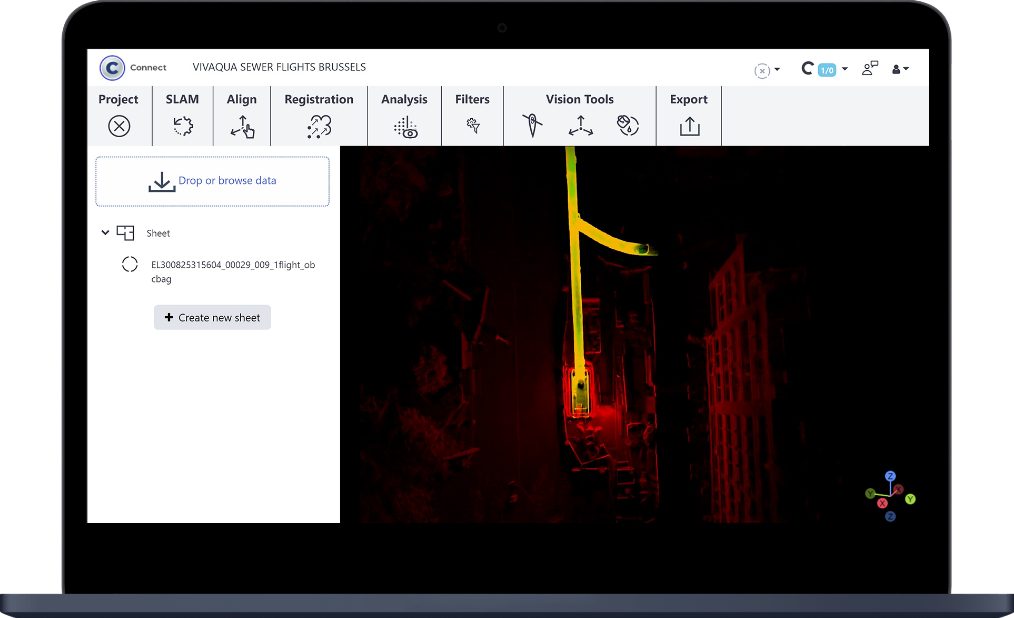
Process in FARO Connect
Export to LAZ, LAS, PLY, TXT or E57 and process directly in FARO Connect — a streamlined path from flight to deliverable in minutes.
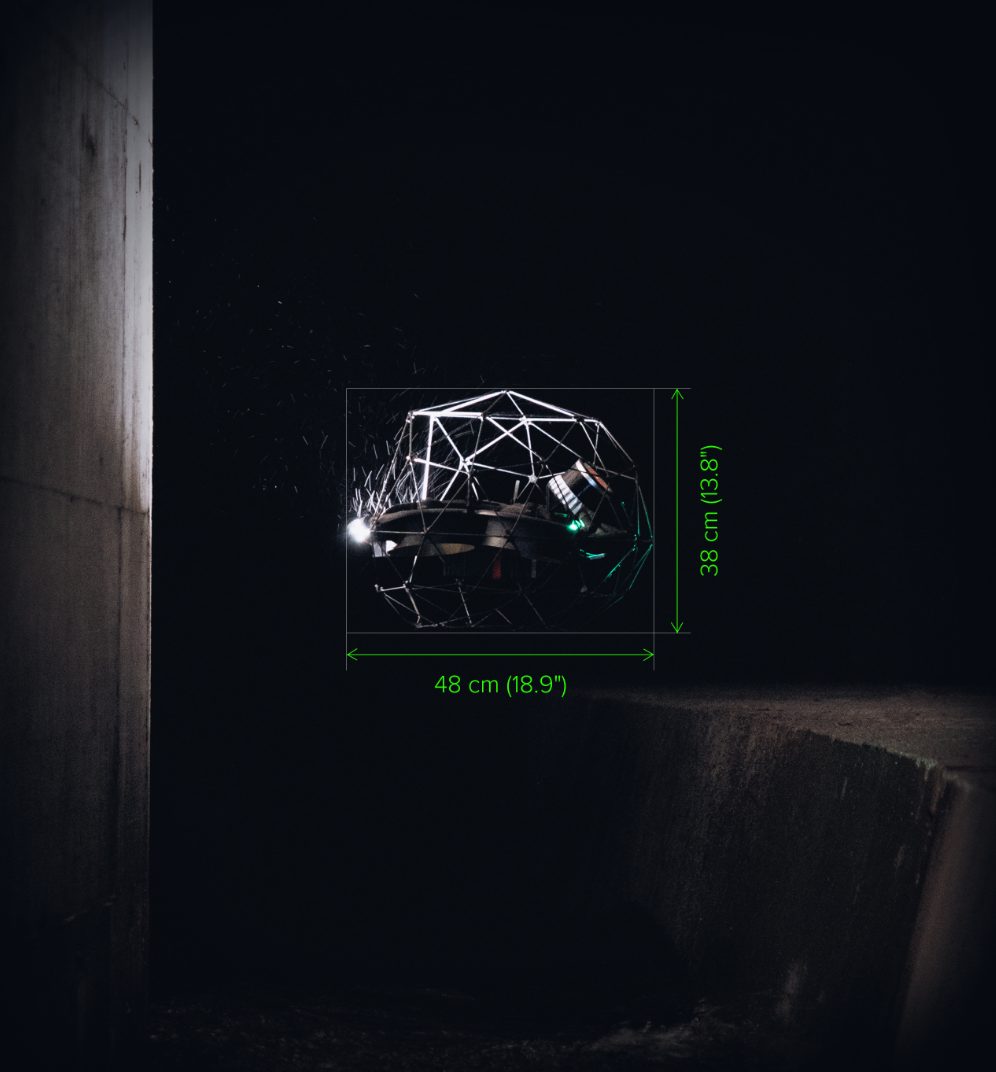
Reach the truly inaccessible
Fitting through a 50 x 50 cm opening, the caged Elios 3 maps confined galleries, ore passes, tanks and voids that no terrestrial scanner can safely reach.
Technical Specifications
| LiDAR Sensor | Ouster OS0-128 Rev 7 |
|---|---|
| SLAM Software | FARO Connect |
| Range | Up to 100 m (80% reflectivity) |
| Scanning Rate | 1,310,720 pts/sec (~1.3M) |
| Precision (1σ) | ± 6 mm |
| Precision (2σ) | ± 12 mm |
| Accuracy | From 0.1% drift |
| Photon Sensitivity | 10x vs standard configuration |
| Max Flight Time | ~9 min |
| Max Altitude | 2,700 m AMSL |
| Export Formats | LAZ, LAS, PLY, TXT, E57 |
| Minimum Opening | Fits through 50 x 50 cm |
| Brand | Flyability |


