


Sniffer4D Nano 2 Plus Multi-Gas — Configurable UAV Air-Quality Sensor
Developed by AIRINS (formerly Soarability), the Sniffer4D Nano 2 Plus Multi-Gas is a lightweight, drone-mounted multi-gas sensor with up to five internal module slots you configure for the gases that matter to your mission. It maps air pollution, monitors ambient air, surveys gas facilities and landfills, and supports HAZMAT response — all geo-referenced and visualized in the AIRINS.ai platform.
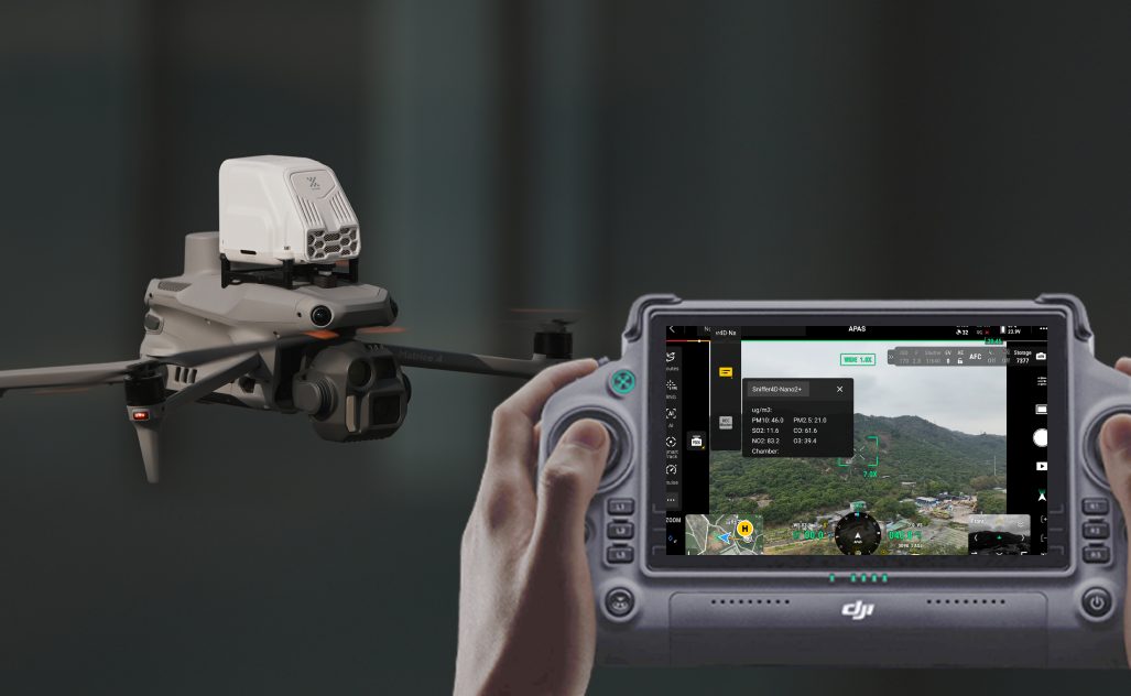
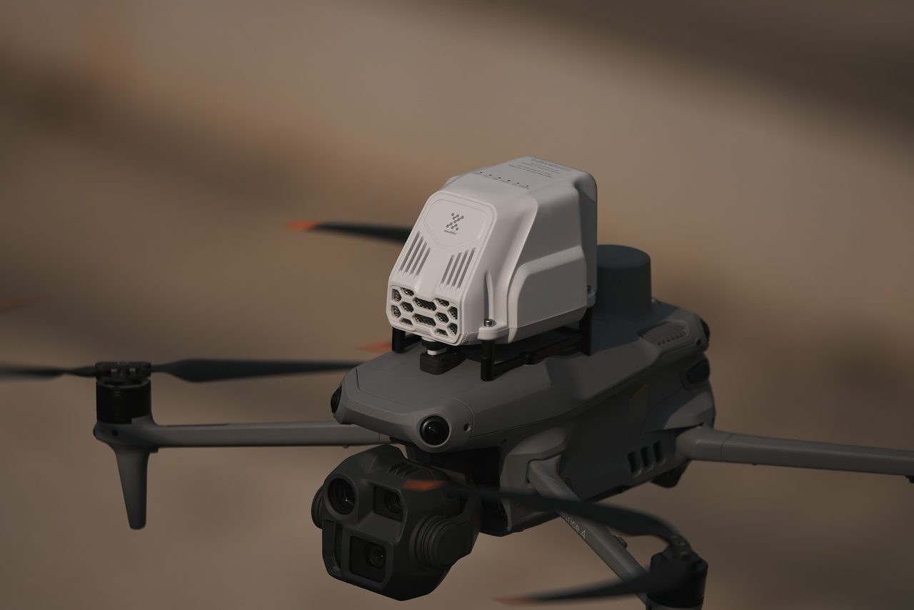
Sniffer4D Nano 2+ & DJI Dock3 & DJI Matrice 4 Series
Configurable Multi-Gas Sensing in Flight
Fly a routine mission while the Nano 2 Plus samples your chosen gases in real time and geo-references every reading, building a live picture of air quality across the survey area.

Up to Five Sensor Modules — Your Choice
Populate five internal slots with the modules you need: PM 1.0 / 2.5 / 10, O3, NO2, CO, TVOC, SO2, H2S, NH3, HCHO and more — reconfigurable as your monitoring program evolves.
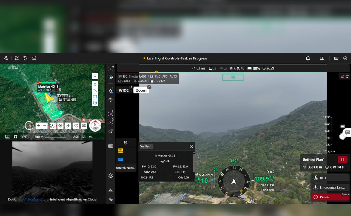
Real-Time Display & Control
Live readings and full system control run through the DJI Pilot App, with fleet operations and data review available in DJI FlightHub 2.
Autonomous & Fleet-Ready
Pair with DJI Matrice 4D / 4TD and Dock 3 for autonomous, scheduled missions, or carry up to two units on a Matrice 400 for wider coverage per flight.

AIRINS.ai 2D / 3D Concentration Mapping
Synced missions render as interactive 2D and 3D concentration maps with point-cloud, grid and interpolation heatmaps, so you can see exactly where pollutants concentrate.
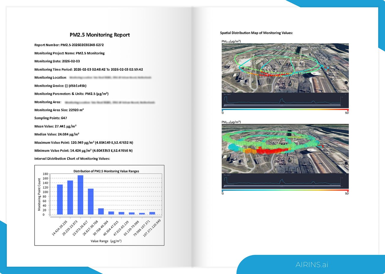
Structured Reports & GIS-Ready Exports
Each mission becomes a structured report with interval and spatial concentration data. Export to CSV, GeoJSON and Shapefile for your GIS, or share PDF / editable DOCX reports.
From Air-Pollution Mapping to HAZMAT Response
One platform spans ambient air-quality mapping, routine plant and landfill surveys, and rapid HAZMAT screening — in the air on UAVs, on the ground via robot dogs, or on the road via vehicles.
Service & Warranty
Supplied and supported by GulfNet Emirates with regional onboarding, configuration guidance and the standard manufacturer warranty. AIRINS.ai platform access is provided per subscription. Contact us for a tailored quotation, an online walkthrough or an on-site evaluation.
Key Specifications
| Sensor Configuration | Up to 5 internal module slots (user-selectable) |
|---|---|
| Available Modules | PM 1.0 / 2.5 / 10, O3 + NO2, NO2, CO, TVOC, H2S, NH3, SO2, HCHO, Odor (OU), TSP |
| PM Module | Light scattering · 5 – 1,000 µg/m³ · LoD 5 µg/m³ · resolution 1 µg/m³ |
| O3 + NO2 / NO2 Module | Electrochemistry · 0 – 11 ppm · LoD 10 ppb · resolution 1 ppb |
| CO Module | Electrochemistry · 0 – 11 ppm · LoD 0.05 ppm · resolution 0.005 ppm |
| Recommended Configurations | PM + O3 + NO2 + CO + TVOC, or PM + O3 + NO2 + CO + SO2 |
| External Module (M400 only) | AIRINS Meteorological System — wind, temperature & humidity (standalone or with a Nano 2 Plus) |
| Carrying Platforms | DJI Matrice 400 (up to 2 units), Matrice 4D / 4TD + Dock 3, Matrice 4E / 4T, Matrice 350 / 300, robot dog, ground vehicle |
| Control & Display | DJI Pilot App, DJI FlightHub 2 |
| Analytics Software | AIRINS.ai (2D / 3D mapping, AI-assisted reports) |
| Export Formats | CSV, GeoJSON (.json), Shapefile (.shp), animations; reports in PDF / DOCX |
| Applications | Air pollution mapping, ambient air monitoring, gas facility / landfill survey, HAZMAT response |
Frequently Asked Questions
Which gases can the Multi-Gas version detect?
It uses up to five configurable modules covering PM 1.0 / 2.5 / 10, O3, NO2, CO, TVOC, SO2, H2S, NH3, HCHO, Odor (OU) and TSP — chosen to match your monitoring needs.
How many modules can it carry at once?
Up to five internal sensing modules simultaneously. Recommended ambient-air configurations are PM + O3 + NO2 + CO + TVOC, or PM + O3 + NO2 + CO + SO2.
Which platforms is it compatible with?
DJI Matrice 400 (up to two units), Matrice 4D / 4TD with Dock 3, Matrice 4E / 4T, Matrice 350 / 300, plus robot dogs and ground vehicles. Control runs through DJI Pilot and FlightHub 2.
How is the data analyzed and exported?
Missions sync to AIRINS.ai for 2D / 3D mapping with point-cloud, grid and interpolation heatmaps, with exports to CSV, GeoJSON and Shapefile and reports in PDF or editable DOCX.
How is it priced?
Pricing is provided on request. Use the Request a Quote button for a tailored proposal, demo and configuration advice from GulfNet Emirates.


