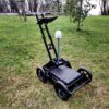
Radar Systems Zond Aero 1000 NG Ground Penetrating Radar (GPR) System
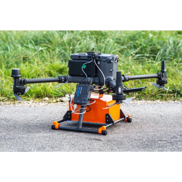
The Zond Aero 1000 NG is the high-resolution member of the Zond Aero family. Its 1000 MHz shielded antenna trades depth for detail, resolving very fine, shallow features within the top metre — making it the tool of choice for snow and ice thickness profiling and for detecting small objects a few tens of centimetres below the surface. Real-Time Sampling (RTS) delivers an exceptional signal-to-noise ratio with geotagged SEGY output for drone, cart or towed surveys.

High-resolution shallow imaging
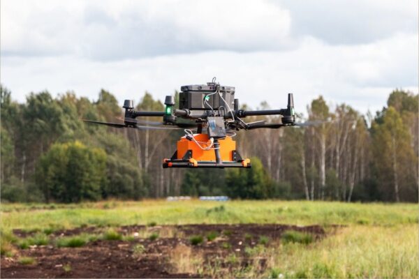
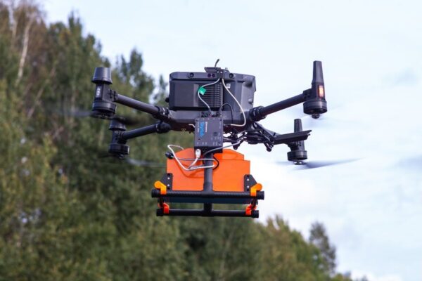
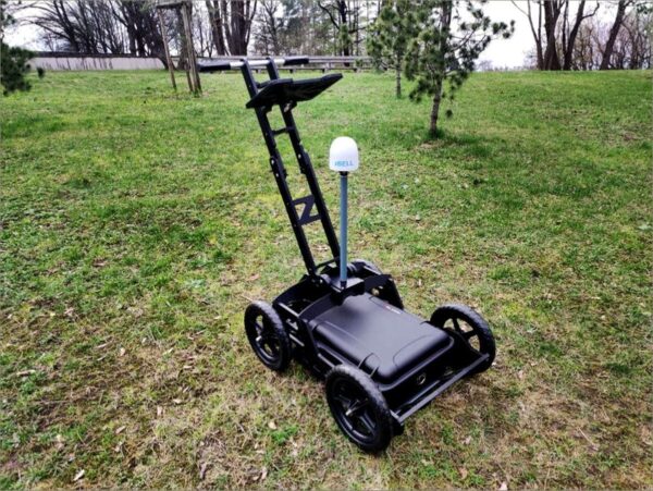
At 1000 MHz the Aero 1000 NG resolves fine detail in the top ~1 m of ground, ice or snow that lower-frequency GPRs miss. It excels at snow/ice thickness profiling and locating small shallow objects, and like the rest of the family it runs on a drone, a cart or a tow rope to suit the site.

RTS data quality, geotagged SEGY
Real-Time Sampling with high hardware stacking gives a clean signal-to-noise ratio, and every trace is geotagged in standard SEGY (.sgy) for Prism 2 and common geophysical software. The IP68 NANUK-cased build with integrated battery and Wi-Fi router is ready for demanding field and cold-environment work.
Applications
Snow and ice thickness profiling to several metres, and detection of small objects a few tens of centimetres below the surface, plus high-resolution shallow utility and archaeological imaging.
Service & Warranty
Supplied by GulfNet Emirates Drone & Robotic Systems with UAE-based technical support, integration guidance and full manufacturer warranty. The Zond Aero 1000 NG requires additional components and software for drone operation — request a quote and our team will propose the complete, ready-to-fly GPR set. The user is responsible for confirming the suitability of a given GPR model for use in a particular country.
Key Specifications
| Type | Single-channel GPR with shielded antenna |
| Central frequency | 1000 MHz |
| Operating bandwidth | 600–1300 MHz (-6 dB) |
| Sampling | Real-Time Sampling (RTS) with high hardware stacking |
| Samples per scan | 256 / 512 / 1024 / 2048 / 4096 / 8192 (selectable) |
| Sample rate | Up to 1,280,000 samples/second |
| Scan rate | Up to 2,500 scans/second |
| Penetration depth | Up to 1 m in average soil (≈0.5 m at 0.5 m antenna elevation) — high resolution |
| Data format | Standard SEGY (.sgy) with trace geotagging |
| Operating temperature | -20°C to 60°C |
| Ingress protection | IP68 in protective case; IP52 airborne |
| Supported drones | DJI M400 / M350 / M300 RTK |
| Weight | 1.8 kg airborne; 7.0 kg in protective case |
| Size (airborne) | 31 × 19 × 15 cm |
| In the kit | Zond Aero 1000 NG GPR (1000 MHz), Prism 2 acquisition/processing software, NANUK protective case with integrated 99 Wh Li-Ion battery and Wi-Fi router, charger, tow rope, DJI M400/M300/M350 mounting kit |
| SKU | IS-RS-ZOND-AERO-1000 |
Frequently Asked Questions
Where can I buy Zond Aero 1000 NG GPR in Dubai?
The system is available through GulfNet Emirates in Dubai, an authorised Zond dealer Dubai teams turn to for shallow high-resolution GPR work. To buy Radar Systems Zond Aero 1000 NG GPR System, contact the team at the Al Fattan Plaza office in Dubai, submit a quote request through the online form, or reach out by phone on +971-4-8972598. Because the 1000 MHz shielded antenna is often paired with a DJI M400, M350 or M300 RTK plus the SkyHub onboard computer and UgCS mission software, procurement is handled as a scoped set rather than a shelf item. GulfNet’s specialists confirm your target application, whether snow and ice profiling or shallow object detection, then quote the complete ready-to-fly configuration.
Is Zond Aero 1000 NG GPR available in the UAE?
Yes. It is stocked and supported by GulfNet Emirates, the Zond distributor UAE surveyors, geophysicists and drone service providers use for shallow high-resolution ground penetrating radar. Teams that want to buy Radar Systems Zond Aero 1000 NG GPR System in UAE can source the 1000 MHz shielded antenna, Prism 2 acquisition and processing software, NANUK protective case with integrated 99 Wh Li-Ion battery and Wi-Fi router, charger, tow rope, and the DJI M400/M300/M350 mounting kit through a single procurement channel. Local support covers integration guidance with SkyHub and UgCS, plus the full manufacturer warranty from SPH Engineering. Availability is confirmed at quote stage, since airborne kits are configured to match the customer’s DJI Matrice platform.
How much is Zond Aero 1000 NG GPR?
The Radar Systems Zond Aero 1000 NG GPR System price is not published as a fixed retail figure because the unit is rarely sold on its own. A complete airborne configuration typically pairs the 1000 MHz shielded antenna with a SkyHub onboard computer, UgCS flight planning software, a DJI M400, M350 or M300 RTK, and the mounting kit that ships with the GPR. Ground-only setups on a cart or tow rope cost less because they skip the drone integration items. GulfNet Emirates issues quotations in AED after confirming the intended survey application, the drone platform on hand, and any accessories already owned. This keeps buyers from paying for hardware they do not need.
What is the Zond Aero 1000 NG GPR price in UAE?
Radar Systems Zond Aero 1000 NG GPR System price UAE quotations from GulfNet Emirates reflect three variables: the base 1000 MHz shielded antenna and case with integrated battery, the airborne integration kit if the unit will fly on a DJI Matrice, and any software licences such as UgCS or Prism 2 that the buyer does not already hold. Import duties, warranty terms, and post-sale technical support are folded into the final figure, so there are no surprises after purchase. Pricing is shared through a formal quote rather than a public list, because Zond Aero systems are configuration-sensitive and export-controlled. Buyers who send their intended application and drone model receive a scoped proposal, usually within one to two business days.
Who sells Zond Aero 1000 NG GPR in the UAE?
GulfNet Emirates Drone & Robotic Solutions is the Zond dealer UAE geophysical, glaciology, and utility survey teams work with when sourcing the 1000 NG. As a trusted seller of Zond Aero 1000 NG GPR in the UAE, the team handles procurement, integration with DJI Matrice drones, and post-sale technical support from Dubai. The company distributes SPH Engineering’s Zond product line, which covers the 500, 600, and 1000 NG frequencies, so buyers comparing depth against resolution can be steered to the right model. Support includes commissioning, integration checks with SkyHub and UgCS, and warranty coordination with the manufacturer. Direct manufacturer channels are also available, but local supply shortens delivery and gives regional buyers a single contact for spares and service.
Can I buy Zond Aero 1000 NG GPR online in UAE?
Yes, buyers can start the process online. Buy Zond Aero 1000 NG GPR online in UAE by submitting the quote request form on the GulfNet Emirates DRS store, listing the intended survey type and drone model. The Radar Systems Zond Aero 1000 NG GPR System for sale listing is not a direct add-to-cart item, because the GPR is typically shipped as a configured kit rather than a standalone SKU. After the quote is accepted, invoicing, payment, and delivery are arranged through the local team, with the unit dispatched from Dubai. This workflow suits enterprise buyers who need formal documentation, VAT invoicing in AED, and a defined delivery window rather than a consumer checkout.
What is the best place to buy Zond Aero 1000 NG GPR in the UAE?
For enterprise procurement, the best place to buy Zond Aero 1000 NG GPR in the UAE is a channel that carries the full SPH Engineering line and can integrate the unit with your existing DJI Matrice drone. GulfNet Emirates fits that brief as an authorised Zond Aero 1000 NG GPR dealer in UAE, offering the base radar, Prism 2 software, the NANUK case, the tow rope, and the DJI M400/M350/M300 mounting kit through one purchase order. Local sourcing also removes the need to import through unofficial channels, which can void warranties. Buyers get integration advice, on-site or remote commissioning support, and a defined route for warranty claims through the manufacturer.
Do you have a Zond Aero 1000 NG GPR supplier in Abu Dhabi?
GulfNet Emirates supplies Abu Dhabi customers from its Dubai office at Al Fattan Plaza, with delivery, on-site handover, and integration support arranged directly to project sites in the emirate. The same team that handles Zond Aero 1000 NG GPR for sale in Dubai coordinates procurement for federal, municipal, and private buyers in Abu Dhabi. Site visits, drone integration checks with a DJI M400, M350 or M300 RTK, and Prism 2 software walkthroughs are scheduled to fit the customer’s project window. Because the 1000 NG is high-resolution and shallow, Abu Dhabi buyers doing utility mapping, archaeological surveys, or snow and ice profiling work should confirm application fit at quote stage before hardware is committed.
How do I get a quote for Zond Aero 1000 NG GPR?
Get a quote for Zond Aero 1000 NG GPR by using the Request a Quote link on the GulfNet Emirates DRS store, or by emailing the Dubai team directly. Provide the intended application, whether it is snow and ice thickness profiling, shallow object detection, or fine-detail utility work, plus the DJI drone model you plan to fly it on. This lets the team scope the correct configuration of the Radar Systems Zond Aero 1000 NG GPR System, including whether SkyHub, UgCS, and a mounting kit are needed. Quotes are issued in AED and include hardware, software licences, warranty terms, and expected lead time. Turnaround is typically one to two business days for standard configurations.
Can I book a Zond Aero 1000 NG GPR demo in Dubai?
Yes. Buyers can book a Zond Aero 1000 NG GPR demo in Dubai through GulfNet Emirates, either at the customer’s site or a location arranged by the team. A demonstration is useful, because the 1000 MHz antenna is optimised for the top metre of ground, ice, or snow, and buyers often want to see how the Real-Time Sampling output looks in Prism 2 before committing to a configuration. The team can also show integration with a DJI Matrice drone if the customer plans an airborne workflow. Demos are scheduled after a short scoping call to confirm application, target depth, and whether the customer prefers a cart, towed, or drone-mounted setup.
Which drones does the Zond Aero 1000 NG support for airborne surveys?
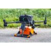
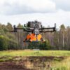
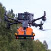
The airborne configuration supports the DJI M400, M350, and M300 RTK, and the kit ships with a mounting bracket for these Matrice models. Airborne weight is 1.8 kg with a footprint of 31 x 19 x 15 cm, so the drone’s payload budget and flight-time margin should be checked before scoping a mission. For airborne surveys the buyer also needs the SkyHub onboard computer and UgCS flight planning software, which are not included in the base kit and must be added at quote stage. Mounts for other drones can be sourced on request from SPH Engineering. Ground use on a cart or on a tow rope needs no drone at all, and the NANUK case handles power and Wi-Fi connectivity.
What is the Zond Aero 1000 NG best used for and how deep does it see?
Its 1000 MHz shielded antenna is built for high-resolution shallow work. Typical applications include snow and ice thickness profiling to a few metres, detection of small objects a few tens of centimetres below the surface, and fine-detail imaging for shallow utility mapping or archaeological surveys. Penetration is up to about 1 m in average soil, or roughly 0.5 m at a 0.5 m antenna elevation, so buyers targeting deeper structures should look at the 500 or 600 NG variants from the same family. Data is written as standard geotagged SEGY files ready for Prism 2 and common geophysical processing software. Operating temperature spans -20°C to 60°C, with IP68 protection in the case and IP52 in flight.