Falcon Plus TDLAS Methane Leak Detector for Drones
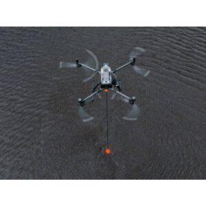
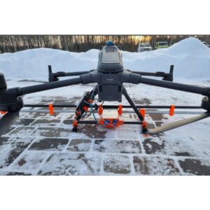
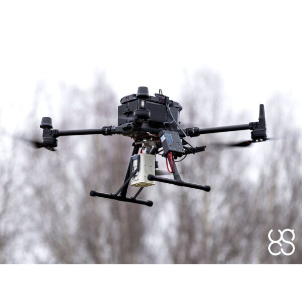
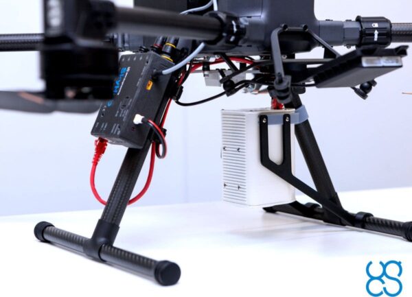
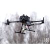
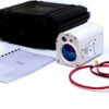
The Falcon Plus is a TDLAS (tunable diode laser absorption spectroscopy) methane leak detector for drone-based, stationary and car-based surveys. Integrated with DJI M300/M350, Wispr, Inspired Flight and SkyFront drones via the SkyHub onboard computer, it brings remote laser gas detection to oil & gas operations and landfill monitoring — screening fast and localising leaks accurately from a safe distance, without confined-space entry.
Methane Detector — Laser Falcon

Remote laser detection, regulation-ready
The Falcon Plus reliably detects methane from 10–40 m with a 25 ms response time. It detects 500 ppm from at least 40 m — meeting the EUMR 2024/1787 Type 2 LDAR above-ground criteria — and 1000 ppm from at least 60 m for underground inspection. A Class 1 infrared detection laser keeps operations eye-safe, while a Class 3R green pointer marks the measurement spot from a distance.

Light, fast and self-calibrating
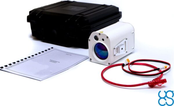
At just 360 g and 130 × 98 × 98 mm, the Falcon Plus surveys at up to 30 m/s and resolves down to a 1 g/h flow rate across a 0–100,000 ppm·m range. An integrated reference gas cell self-calibrates for consistent accuracy and minimal maintenance, and every reading is delivered in real time with georeferenced, RTK-accurate recording.
Drone vs Car vs Helicopter Surveys
| Car | Drone | Helicopter | |
| Average km/day | 200–300 | 80–100 | 500–700 |
| Terrain | Roads only | Any | Any |
| Cost per hour | Medium | Low | High |
| Survey automation | Manual driving | Automatic | Manual piloting |
Applications
Leak detection and repair (LDAR) for oil & gas gathering, transmission and distribution networks; landfill and biogas methane monitoring; pipeline and facility integrity surveys; and regulatory emissions screening under EUMR 2024/1787.
Service & Warranty
Supplied by GulfNet Emirates Drone & Robotic Systems with UAE-based technical support, integration guidance and full manufacturer warranty. The Falcon Plus requires the SkyHub onboard computer and a compatible drone — request a quote and our team will propose the complete, ready-to-fly methane-detection set.
Key Specifications
| Sensor type | TDLAS (tunable diode laser absorption spectroscopy) remote methane leak detector |
| Detection range | 10 – 40 m (reliable) |
| Regulatory compliance | 500 ppm at ≥40 m (EUMR 2024/1787 Type 2 LDAR above-ground); 1000 ppm at ≥60 m (underground) |
| Response time | 25 ms |
| Maximum survey speed | 30 m/s (108 km/h) — mainly limited by drone speed |
| Minimum detectable flow rate | 1 g/h (≈500 ppm) |
| Measurement range / sensitivity | 0 – 100,000 ppm·m |
| Self-calibration | Integrated reference gas cell |
| Laser safety | Methane laser: Class 1 IR; green pointer: Class 3R |
| Real-time data / georeferencing | Real-time data, georeferenced recording and RTK georeferencing — all yes |
| Dimensions | 130 × 98 × 98 mm |
| Weight | 360 g |
| Supported drones | DJI M300 / M350, Wispr, Inspired Flight, SkyFront (via SkyHub) |
| Onboard computer | Requires the SkyHub onboard computer |
| SKU | IS-PERG-LFALCON-DETECTOR-PLUS |
Frequently Asked Questions
Where can I buy the Falcon Plus TDLAS Methane Detector in Dubai?
The Falcon Plus TDLAS Methane Detector is stocked and supplied in the UAE by GulfNet Emirates through the Drone & Robotic Solutions store, with the Dubai office located at Al Fattan Plaza, 6th Floor, Office 607. Buyers looking to buy Falcon Plus TDLAS methane detector units for oil and gas LDAR, landfill monitoring or pipeline integrity surveys can place enquiries directly through the product listing on gulfnetemirates.com/drs or reach the team by phone on +971-4-8972598. Because the sensor requires the SkyHub onboard computer and a compatible drone platform to fly, GulfNet Emirates typically confirms your existing drone fleet first, then quotes the complete, ready-to-integrate methane detection kit rather than the sensor in isolation.
How much is the Falcon Plus Methane Detector, and what is the Falcon Plus Methane Detector price in UAE?
The Falcon Plus TDLAS methane detector price is quotation-based rather than fixed on the store, because the total depends on the drone platform, the SkyHub onboard computer, RTK setup and any integration services bundled with the sensor. Buyers comparing the Falcon Plus TDLAS Methane Detector price UAE listings should request a formal proposal from GulfNet Emirates so the cost reflects the exact configuration, warranty scope and delivery terms. Pricing is issued in AED and includes UAE-based technical support. Sending a specification of your target survey use case, whether above-ground LDAR under EUMR 2024/1787 or underground pipeline screening, helps the team return a sharper, project-specific number faster.
Is the Falcon Plus Methane Detector available in the UAE, and who sells it locally?
Yes. The sensor is listed as in-stock through GulfNet Emirates, so anyone asking who sells Falcon Plus Methane Detector in the UAE can source it locally without importing directly from SPH Engineering. GulfNet Emirates handles enquiries to buy Falcon Plus TDLAS methane detector in UAE from oil and gas operators, environmental consultants, landfill operators and utility integrity teams across the Emirates. Because the Falcon Plus is a specialised TDLAS payload rather than an off-the-shelf drone accessory, orders are processed against a formal quote that confirms sensor availability, SkyHub compatibility with your DJI M300, M350, Wispr, Inspired Flight or SkyFront platform, and estimated delivery timelines to your operations base.
Who is the authorised Falcon dealer in Dubai for this TDLAS sensor?
GulfNet Emirates operates as the authorised Falcon dealer Dubai buyers and procurement teams reach for the Plus TDLAS payload, and functions as the Falcon Plus Methane Detector dealer in UAE across enterprise, government and utility accounts. The company is also positioned as a Falcon dealer UAE and Falcon distributor UAE contact for after-sales support, spare parts routing and integration guidance. Buying through the authorised channel means the sensor arrives with full manufacturer warranty backing from SPH Engineering, correct SkyHub firmware pairing, and a local point of contact who can escalate technical queries to the OEM without the delays typical of grey-market procurement or non-appointed resellers.
How do I get a quote for the Falcon Plus Methane Detector?
To get a quote for Falcon Plus Methane Detector configurations, use the Request a Quote button on the product listing or the dedicated quote form on gulfnetemirates.com/drs. Include the drone model you plan to fly, whether you already own a SkyHub onboard computer, the primary survey type (above-ground LDAR, underground pipeline screening, landfill or biogas monitoring) and your target delivery emirate. The GulfNet Emirates team responds with an itemised proposal covering the Falcon Plus sensor, SkyHub if required, integration support and warranty terms. For urgent tenders or fleet-scale rollouts, calling +971-4-8972598 usually shortens turnaround, and demo scheduling can be arranged alongside the commercial quotation.
What drone platforms and equipment are needed to run the Falcon Plus?
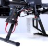
The Falcon Plus is integrated with drones through the SkyHub onboard computer, so a compatible drone plus SkyHub is mandatory before the sensor can fly. Supported platforms include the DJI Matrice 300 and Matrice 350, along with Wispr, Inspired Flight and SkyFront drones. Weighing only 360 g at 130 x 98 x 98 mm, the payload is comfortably within the M300/M350 lift envelope and leaves headroom for RTK modules for georeferenced recording. The sensor also works for car-mounted and stationary surveys, but for drone operations, GulfNet Emirates will confirm SkyHub firmware, mounting hardware and RTK setup are aligned to your specific airframe before dispatching the kit.
What is the detection range, response time and sensitivity of the Falcon Plus TDLAS sensor?
The Falcon Plus reliably detects methane from 10 to 40 m using tunable diode laser absorption spectroscopy, with a 25 ms response time that supports survey speeds up to 30 m/s, or roughly 108 km/h, when the drone platform allows. Minimum detectable flow rate is 1 g/h, equivalent to about 500 ppm, and the measurement range spans 0 to 100,000 ppm.m. An integrated reference gas cell handles self-calibration, so field crews avoid routine manual calibration between missions. Laser safety uses a Class 1 infrared detection beam for eye-safe operation, paired with a Class 3R green pointer that visually marks the measurement spot at distance.
Does the Falcon Plus meet EUMR 2024/1787 LDAR requirements?
Yes. The Falcon Plus is engineered to meet EUMR 2024/1787 Type 2 LDAR criteria for above-ground inspection, detecting 500 ppm from at least 40 m. For underground inspection, it detects 1000 ppm from at least 60 m, which aligns with the harder-to-reach pipeline screening use case the regulation targets. That regulatory alignment is one of the reasons oil and gas operators and midstream integrity teams in the GCC evaluate the Falcon Plus over legacy handheld or open-path methods. Every reading is timestamped, RTK-georeferenced and recorded in real time, giving compliance teams the audit trail needed to defend leak-detection reports against regulatory scrutiny.
Can I book a Falcon Plus Methane Detector demo in Dubai before purchasing?
Yes. Buyers who want to book a Falcon Plus Methane Detector demo in Dubai can request one directly from GulfNet Emirates during the quote conversation, and the team will coordinate a suitable slot with the SPH Engineering integration workflow. A demo is often the best place to buy Falcon Plus Methane Detector in the UAE decision-support step, because it lets your survey crew see the TDLAS beam behaviour, SkyHub data output and RTK-tagged readings under conditions close to your actual site. Demos are typically arranged around your existing DJI M300 or M350 platform so the flight profile, integration path and reporting output can be validated before commercial commitment.
Can I buy the Falcon Plus Methane Detector online in the UAE?
The listing to buy Falcon Plus Methane Detector online in UAE is hosted on the GulfNet Emirates DRS store, but because the payload requires SkyHub integration and drone compatibility checks, the checkout runs through a formal quote rather than a direct add-to-cart transaction. That workflow protects buyers from ordering a sensor that will not pair with an incompatible drone. GulfNet Emirates functions as a trusted seller of Falcon Plus Methane Detector in the UAE with visible SKU (IS-PERG-LFALCON-DETECTOR-PLUS), SPH Engineering brand attribution and a physical Dubai office, so procurement teams get the traceability required for enterprise, government and oil and gas tenders without exposure to unverified resellers.
Is the Falcon Plus Methane Detector for sale in Dubai and Abu Dhabi?
Yes. The Falcon Plus TDLAS methane detector for sale through GulfNet Emirates is available to buyers across the Emirates, including Falcon Plus Methane Detector for sale in Dubai enquiries handled from the Al Fattan Plaza office and Falcon Plus Methane Detector supplier in Abu Dhabi requests routed through the same DRS procurement channel. Delivery, integration and after-sales support are coordinated centrally, so an Abu Dhabi based operator gets the same SkyHub pairing, warranty coverage and technical escalation path as a Dubai based one. For multi-site oil and gas or utility deployments, the team can also stage kits and phase delivery across emirates to match survey rollout schedules.
Why choose the Falcon Plus over car or helicopter methane surveys?
Car surveys are limited to roads and average 200 to 300 km per day of coverage, while helicopters cover 500 to 700 km but at high hourly cost and with manual piloting. A drone carrying the Falcon Plus covers any terrain, automates the survey pattern and runs at low hourly cost, even though daily coverage sits at 80 to 100 km. For facility perimeters, landfill cells, well pads and off-road pipeline corridors, that combination of terrain freedom, automation and cost efficiency usually outperforms the alternatives. Add EUMR 2024/1787 Type 2 compliance and RTK-tagged data, and the drone-mounted TDLAS approach becomes the preferred method for defensible, repeatable emissions screening.