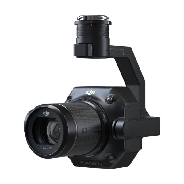
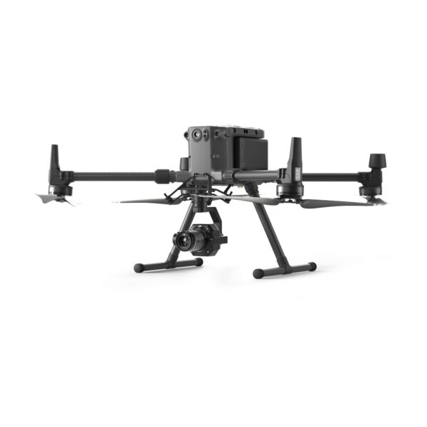
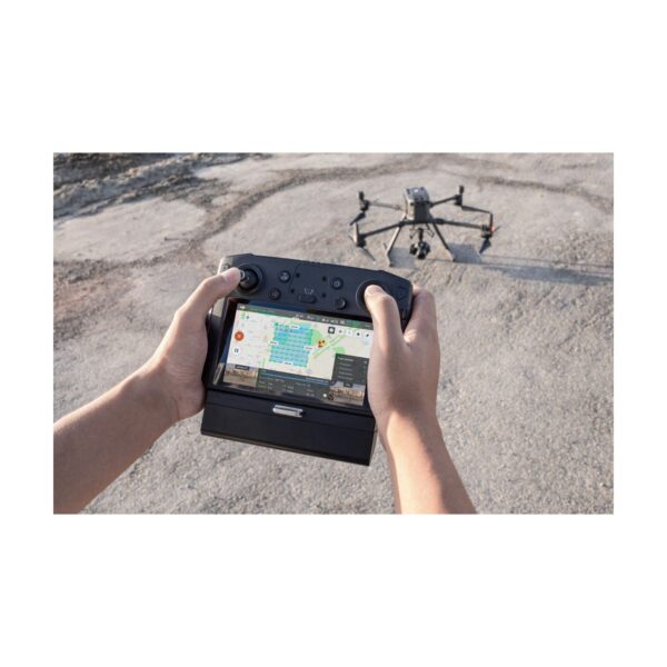
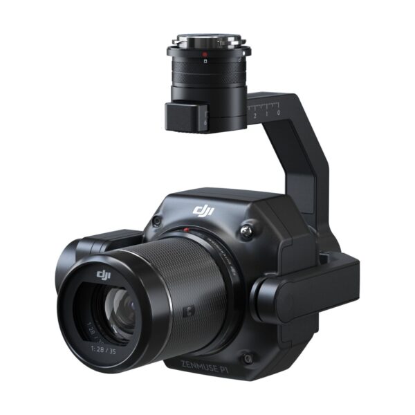
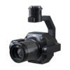
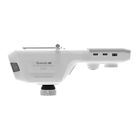
The DJI Zenmuse P1 integrates a 45 MP full-frame sensor with interchangeable DJI DL fixed-focus lenses on a 3-axis stabilised gimbal — delivering 3 cm / 5 cm (H/V) survey-grade accuracy without GCPs, 3 km² coverage per flight, a global mechanical shutter and TimeSync 2.0 microsecond geotag synchronisation. Compatible with the DJI Matrice 300 RTK, 350 RTK and Matrice 400.
The Zenmuse P1 integrates a 45 MP full-frame sensor with a choice of interchangeable DJI DL fixed-focus lenses on a 3-axis stabilised gimbal — delivering survey-grade photogrammetry accuracy, 3 km² coverage per flight, and 3 cm / 5 cm horizontal / vertical absolute accuracy without GCPs. Compatible with the Matrice 300 RTK, Matrice 350 RTK and DJI Matrice 400, the P1 is the benchmark payload for aerial surveying, cadastral mapping, infrastructure inspection and emergency-response missions across the Middle East and beyond.
Large-Area Modeling & Smart Oblique Capture
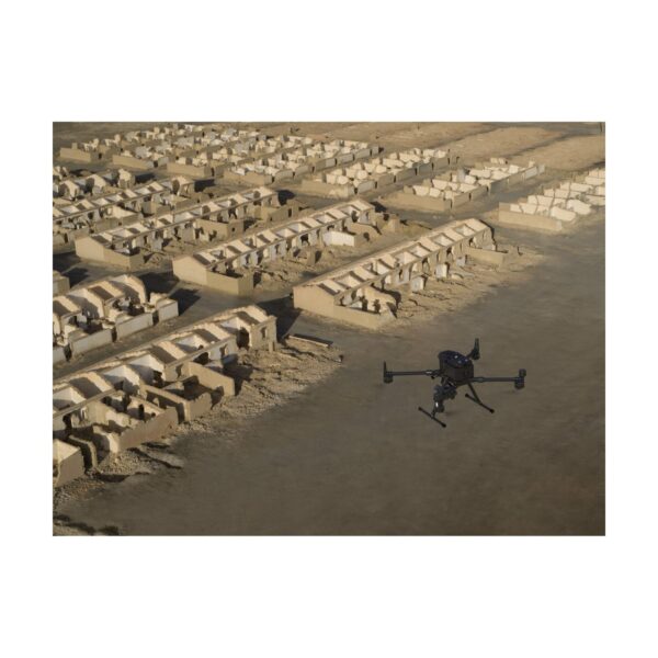
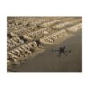
Cover up to 3 km² in a single flight at a ground sample distance of 3 cm, flying at 15 m/s with a 75% front overlap and 55% side overlap. Smart Oblique Capture rotates the gimbal automatically on a 5-direction scan — forward, backward, left, right and nadir — eliminating the need for separate oblique passes and cutting total flight time for 3D city and building models in half. Combined with the 8192×5460 pixel 45 MP sensor, every mission outputs textures fine enough for AEC, urban-planning and heritage-preservation deliverables directly from one flight.
Nap-of-the-Object Photogrammetry
Traditional photogrammetry missions fly at a fixed altitude, producing variable GSD across sloped or complex terrain. Nap-of-the-object missions fly the drone along the contour of the surface — maintaining a constant distance from the subject at all times — so cliff faces, steep embankments, open-pit mines and building facades are captured at uniform resolution from base to summit. The P1’s 3-axis stabilised gimbal and mechanical global shutter ensure every frame is sharp, regardless of the drone’s pitch and roll during terrain-following flight.
AEC & 3D Modelling for Construction & Infrastructure
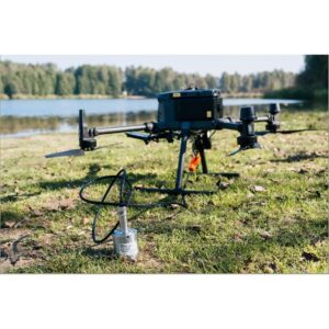
Architects, engineers and contractors use the P1 with DJI Terra to generate survey-accurate 3D models, orthomosaics and elevation models of construction sites, roads, bridges and industrial facilities. The full-frame sensor delivers the fine detail and wide dynamic range needed for material identification and progress-management deliverables — without the resolution compromise of smaller sensors. TimeSync 2.0 synchronises geotag data from the RTK module to the aircraft’s IMU at the microsecond level, so every pixel is precisely geo-referenced without reliance on ground control points.
Real-Time Mapping & Mission Efficiency
With DJI Terra’s real-time 2D mapping mode, a live orthomosaic is stitched on the ground station screen while the P1 is still in the air — so field teams can check coverage, identify gaps and re-fly problem areas before leaving the site. A minimum photo interval of 0.7 seconds enables dense, high-overlap capture even at high airspeeds. The mechanical global shutter fires at up to 1/2000 s, eliminating the rolling-shutter distortion that can degrade the accuracy of fast-moving platform imagery in strong winds or during tight banking turns.
Technical Specifications
General
Product Name
ZENMUSE P1
Dimensions
198 × 166 × 129 mm
Weight
Approx. 800 g
Power
20 W
IP Rating
IP4X
Supported Aircraft
DJI Matrice 300 RTK, Matrice 350 RTK, Matrice 400
Mount
Detachable DJI SKYPORT
Operating Temperature
−20° to +50° C
Storage Temperature
−20° to +60° C
Absolute Accuracy
Horizontal: 3 cm | Vertical: 5 cm * * Mapping Mission at 3 cm GSD, 15 m/s, 75% front overlap, 55% side overlap
DJI DL 24mm F2.8 LS ASPH (FOV 84°) DJI DL 35mm F2.8 LS ASPH (FOV 63.5°) DJI DL 50mm F2.8 LS ASPH (FOV 46.8°)
Photo Size
8192 × 5460 (3:2)
Min. Photo Interval
0.7 s
Shutter Speed
Mechanical: 1/2000−1 s | Electronic: 1/8000−1 s
Aperture Range
f/2.8 – f/16
ISO Range
100 – 25600
Storage
SD / UHS-I or above | Max 512 GB
Video
Video Format
MP4 / MOV
Video Resolution
1920 × 1080 | 3840 × 2160 (35mm lens only)
Frame Rate
Up to 60 fps
Gimbal
Stabilisation
3-axis (tilt, roll, pan)
Angular Vibration
±0.01°
Mechanical Range
Tilt: −130° to +40° | Roll: −55° to +55° | Pan: ±320°
Application Scenarios
The Zenmuse P1 is suited to a wide range of professional mapping and geospatial applications: Topographic Survey, Cadastral Survey, Geological Disaster Investigation, Engineering Survey, Agriculture & Forestry Survey, Energy Facilities Inspection, Natural Resources Survey, Emergency Survey & Disaster Response, and Law Enforcement & Security Mapping.
Frequently Asked Questions
Where can I buy the DJI Zenmuse P1 in Dubai?
Buyers looking to buy dji zenmuse p1 in Dubai can source it through GulfNet Emirates, an authorised DJI dealer Dubai teams rely on for enterprise payloads and mapping hardware. The office in Al Fattan Plaza handles product consultations, quotations, and delivery across the Emirate. Given that the P1 is a survey-grade photogrammetry payload built for the Matrice 300 RTK, 350 RTK, and Matrice 400, most buyers prefer a local point of sale that can advise on aircraft pairing, DL lens selection, and workflow integration with DJI Terra. Requests are handled through the request-a-quote form on the GulfNet Emirates DRS storefront, or directly with the sales team by phone. Delivery, invoicing in AED, and after-sales coordination are all managed within the UAE.
How much is DJI Zenmuse P1 in the UAE?
The dji zenmuse p1 price is not published as a fixed retail figure on the GulfNet Emirates storefront, and the DJI Zenmuse P1 price in UAE is provided on a quotation basis. This is standard practice for enterprise DJI payloads, since final DJI Zenmuse P1 price UAE quotes depend on lens configuration (the DL 24mm, 35mm, or 50mm F2.8 LS ASPH), whether the buyer also needs a compatible aircraft such as the Matrice 350 RTK, and any bundled software licences for DJI Terra. To confirm current pricing, buyers submit the request-a-quote form with their required lens set and intended platform. GulfNet Emirates then issues an AED-denominated quote covering the payload, accessories, and any relevant training.
Is DJI Zenmuse P1 available in the UAE, and who sells it?
Yes. The DJI Zenmuse P1 is listed in stock on the GulfNet Emirates DRS storefront, and buyers across the country can order it without importing directly from overseas. Survey firms, government agencies, and AEC contractors who want to buy dji zenmuse p1 in UAE typically ask who sells DJI Zenmuse P1 in the UAE with the correct SKYPORT-compatible aircraft options. GulfNet Emirates carries the payload alongside the Matrice 300 RTK, 350 RTK, and Matrice 400, so complete mapping kits can be quoted in one place. Local availability shortens lead times compared with cross-border procurement and simplifies the paperwork side, including AED invoicing and delivery to sites in Dubai, Abu Dhabi, Sharjah, and beyond.
Who is a trusted DJI dealer for the Zenmuse P1 in the UAE?
GulfNet Emirates operates as a trusted seller of DJI Zenmuse P1 in the UAE and as a broader DJI distributor UAE customers approach for enterprise payloads, docks, and mapping platforms. As a DJI dealer UAE-based buyers can transact with directly, the company handles procurement queries from survey firms, construction contractors, and government mapping units. The DJI Zenmuse P1 dealer in UAE relationship covers more than the transaction itself: buyers get help matching the P1 with the correct Matrice aircraft, selecting between the 24mm, 35mm, and 50mm DL lenses, and structuring purchase orders that include necessary spares. Post-sale, coordination with DJI for warranty claims and service is routed through the same local point of contact.
Where can I find the DJI Zenmuse P1 for sale in Dubai?
The DJI Zenmuse P1 for sale in Dubai is stocked through the GulfNet Emirates DRS storefront, with the Al Fattan Plaza office serving as the local point of contact. For teams weighing the best place to buy DJI Zenmuse P1 in the UAE, working through a local outlet typically comes down to three practical factors: physical inspection of the payload before purchase, AED-based invoicing, and after-sales access to the same team that arranged the delivery. Because the dji zenmuse p1 for sale here is a survey-grade instrument rather than a consumer camera, buyers usually pair the purchase with a discussion on lens selection and Matrice aircraft compatibility before finalising the order.
Can I buy DJI Zenmuse P1 online in UAE and request a formal quote?
To buy DJI Zenmuse P1 online in UAE, the workflow through GulfNet Emirates is straightforward. The product listing on the DRS storefront carries a Request a Quote button that pre-fills the product name, and buyers can add lens preferences, aircraft details, and delivery location in the same form. To get a quote for DJI Zenmuse P1, no upfront payment or account is needed, and the sales team responds with an AED-denominated proposal covering the payload, any additional DL lenses, and options such as SD storage and spare SKYPORT mounts. For larger fleet orders, purchase-order-based transactions are also supported through the same channel, with invoicing arranged directly with the buyer’s accounts department.
Is there a DJI Zenmuse P1 supplier in Abu Dhabi?
GulfNet Emirates functions as a DJI Zenmuse P1 supplier in Abu Dhabi and across the wider UAE from its Dubai head office. Deliveries to Abu Dhabi-based clients, whether municipal survey departments, oil and gas contractors running facility inspections, or engineering consultancies handling infrastructure mapping, are coordinated from the DRS storefront’s central logistics point. Buyers in Abu Dhabi generally receive the same lead times, warranty terms, and after-sales support as customers in Dubai, without needing a separate procurement route. Because the P1 is often ordered alongside a Matrice 350 RTK or Matrice 400 aircraft, a single quotation and delivery is usually more efficient than sourcing the payload and platform from separate vendors in different Emirates.
Can I book a DJI Zenmuse P1 demo in Dubai before purchase?
Yes, buyers who want to book a DJI Zenmuse P1 demo in Dubai can request one through the GulfNet Emirates sales team. Demonstrations focus on the practical aspects that matter for survey work: how the 45 MP full-frame sensor performs under real conditions, how quickly the DL lens set can be swapped in the field, and how DJI Terra handles the imagery for orthomosaic and 3D model outputs. A demo is particularly useful for teams evaluating the P1 against oblique-camera alternatives, or trying to decide whether a Matrice 350 RTK or Matrice 400 pairing suits their coverage targets. Demo requests are lodged through the same contact channels used for quotation enquiries.
Which DJI aircraft is the Zenmuse P1 compatible with?
The Zenmuse P1 is designed for three DJI enterprise platforms: the Matrice 300 RTK, Matrice 350 RTK, and Matrice 400. It attaches via the detachable SKYPORT quick-release mount, so the same payload can be moved between compatible airframes when a fleet operates more than one platform. For buyers building a new mapping capability, the Matrice 350 RTK and Matrice 400 pairings are the most common, since both offer the flight endurance needed to make the P1’s 3 km² per-flight coverage practical on real project sites. GulfNet Emirates can quote the payload alone, or as a complete mapping kit with the chosen airframe, RTK positioning, DL lenses, and DJI Terra licensing.
What survey accuracy does the P1 deliver without ground control points?
When flown on a compatible RTK-enabled Matrice, the Zenmuse P1 achieves 3 cm horizontal and 5 cm vertical absolute accuracy without ground control points. That figure is based on a mapping mission flown at a 3 cm ground sample distance, 15 m/s cruise speed, with 75% front overlap and 55% side overlap. For cadastral, topographic, and engineering surveys, that level of accuracy is the reason the P1 is chosen over smaller-sensor payloads. TimeSync 2.0 microsecond synchronisation between the RTK module and the aircraft IMU means every exposure is geotagged with survey-grade precision, cutting or eliminating the need for GCP placement on many sites. This is a significant time saving in the field, especially on large or restricted-access areas.
Which DJI DL lens should I pair with the Zenmuse P1 for my project?
The Zenmuse P1 supports three interchangeable DJI DL fixed-focus lenses: the 24mm F2.8 LS ASPH with an 84° field of view, the 35mm F2.8 LS ASPH at 63.5°, and the 50mm F2.8 LS ASPH at 46.8°. The choice affects footprint per frame, ground sample distance, and how many flights are needed to cover a project area. Wider 24mm lenses suit large-area orthomosaic missions where coverage speed matters. The 35mm sits in the middle and is a common default for mixed jobs. The 50mm is preferred when higher altitude and finer detail are both required, for example on tall structures or when maintaining greater standoff distance from a facade during nap-of-the-object flights. GulfNet Emirates can advise on lens selection during the quotation.