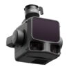
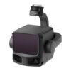
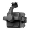
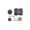
DJI Zenmuse L3

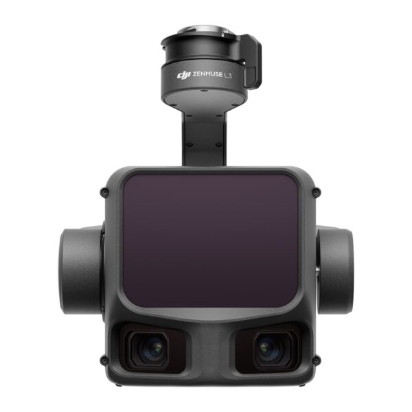
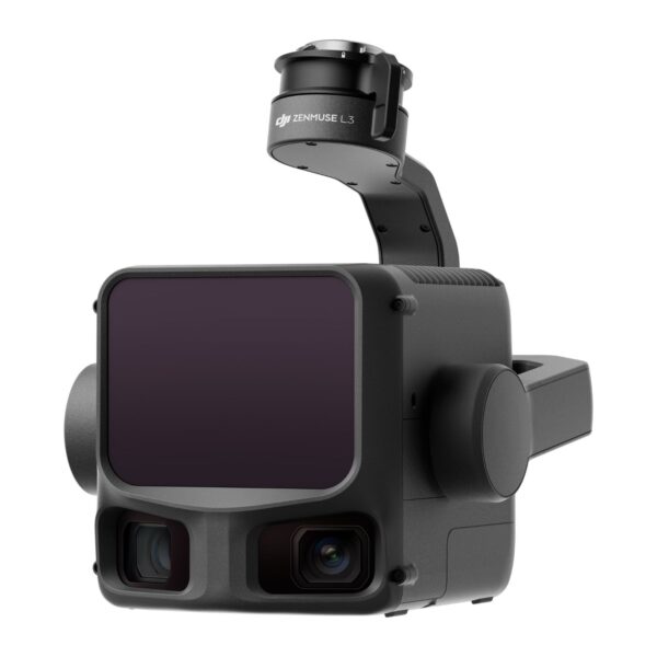
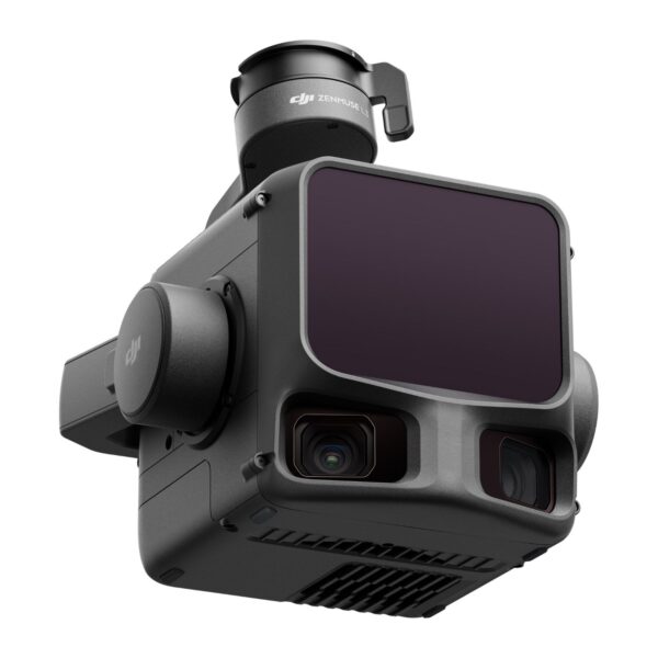
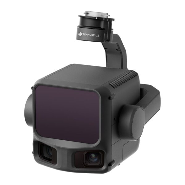
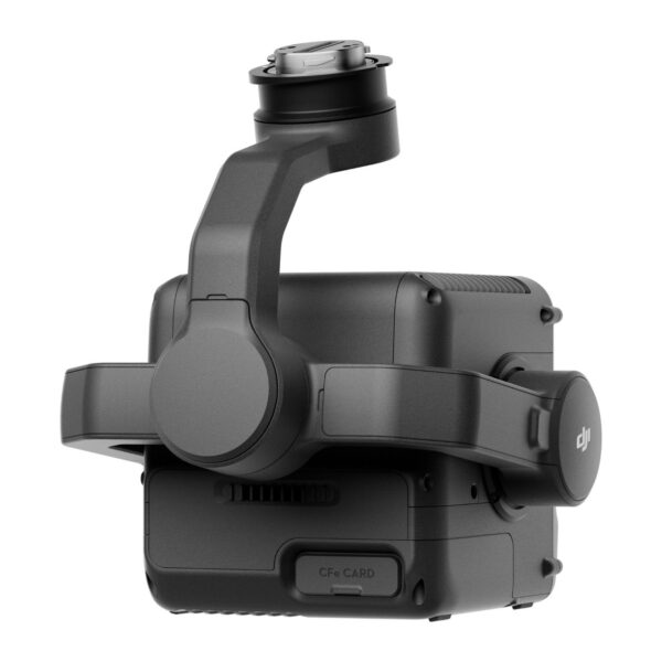
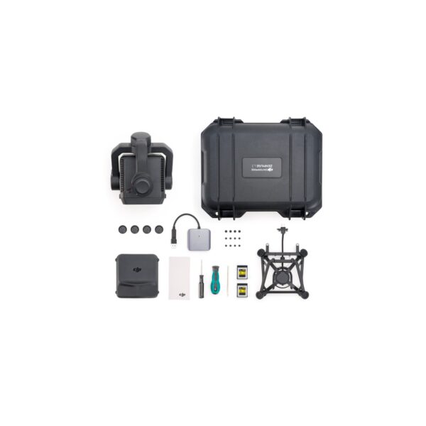
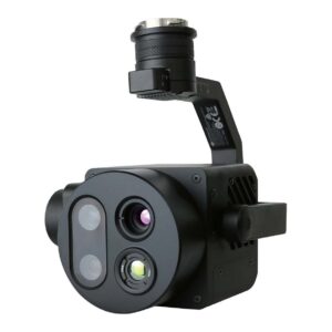
DJI’s first long-range, high-accuracy aerial LiDAR system. The Zenmuse L3 pairs a 1535 nm LiDAR with a 950 m detection range and dual 100MP RGB mapping cameras in one payload — capturing point cloud and survey-grade imagery in a single flight. Mounted on the DJI Matrice 400, a single flight covers up to 10 km², enabling up to 100 km² of high-accuracy mapping per day for topographic, forestry, mining, power-line and emergency-response teams. IP54, 1.6 kg, includes a CFexpress™ Type B 1 TB card.

See Through, Far and True

Survey teams have long had to choose between range and accuracy — fly low and cover a fraction of the project, or push higher altitudes and lose point cloud density beneath the canopy. The Zenmuse L3 closes that gap. A 1535 nm long-range LiDAR detects targets out to 950 m, dual 100MP RGB mapping cameras widen the field of view to 107°, and a high-precision POS system pushes vertical accuracy below 3 cm at 120 m altitude. The result: full-area, survey-grade outputs from a single flight at altitudes that finally make sense for large infrastructure, terrain and forestry work.

See the Zenmuse L3 in Action

Hardware Performance Redefined

Zenmuse L3 integrates a 1535 nm long-range LiDAR, dual 100MP RGB mapping cameras, a high-precision POS system and a 3-axis gimbal into one compact 1.6 kg payload — delivering unprecedented performance for its size and pushing aerial LiDAR mapping to a new class of range, accuracy and efficiency.

1535 nm Long-Range LiDAR

A maximum detection range of 950 m at 10% reflectivity opens up flight altitudes of 300–500 m, dramatically expanding single-flight coverage. A 0.25 mrad beam divergence keeps the laser spot small — about one-fifth the size of the Zenmuse L2 at the same range — so the L3 picks up power lines, branches and other thin targets, and drives more energy beneath dense vegetation. Up to 2 million pulses per second and 16 returns deliver fine-grained 3D reconstruction with strong penetration.

Dual 100MP RGB Mapping Cameras — 107° FOV

Two 100MP 4/3 CMOS RGB sensors with mechanical shutters extend the horizontal field of view to 107° — far wider than a single-camera setup. Even at a 20% LiDAR side-overlap ratio, a single flight captures everything you need to produce both digital orthophoto maps (DOM) and digital elevation models (DEM), cutting flight count and turnaround time. Pixel binning provides an effective 25MP mode with larger pixels for low-light operations.

High Accuracy — LiDAR & Photogrammetry

An upgraded POS system delivers 0.02° heading and 0.01° pitch/roll accuracy (post-processed, 1σ), while the LiDAR achieves 5 mm ranging repeatability at 150 m. Vertical accuracy is better than 3 cm at 120 m altitude, 5 cm at 300 m and 10 cm at 500 m — supporting 1:500, 1:1000 and 1:2000 mapping projects. Point cloud thickness is half that of the Zenmuse L2, and the dual 100MP cameras hit a 3 cm GSD even at 300 m altitude — without ground control points.

Up to 100 km² per Day

Paired with the DJI Matrice 400, the Zenmuse L3 covers up to 10 km² in a single flight at 300 m altitude. Over a full operational day, that is up to 100 km² of high-accuracy mapping — moving large-area surveys, corridor inspections and disaster response from multi-day campaigns into a single shift.

Multiple Deliverables in a Single Flight

One flight, multiple outputs. The Zenmuse L3 captures LiDAR and RGB data simultaneously, generating DEM, DOM, point clouds and 3D models from the same acquisition — no return flights for missed coverage, no separate sensor passes for photogrammetry vs. terrain.

Real-Time Point Cloud & Cloud Measurement

Real-time point cloud SLAM reconstruction delivers instant 2D and 3D previews during operations — measure on the fly, monitor progress, and stream data to DJI FlightHub 2 for emergency response and decision-making. Annotate points of interest and run line/area measurements directly in the cloud, with no waiting for post-processing.

PPK Workflow with DJI Terra

DJI Terra includes a robust PPK (Post-Processed Kinematic) engine for both RGB imagery and LiDAR — compatible with D-RTK 3, D-RTK 2 and standard base-station data (RINEX, RTCM, OEM). Achieve centimetre-level positioning even in areas with poor connectivity or no RTK coverage. Point-cloud processing for the L3 is a free feature in DJI Terra.

DJI Modify — Smart Filter & Profile Tools

DJI Modify automatically classifies point clouds into ground, vegetation, buildings, wires, electric towers and more, then lets you refine with Quick and Structure Selection tools. The Profile Tool extracts cross-sections for terrain analysis, structural review and elevation profiles — and Modify outputs the full range of mapping products (semantic point clouds, DEM, TIN, point grids, contour lines) for CAD and engineering workflows.

Scanning Modes

  • Linear — consistent point cloud distribution, ideal for high-accuracy terrain mapping.
  • Star-Shaped — multiple scan angles plus penetration, suited to forests and dense urban environments.
  • Non-Repetitive — broad coverage with multiple angles, optimised for power-line inspection and complex structural surveys.

Application Scenarios

  • Topographic Survey
  • Earthwork
  • Geological Disaster Investigation
  • Engineering Survey
  • Forestry Management
  • Electricity & Power Line Inspection
  • Mining Survey
  • Emergency Survey & Disaster Response

Compatible Software

DJI Pilot 2 (flight & acquisition), DJI Terra (processing & PPK), DJI Modify (classification, profiling, deliverables) and DJI FlightHub 2 (cloud, real-time point cloud, fleet operations). Point cloud processing for the L3 in DJI Terra is free, including accuracy optimisation.

Key Specifications

LiDAR wavelength 1535 nm
Detection range 950 m @ 10% reflectivity (100 kHz); 2000 m @ 80% reflectivity
Laser pulse rate 100 / 350 / 1000 / 2000 kHz (max 2 million pulses/s)
Number of returns Up to 16 returns (at 100 / 350 kHz)
Ranging repeatability < 5 mm (1σ) at 150 m
Scanning modes Linear, Star-Shaped, Non-Repetitive (80° × 80° max FOV)
RGB cameras Dual 4/3 CMOS, 100MP each (effective 25MP via pixel binning)
Combined RGB FOV 107° horizontal
RGB GSD 3 cm @ 300 m altitude
Point cloud accuracy (300 m) Vertical 5 cm RMSE, Horizontal 7.5 cm RMSE
POS accuracy (1σ, post-processed) Heading 0.02°, Pitch/Roll 0.01°
Gimbal 3-axis (pitch, roll, yaw), ±0.01° angular accuracy
Storage CFexpress™ Type B (1 TB, included), 1500 MB/s sequential write
Compatible aircraft DJI Matrice 400 (via Zenmuse L3 single gimbal connector)
Ingress protection IP54
Operating temperature -20°C to 50°C
Weight & dimensions 1.60 kg · 192 × 162 × 202 mm (L × W × H)
Power 64 W typical / 100 W max
Laser safety Class 1 (IEC 60825-1:2014)

For the complete user manual and technical documentation, visit the official DJI Zenmuse L3 downloads page.

Service & Warranty

Supplied with the standard manufacturer warranty. First year free: DJI Care Enterprise Plus or Official Extended Warranty Service is included — covering unlimited free repairs, free two-way shipping and shared fleet protection (Care Plus), or an additional one-year warranty with original parts and DJI engineer support (Extended Warranty). Backed by GulfNet Emirates after-sales support in the UAE. Browse more drones and payloads at GulfNet Emirates Shop.

FAQ

Where can I buy DJI Zenmuse L3 in Dubai?
GulfNet Emirates supplies the DJI Zenmuse L3 from its Dubai office at Al Fattan Plaza, serving survey, mapping, utility and emergency-response teams across the UAE. As an authorised DJI dealer Dubai buyers can rely on, the team handles pre-sales scoping, aircraft-payload pairing with the DJI Matrice 400, onboarding into DJI Pilot 2, DJI Terra and DJI FlightHub 2, plus after-sales technical support. Orders can be placed through a request-for-quote on the DRS storefront or by phone. Corporate procurement, government tenders and framework agreements are supported, and delivery is available across the Emirates.
How much is DJI Zenmuse L3, and what is the DJI Zenmuse L3 price in UAE?
The DJI Zenmuse L3 price UAE buyers pay is quotation-based, since the payload is sold to enterprise survey, utility and infrastructure operators rather than at a fixed retail sticker. Final pricing depends on configuration choices such as the DJI Matrice 400 airframe, D-RTK 3 base, DJI Terra and DJI Modify licences, spare CFexpress Type B cards, and the extended warranty option selected. To get an accurate dji zenmuse l3 price, share your project scope with GulfNet Emirates, and a written quote is issued in AED with lead time and warranty terms confirmed.
Is DJI Zenmuse L3 available in the UAE?
Yes. GulfNet Emirates stocks the payload for UAE customers and lists it as in-stock on the DRS storefront, so teams looking to buy dji zenmuse l3 in UAE do not need to import directly from overseas. Units ship with the 1 TB CFexpress Type B card, standard manufacturer warranty, and a first-year choice of DJI Care Enterprise Plus or Official Extended Warranty Service. Delivery covers Dubai, Abu Dhabi, Sharjah and the northern Emirates, and units are configured for the DJI Matrice 400 single gimbal connector before dispatch.
Why should I buy DJI Zenmuse L3 instead of the older Zenmuse L2?
Teams choosing to buy dji zenmuse l3 rather than the L2 get a materially different sensor. The 1535 nm LiDAR reaches 950 m at 10% reflectivity, the laser spot is roughly one-fifth the size of the L2 at the same range, and the sensor supports up to 16 returns for stronger vegetation penetration. Dual 100MP RGB cameras widen the horizontal field of view to 107°, and post-processed POS heading accuracy improves to 0.02°. Vertical accuracy is better than 3 cm at 120 m altitude, meaning fewer flights, fewer ground control points, and larger project coverage per shift.
Which drone is compatible with the DJI Zenmuse L3?
The DJI Zenmuse L3 is designed exclusively for the DJI Matrice 400 and mounts via the single gimbal connector on the aircraft’s E1 port. Other DJI Enterprise payloads are not supported on that connector, and the L3 does not fit earlier M300 or M350 airframes. Acquisition runs through DJI Pilot 2 on the Matrice 400 remote, with real-time point cloud SLAM preview and streaming to DJI FlightHub 2. If your fleet does not already include an M400, GulfNet Emirates can quote the payload and airframe together as a single mapping package.
What daily coverage justifies the investment for large survey projects?
Mounted on the DJI Matrice 400, the L3 covers up to 10 km² in a single flight at 300 m altitude and up to 100 km² per day, based on flat terrain, 20% side overlap, 17 m/s cruise, and six hours of total flight time. For corridor inspections, topographic mapping, mining volumetrics, and post-disaster response, this compresses multi-day campaigns into a single shift. The payload also captures LiDAR and RGB data simultaneously, producing DEM, DOM, point clouds, and 3D models from one acquisition, which cuts flight repeats and reduces operator time on site.
Who sells DJI Zenmuse L3 in the UAE?
GulfNet Emirates is a DJI distributor UAE survey and inspection teams work with for enterprise payloads including the Zenmuse L3. The company supplies the sensor with configured firmware, the included 1 TB CFexpress Type B card, and DJI Care Enterprise Plus or Extended Warranty registration handled at point of sale. Support covers first-flight setup on the DJI Matrice 400, DJI Terra PPK workflows, and DJI Modify classification. Procurement channels include direct purchase, tender responses, and integration into larger fleet or docking-station deployments already running on the DRS storefront.
Is there a DJI Zenmuse L3 supplier in Abu Dhabi?
GulfNet Emirates services Abu Dhabi customers from its Dubai office and delivers the L3 to survey firms, utilities, oil and gas contractors, and government mapping departments across the emirate. Quotations, demo bookings, invoicing in AED, and after-sales support can all be arranged remotely, and site visits for large deployments are possible. Because the L3 is designed for corridor inspections, forestry, mining, and emergency response, Abu Dhabi buyers running powerline surveys, desert topography, or offshore-adjacent projects can source the payload without dealing with international freight, unclear warranty terms, or delayed technical support.
What is the best place to buy DJI Zenmuse L3 in the UAE?
For enterprise LiDAR at this class of accuracy, buyers usually want a local partner who can back the hardware after the invoice is signed. GulfNet Emirates positions itself as a trusted seller of DJI Zenmuse L3 in the UAE by pairing the sensor with configured aircraft, licensed software, and technical onboarding rather than shipping a boxed unit and stepping away. That includes verifying compatibility with existing M400 fleets, walking teams through DJI Terra PPK for centimetre-level positioning without RTK coverage, and providing a single point of contact for warranty claims across the first year.
Can I buy DJI Zenmuse L3 online in UAE, or reserve a unit in Dubai?
Yes. Buyers wanting to buy DJI Zenmuse L3 online in UAE can submit a request-for-quote directly from the product listing on the DRS storefront, and a specialist replies with pricing, availability, and delivery terms. Because the L3 is an enterprise payload rather than a consumer camera, checkout is quote-based rather than card-on-file. For teams needing a dji zenmuse l3 for sale in Dubai on a defined timeline, GulfNet Emirates can confirm stock or lead time in writing before purchase, and reserve a unit against a signed quotation or purchase order.
How do I get a quote for DJI Zenmuse L3 and related accessories?
Submit an RFQ from the product listing, by email, or by phone to GulfNet Emirates. Include the intended aircraft (a new DJI Matrice 400 or an existing airframe), preferred software licences such as DJI Terra and DJI Modify, and whether a D-RTK 3 base is required. As a DJI dealer UAE customers can transact with locally, the response covers unit price, spare CFexpress Type B cards, warranty option, estimated delivery to your emirate, and payment terms in AED. Bundled aircraft-and-payload quotes are common for teams standardising a new mapping workflow.
Can I book a DJI Zenmuse L3 demo in Dubai before buying?
Yes. Teams can book a DJI Zenmuse L3 demo in Dubai through GulfNet Emirates, useful for validating vertical accuracy targets, PPK workflows in DJI Terra, and point cloud density under vegetation before committing capex. A demo also lets crews confirm the scanning mode (Linear, Star-Shaped, or Non-Repetitive) that best fits their project type, whether that is powerline inspection, forestry, or urban topographic mapping. As a DJI Zenmuse L3 dealer in UAE with enterprise focus, the team can arrange a joint session covering the DJI Matrice 400 airframe and DJI FlightHub 2 fleet management.


Weight 1.6 kg
Dimensions 19.2 × 16.2 × 20.2 cm
Brand

DJI

Use Case

Aerial Mapping, LiDAR Survey, Power Line Inspection, Forestry, Emergency Response

LiDAR Range

Up to 950 m @ 10% reflectivity

RGB Camera

Dual 100MP, 4/3 CMOS, 107° combined FOV

Compatible Aircraft

DJI Matrice 400

Daily Coverage

Up to 100 km² per day

Chat with us