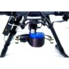
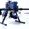
Geolux LX-80-AB Water Level Measurement Kit for Drones
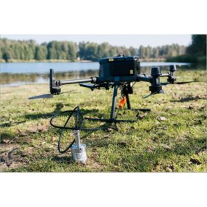
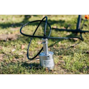
The Geolux LX-80-AB is an airborne 80 GHz radar water-level sensor that measures the distance from the sensor to a water surface without contact. Flown autonomously at 30–40 m along a river, it produces water surface elevation profiles with centimetre accuracy — turning a drone into a flying hydrometric station for rivers, channels, reservoirs and industrial tanks. Because water is an excellent reflector of microwaves, water targets dominate the radar return for clean, reliable readings.
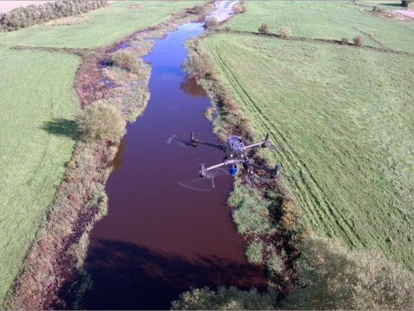
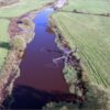
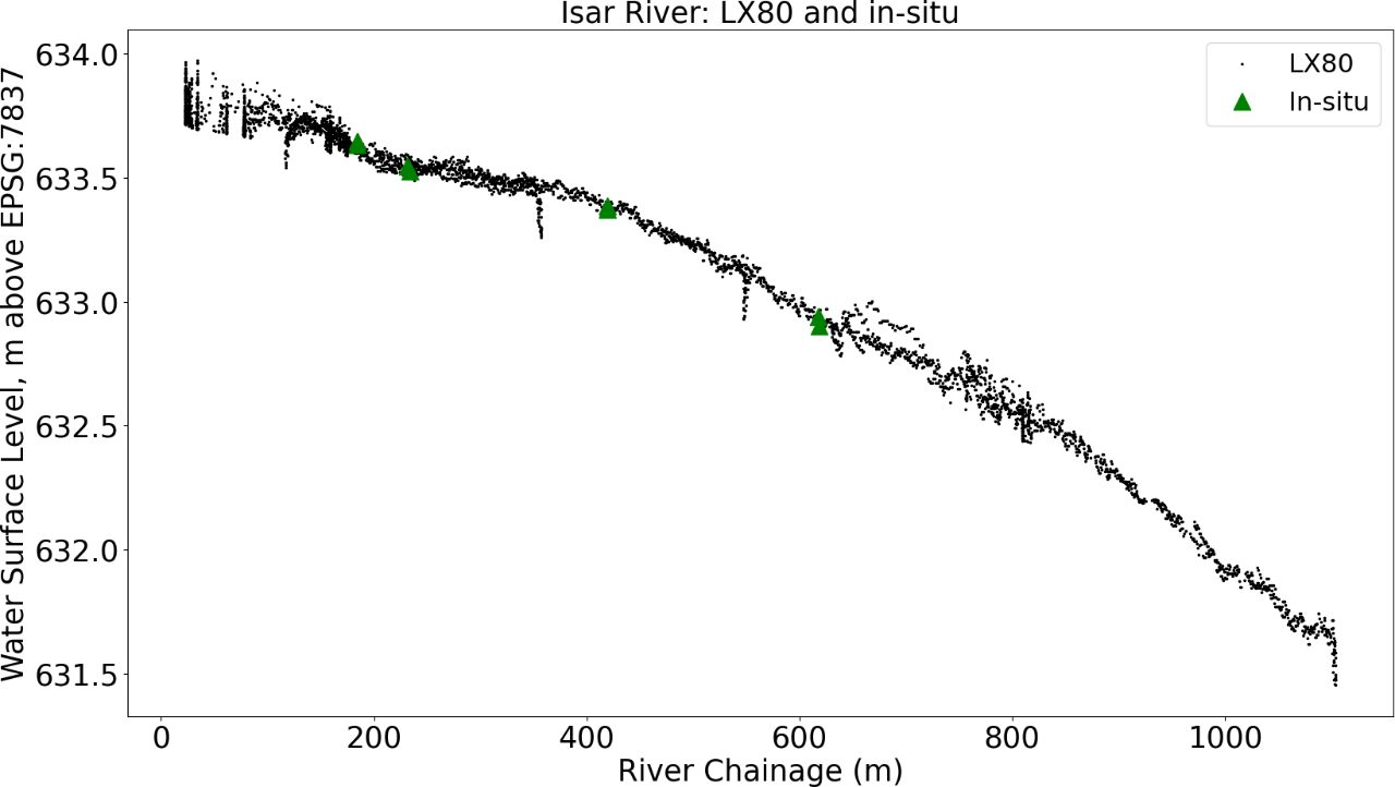
Profiling a River’s Water Surface Elevation Using a UAV-Borne Water Level Radar

Contactless water levels from the air
The LX-80-AB transmits a frequency-modulated wave in the 80 GHz (W-band) range and measures the frequency shift of the reflection from the water surface. Flown along a river at 30–40 m, it captures continuous water surface elevation profiles with centimetre accuracy — no gauges, no in-water installation, and access to reaches a boat or person cannot safely reach.
SkyHub-logged, drone-agnostic
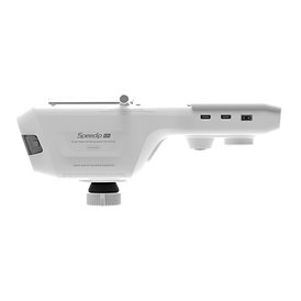
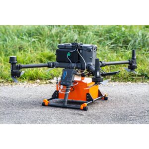
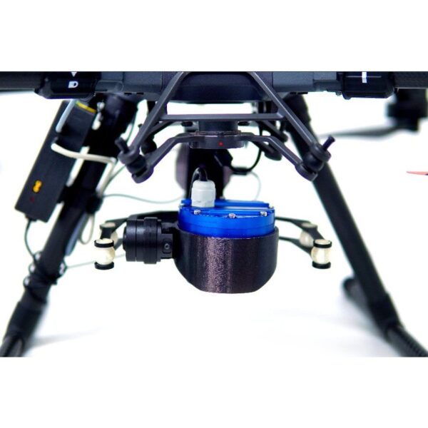
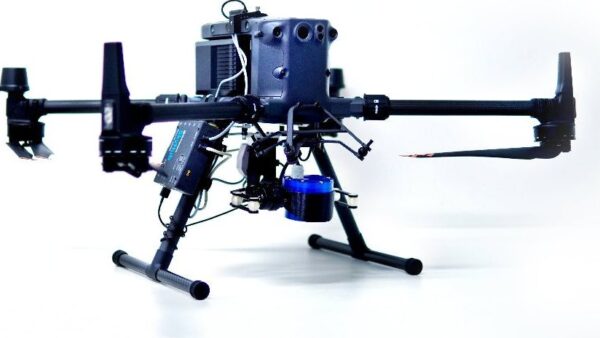
The kit connects to the SkyHub onboard computer, which logs the georeferenced data and lets the sensor fly on a range of platforms including the DJI M350/M300 RTK and Pixhawk-based drones. It ships with the sensor, SkyHub cable, gimbal and mountings, and data-logging software — the airborne version of the proven Geolux LX-80.
Applications
Water level monitoring for rivers, channels and lakes; water reservoir monitoring and irrigation control; level measurement of fluids in the chemical industry; and level monitoring in wastewater and industrial applications.
Service & Warranty
Supplied by GulfNet Emirates Drone & Robotic Systems with UAE-based technical support, integration guidance and full manufacturer warranty. The LX-80-AB requires the SkyHub onboard computer and additional components for drone operation — request a quote and our team will propose the complete, ready-to-fly hydrometric kit.
Key Specifications
| Sensor type | 80 GHz (W-band) FMCW radar water-level sensor — contactless |
| Measurement principle | Frequency-modulated radar wave reflected off the water surface |
| Accuracy | Centimetre-level water surface elevation |
| Operating altitude | 30–40 m, autonomous flight along the river |
| Output | Water surface elevation profiles |
| Onboard computer | Requires the SkyHub onboard computer for data logging |
| Supported drones | DJI M350 / M300 RTK and Pixhawk-based drones (via SkyHub) |
| Base sensor | Airborne version of the Geolux LX-80 |
| Certifications | EN 61326-1, ETSI EN 301 489-1/-3, EN 62368-1, EN 60950-22, EN 61010-1, FCC Part 15 Class B, ISED RSS211 |
| In the kit | Geolux LX-80-AB radar level sensor, cable to SkyHub onboard computer, gimbal and mountings, data-logging software |
| SKU | IS-GEOLUX-LX-80-AB |
Frequently Asked Questions
What is the Geolux LX-80-AB Water Level Measurement Kit and who is it for?
The Geolux LX-80-AB Water Level Measurement Kit is a drone-mounted 80 GHz FMCW radar sensor that measures water surface elevation without any contact with the water. Flown autonomously at 30 to 40 m along a river, it produces centimetre-accurate elevation profiles, effectively turning a UAV into a flying hydrometric station. It is built for hydrology teams, environmental agencies, dam and reservoir operators, irrigation authorities, and industrial site managers who need reliable level data across rivers, channels, reservoirs, wastewater ponds and chemical tanks. Because water strongly reflects microwaves, returns stay clean even over reaches that boats or field crews cannot safely access. The kit ships with the sensor, SkyHub cable, gimbal, mountings and data-logging software.
Where can I buy Geolux LX-80-AB Kit in Dubai?
GulfNet Emirates Drone & Robotic Solutions supplies the Geolux LX-80-AB Water Level Measurement Kit from its Dubai office at Al Fattan Plaza, 6th Floor, Office 607. Orders are handled directly through the DRS storefront, with a Request a Quote option on the product listing that routes enquiries to the technical sales team. Buyers in Dubai receive local coordination, integration support and manufacturer-backed warranty, along with guidance on the additional SkyHub onboard computer and mounting components needed to fly the sensor. Site visits, product walkthroughs and payment options can be arranged with the same team. For urgent requirements, calling +971-4-8972598 is the fastest way to confirm availability and reserve stock.
How much is Geolux LX-80-AB Kit and how do I get the Geolux LX-80-AB Water Level Measurement Kit price in UAE?
Pricing for the Geolux LX-80-AB Water Level Measurement Kit is quotation-based rather than listed openly, because the final figure depends on the drone platform, whether a SkyHub onboard computer is bundled, mounting configuration, shipping and any training required. Buyers looking for the Geolux LX-80-AB Water Level Measurement Kit price should submit a Request a Quote against the product SKU IS-GEOLUX-LX-80-AB. GulfNet Emirates returns a formal quotation in AED covering the sensor, cable to SkyHub, gimbal and mountings, and the data-logging software, along with warranty terms and estimated delivery. This approach keeps the Geolux LX-80-AB Water Level Measurement Kit price UAE customers pay accurate to their actual deployment.
Is Geolux LX-80-AB Kit available in the UAE and can I buy Geolux LX-80-AB Water Level Measurement Kit in UAE without importing it myself?
Yes. The kit is stocked and supplied locally, so customers can buy Geolux LX-80-AB Water Level Measurement Kit in UAE through GulfNet Emirates without arranging their own import, customs clearance or overseas payments. The product listing shows in-stock availability with the SKU IS-GEOLUX-LX-80-AB. Purchasing locally also means the buyer gets UAE-based technical support, integration guidance for DJI M350, M300 RTK and Pixhawk-based drones, and full manufacturer warranty against a locally issued invoice. This is particularly useful for government hydrology projects and consultancies that need documented supply chains, warranty coverage and a UAE point of contact rather than direct-to-factory logistics from Europe.
Who sells Geolux LX-80-AB Kit in the UAE and who is the authorised Geolux dealer Dubai buyers should approach?
GulfNet Emirates operates the Drone & Robotic Solutions storefront that lists and sells this radar sensor, positioning itself as the authorised Geolux dealer Dubai and wider UAE customers can approach for procurement, integration and after-sales. The company handles brand supply across enterprise drones, payloads and sensors, and specialised hydrology instruments, and lists the LX-80-AB under Payloads & Sensors with brand attribution to SPH Engineering, which packages the airborne Geolux radar. Buyers can reach the team through the DRS site, the Contact Us page, the Request a Quote workflow, or directly by phone on +971-4-8972598 to confirm authorisation, warranty scope and integration support for their target drone platform.
How is the Geolux LX-80-AB Water Level Measurement Kit for sale different from the ground-based Geolux LX-80?
The Geolux LX-80-AB Water Level Measurement Kit for sale here is the airborne configuration of the proven Geolux LX-80 ground sensor. Instead of fixed-mount installation over a bridge, weir or gauging station, the LX-80-AB is packaged with a gimbal, drone mountings, a cable to the SkyHub onboard computer and data-logging software so it can fly on a UAV. That opens up reach-by-reach river profiling, reservoir sweeps and access to sites where fixed infrastructure is impractical or unsafe. The radar principle is identical: an 80 GHz FMCW wave reflects off the water surface, and the frequency shift is converted to a centimetre-accurate distance. The mission profile, not the physics, is what changes.
Which drones does the kit support and can I book a Geolux LX-80-AB Kit demo in Dubai before committing?
The kit is drone-agnostic through the SkyHub onboard computer, with confirmed support for the DJI M350 RTK, DJI M300 RTK and Pixhawk-based platforms. SkyHub handles georeferenced logging and integrates the sensor with the flight controller so autonomous river-following missions at 30 to 40 m can be executed cleanly. Buyers who want to see the workflow end to end can book a Geolux LX-80-AB Kit demo in Dubai through the GulfNet Emirates DRS team, either at their office in Al Fattan Plaza or coordinated at a client site. Demos typically walk through mission planning, in-flight logging, and post-flight processing of the water surface elevation profile so procurement teams can validate fit before purchase.
What is the best place to buy Geolux LX-80-AB Kit in the UAE for government hydrology and irrigation projects?
For public sector hydrology, dam authorities and irrigation departments, the best place to buy Geolux LX-80-AB Kit in the UAE is a supplier that combines authorised distribution with local integration capability. GulfNet Emirates fits that profile: the DRS storefront lists the LX-80-AB with the certifications the product carries, including EN 61326-1, ETSI EN 301 489-1 and -3, EN 62368-1, EN 60950-22, EN 61010-1, FCC Part 15 Class B and ISED RSS211, which support compliance documentation for tenders. The team can also propose the full ready-to-fly package with the SkyHub computer, compatible DJI M350 or M300 RTK airframe and training, which is usually more useful for project procurement than sourcing components separately.
How do I buy Geolux LX-80-AB Kit online in UAE, and how does the ordering process actually work?
To buy Geolux LX-80-AB Kit online in UAE, open the product listing on the GulfNet Emirates DRS store and use the Request a Quote button tied to the LX-80-AB SKU. Because the kit needs to be scoped against a specific drone platform and SkyHub configuration, checkout is handled through a formal quotation rather than direct cart payment. The sales team confirms configuration, issues a quotation in AED, and once approved, arranges invoicing, payment terms, delivery scheduling and installation support. Buyers get a written scope covering the sensor, cable, gimbal, mountings and logging software, plus warranty terms. For pure online buyers, this quote-first flow avoids ordering an incomplete setup that cannot actually fly.
Who is the trusted Geolux distributor UAE customers should use for warranty and long-term support?
GulfNet Emirates positions itself as a trusted seller of Geolux LX-80-AB Kit in the UAE and acts as the Geolux distributor UAE buyers can rely on for warranty administration and post-sale support. Every unit shipped from the DRS store carries full manufacturer warranty, backed by UAE-based technical support and integration guidance for DJI M350, M300 RTK and Pixhawk platforms. Because the LX-80-AB is a specialised radar payload rather than a consumer accessory, having a local Geolux dealer UAE teams can contact directly for firmware questions, SkyHub logging issues or spare parts significantly reduces downtime. Invoices, warranty cards and compliance documentation are issued locally, which simplifies audits and internal asset registration.
I need a Geolux LX-80-AB Kit supplier in Abu Dhabi and Northern Emirates, is delivery covered?
GulfNet Emirates supplies the LX-80-AB across the UAE from its Dubai base, functioning as a Geolux LX-80-AB Kit supplier in Abu Dhabi, Sharjah, Ajman, Ras Al Khaimah, Fujairah and Umm Al Quwain. Orders raised through the DRS store are dispatched with tracked delivery, and larger project kits that include the SkyHub onboard computer, gimbal, mountings and drone integration are usually delivered directly to the client site with an engineer available for handover. Abu Dhabi customers running river, wadi or reservoir monitoring programmes typically opt for on-site commissioning so the first mission can be flown against the client’s actual DJI M350 or M300 RTK airframe before the team departs.
How do I get a quote for Geolux LX-80-AB Kit and what should I include in the enquiry?
To get a quote for Geolux LX-80-AB Kit, use the Request a Quote button on the product listing or submit the DRS quote form referencing SKU IS-GEOLUX-LX-80-AB. A stronger enquiry speeds the response: mention the target drone (DJI M350 RTK, M300 RTK or a Pixhawk platform), confirm whether you already own a SkyHub onboard computer or need one bundled, and describe the mission profile, whether river profiling, reservoir sweeps, irrigation channels or industrial tank level checks. Adding project location, expected mobilisation date and any tender or compliance requirements lets GulfNet Emirates return an accurate quotation in AED covering hardware, logistics, warranty and, where relevant, training and site commissioning.