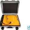
Radar Systems Zond Aero 500 NG Ground Penetrating Radar (GPR) System
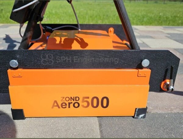
The Zond Aero 500 NG is a universal 500 MHz ground penetrating radar for both terrestrial and airborne surveys. Real-Time Sampling (RTS) technology with built-in digital signal processing delivers an exceptional signal-to-noise ratio, while geotagged SEGY output integrates cleanly into geophysical workflows. One of the lightest GPR systems on the market, it can be flown on medium drones, pushed on a cart or towed — whichever suits the survey.
Ground Penetrating Radar — Radar Systems Zond Aero 500

One system, three survey modes
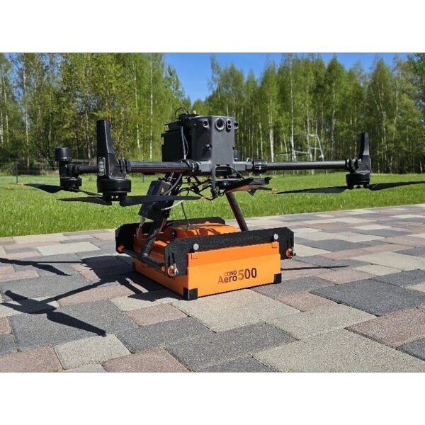
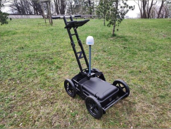
Fly the Zond Aero 500 NG on a DJI M350/M300 RTK for large open areas, mount it on a wheeled cart for streets and confined spaces, or tow it on a rope where the ground will not bear a cart. The same sensor adapts to the site instead of forcing you to own three instruments.

RTS data quality, up to 4 m deep
The 500 MHz shielded antenna with Real-Time Sampling reaches up to 4 m in average soil and resolves utilities, voids and stratigraphy with a clean signal-to-noise ratio. Data is logged as geotagged SEGY (.sgy) for direct use in Prism 2 and standard geophysical software, with an IP68 cased build for rugged field work.
Applications
Utility search and underground infrastructure mapping, archaeology, geotechnical surveys, geological stratigraphy, and glaciology / snow and ice thickness profiling.
Service & Warranty
Supplied by GulfNet Emirates Drone & Robotic Systems with UAE-based technical support, integration guidance and full manufacturer warranty. The Zond Aero 500 NG requires additional components and software for drone operation — request a quote and our team will propose the complete, ready-to-fly GPR set.
Key Specifications
| Type | Single-channel GPR with shielded antenna |
| Central frequency | 500 MHz |
| Operating bandwidth | 200–900 MHz (-12 dB) |
| Sampling | Real-Time Sampling (RTS) with high hardware stacking |
| Samples per scan | 256 / 512 / 1024 / 2048 / 4096 / 8192 (selectable) |
| Sample rate | Up to 1,280,000 samples/second |
| Scan rate | Up to 2,500 scans/second |
| Penetration depth | Up to 4 m in average soil (≈2 m at 0.6 m antenna elevation) |
| Data format | Standard SEGY (.sgy) with trace geotagging |
| Operating temperature | -20°C to 60°C |
| Ingress protection | IP68 in protective case; IP52 airborne |
| Supported drones | DJI M350 / M300 RTK (not compatible with DJI M400) |
| Weight | 2.1 kg airborne; 7.1 kg in protective case |
| Size (airborne) | 41 × 31 × 16 cm |
| Certification | FCC 2AUQQ-AERO500NG · IC 25515-AERO500NG |
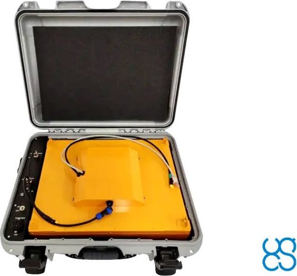
| In the kit | Zond Aero 500 NG GPR (500 MHz), Prism 2 acquisition/processing software, protective case with integrated 99 Wh Li-Ion battery and Wi-Fi router, charger, tow rope, DJI M300/M350 mounting kit |
| SKU | IS-RS-ZOND-AERO-500 |
Frequently Asked Questions
Where can I buy Zond Aero 500 NG GPR in Dubai?
GulfNet Emirates supplies the Zond Aero 500 NG through its Drone & Robotic Systems division, based at Al Fattan Plaza in Dubai. As an authorised Zond dealer Dubai survey teams can approach directly, GulfNet handles technical scoping, delivery, and post-sale integration for buyers who prefer to buy Radar Systems Zond Aero 500 NG GPR System in UAE rather than import it. Enquiries route through the Dubai office, and orders are processed against a formal quotation that covers the SPH Engineering Prism 2 software licence, the protective case with battery and Wi-Fi router, the mounting kit for the DJI M300 or M350 RTK, and any additional drone-integration components a specific workflow requires.
How much is Zond Aero 500 NG GPR?
Pricing is issued per-quotation rather than published on the storefront, because the final figure depends on how the system is built out. The Zond Aero 500 NG GPR price in UAE varies with whether the package is drone-only, cart-only, or a combined ground-and-airborne kit. Bundling the SkyHub onboard computer and UgCS flight-planning software will also shift the Radar Systems Zond Aero 500 NG GPR System price upward compared with a bare payload. To confirm the exact Radar Systems Zond Aero 500 NG GPR System price UAE buyers pay for a specific build, get a quote for Zond Aero 500 NG GPR through GulfNet Emirates. The team responds with a scoped configuration and a firm figure.
Is Zond Aero 500 NG GPR available in the UAE?
Yes. The Zond Aero 500 NG is stocked and supplied locally by GulfNet Emirates, a Zond distributor UAE survey and utility-mapping firms rely on for SPH Engineering payloads. If you are wondering who sells Zond Aero 500 NG GPR in the UAE, availability runs directly through GulfNet’s Drone & Robotic Systems storefront with UAE-based technical support, integration guidance, and full manufacturer warranty. Buyers do not need to arrange international shipping or handle customs clearance for the unit. In-stock status is shown against the SKU IS-RS-ZOND-AERO-500, and lead times for specific drone-mounted or cart-based configurations are confirmed at the quotation stage.
Which drones is the Zond Aero 500 NG GPR compatible with?
The Radar Systems Zond Aero 500 NG GPR System is designed for medium-class enterprise drones, specifically the DJI Matrice 350 RTK and Matrice 300 RTK. It is not compatible with the newer DJI Matrice 400, and buyers targeting that airframe should look at the Zond Aero 600 instead. The airborne configuration weighs 2.1 kg and measures 41 by 31 by 16 cm, keeping it within the M350 and M300 RTK payload envelope. A DJI M300 or M350 mounting kit is included in the standard package, and mounts for other drone types can be supplied on request through the quotation process.
How deep can the Zond Aero 500 NG GPR see underground?
The 500 MHz shielded antenna with Real-Time Sampling reaches up to 4 m in average soil, and around 2 m when flown at a 0.6 m antenna elevation above ground. Actual penetration is influenced by soil conductivity, moisture, and the mineral content of the subsurface, so results in wet clay will differ from those in dry sand or compacted fill. Data is captured at up to 1,280,000 samples per second with a scan rate up to 2,500 scans per second, which gives enough resolution to separate closely spaced utilities, voids, and stratigraphic layers within that depth window.
Can the Zond Aero 500 NG GPR be used on the ground as well as on a drone?
Yes, the same sensor supports three survey modes. It can be flown on a DJI Matrice 350 RTK or Matrice 300 RTK for large open sites, mounted on a wheeled cart for streets, car parks and confined spaces, or towed on a rope where the terrain will not support a cart. The protective case has an integrated 99 Wh Li-Ion battery and a Wi-Fi router built in, so ground-mode operation does not need a separate power pack. This flexibility means one instrument covers airborne utility mapping and hand-pushed archaeological or geotechnical work without a second radar purchase.
What data format does the Zond Aero 500 NG GPR produce?
Recordings are logged in standard SEGY (.sgy) format with per-trace geotagging, which is the format most geophysical processing tools expect. The included Prism 2 acquisition and processing software from Radar Systems handles field capture and first-pass interpretation, and the geotagged SEGY output can be moved into common third-party GPR packages without conversion. Because coordinates travel with each trace, aligning radar data against RTK survey grids, GIS layers or topographic maps is direct. This matters for utility deliverables and geotechnical reports where every anomaly needs a precise location fix rather than an approximate track line.
What is included in the kit, and what else is needed for drone surveys?
The base package covers the Zond Aero 500 NG GPR unit, Prism 2 software, protective case with the integrated 99 Wh battery and Wi-Fi router, a charger, a tow rope, and the DJI M300/M350 mounting kit. For drone operation you also need the SkyHub onboard computer and UgCS flight-planning software to sequence the mission and stream data. GulfNet’s team scopes and quotes the SkyHub, UgCS licence, and any project-specific integration parts alongside the payload, so the delivered kit is a complete, ready-to-fly GPR set rather than a bare sensor that still needs assembly work.
What applications is the Zond Aero 500 NG GPR suited for?
Typical deployments include utility search and underground infrastructure mapping, archaeological prospection, geotechnical site investigation, geological stratigraphy, and glaciology work such as snow and ice thickness profiling. The IP68-rated protective case, IP52 airborne rating, and a wide operating range from -20°C to 60°C mean it holds up in Gulf desert conditions as well as cold-climate ice surveys. Airborne mode suits large open desert sectors and pipeline corridors where a cart would be too slow, while the ground modes cover urban utility mapping and heritage sites where drone flight is restricted or unnecessary.
Who is the best supplier of the Zond Aero 500 NG GPR in the UAE?
GulfNet Emirates is the go-to Zond Aero 500 NG GPR dealer in UAE surveying and geophysics teams work with, and is widely regarded as the best place to buy Zond Aero 500 NG GPR in the UAE for integrated drone-plus-GPR packages. Head office is in Dubai, and the same team acts as a Zond Aero 500 NG GPR supplier in Abu Dhabi for federal utility, oil-and-gas and infrastructure clients. As a Zond dealer UAE customers can approach for both the payload and the drone integration side, GulfNet handles procurement, SkyHub and UgCS configuration, and after-sales technical support from a single point of contact.
Can I buy the Zond Aero 500 NG GPR online in the UAE?
Yes. The product listing on GulfNet’s Drone & Robotic Systems storefront is the entry point to buy Zond Aero 500 NG GPR online in UAE, and the Radar Systems Zond Aero 500 NG GPR System for sale there is routed through a request-a-quote workflow rather than instant checkout, because the final configuration needs to be scoped for each buyer. GulfNet is a trusted seller of Zond Aero 500 NG GPR in the UAE for enterprise buyers, government surveying units and geophysics consultancies, and lists the unit as Zond Aero 500 NG GPR for sale in Dubai with in-stock availability against SKU IS-RS-ZOND-AERO-500.
Can I book a Zond Aero 500 NG GPR demo in Dubai before buying?
Yes. Buyers who want to see the payload before they commit can book a Zond Aero 500 NG GPR demo in Dubai through GulfNet Emirates. A typical demo walks through the airborne mounting on a DJI M350 RTK, the cart configuration for street-level surveys, and a live Prism 2 acquisition pass so the operator sees the SEGY output first-hand. Once the configuration is agreed, the same team processes the order to buy Radar Systems Zond Aero 500 NG GPR System with the SkyHub, UgCS and mounting kit specified for the chosen airframe. Training and integration support are arranged in the same window.