


PIX4Dreact Emergency Response Mapping Software
PIX4Dreact delivers rapid 2D situational awareness when every minute counts. Built for public-safety and emergency-response teams, it stitches georeferenced orthomosaics in minutes on a standard laptop — with no internet connection required in the field.
Meet PIX4Dreact – 2D fast-mapping for emergency response and public safety
Step 1 — Capture
Fly your drone over the scene to capture the images you need. Compatible with DJI and Parrot drones via the PIX4Dcapture flight app for automated, optimised flight plans.

Step 2 — Process
Combine large numbers of images in minutes with PIX4Dreact’s fast-stitching engine. Create accurate, measurable 2D orthomosaic maps in the field or at base — no internet required.

Step 3 — Examine
Use simple tools to identify and measure points of interest, mark GPS coordinates, and evaluate the situation on the ground. Overlay the US National Grid for universal reference across teams.
Step 4 — Respond
With up-to-date aerial maps, gain precious time, improve responder safety, and coordinate action with effective situational awareness. Export maps and PDF reports to share instantly with decision makers.
Fast & intuitive mapping
PIX4Dreact creates accurate 2D maps from drone imagery in minutes, without any specialist knowledge. Developed with public safety professionals, it is designed to perform in high-pressure, offline environments.
Drones in public safety
Drones equipped with PIX4Dreact are rapidly becoming the standard tool for first responders. From wildfire management to disaster relief, aerial mapping gives teams the situational awareness they need when it matters most.
2D orthomosaic maps
PIX4Dreact’s fast-stitching technology combines nadir drone images into accurate, georeferenced 2D orthomosaics. Export as GeoTIFF for integration with GIS platforms or sharing with partner agencies.
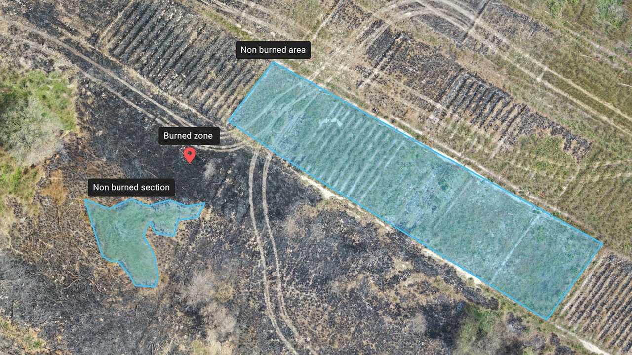
Markers & measurements
Add GPS markers, measure distances and areas, and annotate maps with points of interest. Export markers in GeoJSON, KML, or Shapefile format for use in command-and-control systems.
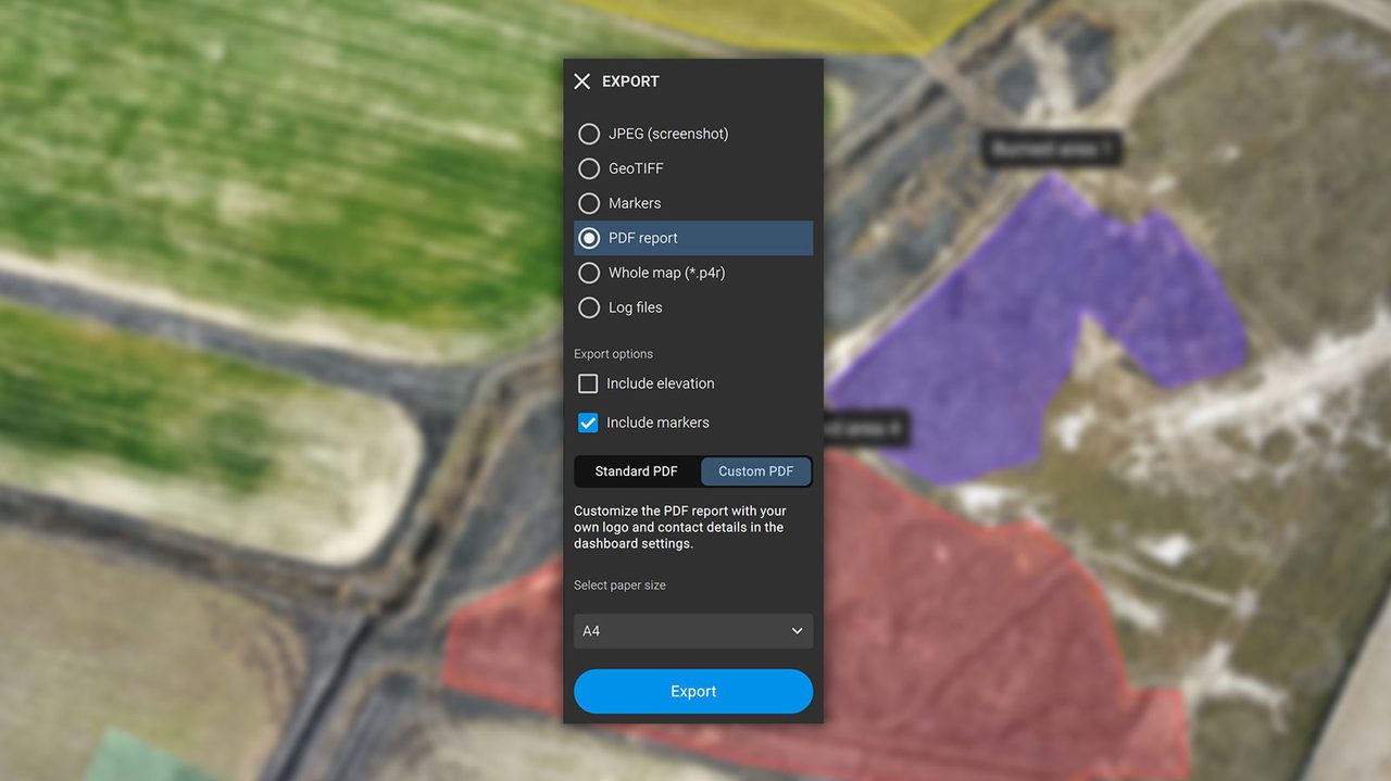
Custom PDF reports
Share a 2D orthomosaic, GPS markers, and measurements in a single PDF report over email or messaging. White-label the report with your agency’s logo and details for professional documentation.
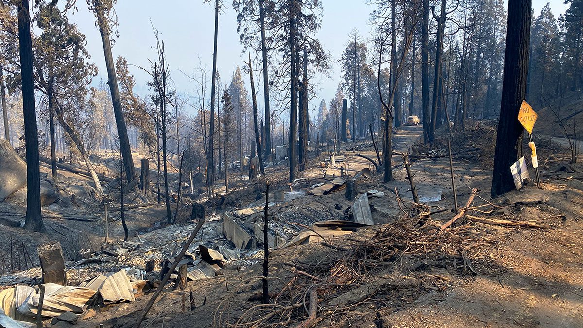
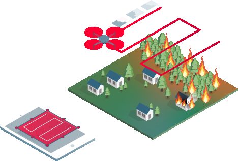
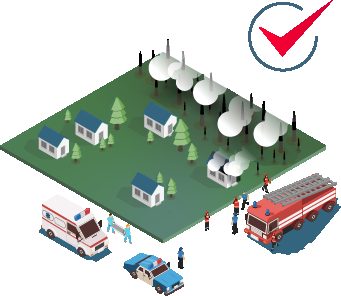
Wildfire response
Aerial mapping with PIX4Dreact helps fire crews track fire perimeters, identify access routes, and plan resource deployment — all from real-time drone data processed on-site without cloud connectivity.
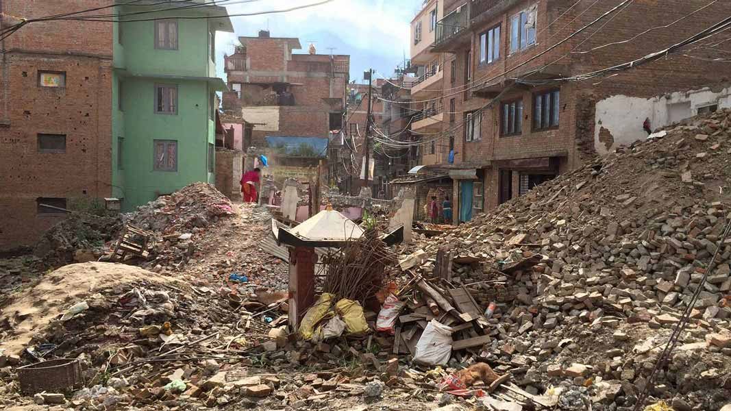
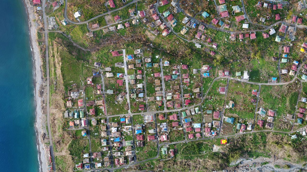
Disaster & earthquake response
Following earthquakes, floods, or other disasters, PIX4Dreact enables rapid damage assessment mapping within minutes of drone deployment, providing critical intelligence for search-and-rescue and relief operations.
Service & Warranty
Every PIX4D licence supplied by GulfNet Emirates includes official Pix4D activation, access to the latest software updates within your licence term, and onboarding support from our certified team in the UAE. We provide local technical assistance, training, and renewal management so your mapping workflows stay productive. Contact us for volume licensing, education pricing, and tailored support packages.
Key Specifications
| Software Type | 2D fast-mapping software for emergency response |
|---|---|
| Platform | Windows, macOS |
| Compatible Drones | DJI, Parrot, and all nadir image-capture drones |
| Processing | Offline (no internet required), on mid-range laptop |
| Output: 2D Map | GeoTIFF orthomosaic |
| Output: Markers | GeoJSON, KML, Shapefile |
| Output: Report | Custom PDF (white-label) |
| Output: Full Map | .p4r (import on another PIX4Dreact device) |
| Cloud Sharing | PIX4Dcloud (optional) |
| License Type | Annual subscription |
| Language Support | English, French, German, Italian, Japanese, Korean, Portuguese, Russian, Spanish, Ukrainian, Chinese |
Frequently Asked Questions
How quickly can PIX4Dreact produce a map after drone flight?
PIX4Dreact can process drone imagery and produce an accurate 2D orthomosaic map within minutes of landing — processing speed depends on image count and hardware, but typical survey flights are processed in 5–15 minutes.
Does PIX4Dreact require an internet connection in the field?
No. PIX4Dreact is designed specifically to operate fully offline. All processing and map generation happens locally on a laptop or desktop in the field, without any cloud or internet dependency.
What types of emergencies is PIX4Dreact used for?
PIX4Dreact is used across a wide range of emergency scenarios including wildfires, floods, earthquakes, crash scene investigation, missing person searches, tactical planning, and humanitarian aid operations.
Can PIX4Dreact maps be shared with other teams in real time?
Yes. Maps can be uploaded to PIX4Dcloud for instant sharing with remote teams and command centres, or exported as GeoTIFF, PDF reports, and Shapefiles for use in existing command-and-control workflows.


