
MetScan + AIRINS.ai — UAV Methane 3D Screening & Quantification
MetScan, from AIRINS (formerly Soarability), is a UAV-mounted diffuse-reflection OP-TDLAS sensor that pairs with the AIRINS.ai (AAI) analytics platform to deliver fast, repeatable methane leak screening, 3D mapping and trial quantification across pipelines and facilities. Engineered for LDAR programs and aligned with the EU Methane Regulation and OGMP 2.0, it turns routine drone missions into geo-referenced, follow-up-ready methane intelligence.
Combining UAV & 3D Scanning Technology for High-Efficiency Methane Leak Detection
High-Efficiency Methane Leak Detection from the Air
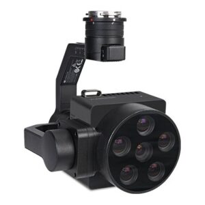
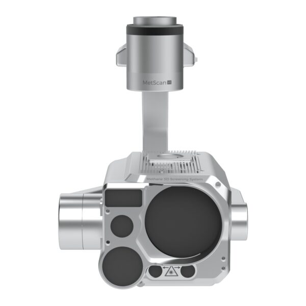
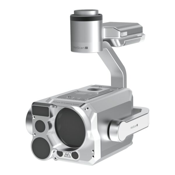
A Class 3R laser and diffuse-reflection OP-TDLAS measure methane at up to 50 Hz, capturing even small plumes with confidence while a dual-view imaging system records synchronized telephoto and wide-angle video for full context.
Belt & Sector Scan for Pipelines and Facilities
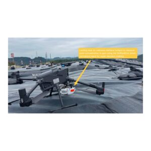
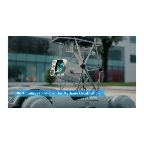
Automated Belt Scan sweeps a wide, geo-referenced band along pipelines, while Sector Scan lets crews screen a facility from the fenceline when they cannot fly inside — reducing the chance of missing a gas cloud as wind shifts.
Plug-and-Play DJI Integration
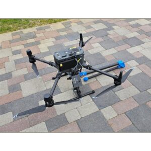
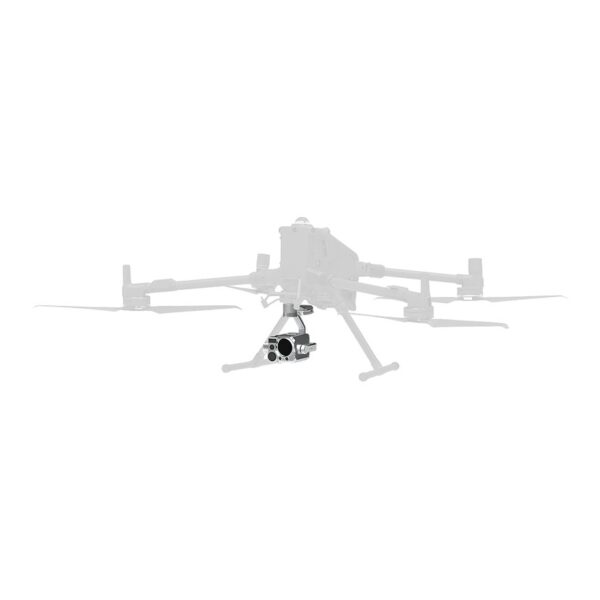
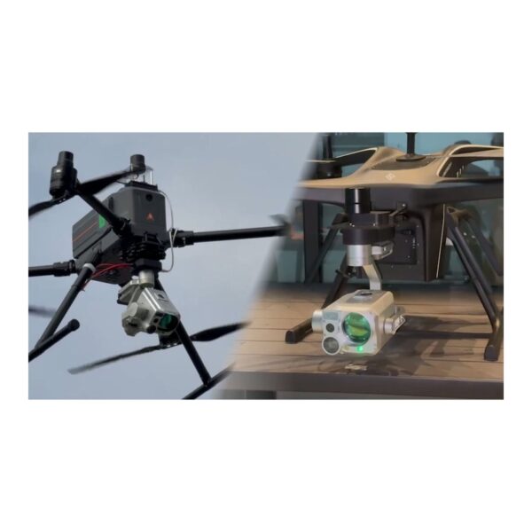
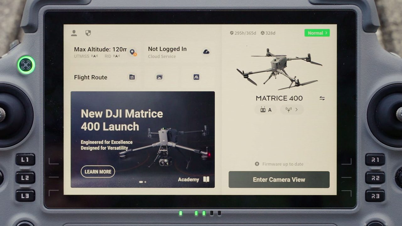
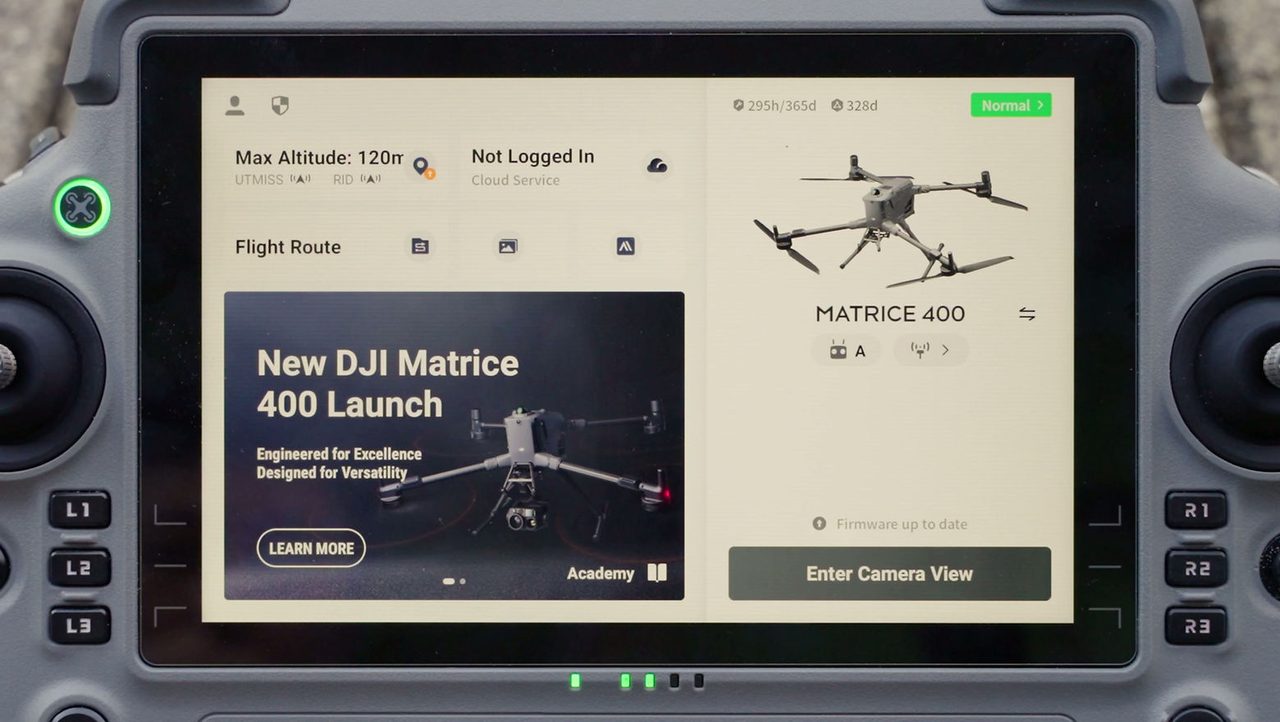
MetScan integrates with DJI Matrice 350 / 400 via the Payload SDK and SkyPort and runs directly in the DJI Pilot app — no third-party flight app required. For other platforms, an integration kit with onboard RTK-GNSS and IMU keeps it self-contained.
AIRINS.ai 2.5D / 3D Reality Mapping
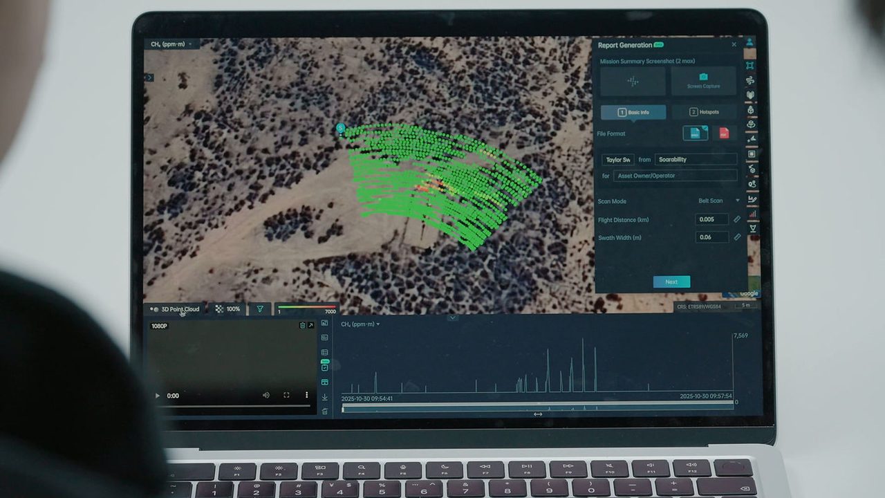
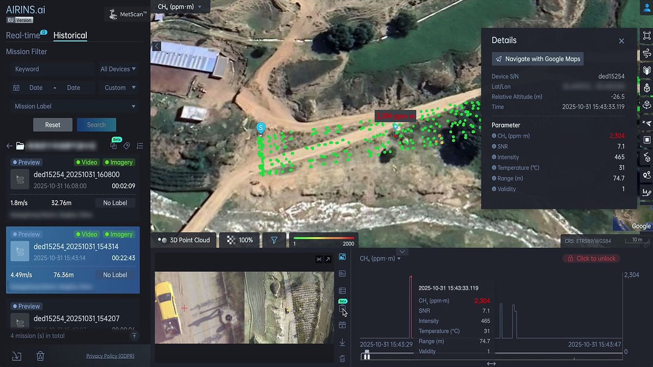
Synced missions render as interactive 2D and 3D methane concentration overlays on white-building models or detailed 3D meshes. Rotate, zoom and scrub the timeline, cross-check video, and revisit historical missions to compare results.
One-Click AI-Assisted Reports
AIRINS.ai turns each mission into a structured report — executive summary, ranked suspected hotspots with coordinates, ppm·m levels and SNR confidence, plus shareable map links — exportable as PDF or editable DOCX.
Built for Pipelines & Oil-and-Gas Facilities
From remote pipeline segments with difficult ground access to pads, stations and plants with distributed leak sources, MetScan delivers repeatable coverage that helps teams prioritize repairs and narrow bottom-up versus top-down gaps.
Store-and-Forward Field Workflow
Preview live data in AIRINS.ai for an in-field QA check, then sync over Wi-Fi, Starlink, hotspot or USB-C. Store-and-forward keeps teams flying even with poor connectivity, and every mission is saved for later review under GDPR-aligned governance.
Beyond UAVs — Ground & Non-DJI Platforms
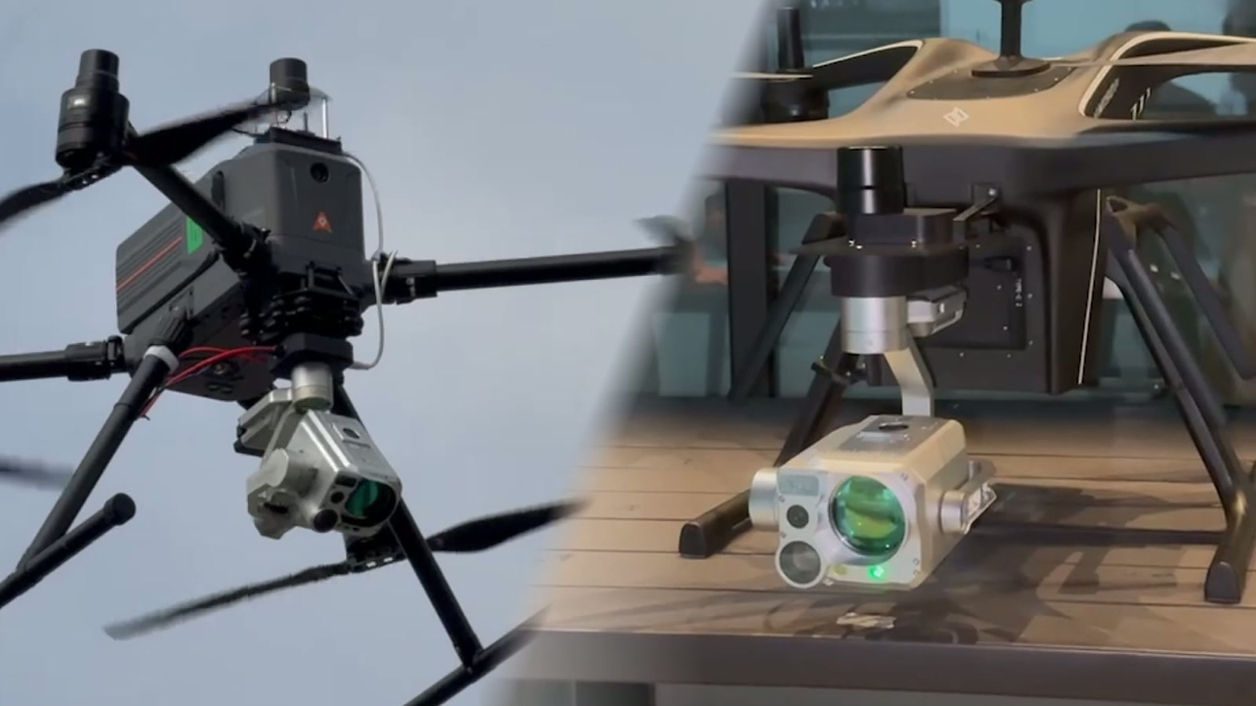
The platform-agnostic kit lets MetScan fly on non-DJI UAVs or ride on ground robots, so the same OP-TDLAS performance extends to platforms suited to your site and airspace constraints.
Service & Warranty
MetScan + AIRINS.ai is offered by GulfNet Emirates primarily as a combined HaaS + SaaS subscription (hardware access, defined inspection distance, AIRINS.ai platform, main account and remote support), with a perpetual purchase option available. Onboarding, training and ongoing remote support are included per the selected package. Contact us for a tailored proposal, an online walkthrough or an on-site evaluation.
Key Specifications
| Detection Technology | Diffuse-reflection OP-TDLAS (open-path tunable diode laser) |
|---|---|
| Target Gas | Methane (CH₄), path-integrated concentration |
| Data Output Frequency | Up to 50 Hz (ultra-dense sampling) |
| Laser | Class 3R (higher optical power and range than Class 1) |
| Imaging | Dual-view telephoto + wide-angle, synchronized video |
| Onboard Compute | 8-core CPU, up to 6 TOPS |
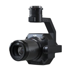
| Stabilization | In-house ultra-stable 3-axis gimbal |
| UAV Integration | DJI Matrice 350 / 400 via Payload SDK + SkyPort (runs in DJI Pilot); platform-agnostic kit with onboard RTK-GNSS + IMU for non-DJI UAVs and robots |
| Calibration | Factory-calibrated + automatic per-mission; methane reference cell included |
| Connectivity | 4G real-time streaming; onboard MS-DATA storage; upload via USB-C, Wi-Fi, Starlink or hotspot |
| Analytics Software | AIRINS.ai (AAI) — 2.5D / 3D mapping, AI hotspot identification, one-click reports |
| Quantification | Trial offline emission-rate workflow (e.g. kg/h) with the AIRINS team (not a default function) |
| Outputs | AI-assisted reports (PDF / DOCX), heatmaps; exports CSV, GeoJSON (.json), Shapefile (.shp), animations |
| Data Hosting | Multi-region (EU, US, Singapore, China), GDPR-aligned; main + sub-account model |
| Deployment | Cloud (SaaS) or optional on-premises |
| Commercial Model | HaaS + SaaS subscription (perpetual option available) |
| Applications | Pipeline & facility methane LDAR screening; EU Methane Regulation 2024/1787 & OGMP 2.0 alignment |
Frequently Asked Questions
What exactly do you get when you buy the MetScan + AIRINS.ai Methane 3D Screening System?
You get an integrated methane inspection stack, not a standalone sensor. On the hardware side, the MetScan payload is a UAV-mounted diffuse-reflection OP-TDLAS methane sensor from AIRINS (formerly Soarability), sampling at up to 50 Hz with a Class 3R laser, dual-view telephoto and wide-angle imaging, and an in-house 3-axis stabilised gimbal. On the software side, the AIRINS.ai (AAI) platform delivers 2.5D and 3D concentration mapping, AI hotspot ranking, one-click reports, and multi-region GDPR-aligned data hosting. GulfNet Emirates delivers it primarily as a combined HaaS plus SaaS subscription covering hardware access, a defined inspection distance, platform licensing, a main account, onboarding, training, and remote support, with a perpetual purchase option for buyers who prefer a capex model.
Where can I buy MetScan AirINS AI in Dubai, and is it available in the UAE?
GulfNet Emirates supplies the MetScan + AIRINS.ai Methane 3D Screening System across the UAE from its Dubai office at Al Fattan Plaza, and the product page lists it as in stock. As an authorised AIRINS dealer Dubai buyers can transact with directly, GulfNet handles sales, onboarding, training, and remote support for oil and gas operators, LDAR contractors, and pipeline inspection teams in Dubai, Abu Dhabi, and the wider GCC. Procurement runs through the Request a Quote workflow on the DRS store, which routes the enquiry with the product SKU pre-attached. For teams evaluating the system, the same channel is used to arrange an online walkthrough, a technical scoping call, or an on-site demonstration.
How much is MetScan AirINS AI, and what does the price in the UAE include?
The MetScan + AIRINS.ai Methane 3D Screening System price is quoted on request rather than listed publicly, because the commercial model is primarily HaaS plus SaaS subscription with a perpetual option. Each proposal is scoped to the operator’s fleet, inspection distance, deployment footprint, and whether cloud or on-premises hosting is preferred. A typical UAE package covers hardware access, the AIRINS.ai analytics platform, a main account with sub-account structure, onboarding, training, and ongoing remote support. To get a quote for MetScan AirINS AI, submit the request form on the GulfNet Emirates DRS store with your target sites and integration platform (DJI Matrice 350, 400, or a non-DJI UAV or ground robot), and the team returns a tailored MetScan + AIRINS.ai Methane 3D Screening System price UAE proposal.
Which drones does the MetScan payload integrate with?
MetScan is engineered for plug-and-play use on the DJI Matrice 350 and DJI Matrice 400 through the DJI Payload SDK and SkyPort interface, and it runs directly inside the DJI Pilot app so crews do not need a third-party flight application. For fleets built on non-DJI airframes or ground platforms, AIRINS supplies a platform-agnostic integration kit that includes onboard RTK-GNSS and an IMU, keeping the payload self-contained with its own positioning and orientation data. That flexibility lets the same OP-TDLAS sensing performance ride on quadruped robots or fixed-wing and multirotor UAVs that suit specific site geometries, airspace rules, or endurance requirements across UAE and GCC oil and gas operations.
Does it actually quantify methane emissions, or only detect leaks?
Both, with a clear distinction between routine capability and specialist workflow. In every deployment, the MetScan + AIRINS.ai Methane 3D Screening System handles high-efficiency screening, localization, and 3D mapping of methane concentrations, with AI-ranked suspected hotspots that carry coordinates, ppm·m readings, and SNR confidence scores. Emission-rate quantification, for example results expressed in kg per hour, is offered as a trial offline workflow processed together with the AIRINS team rather than as a default, always-on function. That structure matches how mature LDAR programmes usually split detect-and-locate work from quantitative follow-up, and it fits reporting expectations under the EU Methane Regulation 2024/1787 and OGMP 2.0 frameworks.
Is MetScan AirINS AI a good fit for pipeline inspection and oil-and-gas facility screening?
Yes, that is the exact use case it is built for. Automated Belt Scan sweeps a wide, geo-referenced band along pipeline right-of-way, so long linear assets in remote desert or offshore-adjacent corridors can be covered efficiently. Sector Scan lets crews screen a facility from the fenceline when internal flight is restricted, reducing the risk of missing a plume as wind direction shifts. The dual-view synchronized video, 50 Hz OP-TDLAS sampling and Class 3R laser give strong sensitivity across pads, compressor stations, gas plants, and distributed leak sources. Combined with AIRINS.ai reports and heatmaps, teams can prioritise repairs and narrow bottom-up versus top-down emission gaps, which is central to LDAR programmes in the GCC upstream and midstream sectors.
Can I book a MetScan AirINS AI demo in Dubai before committing?
Yes. GulfNet Emirates, as the AIRINS distributor UAE customers deal with locally, arranges evaluations through the same Request a Quote workflow used for procurement. Buyers can choose between an online walkthrough of the AIRINS.ai platform, showing recorded missions, 2.5D and 3D concentration overlays, AI-ranked hotspots, and generated reports, or an on-site evaluation where the MetScan payload is flown on a DJI Matrice 350 or 400 over a representative pipeline segment or facility. This is generally recommended before finalising a HaaS plus SaaS subscription, because it lets technical, HSE, and procurement stakeholders confirm workflow fit, data handling, and integration with existing DJI fleets ahead of committing to inspection distance and reporting cadence.
What outputs and file formats does the system produce for reporting?
Each mission converts into a structured, AI-assisted report delivered as PDF or editable DOCX, with an executive summary, ranked suspected hotspots including coordinates, ppm·m concentration values, and SNR confidence indicators, plus shareable map links. For GIS and analytics teams, AIRINS.ai exports data in CSV, GeoJSON (.json), and Shapefile (.shp), which slot directly into ArcGIS, QGIS, and internal asset databases. Visual outputs include 2D and 3D concentration maps, heatmaps, and animated playback suited to management briefings or regulator submissions. The synchronised telephoto and wide-angle video is retained alongside the geo-referenced measurements, so any hotspot can be cross-checked visually during review of past missions.
How does field data get from the drone to the platform in areas with weak connectivity?
MetScan is designed around a store-and-forward workflow, which suits remote GCC pipeline corridors and offshore-adjacent sites where 4G coverage is patchy. During the mission, live data can be previewed in AIRINS.ai over 4G for an in-field QA check, so operators know immediately whether the flight captured usable readings. Full mission data is stored onboard on MS-DATA storage and can be uploaded once the crew is back within range, using USB-C, Wi-Fi, a mobile hotspot, or a Starlink link. Every mission is retained under GDPR-aligned governance in the AIRINS.ai environment, hosted across EU, US, Singapore, and China regions, with a main account and sub-account model that fits multi-site operators.
Does the MetScan + AIRINS.ai Methane 3D Screening System support EU Methane Regulation and OGMP 2.0 workflows?
Yes. The system is engineered specifically for LDAR programmes and is aligned with the EU Methane Regulation 2024/1787 and OGMP 2.0. Routine drone missions produce geo-referenced, follow-up-ready methane intelligence with timestamped concentration data, ranked hotspots, and repeatable coverage that can be revisited mission over mission. That structure supports the traceability, reporting cadence, and evidence trail these frameworks expect from operators, and matters even for GCC producers exporting into markets governed by the EU rules. Historical missions can be reopened in AIRINS.ai for comparison, letting teams evidence source persistence, repair verification, and reduction trends across reporting cycles, which is exactly the kind of documentation regulators and OGMP 2.0 assessors look for.
Who is the trusted seller of MetScan AirINS AI in the UAE, and what support comes with a subscription?
GulfNet Emirates is the AIRINS dealer UAE operators can transact with locally, and acts as MetScan AirINS AI supplier in Abu Dhabi, Dubai, and across the Emirates. Every HaaS plus SaaS package includes onboarding, product training, and ongoing remote support tied to the selected tier, so crews are certified on the DJI Payload SDK integration, the DJI Pilot workflow, and the AIRINS.ai analytics environment before entering production. Support continues after go-live through the main account channel, covering platform updates, mission review assistance, and coordination with the AIRINS team for the trial offline quantification workflow when operators want to move from screening into emission-rate reporting.
Can I buy MetScan AirINS AI online in UAE, or does procurement have to go through a formal quote?
Because the MetScan + AIRINS.ai Methane 3D Screening System is a subscription-led enterprise solution rather than an off-the-shelf drone accessory, procurement runs through a formal quote on the GulfNet Emirates DRS store rather than a direct add-to-cart checkout. Buyers looking for MetScan + AIRINS.ai Methane 3D Screening System for sale in the UAE start on the product page, submit the Request a Quote form with the SKU pre-attached, and receive a tailored proposal covering inspection distance, hosting choice, and subscription tier. Typical delivery and onboarding lead time is around one month after order confirmation. Buyers preferring a capex route can request the perpetual purchase option in the same enquiry, and the team will structure the commercial package accordingly.