EchoLogger ECT 400S Echo Sounder for Drone Bathymetry
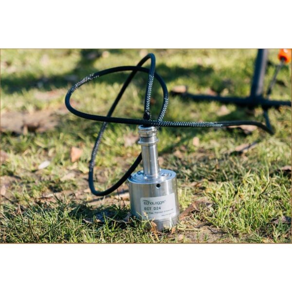
The EchoLogger ECT 400S turns an enterprise drone into a flying survey vessel, mapping water depth from the air where boats cannot safely go. This single-beam, single-frequency 450 kHz echo sounder ships with integrated tilt/roll and temperature sensors, a protective stainless-steel housing with drone mountings, and connects directly to the SkyHub onboard computer for autonomous bathymetric surveys.
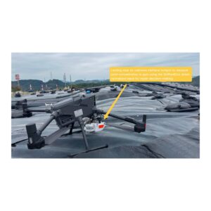
Making a River’s Cross-Section Bathymetry Using a UAV-Borne Echo Sounder
Survey water depth without a boat
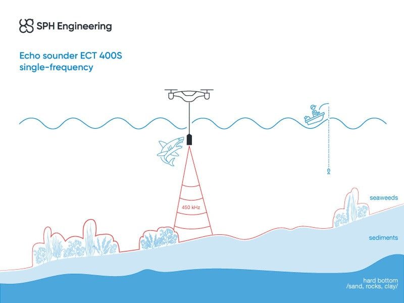
Suspended beneath a DJI Matrice or other compatible UAV, the ECT 400S measures depth from 0.15 m to 100 m with a narrow 5° conical beam, 1 mm range resolution and accuracy of 0.2% of the measured depth. Hard-to-reach ponds, tailings facilities, settling tanks and steep-banked rivers can be surveyed safely from the air.
Integrated, field-ready and SkyHub-connected
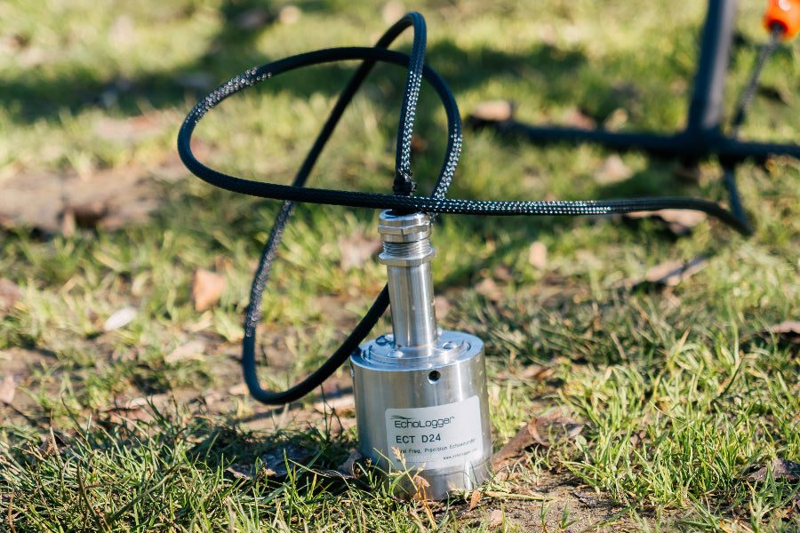
Built-in tilt/roll and temperature sensors correct every reading in flight, while the rugged stainless-steel housing, harness and 2.5 m protected cable are made for repeated field deployment. An RS232 interface connects straight to SkyHub, which logs georeferenced depth data alongside UgCS flight automation.
Applications
Water-depth mapping and bathymetry, dredging planning and monitoring, tailings storage facility (TSF) monitoring, wastewater and stormwater surveying, and hydrology studies.
Service & Warranty
Supplied by GulfNet Emirates Drone & Robotic Systems with UAE-based technical support, integration guidance and full manufacturer warranty. The ECT 400S requires additional components and software for drone operation — request a quote and our team will propose the complete, ready-to-fly bathymetry kit.
Key Specifications
| Sensor type | SBES — single-beam, single-frequency echo sounder |
| Acoustic frequency | 450 kHz |
| Measurement range | 0.15 – 100 m |
| Beam width | 5° conical (-3 dB) |
| Range resolution | 1.0 mm |
| Accuracy | 0.2% of the depth measurement |
| Integrated tilt/roll sensor | Yes |
| Integrated temperature sensor | Yes |
| Sediment measurement | No |
| Supported drones | DJI M400 / M350 / M300, Inspired Flight IF800 / IF1200A, WISPR RangerPro |
| Cable length | 2.5 m |
| Echo sounder weight (in air) | 1.3 kg |
| All components weight (in air) | 1.9 kg (sensor, SkyHub, altimeter, housing, cables, mountings) |
| In the kit | Echo sounder, harness with carabiner, stainless-steel housing, RS232 data cable with SkyHub connector, transport hard case |
| SKU | IS-EL-ECT-400S |
Frequently Asked Questions
Where can I buy the EchoLogger ECT 400S Echo Sounder in Dubai?
GulfNet Emirates supplies the EchoLogger ECT 400S through its Drone & Robotic Solutions storefront, operated from the Dubai office at Al Fattan Plaza, Office 607. Buyers who want to buy EchoLogger ECT 400S Echo Sounder units in Dubai submit a request-a-quote form rather than a standard checkout, because the sensor is not a plug-and-play unit: it requires the SkyHub onboard computer, UgCS flight planning, and a compatible enterprise UAV. After the enquiry lands, the team scopes the full bathymetry kit around your existing drone fleet and confirms availability, pricing in AED, and lead time. Technical consultation, integration guidance, and manufacturer warranty are handled locally rather than through an overseas reseller.
How much is the EchoLogger ECT 400S in the UAE?
Pricing is quoted on request in AED rather than listed openly, because the final figure depends on the accompanying components. A working setup pairs the sensor with a SkyHub onboard computer, a radar altimeter, UgCS flight planning, and mounting hardware for the target drone (DJI M400, M350, M300, Inspired Flight IF800/IF1200A, or WISPR RangerPro). GulfNet Emirates prepares a line-itemised quotation covering the sensor kit, integration items, and any software licences required to log georeferenced depth data. For an accurate EchoLogger ECT 400S price in UAE dirhams, or the full EchoLogger ECT 400S Echo Sounder price UAE breakdown covering ancillary items, submit the RFQ form with your drone model and survey environment attached.
Is the EchoLogger ECT 400S Echo Sounder available in the UAE, and who sells it?
Yes, the sensor is available in the UAE through GulfNet Emirates and is listed as in stock under Payloads & Sensors on the DRS storefront. As the local supplier, GulfNet Emirates handles procurement, drone integration, and post-sale technical support from Dubai. Buyers looking for an EchoLogger dealer UAE side or an EchoLogger distributor UAE contact can route enquiries directly through the request-a-quote workflow rather than importing the unit privately. This keeps the manufacturer warranty valid, ensures the correct SkyHub and cable variant is shipped, and gives the survey team a UAE-based escalation point for firmware, harness, or RS232 interface questions during commissioning.
What drones does the EchoLogger ECT 400S work with?
The ECT 400S is engineered for enterprise UAVs with sufficient payload capacity and a stable mounting point for a 1.9 kg suspended load (sensor, SkyHub, altimeter, housing, cables, and mountings combined). Officially supported airframes are the DJI Matrice M400, M350, and M300, the Inspired Flight IF800 and IF1200A, and the WISPR RangerPro. Consumer drones and lightweight mapping quadcopters cannot carry the harness or run the SkyHub interface, so they are not compatible. If your fleet uses a different enterprise UAV, GulfNet Emirates can check integration feasibility with SPH Engineering before you commit. This ensures the RS232 data cable, harness, and flight planning workflow will line up with your aircraft.
Can I book an EchoLogger ECT 400S demo in Dubai before purchasing?
Yes. Because the sensor forms part of a wider UAV bathymetry system involving SkyHub, UgCS, and DroneGIS, GulfNet Emirates typically arranges a scoping session before buyers commit. This covers the survey environment, target depth range (0.15 m to 100 m), the enterprise drone in use, and the deliverables the survey team needs. A demo or technical walkthrough for the EchoLogger ECT 400S can be requested through the Dubai office, and the team will confirm timing and format based on operational scale. This is the recommended path for dredging contractors, TSF operators, and hydrology consultants who want to see the workflow before issuing a purchase order.
What is the depth range and accuracy of the ECT 400S?
The ECT 400S is a single-beam, single-frequency echo sounder operating at 450 kHz. It measures water depth from 0.15 m up to 100 m with a range resolution of 1 mm and an accuracy of 0.2 percent of the measured depth. The 5-degree conical beam width (at -3 dB) keeps the acoustic footprint tight, which suits narrow rivers, ponds, and tailings storage facilities where wider beams would return noisy edges. Integrated tilt/roll and temperature sensors compensate every reading in flight, so pitch changes and thermal drift are handled automatically. These specifications position the sensor for shallow to mid-depth bathymetry rather than deep-water hydrographic work.
Does the EchoLogger ECT 400S measure sediment layers?
No. The ECT 400S is a single-frequency 450 kHz unit built strictly for water-depth measurement. Sub-bottom profiling and sediment thickness readings require a dual-frequency echo sounder such as the EchoLogger ECT D052S, which combines low and high frequencies to separate the water column from the sediment interface. Survey teams that need both depth and sediment data on the same flight should flag this at the quotation stage so GulfNet Emirates can propose the correct model. For clients whose scope is limited to bathymetry, dredging planning, or reservoir volume calculations, the ECT 400S remains the lighter, lower-cost option since it strips out the second frequency channel.
How is depth data recorded and processed during a UAV survey?
The sensor connects to the SkyHub onboard computer over RS232 using the supplied 2.5 m protected cable. SkyHub logs georeferenced depth values in flight, syncing them with GNSS position from the drone. Survey missions are planned and executed through UgCS, which automates the flight lines, altitude control, and terrain following required for consistent readings. After the flight, raw logs can be processed in DroneGIS to produce bathymetric maps, cross-sections, and volume calculations. This end-to-end chain, sensor to SkyHub to UgCS to DroneGIS, means the ECT 400S is not a standalone tool but a component in a fully automated UAV bathymetry workflow.
Where can I get a quote for the EchoLogger ECT 400S in Abu Dhabi?
GulfNet Emirates covers the wider UAE market from its Dubai base, and Abu Dhabi buyers can raise a quotation request through the same DRS request-a-quote channel. Because the ECT 400S ships with a fixed accessory kit (echo sounder, harness with carabiner, stainless-steel housing, RS232 cable with SkyHub connector, transport hard case), the quote will confirm what is included and what needs to be added for flight, typically SkyHub, an altimeter, and UgCS licensing. If you need an EchoLogger ECT 400S supplier in Abu Dhabi or want the unit listed EchoLogger ECT 400S for sale in Dubai reviewed against your survey scope, this is the direct route. Deliveries and technical support across the emirate are coordinated from the Dubai office.
Which survey applications is the ECT 400S actually suited for?
The sensor is aimed at operations where a boat cannot go safely or economically. Documented use cases include water-depth mapping and bathymetry, dredging planning and monitoring, tailings storage facility (TSF) monitoring at mining sites, wastewater and stormwater surveying, and general hydrology studies. The airborne workflow suits steep-banked rivers, contaminated ponds, settling tanks, and remote reservoirs. Because the ECT 400S is single-frequency and single-beam, it is not intended for wide-swath hydrographic charting or deep offshore work. Buyers should match the 0.15 m to 100 m range and the 5-degree beam against their survey environment before purchasing. GulfNet Emirates can advise on fit during the scoping call.
Is GulfNet Emirates an authorised EchoLogger dealer in Dubai?
GulfNet Emirates supplies the EchoLogger ECT 400S through SPH Engineering, the brand owner behind SkyHub and UgCS, and lists the product under its DRS storefront with full manufacturer warranty coverage. This positions it as the best place to buy EchoLogger ECT 400S in the UAE for teams that want a trusted seller of the EchoLogger ECT 400S in the UAE rather than a grey-market import. Local invoicing in AED, UAE-based technical support, and integration help sized to your drone fleet come included. This matters for TSF operators, dredging contractors, and consulting engineers whose procurement teams require formal documentation, warranty traceability, and a local escalation contact. Enquiries about the authorised EchoLogger dealer Dubai channel go through the request-a-quote form.
Can I buy the EchoLogger ECT 400S online in the UAE, or do I have to request a quote?
The storefront lists the ECT 400S as in stock, but checkout is handled through the quotation flow rather than a direct add-to-cart purchase. This is deliberate: the sensor cannot fly on its own and needs additional hardware and software to function, so a blind online order would leave the buyer with an incomplete system. To buy EchoLogger ECT 400S online in UAE conditions, or to buy EchoLogger ECT 400S Echo Sounder in UAE with the correct SkyHub and UgCS pairing, submit the request-a-quote form with your drone model, survey environment, and target depth range. Because the sensor is also listed EchoLogger ECT 400S Echo Sounder for sale via the DRS storefront, GulfNet Emirates responds with a scoped quotation covering the sensor, integration items, and licences, then confirms payment terms and delivery timeline.