EchoLogger ECT D052S Dual-Frequency Echo Sounder for Drone Bathymetry
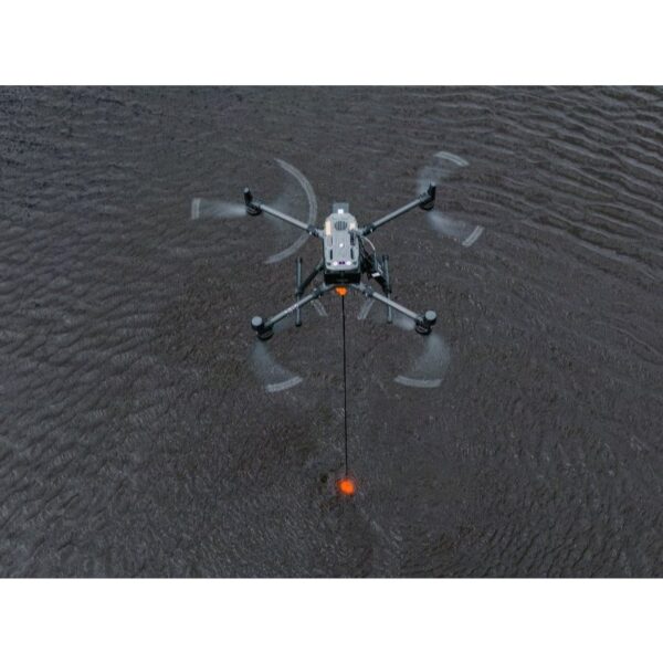
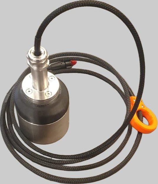
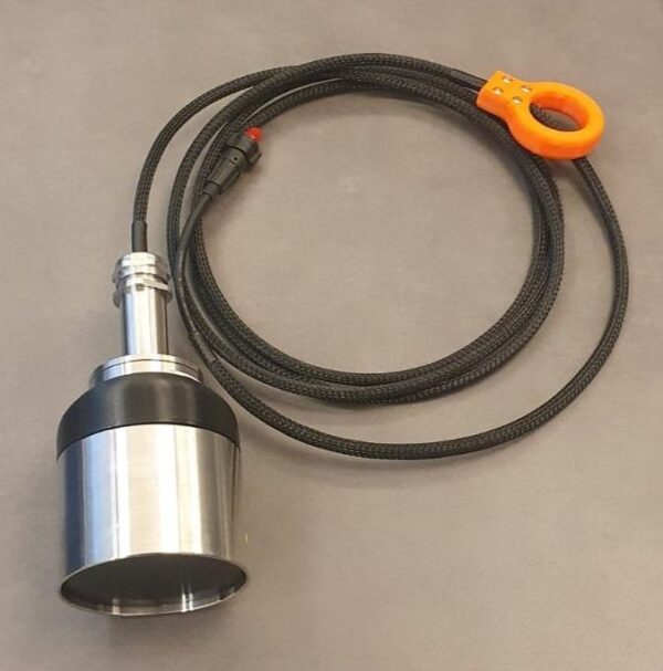
The EchoLogger ECT D052S is a dual-frequency UAV echo sounder that maps both water depth and sub-bottom sediment from the air. Operating at 50 and 200 kHz, it surveys from 0.5 m to 200 m and — unlike single-frequency models — distinguishes soft sediment layers from the hard bottom, making it ideal for dredging volumes and tailings monitoring. It ships with integrated tilt/roll and temperature sensors, a stainless-steel housing and drone mountings, and connects directly to the SkyHub onboard computer.
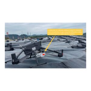
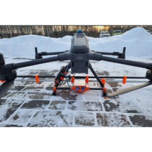
Manual Take-off and Landing with an Attached Echo Sounder
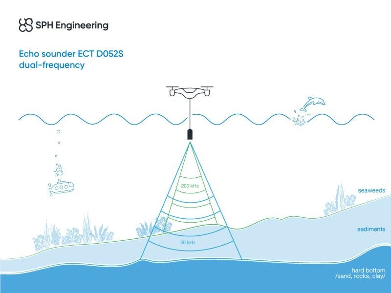
Two frequencies — depth and sediment in one pass
The 200 kHz channel returns a sharp 7° beam for precise depth, while the 50 kHz channel penetrates soft sediment with a wider 27° beam to reveal the sub-bottom. Survey reservoirs, settling ponds and dredge sites and obtain both the water surface-to-bed depth and the sediment thickness in a single flight.
Field-ready and SkyHub-connected
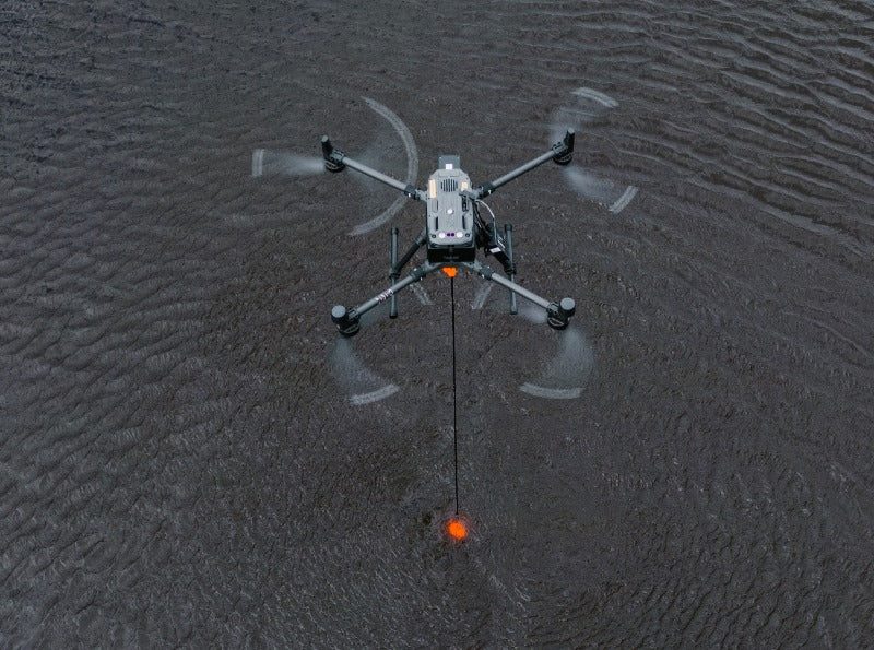
At 1.85 kg the sensor flies under DJI Matrice, Inspired Flight, WISPR and other comparable enterprise UAVs. Integrated tilt and temperature sensors correct every reading, and the RS232 interface connects straight to SkyHub, which logs georeferenced depth and sediment data alongside UgCS flight automation for processing in DroneGIS.
Applications
Water-depth mapping and bathymetry, dredging planning and monitoring, tailings storage facility (TSF) monitoring, wastewater and stormwater surveying, and hydrology studies.
Service & Warranty
Supplied by GulfNet Emirates Drone & Robotic Systems with UAE-based technical support, integration guidance and full manufacturer warranty. The ECT D052S requires additional components and software for drone operation — request a quote and our team will propose the complete, ready-to-fly bathymetry kit.
Key Specifications
| Sensor type | SBES — single-beam, dual-frequency echo sounder |
| Acoustic frequency | 50 / 200 kHz |
| Measurement range | 1.0 – 200 m (50 kHz); 0.5 – 200 m (200 kHz) |
| Beam width | 27° / 7° conical (-3 dB) at 50 / 200 kHz |
| Range resolution | 1.0 mm |
| Accuracy | 0.2% of the depth measurement |
| Sediment measurement | Yes |
| Integrated tilt/roll sensor | Yes |
| Integrated temperature sensor | Yes |
| Supported drones | DJI M400 / M350 / M300, Inspired Flight IF800 / IF1200A, WISPR RangerPro, other Pixhawk/Cube-based drones of comparable size |
| Cable length | 2.5 m |
| Echo sounder weight (in air) | 1.85 kg |
| All components weight (in air) | 2.45 kg |
| In the kit | Echo sounder, harness with carabiner, stainless-steel housing, RS232 data cable with SkyHub connector, transport hard case |
| SKU | IS-EL-ECT-D052S |
Frequently Asked Questions
Where can I buy the Echologger ECT D052S in Dubai?
GulfNet Emirates supplies the Echologger ECT D052S from its Dubai office at Al Fattan Plaza, 6th Floor, Office 607, covering buyers across the UAE and the wider GCC. Enquiries route through a request-a-quote workflow rather than a walk-in checkout, since the sensor ships as part of a ready-to-fly kit configured to your drone. The team confirms aircraft compatibility, adds the SkyHub onboard computer and UgCS planning software, and quotes a complete package. Delivery, integration guidance and manufacturer warranty are handled locally, which shortens lead times compared to importing directly. Survey firms in Dubai, Abu Dhabi and Sharjah typically place enquiries through the DRS store or by phoning +971-4-8972598 to speak with the payload team.
How much is the Echologger ECT D052S and where can I check the Echologger ECT D052S price in UAE?
There is no fixed shelf price for this sensor, and the standard question of how much is Echologger ECT D052S is answered by a written quotation. The kit is configured per project, so cost depends on the host drone (DJI M400, M350, M300, Inspired Flight or WISPR RangerPro), whether the SkyHub onboard computer is already owned, and which software licences are needed for UgCS and DroneGIS. GulfNet Emirates issues a formal quote in AED with warranty terms, expected lead time and support scope on a single document. Buyers submit their aircraft model and intended survey environment through the request-a-quote form and receive itemised pricing within a working day.
Who is the Echologger ECT D052S dealer in UAE and an authorised EchoLogger dealer Dubai buyers can approach?
GulfNet Emirates acts as an authorised EchoLogger dealer Dubai survey teams and hydrology consultancies rely on for the ECT D052S. The Dubai team handles pre-sales scoping, integration with SkyHub, on-site setup for the first flight, and manufacturer-backed warranty claims. As a dedicated payload specialist rather than a general drone reseller, the Echologger ECT D052S dealer in UAE role includes verifying that the buyer’s aircraft has the payload capacity and RS232 pass-through required to fly a 1.85 kg sensor. That vetting step matters because the sensor needs specific mounting hardware and a compatible flight controller, and misconfiguration voids readings even when the hardware is genuine.
Is the Echologger ECT D052S available in the UAE and who is the EchoLogger distributor UAE clients rely on?
Yes, the Echologger ECT D052S is stocked and supported in the UAE through GulfNet Emirates, which functions as the EchoLogger distributor UAE hydrographic and environmental firms turn to. Availability is confirmed against active project requirements, since kits ship with a bundle of hardware and software rather than as a single boxed item. The distributor role covers direct import, customs clearance, technical onboarding, spare cables, and coordination with SPH Engineering when firmware updates or replacement housings are needed. Buyers in Dubai, Abu Dhabi, Sharjah and the northern Emirates receive local invoicing in AED, avoiding the currency and duty complications that come with buying the sensor from a European reseller.
Can I buy Echologger ECT D052S online in UAE, and what is the best place to buy Echologger ECT D052S in the UAE?
The listing lives on the GulfNet Emirates Drones & Robotic Solutions store, but purchase runs through a quote request rather than a card-on-file checkout, so the option to buy Echologger ECT D052S online in UAE begins with the request-a-quote button on the product listing. That flow captures your aircraft, survey targets and preferred incoterms, then returns a formal proposal. For most buyers the best place to buy Echologger ECT D052S in the UAE is a payload-focused distributor that also carries UgCS, DroneGIS and matching enterprise drones, because a single vendor can commission the full workflow. GulfNet Emirates fits that description, which is why hydrographic contractors typically consolidate the order with them.
Which drones and payload interfaces does the EchoLogger ECT D052S Dual-Frequency Echo Sounder support?
The EchoLogger ECT D052S Dual-Frequency Echo Sounder is validated on the DJI Matrice M400, M350 and M300, Inspired Flight IF800 and IF1200A, and the WISPR RangerPro, along with other Pixhawk or Cube-based drones of comparable payload class. The sensor weighs 1.85 kg on its own and 2.45 kg with all mounting components, so the host aircraft needs the corresponding lift margin. Data flows through an RS232 cable of 2.5 m into the SkyHub onboard computer, which timestamps and georeferences every ping. Buyers who fly outside that supported list should confirm compatibility with the Dubai team before ordering, since custom brackets and cable adaptors can usually be sourced but must be scoped in advance.
How does the sensor capture depth and sediment in a single pass, and does this justify the choice to buy EchoLogger ECT D052S Dual-Frequency Echo Sounder?
The unit transmits on two acoustic frequencies at once. The 200 kHz channel emits a narrow 7 degree beam that returns a sharp bottom reading with 1 mm range resolution and 0.2 percent depth accuracy, while the 50 kHz channel sends a wider 27 degree beam that penetrates soft sediment and reveals the sub-bottom layer. On a single flight over a reservoir, tailings pond or dredge site the operator records both water depth and sediment thickness, which is the core reason survey teams choose to buy EchoLogger ECT D052S Dual-Frequency Echo Sounder rather than a single-frequency alternative. Integrated tilt, roll and temperature sensors correct each reading, so post-processing in DroneGIS starts with clean, compensated data.
What ships in the box when the EchoLogger ECT D052S Dual-Frequency Echo Sounder for sale is ordered, and what else is needed to fly it?
The EchoLogger ECT D052S Dual-Frequency Echo Sounder for sale through GulfNet Emirates ships with the echo sounder itself, a harness with carabiner, a stainless-steel protective housing, the RS232 data cable terminated with a SkyHub connector, and a transport hard case. The kit does not include everything required for a complete aerial bathymetry mission. Operators additionally need the SkyHub onboard computer, UgCS flight-planning software and DroneGIS for post-processing, plus a supported drone. GulfNet Emirates bundles those items into the quotation so the buyer receives a single, coherent package rather than sourcing components separately, which also keeps warranty accountability with one vendor.
Can I book an Echologger ECT D052S demo in Dubai or arrange an Echologger ECT D052S supplier in Abu Dhabi visit?
Yes. Buyers can book an Echologger ECT D052S demo in Dubai through GulfNet Emirates, typically scheduled at a controlled water body where the dual-frequency response can be shown against a known depth profile. For projects based further west, the same team travels as the Echologger ECT D052S supplier in Abu Dhabi, running the sensor under the buyer’s own aircraft where possible so operators see integration with SkyHub and UgCS on their existing fleet. Demos usually cover mounting, tilt compensation, live depth traces on both channels, and a short post-flight walkthrough in DroneGIS. Schedule requests go through the contact form or the Dubai landline.
How do I get a quote for Echologger ECT D052S when I want to buy EchoLogger ECT D052S Dual-Frequency Echo Sounder in UAE?
The workflow to get a quote for Echologger ECT D052S starts on the product listing, where the request-a-quote link auto-fills the model into an enquiry form. Buyers who want to buy EchoLogger ECT D052S Dual-Frequency Echo Sounder in UAE should include the target drone platform, the survey environment such as reservoir, dredge site or tailings pond, and whether SkyHub, UgCS and DroneGIS are already licensed on their end. GulfNet Emirates returns a written proposal in AED covering the sensor, housing, cabling, any missing software licences, warranty terms and estimated delivery. Follow-up questions run through +971-4-8972598 or the DRS contact form.
Who sells Echologger ECT D052S in the UAE and is there a trusted seller of Echologger ECT D052S in the UAE for enterprise projects?
The direct answer to who sells Echologger ECT D052S in the UAE is GulfNet Emirates, operating under its Drones & Robotic Solutions storefront out of Dubai. For enterprise buyers, a trusted seller of Echologger ECT D052S in the UAE needs to do more than move a boxed sensor. It must integrate the unit with the SkyHub onboard computer, verify RS232 handshake with the drone flight controller, and provide a post-sale point of contact who understands SPH Engineering firmware. GulfNet Emirates fits that brief as an established EchoLogger dealer UAE-based hydrographic contractors already work with on Matrice and Inspired Flight deployments, and invoicing and support stay inside the country.
Is the Echologger ECT D052S for sale in Dubai, and what is the EchoLogger ECT D052S Dual-Frequency Echo Sounder price UAE buyers should expect?
The Echologger ECT D052S for sale in Dubai is offered through GulfNet Emirates on a quote basis, not a fixed retail tag. The EchoLogger ECT D052S Dual-Frequency Echo Sounder price is shaped by which components a buyer already owns, most notably the SkyHub onboard computer, UgCS licence and DroneGIS licence, and by the mounting hardware required for the chosen drone. The final EchoLogger ECT D052S Dual-Frequency Echo Sounder price UAE quotation lands in AED, itemises hardware and software separately, and states delivery time and warranty terms. Requesting a quote is the fastest way to convert a shortlist into a firm, comparable number for internal approval.