Radar Systems Zond Aero 600 NG Ground Penetrating Radar (GPR) System
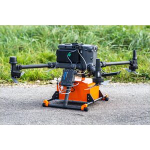
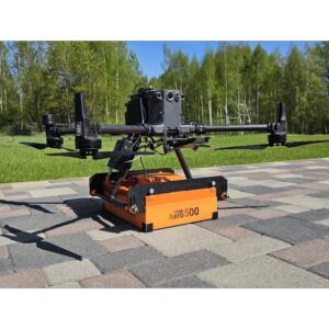
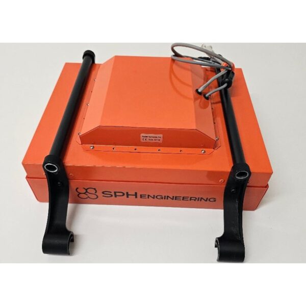
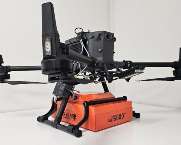
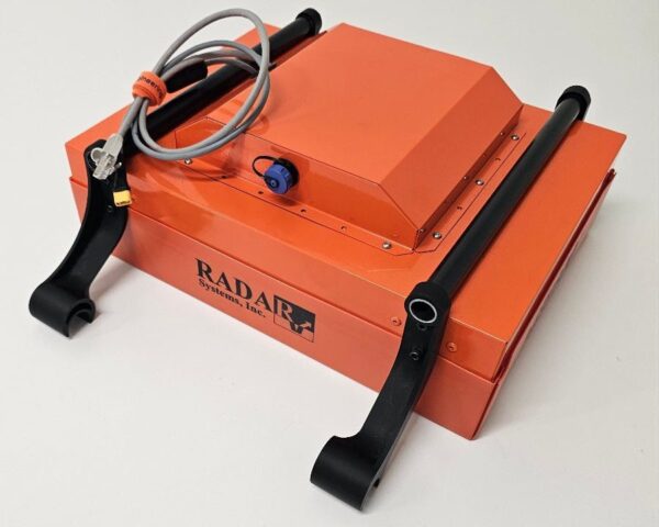
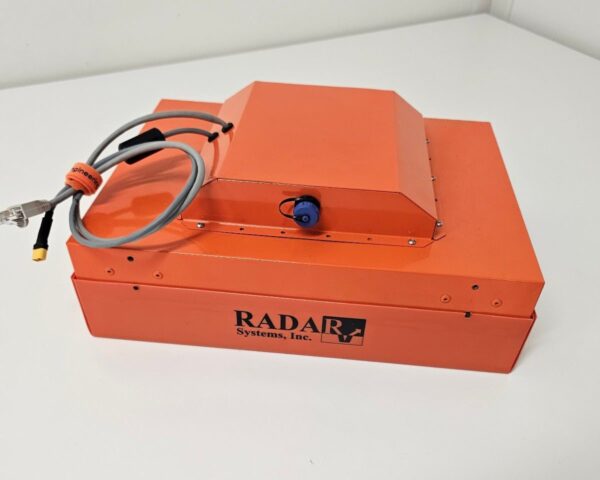
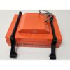
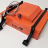
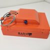
The Zond Aero 600 NG is a compact 600 MHz ground penetrating radar that delivers virtually the same data and penetration as the larger Aero 500 NG, but is small enough to fit between the legs of most popular drones — including the DJI M400 — with no complicated mounting hardware. Real-Time Sampling (RTS) and built-in digital signal processing produce a clean signal-to-noise ratio, with geotagged SEGY output for terrestrial and airborne surveys alike.

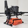
Fits between the legs — including the DJI M400
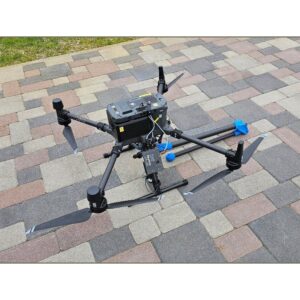
At just 1.5 kg and 34 × 25 × 13 cm in airborne configuration, the Aero 600 NG mounts neatly beneath medium drones such as the DJI M400, M350 and M300 without bespoke hardware. The same system also runs on a cart or tow rope for ground surveys, making it a true do-everything GPR.

RTS data quality to 4 m depth
The 600 MHz shielded antenna with Real-Time Sampling penetrates up to 4 m in average soil and resolves utilities, voids and stratigraphy with an exceptional signal-to-noise ratio. Data is recorded as geotagged SEGY (.sgy) for Prism 2 and standard geophysical processing, with an IP68 cased build for the field.
Applications
Utility search and underground infrastructure mapping, archaeology, geotechnical surveys, geological stratigraphy, and glaciology / snow and ice thickness profiling.
Service & Warranty
Supplied by GulfNet Emirates Drone & Robotic Systems with UAE-based technical support, integration guidance and full manufacturer warranty. The Zond Aero 600 NG requires additional components and software for drone operation — request a quote and our team will propose the complete, ready-to-fly GPR set. The user is responsible for confirming the suitability of a given GPR model for use in a particular country.
Key Specifications
| Type | Single-channel GPR with shielded antenna |
| Central frequency | 600 MHz |
| Operating bandwidth | 300–950 MHz (-12 dB) |
| Sampling | Real-Time Sampling (RTS) with high hardware stacking |
| Samples per scan | 256 / 512 / 1024 / 2048 / 4096 / 8192 (selectable) |
| Sample rate | Up to 1,280,000 samples/second |
| Scan rate | Up to 2,500 scans/second |
| Penetration depth | Up to 4 m in average soil (≈2 m at 0.6 m antenna elevation) |
| Data format | Standard SEGY (.sgy) with trace geotagging |
| Operating temperature | -20°C to 60°C |
| Ingress protection | IP68 in protective case; IP52 airborne |
| Supported drones | DJI M400 / M350 / M300 (fits between the legs, no complex mount) |
| Weight | 1.5 kg airborne (1.7 kg with mount); 6.5 kg in protective case |
| Size (airborne) | 34 × 25 × 13 cm |
| In the kit | Zond Aero 600 NG GPR (600 MHz), Prism 2 acquisition/processing software, protective case with integrated 99 Wh Li-Ion battery and Wi-Fi router, charger, tow rope, DJI M400/M350/M300 mounting kit |
| SKU | IS-RS-ZOND-AERO-600 |
Frequently Asked Questions
What is the Radar Systems Zond Aero 600 NG GPR System and what makes it useful for enterprise survey work?
The Radar Systems Zond Aero 600 NG GPR System is a compact 600 MHz ground penetrating radar built by SPH Engineering for drone, cart, and towed surveys. It weighs 1.5 kg in airborne configuration and measures 34 x 25 x 13 cm, letting it fit between the legs of medium DJI drones without a bespoke mount. The 600 MHz shielded antenna uses Real-Time Sampling with high hardware stacking to deliver a clean signal-to-noise ratio down to roughly 4 m in average soil. Output is recorded as geotagged SEGY (.sgy) files, ready for Prism 2 or standard geophysical processing. Typical buyers use it for utility mapping, geotechnical work, archaeology, and glaciology projects across the GCC.
Where can I buy Zond Aero 600 NG GPR in Dubai?
GulfNet Emirates Drone & Robotic Solutions handles this radar out of its Dubai office at Al Fattan Plaza, and remains the direct route to buy Radar Systems Zond Aero 600 NG GPR System in UAE deployments. As an authorised Zond dealer Dubai buyers can approach for procurement, integration, and after-sale support, the team can quote the standalone unit or a full ready-to-fly configuration paired with SkyHub, UgCS, and a matching drone mount. Orders can be placed by requesting a quote through the product listing or by calling the Dubai office directly on +971-4-8972598. Delivery, technical onboarding, and manufacturer warranty are managed locally, which shortens lead time compared with importing the unit yourself.
How much is Zond Aero 600 NG GPR and what does the price in UAE typically depend on?
The Radar Systems Zond Aero 600 NG GPR System price is not published as a fixed retail figure because the Zond Aero 600 NG GPR price in UAE varies with the exact configuration a buyer needs. A quotation is prepared per project, and the final Radar Systems Zond Aero 600 NG GPR System price UAE clients receive reflects whether the request is for the radar unit alone or a complete drone-ready kit with SkyHub onboard computer, UgCS flight planning, and the DJI M400, M350, or M300 mounting kit. Software licences, spares, training, and support terms also move the number. To find out how much is Zond Aero 600 NG GPR in your setup, submit a scoped RFQ to GulfNet Emirates and the team will return a written proposal.
Is Zond Aero 600 NG GPR available in the UAE, and who sells it locally?
Yes. GulfNet Emirates lists the unit as in stock through its DRS storefront, so the answer to Is Zond Aero 600 NG GPR available in the UAE? is affirmative for enterprise procurement. On the question of Who sells Zond Aero 600 NG GPR in the UAE?, the company acts as the appointed Zond distributor UAE contact for utility, survey, and geotechnical operators. Sales, integration guidance, and warranty claims are all handled from the Dubai office, and orders can be scoped for clients across Abu Dhabi, Sharjah, and the wider GCC. Buyers deal with a single local point of contact for the radar itself, the software, and the drone-side integration components.
Which drones does the Aero 600 NG fit, and does it work on the ground too?
In airborne configuration the unit is designed to sit between the legs of the DJI Matrice 400, Matrice 350, and Matrice 300, using the supplied mounting kit rather than a custom bracket. That compatibility is one of its main differentiators against the larger Aero 500 NG, which does not fit the M400. Beyond drone use, the same radar can be operated from a cart or on a tow rope for terrestrial surveys. The protective case integrates a 99 Wh Li-Ion battery and a Wi-Fi router, so a ground crew can run the system standalone without the drone stack. That flexibility lets one asset cover flown corridors and hand-pushed profiles on the same job site.
How deep does the Zond Aero 600 NG actually penetrate in field conditions?
Radar Systems specifies penetration of up to about 4 m in average soil, with roughly 2 m of imaging when the antenna is elevated 0.6 m above the ground during flight. Actual depth on any given site depends on soil conductivity, moisture content, and clay presence, which is standard behaviour for 600 MHz GPR. The unit uses Real-Time Sampling with a sample rate up to 1,280,000 samples per second and a scan rate up to 2,500 scans per second, which is what keeps the signal clean at depth. Bandwidth runs 300 to 950 MHz at -12 dB. For deeper reconnaissance surveys, operators usually pair it with a lower-frequency Zond system on the same platform.
Can I buy Zond Aero 600 NG GPR online in UAE without a lengthy sales process?
The product is listed on the GulfNet Emirates DRS storefront, so buyers who prefer to buy Radar Systems Zond Aero 600 NG GPR System through a digital channel can initiate the order online by submitting a quote request against the product SKU IS-RS-ZOND-AERO-600. Because this is a specialised radar payload that usually ships as part of a larger integration, the storefront routes the enquiry to a specialist rather than processing a card checkout. The team confirms configuration, timelines, and export documentation before invoicing. For qualified enterprise accounts, repeat orders and consumables can be processed faster once the initial configuration is on file, keeping subsequent purchases straightforward.
What is the best place to buy Zond Aero 600 NG GPR in the UAE for enterprise projects?
For utility, survey, and infrastructure clients, the practical answer to best place to buy Zond Aero 600 NG GPR in the UAE is a supplier that also handles the drone airframe, flight planning software, and onboard computer under one contract. GulfNet Emirates operates as a Zond dealer UAE buyers can rely on for that end-to-end scope, which reduces integration risk when the payload has to fly on a specific DJI Matrice model. Choosing a trusted seller of Zond Aero 600 NG GPR in the UAE also means local warranty handling, faster spares turnaround, and access to on-site or remote support during the first few missions.
How do I get a quote for Zond Aero 600 NG GPR or book a demo in Dubai?
To get a quote for Zond Aero 600 NG GPR, use the Request a Quote button on the product listing or send project details directly to the GulfNet Emirates Dubai office. Useful information to include: the drone model you plan to fly, whether you already run UgCS and SkyHub, the survey depth and area, and any export or country-of-use constraints. To book a Zond Aero 600 NG GPR demo in Dubai, request a scheduled walk-through at the Dubai office or a site visit for enterprise accounts. Demos typically cover mounting on a DJI Matrice, a short data collection sequence, and a review of geotagged SEGY output in Prism 2 processing.
Is there a Zond Aero 600 NG GPR supplier in Abu Dhabi or does everything ship from Dubai?
GulfNet Emirates operates from Dubai, but it services the whole country and acts as a Zond Aero 600 NG GPR supplier in Abu Dhabi through direct delivery, on-site integration, and remote technical support. For utility mapping, oil and gas, and municipal infrastructure teams based in the capital, the same commercial and warranty terms apply as for Dubai buyers. Working with a single Zond Aero 600 NG GPR dealer in UAE means one point of accountability for the radar, the SkyHub onboard computer, UgCS licences, and any DJI Matrice mounting hardware. Site visits, training, and post-sale calibration checks are arranged out of the Dubai office on request.
What applications is the Zond Aero 600 NG built for on real projects?
Radar Systems positions the 600 NG as a general-purpose 600 MHz platform, and the typical workload reflects that. Utility search and underground infrastructure mapping is the highest-volume use case, followed by geotechnical surveys and geological stratigraphy for pre-construction and route planning. Archaeological teams use it to locate buried features without excavation. Glaciology and snow or ice thickness profiling round out the list, supported by the -20 to 60 degree Celsius operating range and IP68 protection inside the transport case (IP52 in airborne trim). Because the same unit can be flown, wheeled, or towed, one team can carry it across corridor mapping, spot investigations, and hard-to-access terrain in the same deployment.
Where can I find Zond Aero 600 NG GPR for sale in Dubai, and what is actually in the kit?
The Zond Aero 600 NG GPR for sale in Dubai through GulfNet Emirates ships with everything needed to operate the radar in ground mode out of the box. The standard kit for the Radar Systems Zond Aero 600 NG GPR System for sale includes the 600 MHz GPR unit itself, Prism 2 acquisition and processing software, a protective case with an integrated 99 Wh Li-Ion battery and Wi-Fi router, a charger, a tow rope, and the DJI M400, M350, and M300 mounting kit. For drone missions, buyers add the SkyHub onboard computer and UgCS flight planning separately. The team will confirm whether extra components are required for your specific aircraft and country of use before invoicing.