
GeoHammer Pro — Geophysical Data Processing Software
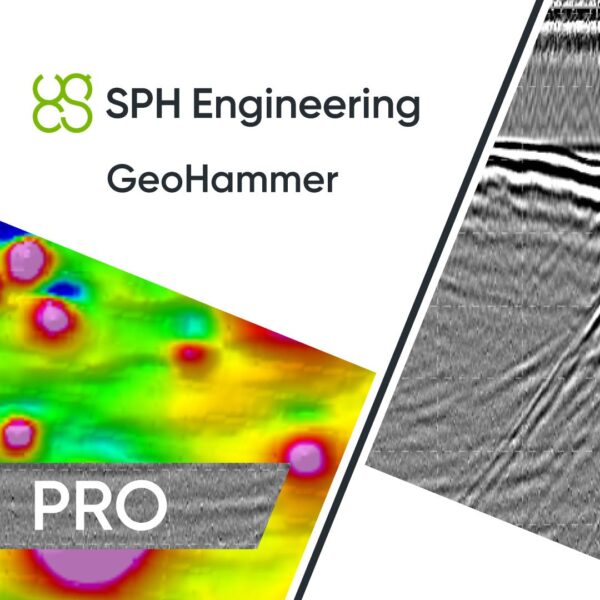
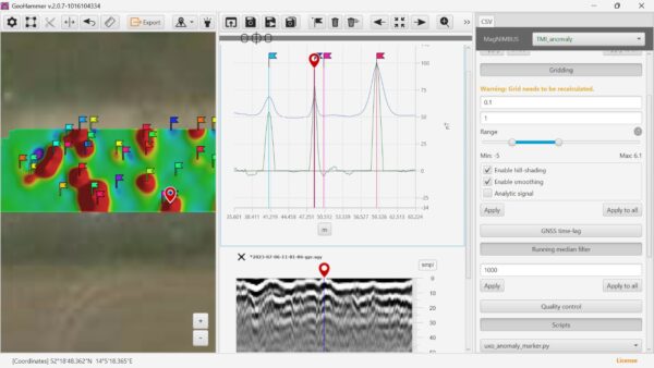
GeoHammer Pro is SPH Engineering’s simple, fast tool for assessing and processing GPR and CSV sensor data in the field. It handles ground penetrating radar alongside data from magnetometers, metal detectors and gamma-ray spectrometers, with an interface optimised for maximum simplicity — so a survey crew can quality-check and process results on site, the same day they fly.
Webinar | Fast Magnetometer Data Processing with GeoHammer
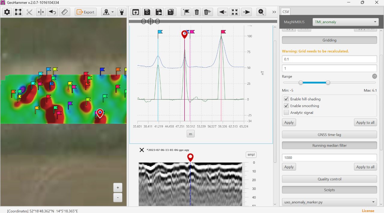
One tool for GPR and sensor CSV data
Import GPR in SEG-Y and GSSI DZT, and CSV data via ready-made templates for SkyHub, SPH MagNIMBUS, SENSYS MagDrone R1/R3/R4, Medusa MS gamma-ray, Geometrics MagArrow, GEM GSMP, Marine Magnetics SeaSpy and more. Geotag with POS files or precise flight tracks, display data tracks on the map, and split surveys into clean lines.
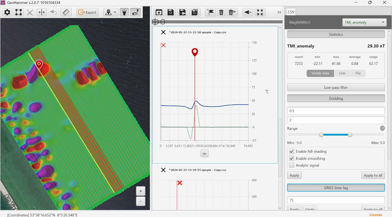
Field-ready processing in a few clicks
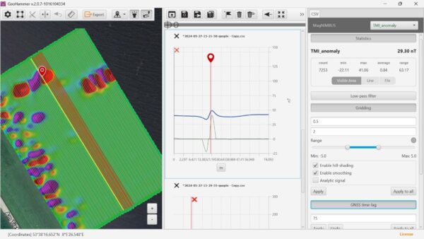
Apply the processing that matters: background removal and gain for GPR; low-pass filtering, GNSS time-lag compensation, data-quality checks and running-median anomaly highlighting for CSV. Generate GPR amplitude maps, grid CSV data, set marks on targets — ideal for utility detection and other man-made object surveys. Runs on Windows and macOS.
Applications
In-field and office processing of drone geophysical surveys — GPR utility and infrastructure detection, magnetometer and metal-detector anomaly mapping, gamma-ray spectrometry, and bathymetry from supported MBES sonars.
Service & Licensing
Supplied by GulfNet Emirates Drone & Robotic Systems with UAE-based support. GeoHammer Pro is a perpetual licence whose price includes one year of support and access to new versions; the activation licence is emailed within one business day of purchase. Request a quote and our team will arrange your licence.
Key Specifications
| Software type | Geophysical data processing software for GPR and CSV sensor data |
| Processes | GPR (ground penetrating radar) plus CSV data from magnetometers, metal detectors, gamma-ray spectrometers and more |
| Designed for | Fast, simple in-field data processing |
| Operating systems | Windows and macOS |
| GPR import | SEG-Y and GSSI DZT formats; Cerulean Sonar SVLOG (MBES) |
| CSV import templates | SkyHub position.csv, SPH MagNIMBUS, SENSYS MagDrone R1/R3/R4, Medusa MS gamma-ray, Geometrics MagArrow, GEM GSMP-25/35, Marine Magnetics SeaSpy, and more |
| Geotagging | Via POS files or precise flight tracks; display tracks on map; split data into lines |
| GPR processing | Background removal, contrast/gain adjustment, amplitude maps |
| CSV processing | Low-pass filtering, GNSS time-lag compensation, data-quality (coverage/altitude) check, running-median anomaly highlighting, data gridding |
| Licensing | Perpetual licence; price includes 1 year of support and new versions; activation emailed within 1 business day |
| SKU | IS-GEOHAMMER-PERP |
Frequently Asked Questions
What is the GeoHammer Pro Data Processing Software and which teams get the most value from it?
GeoHammer Pro is SPH Engineering’s field-focused tool for assessing and processing ground penetrating radar (GPR) alongside CSV sensor data from magnetometers, metal detectors and gamma-ray spectrometers. It is built for survey crews who need to quality-check results on site the same day they fly, rather than waiting to return to the office. Geophysical contractors, utility detection teams, UXO and archaeology specialists, and drone service providers running SkyHub, SPH MagNIMBUS, SENSYS MagDrone, Medusa, Geometrics MagArrow, GEM and Marine Magnetics payloads benefit most. The interface is deliberately kept simple, so the operator can move from raw import to amplitude maps, gridded outputs and anomaly marks in a few clicks.
How much is GeoHammer Pro and what does the licence fee actually include?
The GeoHammer Pro Data Processing Software price starts from AED 10,885 per licence when purchased through GulfNet Emirates. This covers a perpetual licence, which means you own the software outright rather than renting it monthly. Bundled into that figure is one year of technical support and full access to all new versions released during that period, so teams stay current without a separate maintenance contract. The activation licence is emailed within one business day of purchase, allowing crews to install on Windows or macOS and begin processing straight away. Volume pricing for multi-seat deployments and public sector projects is available on request, and the team can share a formal proposal against your SKU IS-GEOHAMMER-PERP requirement.
Where can I buy GeoHammer Pro in Dubai and how does the ordering process work?
GulfNet Emirates handles GeoHammer Pro sales from its Dubai office at Al Fattan Plaza, serving customers across the Emirates. To buy GeoHammer Pro Data Processing Software in UAE, you can submit a quote request through the DRS storefront, call the Dubai line, or email the sales desk with your organisation details and seat count. The team confirms pricing, issues a proforma invoice, and once payment clears, the perpetual activation key arrives by email within one business day. For enterprise buyers needing purchase orders, VAT invoicing, or procurement portal onboarding, standard commercial terms apply. Delivery is fully digital, so there is no shipping wait for the software itself.
Is GeoHammer Pro available in the UAE through an authorised channel?
Yes. GeoHammer Pro is available in the UAE through GulfNet Emirates Drone & Robotic Systems, which supplies SPH Engineering’s product range with UAE-based support. Buyers get local invoicing in AED, direct escalation for technical queries, and continuity of service as new software versions are released. This matters for geophysical contractors and public sector teams that need a documented supply chain, warranty of licence validity, and a UAE point of contact for procurement audits. Ordering through a local channel also removes the friction of international card payments, cross-border VAT reclaim, and time-zone gaps when raising support tickets during active field campaigns.
Who sells GeoHammer Pro in the UAE and what should I look for in a supplier?
GulfNet Emirates operates as a GeoHammer distributor UAE customers can transact with directly, covering licence sales, quotations, and post-purchase support for SPH Engineering products. When comparing suppliers, look for three things: a genuine relationship with SPH Engineering rather than a grey-market reseller, the ability to issue tax invoices in AED with a UAE TRN, and a clear support pathway for activation issues, version upgrades, and integration questions. GulfNet Emirates meets all three, and the DRS storefront lists the SKU, current pricing and applications so procurement teams can validate the offer against internal specifications before raising a purchase order.
What is the GeoHammer Pro price in UAE for perpetual, and are there subscription options?
The GeoHammer Pro Data Processing Software price UAE buyers pay starts at AED 10,885 for a perpetual licence, inclusive of one year of support and access to new releases. Beyond the first year, customers can continue using the version they have indefinitely or extend maintenance to keep receiving updates. The product is offered by SPH Engineering primarily under this perpetual model, which is well suited to organisations that prefer capital expenditure over recurring operational costs and want to avoid the risk of losing access at renewal. GulfNet Emirates can quote per seat, per project, or as part of a wider drone geophysics bundle that includes payload, flight planning and processing tools together.
Can I buy GeoHammer Pro online in UAE, or does it need a direct sales conversation?
The DRS storefront lists the product with a Request a Quote workflow rather than an instant checkout button, which is the standard route for professional geophysics software. To buy GeoHammer Pro online in UAE, submit the quote form with your organisation name, number of seats, and intended sensor payloads. The sales desk responds with a confirmed price, invoice and payment link. This step exists because SPH Engineering issues perpetual keys tied to the licensee, so the team needs the correct end-user details before activation. Once paid, the whole handover is digital, and the licence key reaches you by email within one working day, ready for installation on Windows or macOS.
Is there a trusted seller of GeoHammer Pro in the UAE for enterprise procurement?
For enterprise buyers looking for a trusted seller of GeoHammer Pro in the UAE, GulfNet Emirates provides commercial documentation, technical validation, and post-sales support from a Dubai base. Many contractors describe the company as the best place to buy GeoHammer Pro in the UAE because it stocks the GeoHammer Pro Data Processing Software for sale alongside complementary tools such as UgCS flight planning and DJI Terra, giving teams a single vendor for the drone geophysics workflow from mission planning to processed deliverables. Listings for GeoHammer Pro for sale in Dubai are backed by proper SPH Engineering channel authorisation, so licences carry full activation rights and version entitlement. Government tenders, oil and gas contractors, and academic institutions can access proforma invoices, trade licence copies, VAT registration, and vendor onboarding paperwork on request, which simplifies compliance for high-value procurement cycles.
Can I book a GeoHammer Pro demo in Dubai before committing to a licence?
Yes, teams evaluating GeoHammer Pro can request a walkthrough with the GulfNet Emirates specialists in Dubai to see how the software handles their specific data. Typical demos cover importing a sample SEG-Y or GSSI DZT file, running background removal and amplitude mapping on GPR, and processing a magnetometer CSV with low-pass filtering, GNSS time-lag compensation and running-median anomaly highlighting. Bringing a small dataset from a recent survey makes the session most useful, since the team can confirm compatibility with your SkyHub, MagNIMBUS, MagDrone, MagArrow or SeaSpy exports. Demos can be run in person at the Dubai office or online for stakeholders based in Abu Dhabi and other emirates.
How much is GeoHammer Pro compared with going without dedicated processing software?
Without a purpose-built processor, survey teams typically stitch together generic GIS tools, spreadsheets and scripts to clean magnetometer or GPR data, which slows down deliverables and introduces manual errors. Against that baseline, the GeoHammer Pro Data Processing Software price of AED 10,885 for a perpetual licence is generally recovered within a handful of field campaigns through faster turnaround, cleaner anomaly marking and fewer repeat mobilisations. It also replaces the need to send raw data to third-party specialists for basic processing tasks like gridding, coverage checks and background removal. For a working contractor, the recurring value sits in same-day quality control before the crew leaves the site.
Is GulfNet Emirates the GeoHammer dealer UAE customers can rely on for support after purchase?
As the authorised GeoHammer dealer Dubai and wider UAE customers work with, GulfNet Emirates provides local support for activation, version updates, workflow queries and integration with SPH Engineering’s SkyHub and MagNIMBUS ecosystems. The GeoHammer Pro dealer in UAE relationship means clients raise tickets through a UAE contact rather than routing every query overseas, which shortens turnaround during active projects. Support during the first year is included with the perpetual licence, covering software questions and access to newly released versions. Extended support beyond year one can be arranged on request, and the team can also advise on hardware pairing when the software is bought as part of a larger geophysics kit.
Is there a GeoHammer Pro supplier in Abu Dhabi for federal and public sector projects?
GulfNet Emirates supplies GeoHammer Pro to buyers based in Abu Dhabi, including public sector, defence-adjacent and utility clients running geophysical surveys for infrastructure, unexploded ordnance clearance and archaeological screening. As a GeoHammer Pro supplier in Abu Dhabi, the team handles federal procurement documentation, delivers licences digitally to speed up mobilisation, and coordinates with project managers on multi-seat rollouts. If you also need to get a quote for GeoHammer Pro alongside compatible payloads or flight planning software, a single consolidated proposal can be issued rather than splitting the requirement across vendors, which simplifies budget approval and reduces the number of purchase orders needed to close out a project.