


PIX4Dfields Agriculture Mapping Software
PIX4Dfields turns drone and satellite imagery into actionable agronomic insight in minutes — even fully offline at the edge of the field. From vegetation-index maps to zonation and variable-rate prescription outputs, it gives agronomists and spray-drone operators the data they need to act the same day.
Introduction to PIX4Dfields
Fast processing — in the field or office
PIX4Dfields’ instant processing engine creates accurate crop maps in minutes — no internet required. Work fully offline at the field edge or process in the office and share results instantly via PIX4Dcloud.
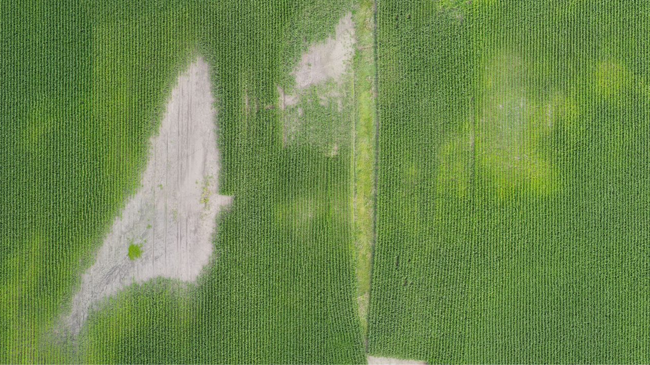
High-resolution orthomosaics
Generate geometrically corrected, georeferenced orthomosaic maps from drone or satellite imagery. Unlimited hectare mapping per licence — map as many fields as you need.
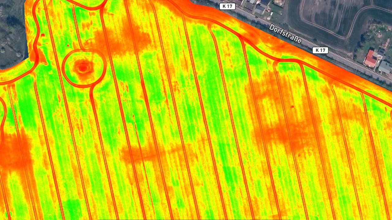
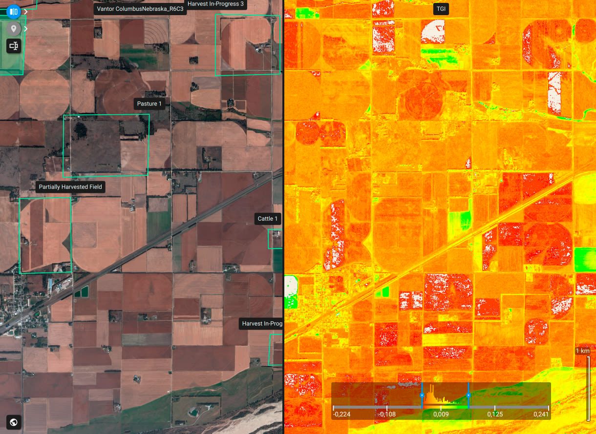
Vegetation index maps
Calculate NDVI, NDRE, GNDVI, and other custom indices from multispectral imagery to monitor crop health at any growth stage. Instantly identify stressed areas for targeted intervention.
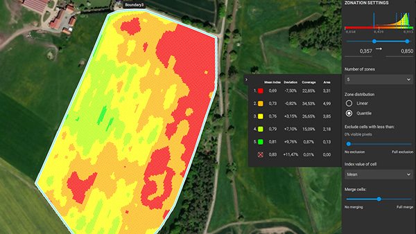
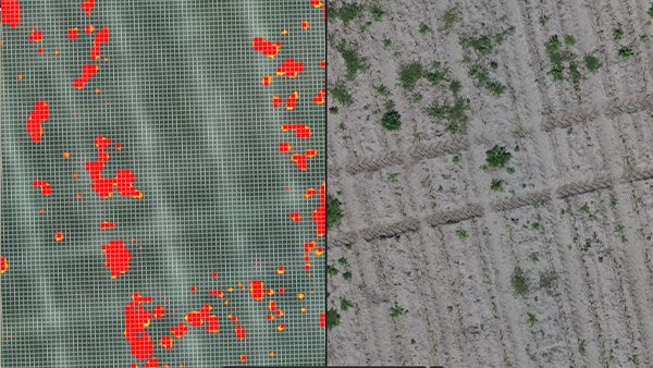
Zonation & prescription maps
Automatically segment fields into management zones based on crop health indices. Generate variable rate application (VRA) and spot-spraying prescription maps ready for export to agricultural machinery.
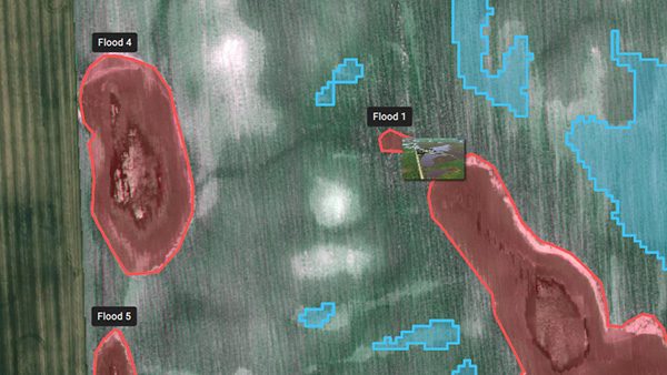
Annotations & measurements
Mark areas of interest, measure distances, areas, and counts directly on your maps. Document field observations and share annotated reports as PDFs with agronomists and farm managers.
Targeted operations & spot spraying
Create ready-to-use prescription maps compatible with DJI, XAG, John Deere Operations Center, and ISOBUS-standard machinery. Reduce chemical inputs with precision variable-rate and spot-spraying applications.
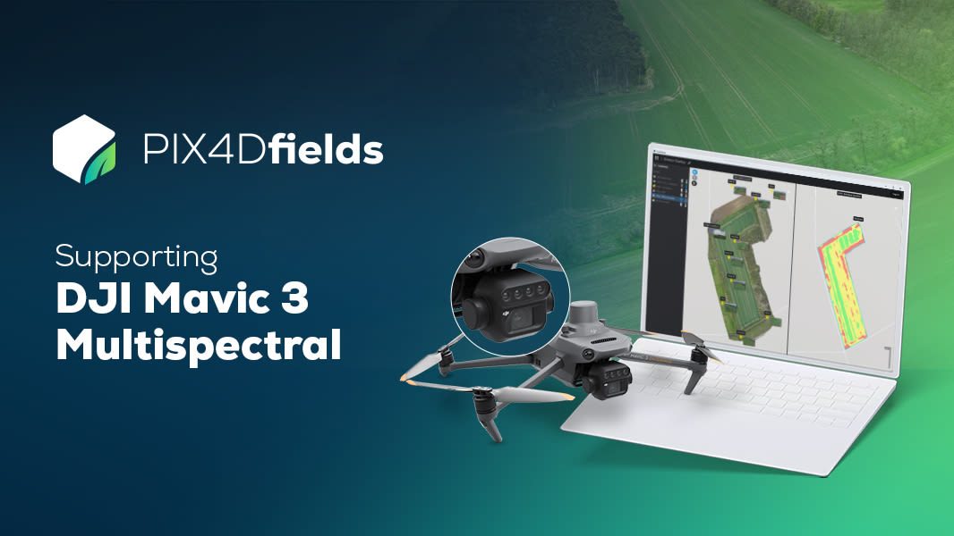
DJI Mavic 3 Multispectral compatible
PIX4Dfields is fully optimised for DJI Mavic 3 Multispectral datasets. Seamlessly import, process, and generate crop insights from DJI’s latest multispectral drone platform.
Satellite imagery integration
Access high-resolution satellite imagery directly within PIX4Dfields to generate crop insights and vegetation indices from anywhere in the world — without flying a drone.
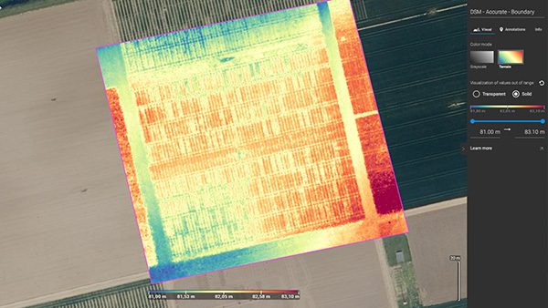
Digital surface model (DSM)
Generate digital surface models to measure crop height, estimate biomass, and analyse field topology for drainage planning and irrigation management.
Service & Warranty
Every PIX4D licence supplied by GulfNet Emirates includes official Pix4D activation, access to the latest software updates within your licence term, and onboarding support from our certified team in the UAE. We provide local technical assistance, training, and renewal management so your mapping workflows stay productive. Contact us for volume licensing, education pricing, and tailored support packages.
Key Specifications
| Software Type | Agriculture mapping & precision farming software |
|---|---|
| Platforms | Windows, macOS |
| Input Imagery | RGB, Multispectral (drone & satellite) |
| Supported Drones | DJI, XAG, and 100+ compatible drone platforms |
| Key Outputs | Orthomosaic, Vegetation Index Maps, Zonation Maps, Prescription Maps (VRA/Spot Spray), DSM, PDF Reports |
| Machine Compatibility | DJI, John Deere (Operations Center), XAG, ISOBUS / ISOXML standard |
| Satellite Integration | Yes (high-resolution satellite imagery) |
| Offline Processing | Yes (fully offline at field edge) |
| License Type | Annual subscription — unlimited hectares |
| Language Support | English, German, Japanese, Spanish, Chinese, Portuguese, French, Italian, Czech, Hungarian, Russian |
Frequently Asked Questions
What drones are compatible with PIX4Dfields?
PIX4Dfields supports over 100 drone platforms including all major DJI models (Mavic 3 Multispectral, Phantom 4 Multispectral, Agras series), XAG, and other RGB or multispectral drones. Check pix4d.com/supported-drones for the full list.
Can I use satellite imagery without a drone?
Yes. PIX4Dfields provides direct access to high-resolution satellite imagery, allowing you to generate crop health maps and vegetation indices for any field in the world — ideal for large areas or when drone flights aren’t possible.
How does PIX4Dfields export prescription maps to machinery?
PIX4Dfields exports prescription maps in ISOXML format (compatible with any ISOBUS-standard machine terminal) and integrates directly with John Deere Operations Center. DJI and XAG spray drones are also directly supported.
Is an annual licence limited to a certain number of hectares?
No. PIX4Dfields licences allow unlimited hectare mapping — you can process as many fields and flights as needed within the subscription period.


