Radar Systems Zond Aero LF Low-Frequency Ground Penetrating Radar (GPR) System
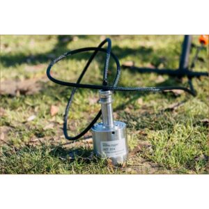
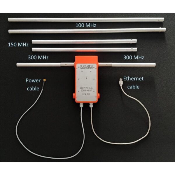
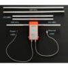
The Zond Aero LF is the deep-penetration, low-frequency member of the Zond Aero family and the most versatile system in the range. Its unshielded dipole antennas reach up to 20 m into average soil — far deeper than the shielded high-frequency models — making it the tool for geophysical, archaeological and engineering investigations of deep targets. It ships with three dipole sets (100, 150 and 300 MHz) and is fully tunable: order custom 50–400 MHz dipoles, or even cut the supplied dipoles to hit a specific centre frequency.
Ground Penetrating Radar — Radar Systems Zond Aero LF

Deep penetration up to 20 m
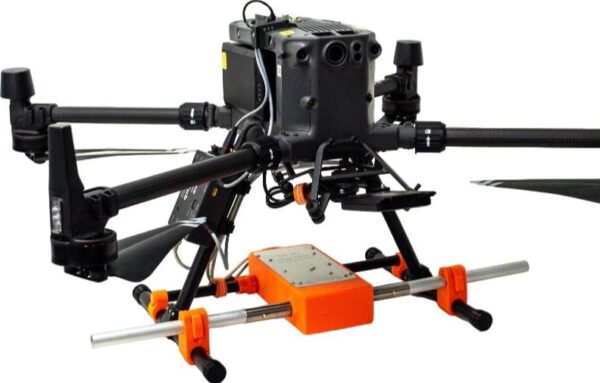
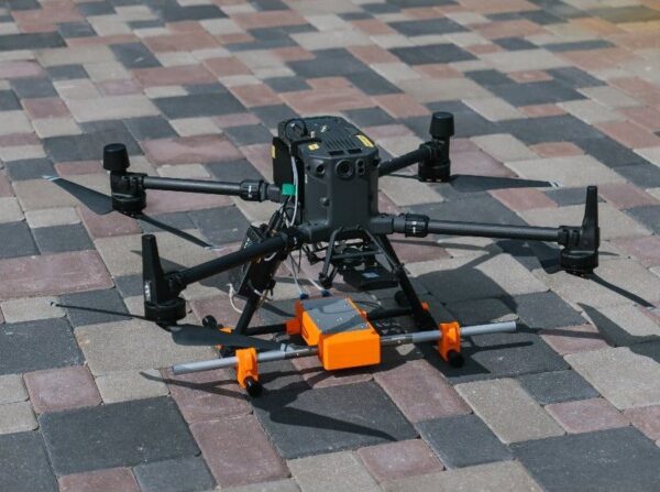
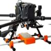
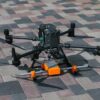
Low frequency means depth. The Aero LF trades the fine resolution of the higher-frequency Zond models for penetration to around 20 m in favourable soil, ideal for mapping bedrock, deep stratigraphy, large buried structures and groundwater interfaces. Extra-lightweight, it flies on DJI M400, M300 and M350 RTK drones.

Tunable frequency, one system
Three dipole sets (100, 150, 300 MHz) cover most survey needs, and the system has been tested across 50–400 MHz. Need maximum depth? Add the optional 50 MHz dipole set. RTS with high hardware stacking keeps the data low-noise, and every trace is geotagged in standard SEGY (.sgy).
Applications
Deep subsurface investigation for geophysics, archaeology and engineering — bedrock and deep-stratigraphy mapping, large buried structures, groundwater interfaces and other deep targets where penetration matters more than fine resolution.
Service & Warranty
Supplied by GulfNet Emirates Drone & Robotic Systems with UAE-based technical support, integration guidance and full manufacturer warranty. The Zond Aero LF requires additional components and software for drone operation — request a quote and our team will propose the complete, ready-to-fly GPR set. The user is responsible for confirming the suitability of a given GPR model for use in a particular country.
Key Specifications
| Type | Single-channel GPR with unshielded dipole antenna |
| Central frequency | 100 / 150 / 300 MHz (custom 50–400 MHz on request) |
| Operating bandwidth | 50–200 / 75–300 / 150–600 MHz (-12 dB) |
| Sampling | Real-Time Sampling (RTS) with high hardware stacking |
| Samples per scan | 256 / 512 / 1024 / 2048 / 4096 / 8192 (selectable) |
| Sample rate | Up to 1,280,000 samples/second |
| Scan rate | Up to 2,500 scans/second |
| Penetration depth | Up to 20 m in average soil (≈10 m at <3 m antenna elevation) |
| Data format | Standard SEGY (.sgy) with trace geotagging |
| Operating temperature | -20°C to 60°C |
| Ingress protection | IP68 in protective case; IP52 airborne |
| Supported drones | DJI M400 / M300 / M350 RTK |
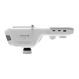
| Controller weight | 0.8 kg with drone mount; dipoles 0.1–0.4 kg each |
| Controller size | 23 × 25 × 5.5 cm |
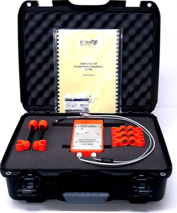
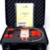
| In the kit | Zond Aero LF GPR with 100, 150 and 300 MHz dipole antennas, Prism 2 acquisition/processing software, transport case, antenna tube, DJI M400/M300/M350 mounting kit |
| SKU | IS-RS-ZOND-AERO-LF |
Frequently Asked Questions
How much is the Zond Aero LF GPR, and what does the Radar Systems Zond Aero LF Low-Frequency GPR System price include in the UAE?
Pricing is quotation-based rather than fixed on-shelf, because the Zond Aero LF is rarely sold as a standalone unit. A working airborne kit needs the SkyHub onboard computer, UgCS flight-planning software and the aircraft mounting hardware alongside the GPR itself. The base bundle ships with the controller, three dipole sets at 100, 150 and 300 MHz, Prism 2 acquisition and processing software, a transport case, an antenna tube, and a DJI M400/M300/M350 mounting kit. Options like the 50 MHz dipole set for deeper penetration, terrestrial mono-static or bi-static kits, or custom dipoles cut to a specific centre frequency all shift the final figure. Share your target depth and drone platform with GulfNet Emirates and a scoped quote follows.
Where can I buy the Zond Aero LF GPR in Dubai, and is there an authorised Zond dealer Dubai buyers can trust?
GulfNet Emirates handles the Zond Aero LF GPR for sale in Dubai from its Al Fattan Plaza office in Jumeirah Beach Residence. Working directly with an authorised Zond dealer Dubai teams can rely on means the unit is procured through the correct SPH Engineering channel, arrives with full manufacturer warranty, and comes with local integration guidance for DJI M400, M300 or M350 RTK aircraft. Buyers also get one point of contact for the connected components a GPR needs to actually fly, including the SkyHub computer and UgCS licence. Walk-in consultations, on-site scoping and RFQ submissions are all handled from the Dubai office.
Is Zond Aero LF GPR available in the UAE, and who acts as the Zond distributor UAE for the airborne range?
Yes. GulfNet Emirates Drone & Robotic Solutions stocks and supplies the Aero LF as part of its Payloads & Sensors line, with SPH Engineering listed as the brand of record. Acting as the Zond distributor UAE operators approach for the aerial GPR series, GulfNet Emirates carries the wider Zond Aero family too, including the shallow-target Zond Aero 1000 NG and the standalone 50 MHz dipole antenna for maximum penetration work. Stock status shows in-stock on the product record, and any items configured to order are confirmed at the quote stage. Delivery is arranged UAE-wide from Dubai.
Who sells Zond Aero LF GPR in the UAE, and how do I confirm a legitimate Zond dealer UAE surveyors can source through?
GulfNet Emirates is the direct sales route in-country and is also the Zond Aero LF GPR dealer in UAE listings that OEMs point survey and geophysics firms to. A legitimate Zond dealer UAE contract sits under SPH Engineering, the manufacturer behind the Aero LF platform, and any authorised supplier will confirm that link before quoting. GulfNet Emirates provides SKU-level traceability, in this case IS-RS-ZOND-AERO-LF, along with the SPH Engineering brand attribution, transport case, Prism 2 acquisition software, and matched DJI mounting kit. Buyers can verify authenticity by cross-referencing the SKU on the invoice against the product record before dispatch.
What’s the current Zond Aero LF GPR price in UAE terms, and does the Radar Systems Zond Aero LF Low-Frequency GPR System price UAE change with the frequency options?
The Zond Aero LF GPR price in UAE quotes is set in AED and issued per configuration rather than as a shelf tag. That’s because the Radar Systems Zond Aero LF Low-Frequency GPR System price UAE clients pay reflects the frequency mix selected. The default kit covers 100, 150 and 300 MHz dipoles, and buyers can add the optional 50 MHz set for deeper reach or request custom dipoles anywhere in the 50 to 400 MHz range. The airborne bundle also depends on the drone chosen from the DJI M400, M300 or M350 RTK line and whether the SkyHub computer and UgCS licence are included. Submit an RFQ against SKU IS-RS-ZOND-AERO-LF for the current figure.
How do I buy Radar Systems Zond Aero LF Low-Frequency GPR System in UAE, and is there a Zond Aero LF GPR supplier in Abu Dhabi as well as Dubai?
To buy Radar Systems Zond Aero LF Low-Frequency GPR System in UAE, submit a quote request through GulfNet Emirates against the SKU IS-RS-ZOND-AERO-LF, or contact the Dubai team directly on +971 4 8972598. GulfNet Emirates operates as the Zond Aero LF GPR supplier in Abu Dhabi teams engage as well: sales, logistics and technical scoping are coordinated centrally from the Dubai office and delivered nationally, with integration support extended into Abu Dhabi survey operations, remote field sites, and offshore-adjacent projects. The user remains responsible for confirming that a given GPR configuration is suitable for use in the country of operation, and GulfNet Emirates advises on that during scoping.
Can I buy Zond Aero LF GPR online in UAE, and what’s the fastest way to get a quote for Zond Aero LF GPR configurations?
The product listing is available online at the GulfNet Emirates DRS store, but the Aero LF is transacted through a Request-for-Quote flow rather than an add-to-cart checkout, because each kit needs to be configured against the buyer’s drone platform and target depth. Anyone looking to buy Zond Aero LF GPR online in UAE clicks the RFQ button on the product record, which routes the enquiry straight into the sales queue with the SKU pre-filled. To get a quote for Zond Aero LF GPR faster, include the DJI airframe you’ll fly it on, the frequency sets you want, whether the terrestrial kit is needed, and your delivery emirate.
Where’s the best place to buy Zond Aero LF GPR in the UAE, and how do I identify a trusted seller of Zond Aero LF GPR in the UAE market?
For geophysics, archaeology and deep-engineering teams, the best place to buy Zond Aero LF GPR in the UAE is a supplier that carries the SPH Engineering line under a documented distributor relationship, not a re-seller flipping a single unit. A trusted seller of Zond Aero LF GPR in the UAE should be able to quote the SKU IS-RS-ZOND-AERO-LF, itemise the dipole sets, list the Prism 2 software and confirm the DJI M400, M300 or M350 RTK mounting kit within the same proposal. GulfNet Emirates meets that bar and adds UAE-based technical support, integration guidance for the SkyHub computer and UgCS, and the manufacturer warranty.
Can I book a Zond Aero LF GPR demo in Dubai before I commit to buy Radar Systems Zond Aero LF Low-Frequency GPR System?
Yes. Buyers can book a Zond Aero LF GPR demo in Dubai through GulfNet Emirates ahead of a purchase decision, which is the sensible route for firms weighing the low-frequency Aero LF against the shallower, high-resolution Zond Aero 1000 NG. Because the choice to buy Radar Systems Zond Aero LF Low-Frequency GPR System usually hinges on target depth, up to around 20 m in average soil and roughly 10 m at antenna elevations under 3 m, a scoped demo confirms that the frequency mix matches the geology in question. Contact the Dubai office to arrange a briefing, walkthrough of the controller and dipole antennas, and, where feasible, an on-site flight assessment.
What survey applications suit the Radar Systems Zond Aero LF Low-Frequency GPR System for sale from GulfNet Emirates, and how does the Radar Systems Zond Aero LF Low-Frequency GPR System handle deep targets?
The Radar Systems Zond Aero LF Low-Frequency GPR System for sale through GulfNet Emirates is engineered for deep subsurface investigation, not fine near-surface imaging. Typical work includes bedrock and deep-stratigraphy mapping, tracing large buried structures for archaeology, locating groundwater interfaces, and supporting engineering studies where reach outranks resolution. The Radar Systems Zond Aero LF Low-Frequency GPR System uses unshielded dipole antennas across 100, 150 and 300 MHz as standard, tunable across 50 to 400 MHz, and reaches around 20 m in average soil. Data is captured with Real-Time Sampling and high hardware stacking, then output as geotagged SEGY (.sgy) traces for downstream processing in Prism 2 or third-party geophysics software.
Which DJI drones does the Zond Aero LF fly on, and can it also be used on the ground?
The airborne configuration is designed for the DJI M400, M300 and M350 RTK platforms, and the kit ships with the corresponding mounting hardware. The controller weighs 0.8 kg with the drone mount, dipoles run between 0.1 and 0.4 kg each, and the overall payload footprint is compact enough for medium-sized enterprise multirotors. Mounts for other airframes are available on request. For teams that want a dual-use tool, GulfNet Emirates can supply mono-static and bi-static terrestrial kits so the same GPR unit is deployable as a ground-towed system in areas where flight isn’t practical, such as tight archaeological sites or restricted airspace, without buying a second radar.
How rugged is the Zond Aero LF for UAE field conditions, and what data format does it output for post-processing?
The Aero LF is rated to operate between minus 20°C and 60°C, which covers the working envelope surveyors face in the UAE’s summer heat, mountain interior of Ras Al Khaimah and inland desert sites. Ingress protection is IP68 inside the protective case and IP52 in airborne configuration, so dust and light moisture on the flight line are handled without special measures. Data output is standard SEGY (.sgy) with per-trace geotagging, which drops directly into Prism 2 for acquisition and processing and is readable by mainstream geophysics packages downstream. Sample rate reaches 1,280,000 samples per second and scan rate up to 2,500 scans per second, with selectable samples-per-scan from 256 to 8,192.