


Aurora by Pixxel — Earth Observation Studio
Aurora is Pixxel’s in-house Earth Observation Studio: a no-code, cloud-native platform that turns complex satellite data into clear, decision-ready insight. Task imaging sensors or browse a vast archive, then explore, analyse and automate — all from your browser, powered by AI.
A game-changer for Geospatial Analysis | Aurora launch | Pixxel
One Platform, Endless Possibilities
Aurora brings open-source Earth Observation datasets, ready-to-use models and indices, and Pixxel’s hyperspectral imagery together in one unified workspace. Its no-code interface and customisable workflows remove the friction of traditional GIS tools.
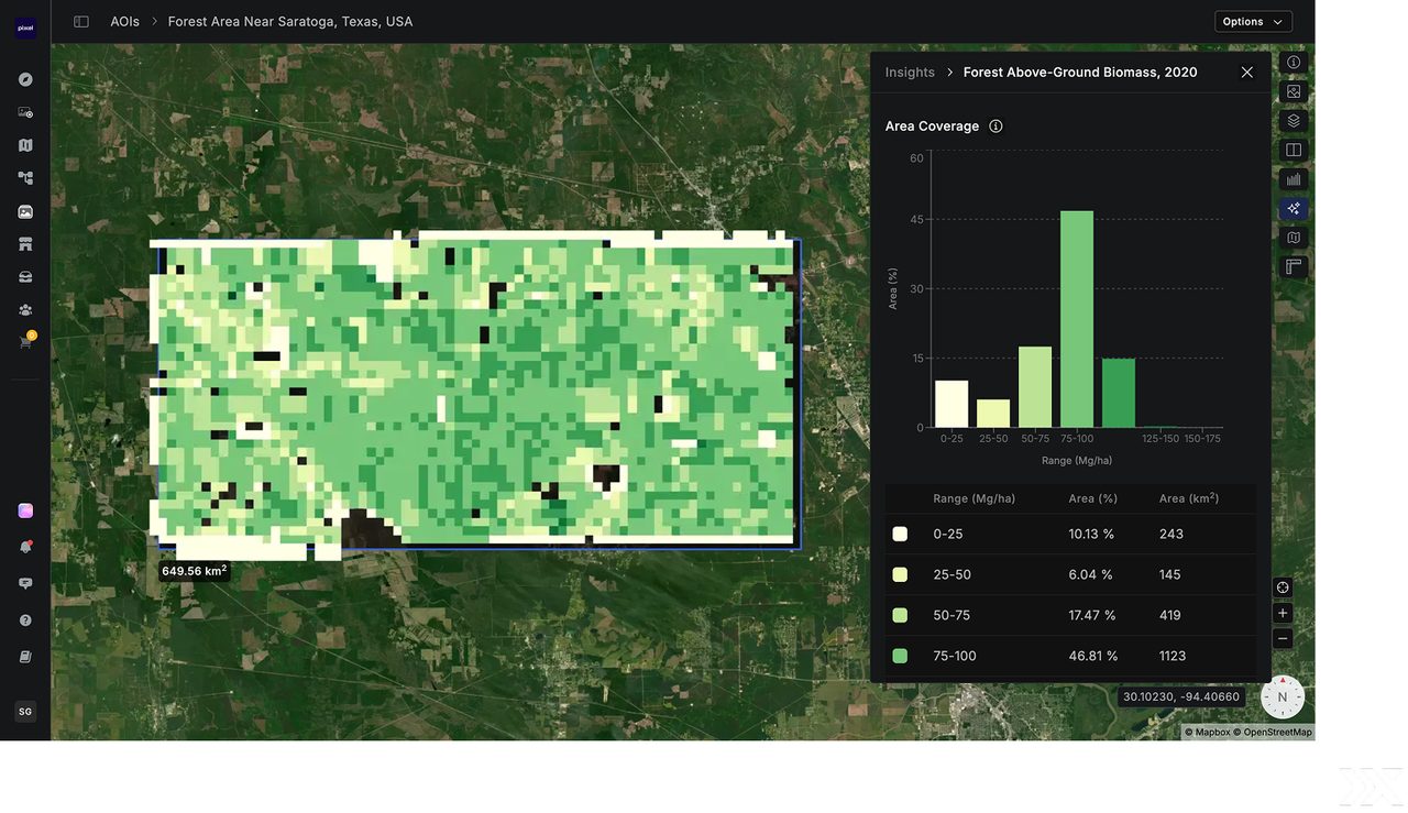
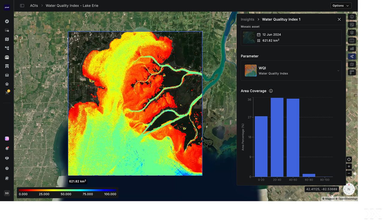
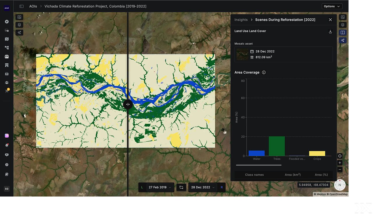
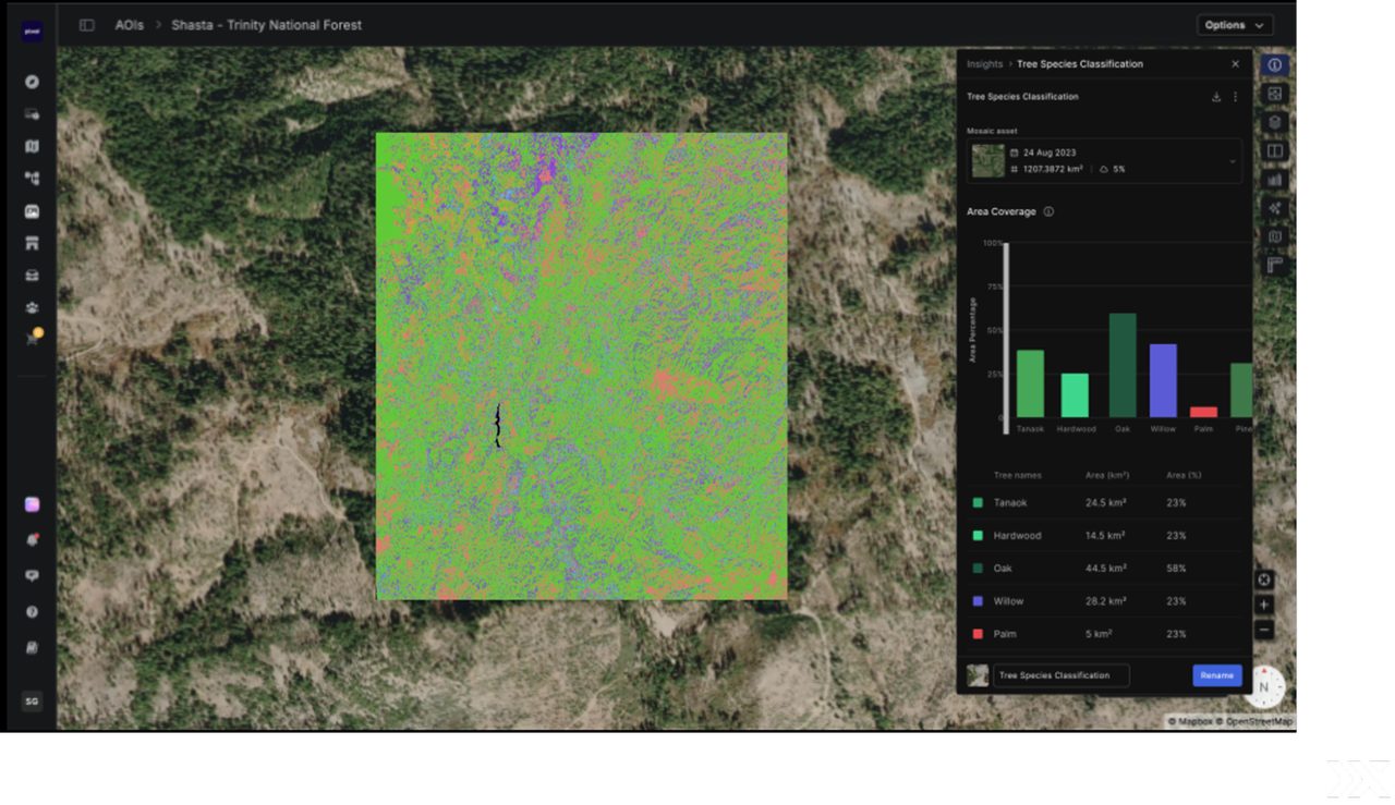
From Raw Imagery to Real Insight
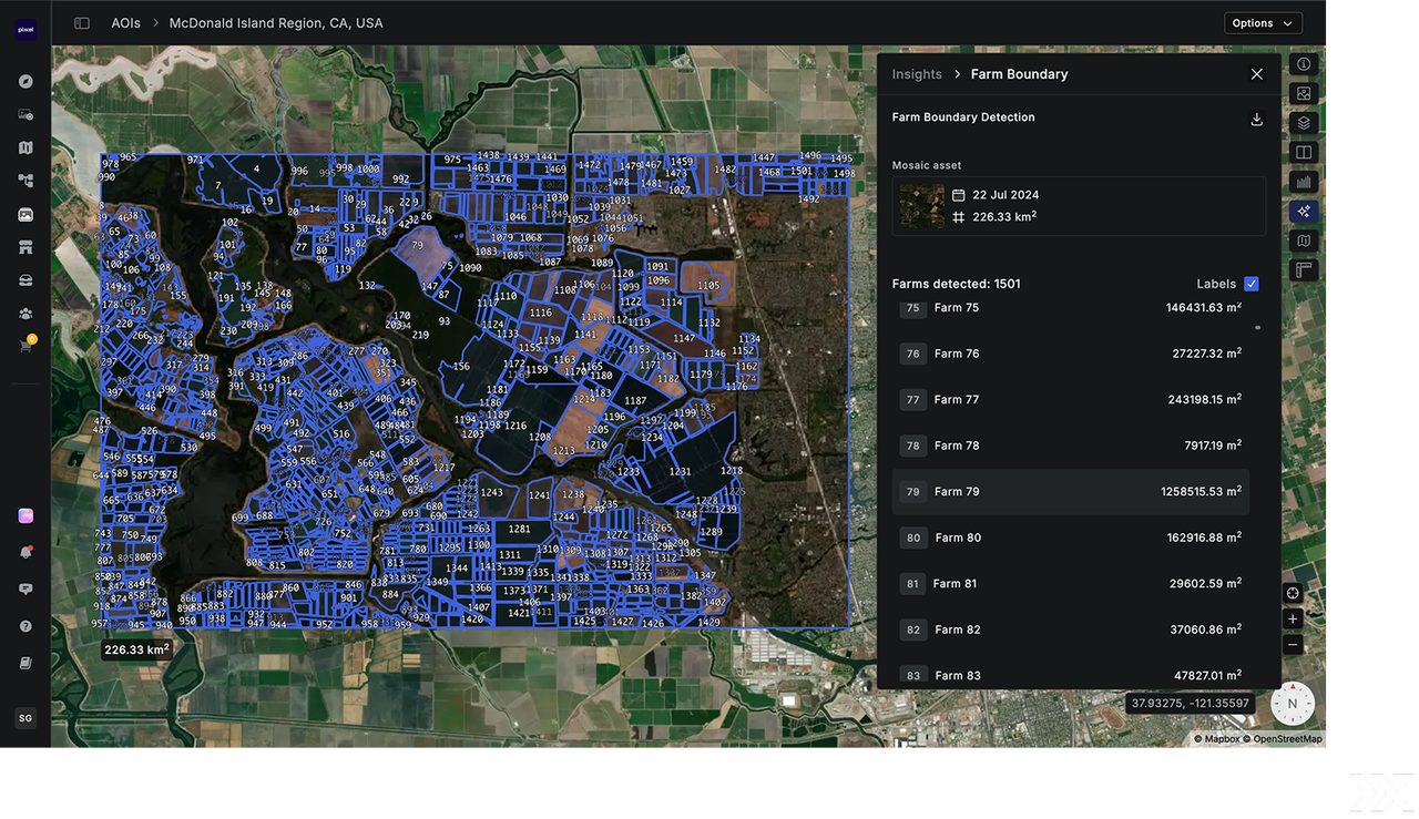
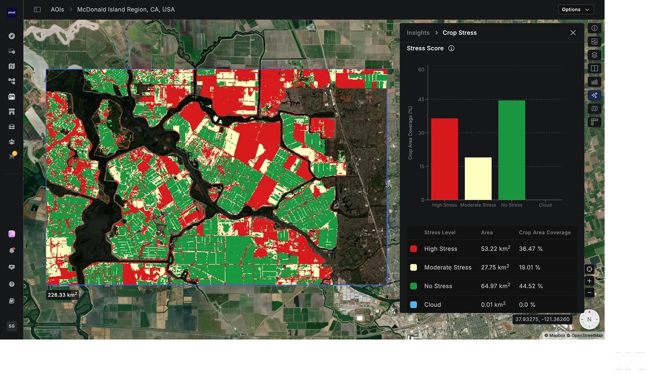
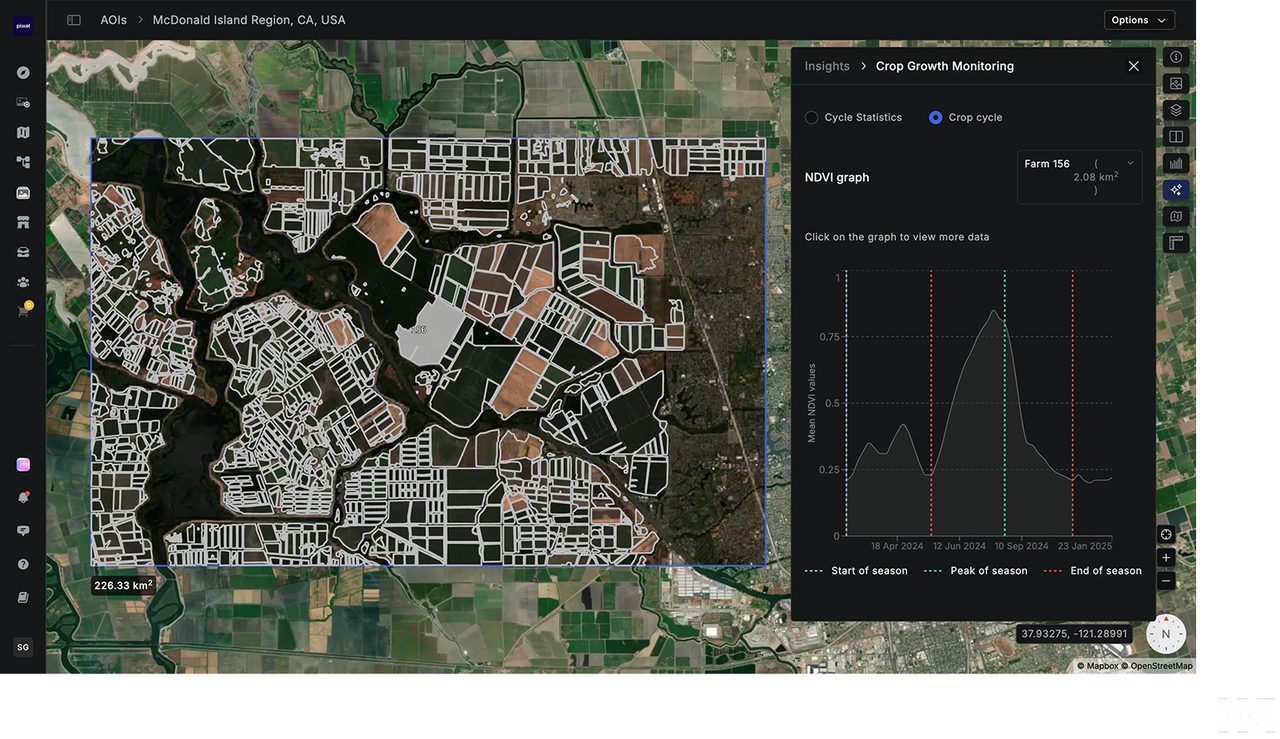
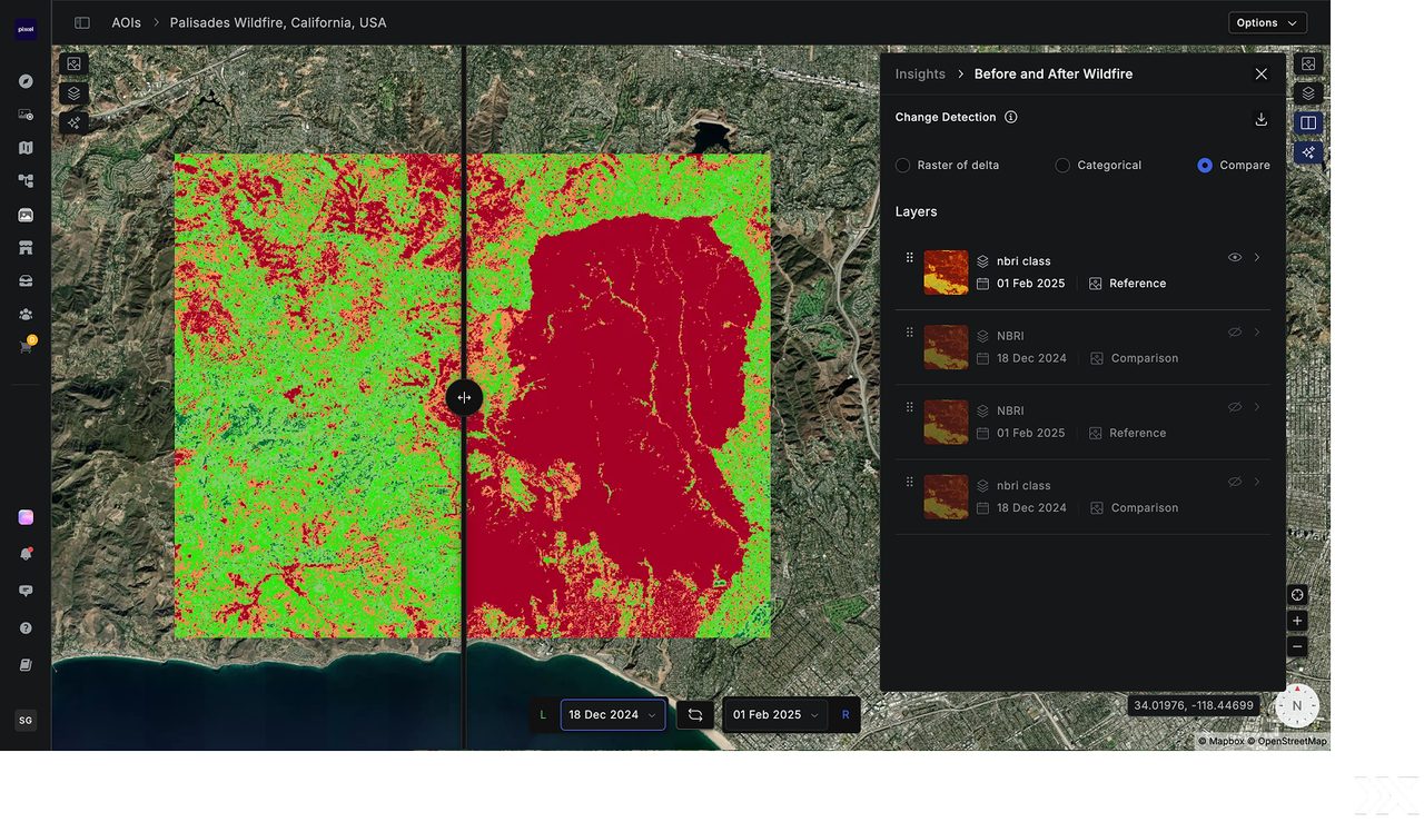
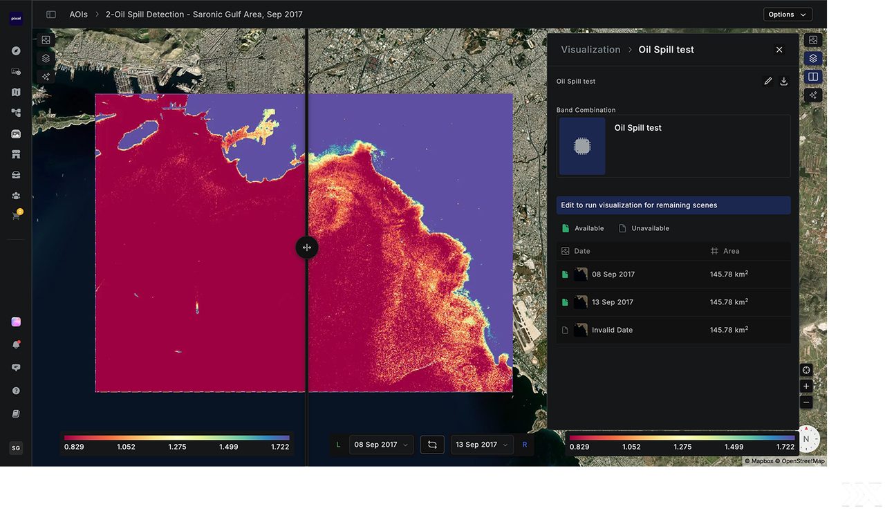
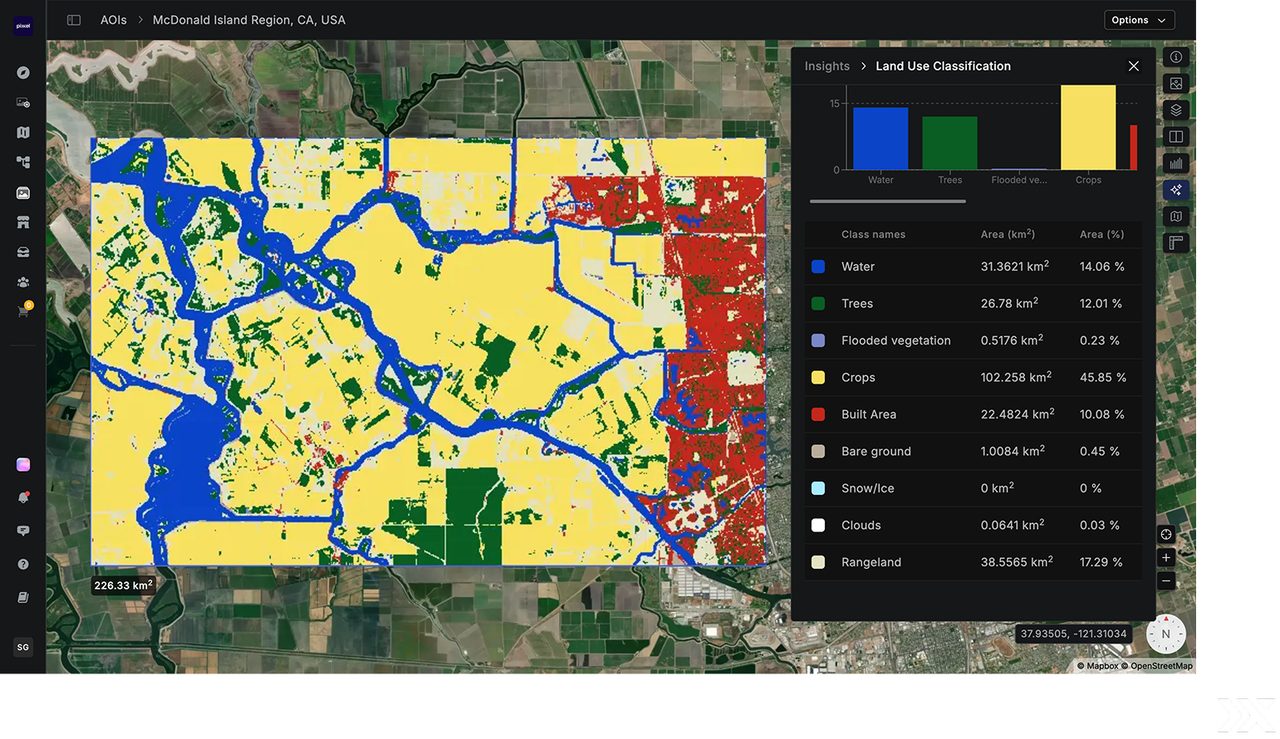
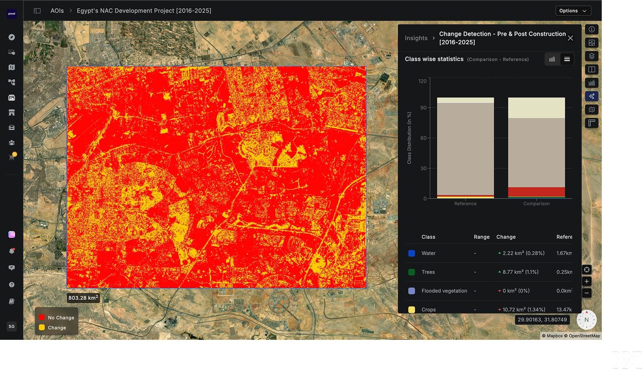
Draw or upload an area of interest, tap a huge imagery archive, run AI/ML models, and view spectral and temporal graphs — surfacing one-click insights without writing a line of code.
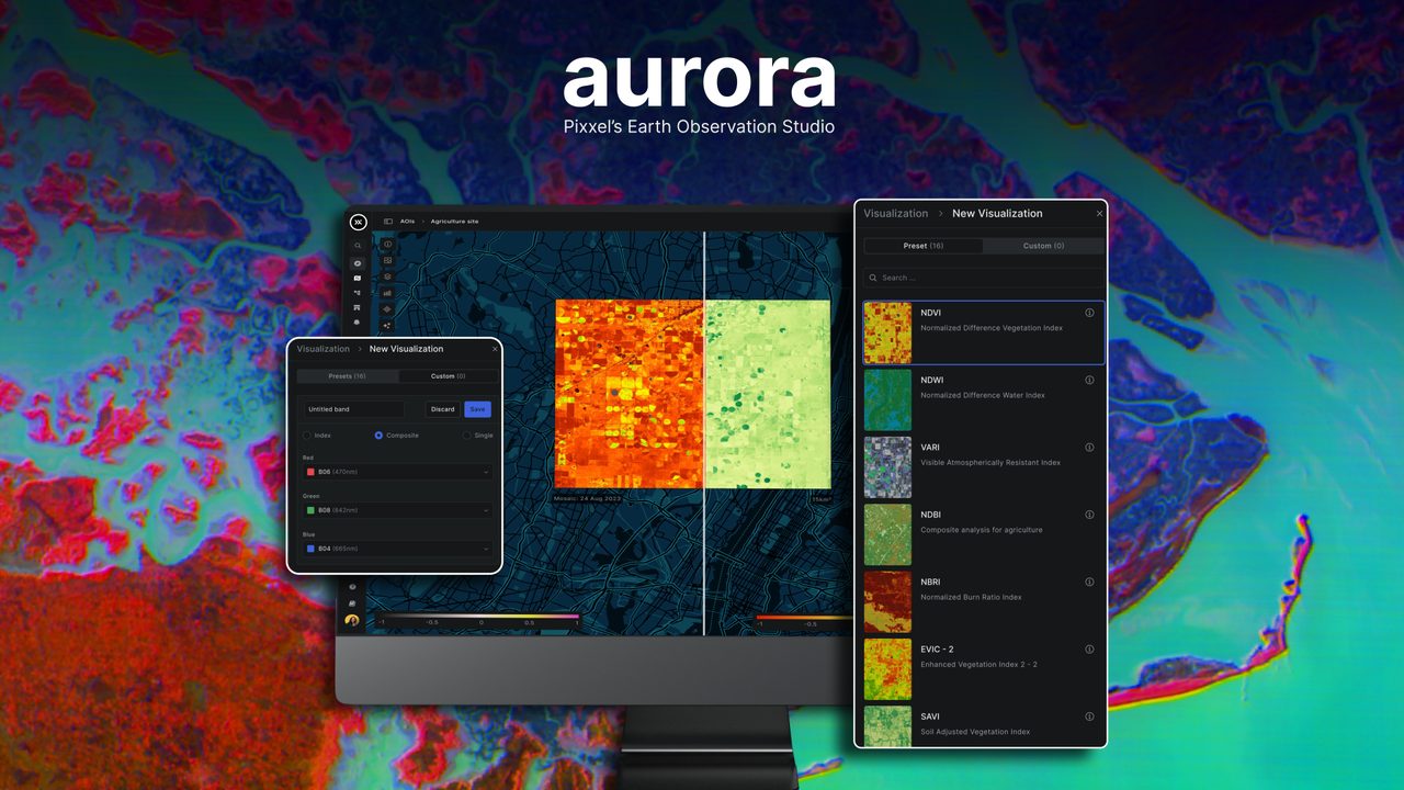
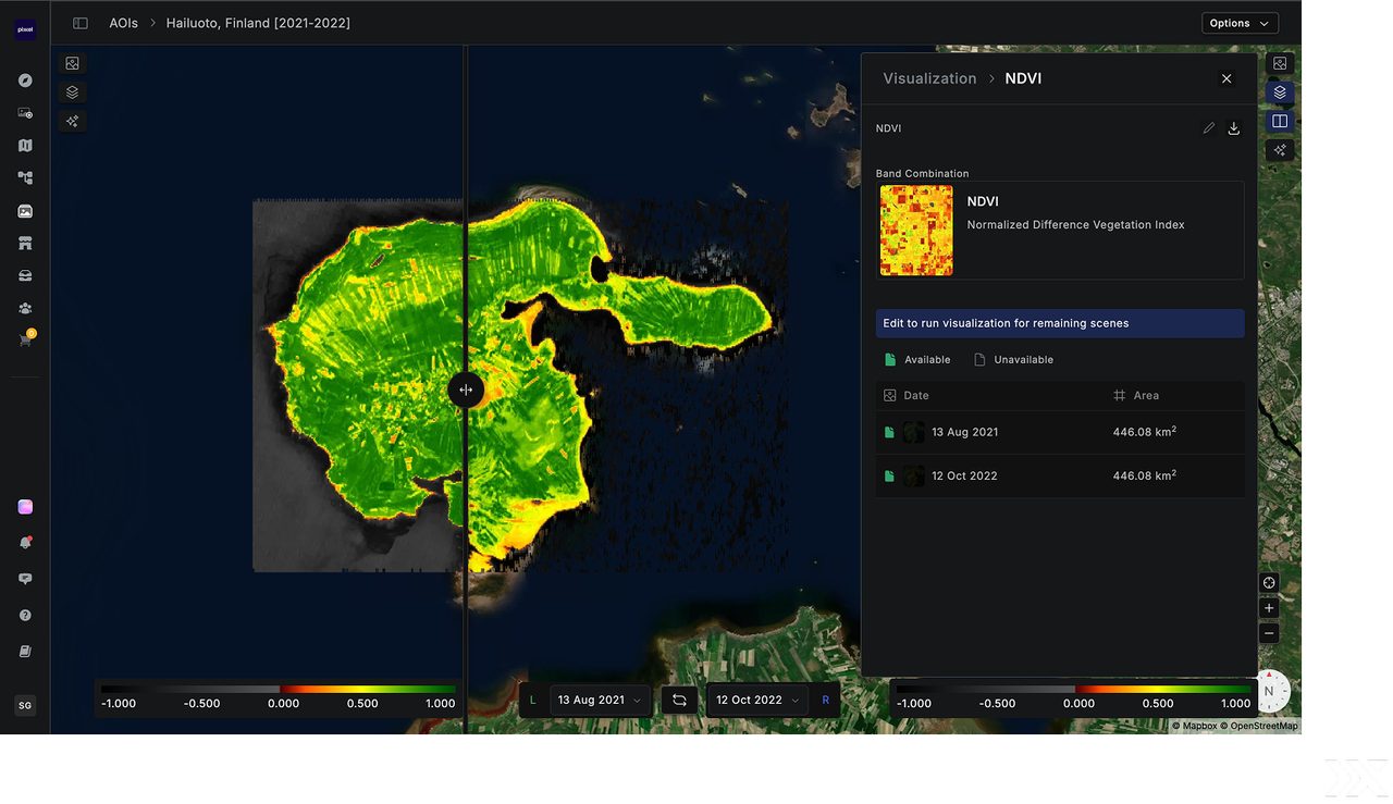
Visualise 20+ Spectral Indices
Apply preset indices such as NDVI and NDWI, build your own custom indices and composites, and compare scenes side by side with the split-compare view.
Solutions Across Industries
Aurora adapts to diverse industry needs, delivering the precision required for monitoring, compliance and resource management — and making it easy to integrate satellite data into core operations.
Agriculture
Forestry & Environment
Energy


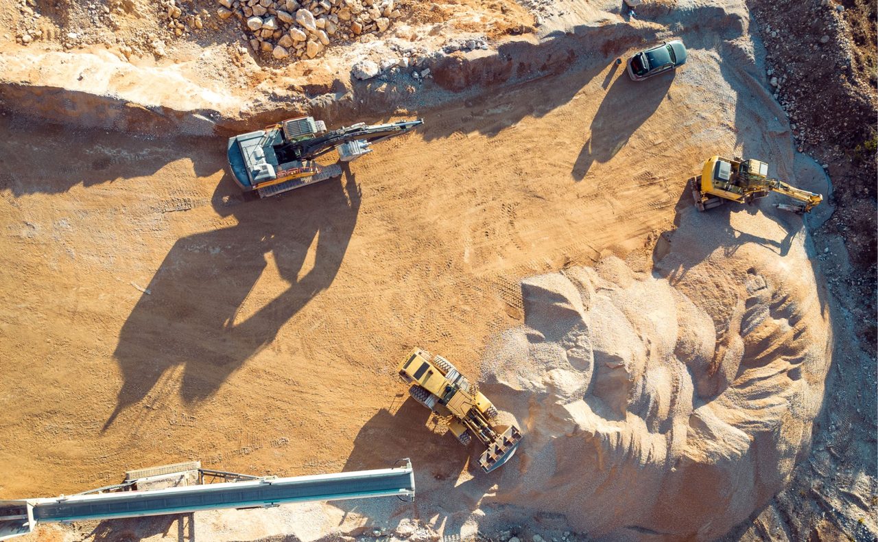
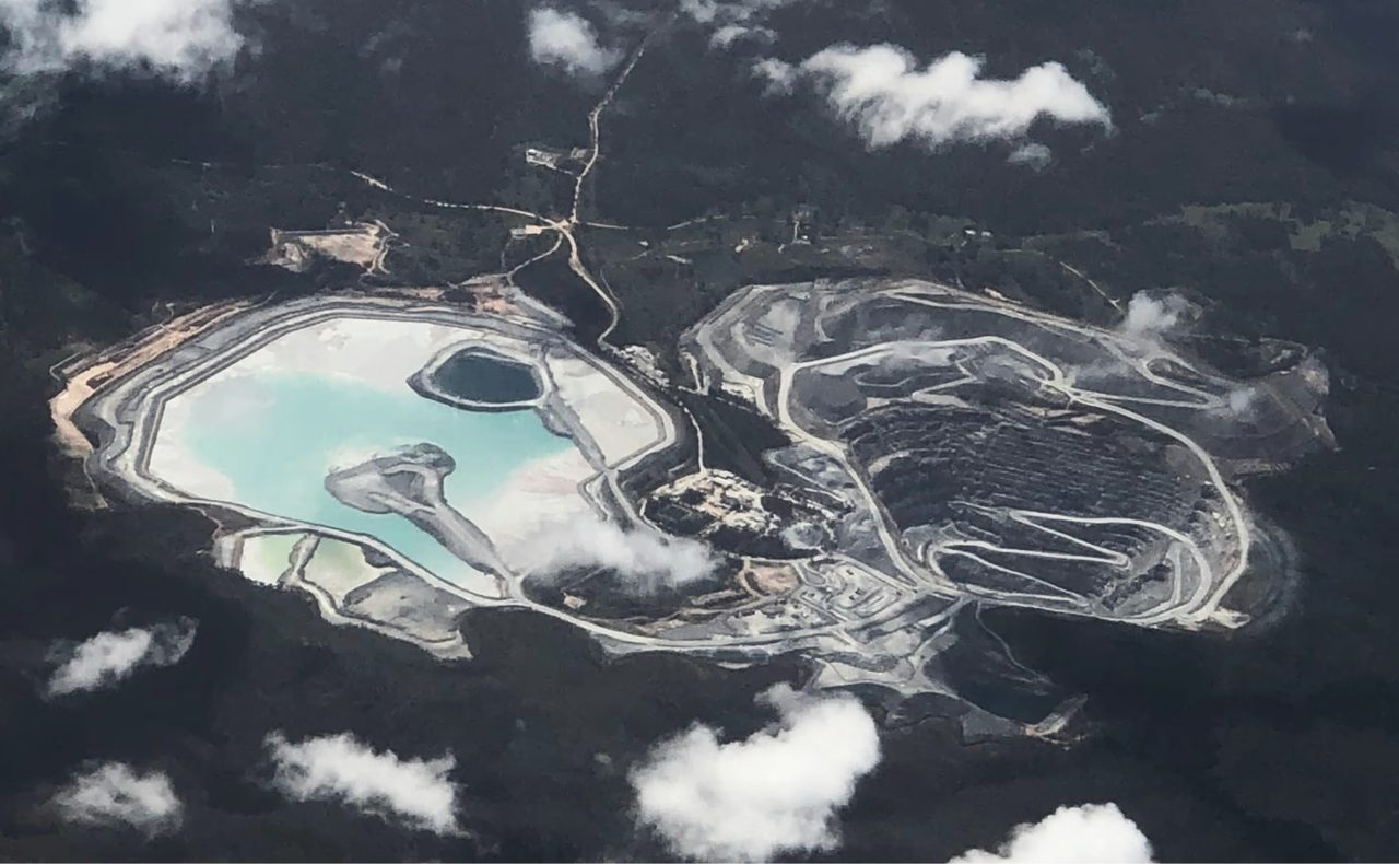
Mining

Government & Land
Service & Warranty
Aurora is delivered as a managed cloud subscription by Pixxel, with continuous platform updates, full documentation and live onboarding. GulfNet Emirates provides regional sales, account setup and first-line support across the UAE and wider GCC. Request a quote for Professional or Enterprise plans tailored to your team.
Key Specifications
| Product type | Earth Observation Studio (SaaS) |
|---|---|
| Deployment | Cloud-native, browser-based, with API access |
| Datasets | Open-source & commercial EO data + Pixxel hyperspectral imagery |
| Preset indices | 20+ (NDVI, NDWI and more) |
| Custom indices | Yes — build and save custom indices & composites |
| Analysis tools | Split-compare, spectral & temporal graphs, one-click insights |
| AI assistant | Aurora Intelligence |
| Workflows | Drag-and-drop processing blocks + APIs |
| Tasking AOI | Up to 5,000 km² |
| Plans | Standard (free), Professional, Enterprise |
| Installation | None — runs in your browser |
| Support | Documentation, live tutorials, regional support |
Frequently Asked Questions
What is Aurora by Pixxel?
Aurora is Pixxel’s Earth Observation Studio — a no-code, cloud platform to access, explore, analyse and automate satellite data without specialised GIS software.
Do I need to install any software?
No. Aurora runs entirely in your browser, with optional API access for automation and integration.
What satellite data can I use?
Aurora combines open-source and commercial Earth Observation datasets with Pixxel’s own hyperspectral imagery in one place.
Is Aurora really no-code?
Yes. You can draw an area of interest, apply indices and models, and build drag-and-drop workflows with no programming required.
Can I task a satellite or only use archives?
Both. You can browse archive imagery or task Pixxel’s imaging sensors over a defined area of interest (up to 5,000 km²).
Which industries use Aurora?
Agriculture, forestry, environment, energy, mining and government — for monitoring, compliance and resource management.
How is Aurora priced?
Aurora offers a free Standard tier plus Professional and Enterprise plans. Contact GulfNet Emirates for a quote tailored to your team.


