


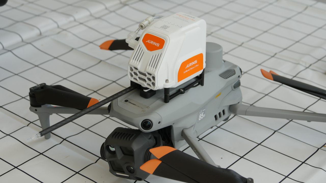
Sniffer4D Nano 2 Plus Methane — UAV Methane Detection & Mapping
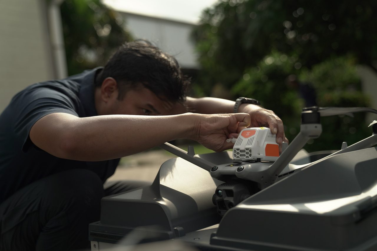
Developed by AIRINS (formerly Soarability), the Sniffer4D Nano 2 Plus Methane is a compact, drone-mounted gas sensor engineered for fast, repeatable methane screening across natural gas facilities and landfills. Using Multi-Pass TDLAS technology it sniffs CH₄ in real time and geo-references every reading, streaming results to the AIRINS.ai platform for 2D / 3D mapping, analysis and reporting.
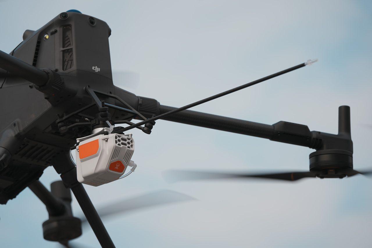
Sniffer4D Nano 2+ & DJI Dock3 & DJI Matrice 4 Series
Real-Time Methane Sniffing in the Field
Multi-Pass TDLAS detection delivers a 0 – 11,000 ppm linear range with a 200 ppb limit of detection, so teams can quickly flag concentration anomalies over large gas assets and waste sites — all while flying a routine mission.
Versatile Platform Integration
One payload, many carriers: DJI Matrice 400 (up to two units), Matrice 4D / 4TD with Dock 3 for autonomous missions, Matrice 4E / 4T, Matrice 350 / 300, and even robot dogs or ground vehicles for road and perimeter surveys.
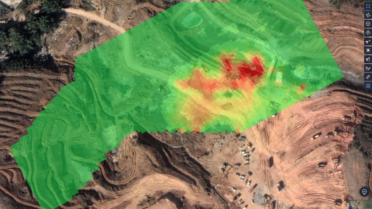
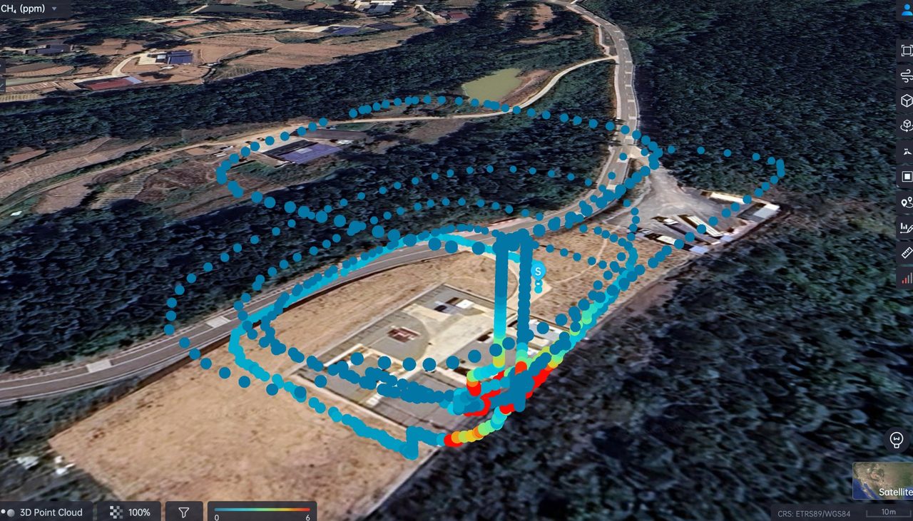
AIRINS.ai 2D / 3D Gas Mapping
Synced missions are rendered in AIRINS.ai as interactive 2D and 3D concentration maps. Switch between point-cloud, grid and interpolation heatmaps to see exactly where gas concentrates across the surveyed area.
AI-Assisted Reports & GIS-Ready Exports
Turn each mission into a structured report with concentration statistics and spatial distribution. Export to CSV, GeoJSON and Shapefile for your GIS, and generate shareable PDF or editable DOCX reports plus animated playback.
Built for Routine CH₄ Rough Survey
Ideal for routine methane rough-survey at natural gas plants and landfills: check overall concentration anomalies first, then deploy MetScan + AIRINS.ai for precise localization and quantification.
Geo-Referenced, Repeatable Coverage
Every measurement is tagged with position, altitude and time, so the same area can be re-flown and compared across runs — building a defensible record for monitoring programs.
Service & Warranty
Supplied and supported by GulfNet Emirates with regional onboarding, configuration guidance and the standard manufacturer warranty. AIRINS.ai platform access is provided per subscription. Contact us for a tailored quotation, an online walkthrough or an on-site evaluation.
Key Specifications
| Detection Technology | Multi-Pass TDLAS (methane-only sniffing) |
|---|---|
| Target Gas | Methane (CH₄) |
| Linear Range | 0 – 11,000 ppm |
| Limit of Detection | 200 ppb (3× typical baseline noise of 60 ppb at stable temperature) |
| Display Resolution | 100 ppb |
| Data Output | Real-time, geo-referenced readings |
| Carrying Platforms | DJI Matrice 400 (up to 2 units), Matrice 4D / 4TD + Dock 3, Matrice 4E / 4T, Matrice 350 / 300, robot dog, ground vehicle |
| Control & Display | DJI Pilot App, DJI FlightHub 2, AIRINS.ai Live View |
| Analytics Software | AIRINS.ai (2D / 3D mapping, AI-assisted reports) |
| Export Formats | CSV, GeoJSON (.json), Shapefile (.shp), animations; reports in PDF / DOCX |
| Optional Module | AIRINS Meteorological System — wind, temperature & humidity (DJI Matrice 400 only) |
| Recommended Use | Natural gas plant / landfill routine CH₄ rough survey |
Frequently Asked Questions
What does the Sniffer4D Nano 2 Plus Methane detect?
It detects methane (CH₄) only, using Multi-Pass TDLAS with a 0 – 11,000 ppm range and a 200 ppb limit of detection — purpose-built for fast methane rough-survey rather than multi-gas monitoring.
Which platforms is it compatible with?
DJI Matrice 400 (up to two units), Matrice 4D / 4TD with Dock 3, Matrice 4E / 4T, Matrice 350 / 300, plus robot dogs and ground vehicles. Live data and control run through the DJI Pilot App and DJI FlightHub 2.
How is the data visualized and exported?
Missions sync to AIRINS.ai for 2D / 3D mapping with point-cloud, grid and interpolation heatmaps. Outputs export to CSV, GeoJSON and Shapefile, with reports in PDF or editable DOCX.
How is it different from MetScan?
Sniffer4D is a fast rough-survey sniffer for spotting concentration anomalies. MetScan + AIRINS.ai adds precise leak localization and trial quantification (kg/h). Many teams screen with Sniffer4D, then localize with MetScan.
How is it priced?
Pricing is provided on request. Use the Request a Quote button for a tailored proposal, demo and configuration advice from GulfNet Emirates.


