


Agisoft Metashape Professional Edition
Agisoft Metashape Professional Edition is a stand-alone photogrammetry application that turns ordinary still images into high-resolution, georeferenced 3D spatial data. It processes aerial, close-range and satellite imagery into dense point clouds, digital elevation models, orthomosaics and textured 3D models — entirely offline, with no per-project cloud fees. A perpetual node-locked license trusted by surveyors, GIS professionals, archaeologists and VFX studios worldwide.
Agisoft Metashape 2.2 presentation
Photogrammetric Triangulation
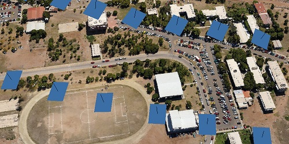
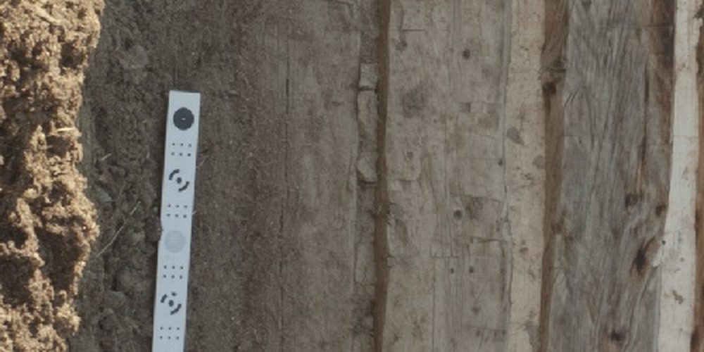
Process aerial (nadir and oblique), close-range and satellite imagery with automatic camera calibration for frame, fisheye, spherical and cylindrical lenses. Multi-camera and scanned imagery with fiducial marks are fully supported.
Dense Point Cloud Editing & Classification
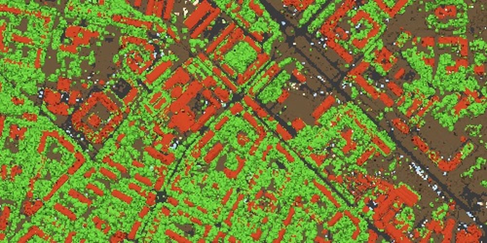
Generate dense point clouds and refine them with elaborate editing tools. Automatic multi-class point classification lets you customise downstream reconstruction, with import/export to fit any classical point-data workflow.
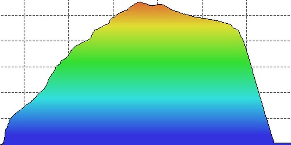
DSM / DTM Generation
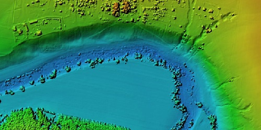
Build digital surface and digital terrain models georeferenced from EXIF, flight logs or ground control points. Supports EPSG coordinate systems (WGS84, UTM) and configurable vertical datums via geoid grids, with breakline and fill editing.
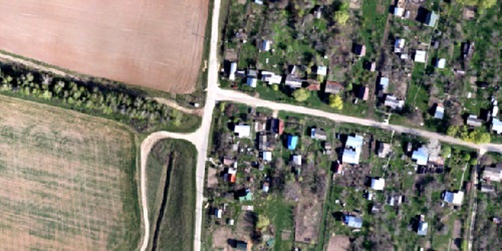
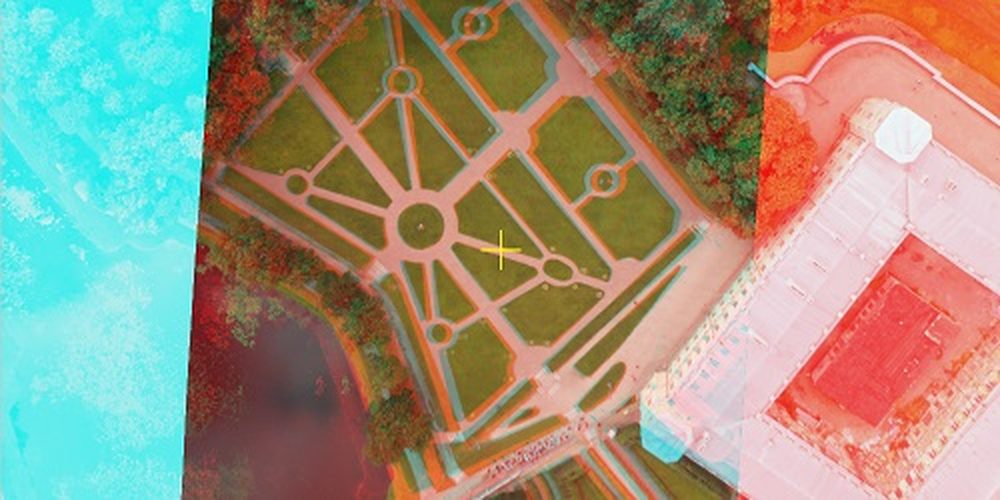
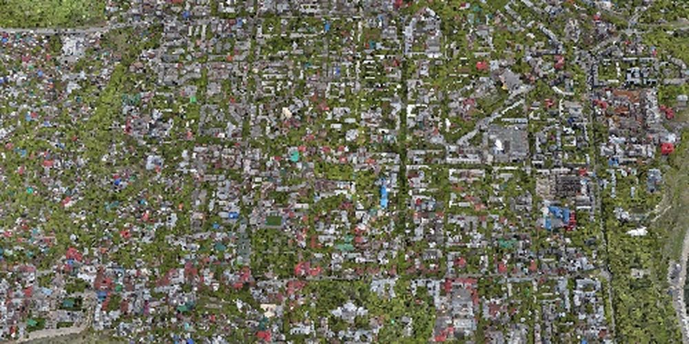
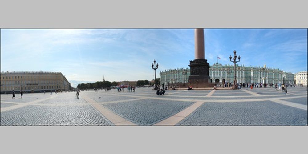
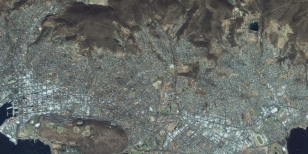
Georeferenced Orthomosaic
Export GIS-ready GeoTIFF orthomosaics and Google-Earth KML. Process huge projects in blocks, apply colour correction for homogeneous texture, and remove moving-object artefacts with the built-in ghosting filter.
LiDAR Data Support
Import aerial LiDAR with point attributes, register and marker-align laser scans, visualise them in the Model view, and run ground-point classification tuned for LiDAR data — combining imagery and laser scanning in one project.
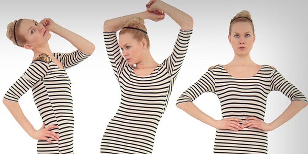
3D Model Generation & Texturing
Reconstruct archaeological sites, artefacts, buildings, interiors and people as photorealistic textured 3D models. HDR and multi-file textures (including UDIM layouts) with direct upload to online platforms and export to all popular formats.
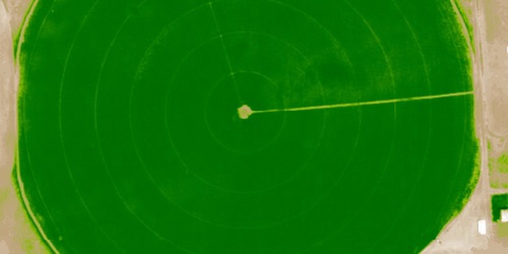
Multispectral Imagery & Vegetation Indices
Process RGB, NIR, thermal and multispectral imagery, generate multichannel orthomosaics and calculate user-defined vegetation indices such as NDVI — ideal for precision agriculture and environmental monitoring.
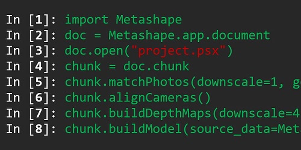
Automation: Python & Java API
Beyond batch processing, the Python scripting and Java bindings enable sophisticated automation — from adding custom operations to the GUI through to complete job automation and integration into larger processing pipelines.
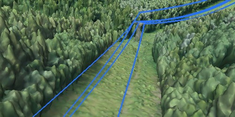
More Professional Capabilities
The Professional Edition also includes ground control point and scale-bar support with coded-target auto-detection; distance, area and volume measurements; stereoscopic vectorisation on professional 3D monitors; hierarchical tiled models for city-scale projects with Cesium publishing; 4D modelling of dynamic scenes; 360° panorama stitching; automatic powerline detection; satellite imagery processing with RPC data; and distributed network & cloud processing for very large datasets.


Service & Warranty
GulfNet Emirates is your regional partner for Agisoft Metashape. Every license is genuine and supplied with official activation, free updates within the licensed version series, and local technical support in the UAE. Our specialists assist with installation, workflow onboarding and licensing options including node-locked, floating and educational licenses.
Key Specifications
| Edition | Professional Edition |
|---|---|
| License | Node-locked, perpetual |
| Platforms | Windows, macOS, Linux (64-bit) |
| Imagery Types | Aerial (nadir/oblique), close-range, satellite, multispectral, thermal |
| Camera Support | Frame, fisheye, spherical, cylindrical; multi-camera rigs |
| Point Cloud | Dense generation, editing, multi-class classification |
| Elevation Models | DSM / DTM generation & editing |
| Orthomosaic | Georeferenced GeoTIFF, KML; block export |
| LiDAR | Aerial LiDAR & laser-scan registration |
| Georeferencing | GCPs, scale bars, EPSG datums, geoid grids |
| 3D Modeling | Textured models, hierarchical tiled models, 4D |
| Analysis | Distance, area, volume; NDVI & custom indices |
| Automation | Python & Java API, batch, network & cloud processing |
Standard vs Professional
Both editions share the same core photogrammetry engine. The Professional Edition adds geospatial, sensor, analysis and automation tools for mapping, survey and GIS work.
| Feature | Standard | Professional |
|---|---|---|
| Photogrammetric triangulation | ✓ | ✓ |
| Dense point cloud generation & editing | ✓ | ✓ |
| 3D model generation & texturing | ✓ | ✓ |
| 360° panorama stitching | ✓ | ✓ |
| Batch processing & GPU acceleration | ✓ | ✓ |
| DSM / DTM & georeferenced orthomosaic | — | ✓ |
| Ground control points, markers & scale bars | — | ✓ |
| Multi-camera, multispectral & thermal imagery | — | ✓ |
| LiDAR & satellite imagery | — | ✓ |
| Distance / area / volume measurement & NDVI | — | ✓ |
| Point cloud classification & DEM editing | — | ✓ |
| Automatic power-line detection | — | ✓ |
| Python scripting & Python / Java API | — | ✓ |
| Network & cloud processing | — | ✓ |
| Hierarchical tiled & 4D modeling | — | ✓ |
| Node-locked perpetual license & 30-day trial | ✓ | ✓ |
| Floating & service-provider licenses | — | ✓ |
| Windows / macOS / Linux | ✓ | ✓ |
Frequently Asked Questions
What is the difference between the Professional and Standard editions?
The Professional Edition adds georeferencing (GCPs, DEMs, orthomosaics), LiDAR and satellite imagery support, multispectral processing with vegetation indices, network and cloud processing, and a full Python/Java API. The Standard Edition focuses on point clouds, 3D models and panorama stitching for non-georeferenced projects.
Which operating systems are supported?
Agisoft Metashape Professional runs as a native 64-bit application on Windows, macOS and Linux.
Is the license perpetual?
Yes. This is a node-locked perpetual license — you own the version you buy, and updates within the same major series are free. Floating and educational licenses are also available on request.
Can it process LiDAR, satellite and multispectral data?
Yes. The Professional Edition supports aerial LiDAR point clouds, satellite imagery with RPC data, and RGB/NIR/thermal/multispectral imagery with multichannel orthomosaic and NDVI output.
Does it support automation and large datasets?
Yes. Batch processing, Python scripting and Java bindings allow full automation, and distributed network & cloud processing combine multiple nodes for very large projects.
Do you offer floating or educational licenses?
Yes. Floating licenses for shared environments and discounted educational licenses are available — request a quote and our team will advise the best option.


