
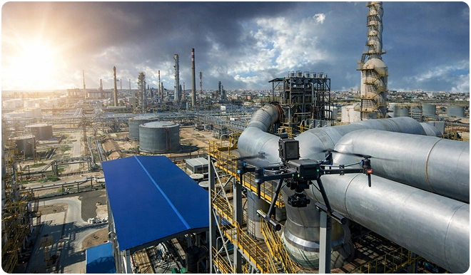
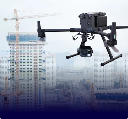
Gulfnet provides precision drone inspection services for critical infrastructure throughout the GCC, mitigating risk, minimising downtime and providing actionable insights without putting your teams or operations in harm's way.
Traditional methods of inspection place people at risk. Scaffolding, rope access and manual surveys expose teams to heights, confined spaces and dangerous environments. They also close down operations, delay projects and provide inconsistent data.
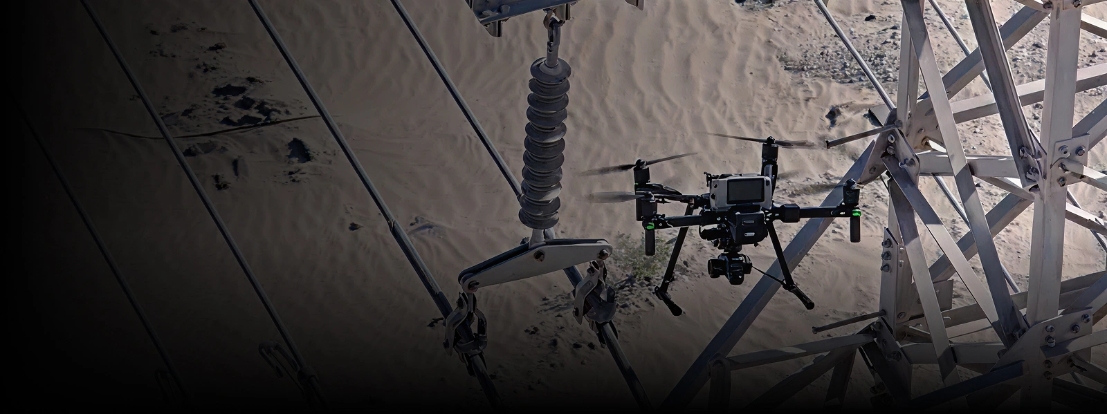
Drone based aerial inspections delivered by Gulfnet remove these risks. They offer a quicker turnaround, centimeter-level accuracy and full visual documentation, all without stopping production and compromising safety.
Gulfnet specializes in industrial-grade drone inspections across the Middle East, supporting energy, infrastructure, and utilities sectors, with certified pilots, advanced sensors and proven delivery.
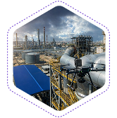
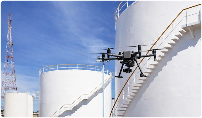
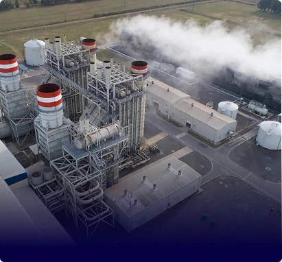
We perform detailed external inspections of oil & gas plants, refineries, terminals, and industrial facilities, capturing high-resolution imagery of critical components and structures without interrupting operations.
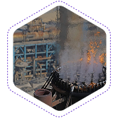
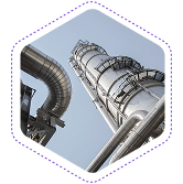
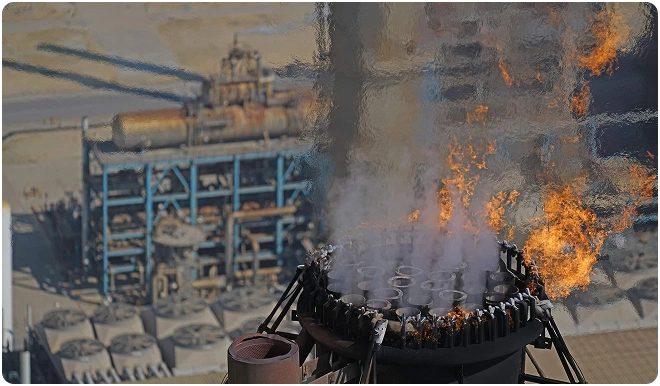
Our drones safely inspect flare stacks and flare tips while assets remain operational, eliminating the need for shutdowns, scaffolding, or rope access.
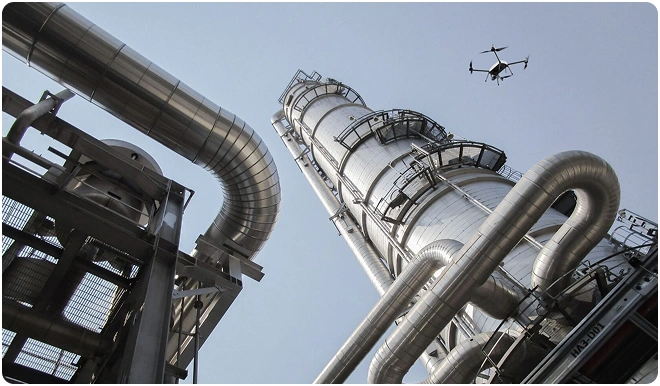
Gulfnet provides aerial inspections for chimneys, exhaust stacks, and tall structures across industrial and utility sites.
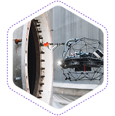
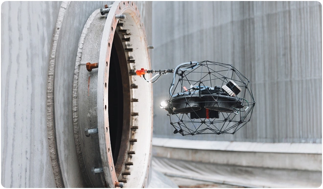
We deploy drones designed for confined and enclosed environments to inspect tanks, vessels, silos, and internal structures where human entry is unsafe or restricted.
Gulfnet supports ultrasonic thickness measurements using drone-assisted inspection approaches where applicable, helping assess wall thickness and corrosion-related material loss.
(UT deployment is subject to surface conditions, access feasibility, and client requirements.
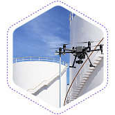
Our aerial inspections cover above-ground storage tanks, including shells, roofs, nozzles, and external fittings.
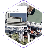
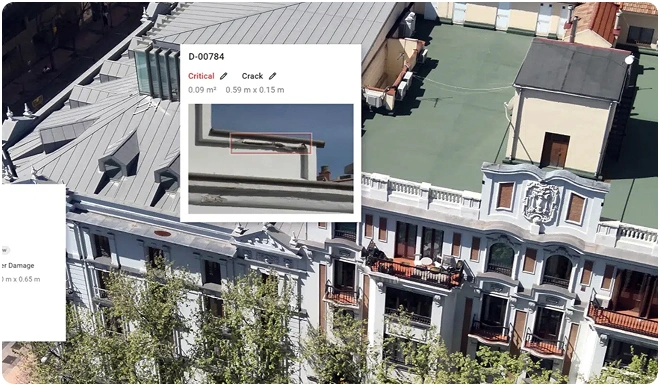
We inspect building facades, cladding systems, and high-rise structures without the need for cranes or suspended platforms.
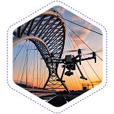
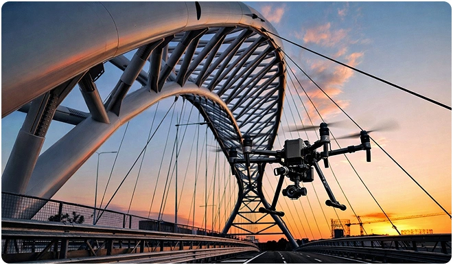
Gulfnet provides aerial inspections of bridges and flyovers, enabling safe access to structural elements that are difficult to reach by conventional means.
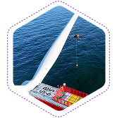
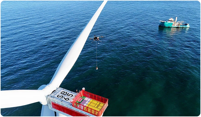
Our drone inspections support routine visual assessments of wind turbine blades and towers.
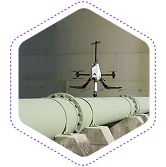
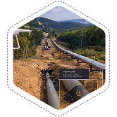
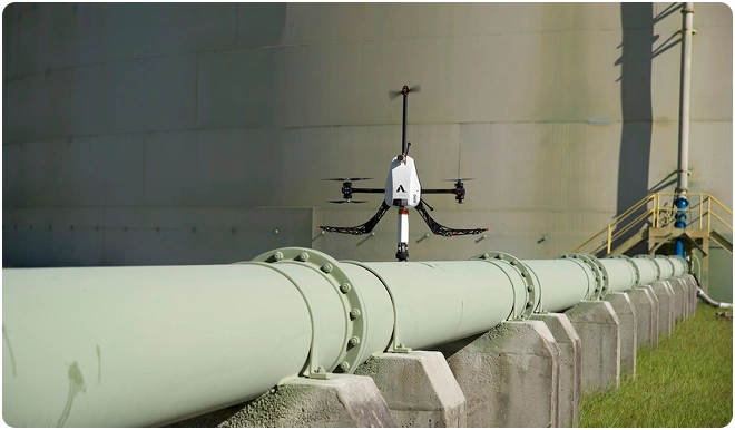
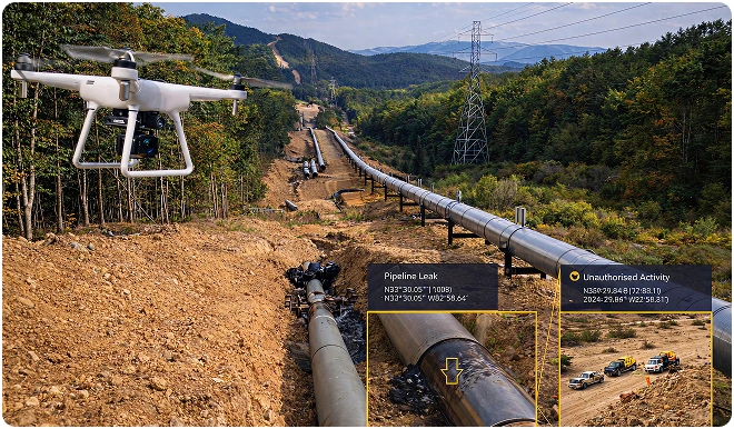
Gulfnet provides autonomous aerial inspection of long-distance pipeline corridors across the UAE.
This service improves corridor coverage, enhances safety, and supports proactive asset integrity management.
Inspection flights capture the data. Gulfnet Insight® delivers the answers.
Every single inspection produces thousands of images, videos, and data points. Gulfnet Insight converts that raw information into something much more valuable. Our cloud-based platform brings every visual, measurement, and finding to a centralized and secure platform. Defects are automatically categorized. Anomalies are flagged. Trends emerge across inspection cycles. And when you need a report for engineering review or regulatory compliance, you get it ready in minutes not days.
Share your inspection challenges with us. We'll build a drone-based solution that works around your operations

Aerial drone inspection services in UAE allow operators to assess critical infrastructure in a fraction of the time required by conventional methods. A flare stack or telecom tower survey that would traditionally take several days using scaffolding and rope access can be completed within hours using industrial-grade UAVs. Gulfnet deploys certified pilots and advanced sensor platforms to capture high-resolution imagery without halting production. The actual timeline depends on asset size, inspection scope, and environmental conditions, but the objective is always minimal disruption paired with fast, reliable delivery of actionable data.
In most cases, no. Our aerial inspection drone platforms are made to inspect live assets, including pipelines under pressure, energized equipment and operational facilities, without power outages or production halts. This non-intrusive approach is a core advantage of professional aerial inspection service delivery. For confined spaces or some high-risk environments, we will work with your team to find the safest way to go about things with minimum downtime.
Gulfnet is a fully certified aerial inspection drone company in Abu Dhabi and Dubai, operating under all applicable GCC aviation and industrial safety regulations. Our remote pilots hold recognized qualifications, and every mission is coordinated with relevant civil aviation authorities before deployment. We also align each inspection with your site-specific HSE protocols, working closely with on-ground safety teams to ensure zero-incident execution. Whether the asset is located in Abu Dhabi’s industrial zones or across Dubai’s commercial districts, Gulfnet brings the same regulatory compliance, operational discipline, and transparent documentation to every project.
Drone aerial inspection services are usually 40-70% cheaper than rope access, scaffolding or manned access, and provide a quicker turnaround with better data quality. Our aerial inspection solutions are priced based on asset type, location and complexity of inspection, with transparent per-asset rates and no hidden fees.
Contact us for a customized proposal depending on your specific needs.
Drone based visual inspections for hard to reach areas in the UAE use industrial UAV platforms equipped with high-definition and zoom cameras to safely access locations where manual entry is dangerous or impractical. This includes offshore oil and gas installations, elevated flare stacks, confined internal structures, remote desert infrastructure, and corrosive industrial zones. Gulfnet coordinates full logistics, site access, and safety planning with your operations team before every mission. The result is thorough visual documentation captured without scaffolding, rope access, or production shutdowns, covering assets that would otherwise require significant time and safety risk to inspect.
Yes. Gulfnet’s drone inspection services with detailed reports in the GCC go well beyond raw image capture. Every completed inspection is delivered with structured reporting that includes geo-referenced imagery, annotated defect maps, severity classifications, and maintenance recommendations tailored to the specific asset. Reports are generated through Gulfnet Insight, our cloud-based platform, and made available to authorized personnel through encrypted, role-based access. All data remains protected under strict non-disclosure agreements and your organization’s governance policies, ensuring both comprehensive documentation and enterprise-grade security throughout the process.
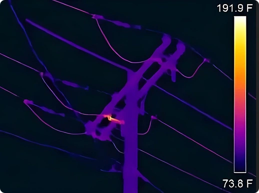
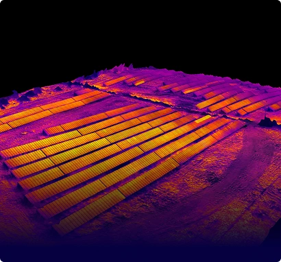
High resolution aerial inspections for industrial facilities in the UAE involve deploying enterprise-grade drones fitted with photogrammetric, thermal, multispectral, and LiDAR sensors to capture centimeter-accurate data across refineries, processing plants, power stations, and similar assets. Gulfnet processes all captured data in-house, producing deliverables such as detailed orthomosaics, 3D point clouds, digital elevation models, and volumetric calculations. These outputs integrate directly with your GIS, BIM, and asset management platforms. The scope ranges from single-asset close-range surveys to multi-kilometer corridor mapping, with every dataset accessible through Gulfnet Insight for centralized review and engineering analysis.
Gulfnet is recognized as a professional drone inspection company in Dubai because it delivers a fully integrated service model that most providers cannot match. From mission planning and certified pilot deployment to in-house data processing and cloud-based report delivery through Gulfnet Insight, every stage is managed under a single point of accountability. The team matches the right sensor and platform configuration to each mission profile, whether it is a close-range thermal assessment or a corridor-wide LiDAR survey. This end-to-end capability translates into faster turnaround, consistent data quality, and inspection outputs that fit directly into existing engineering workflows.
Regular aerial drone survey programs build a historical baseline of asset condition that supports predictive maintenance, lifecycle planning and capital expenditure prioritization. Each UAV aerial survey flight captures time-stamped, georeferenced data that can be compared against previous inspections to quantify degradation rates, track defect progression and validate the effectiveness of remediation work. Over successive cycles, this dataset becomes a powerful planning tool that helps operators move from reactive maintenance to condition-based strategies, reducing unplanned downtime and extending asset service life. All historical data is stored on Gulfnet Insight(R) with trend analysis tools that allow your engineering teams to visualize change over time and generate evidence-based maintenance recommendations.
Gulfnet Emirates offers aerial inspections for buildings and assets across the GCC, covering everything from high-rise facade assessments and cladding condition reviews to large-scale industrial asset surveys. The team uses close-range drone platforms to capture detailed imagery of exterior finishes, glazing, structural joints, and surface deterioration without cranes or suspended access systems. For commercial and residential buildings, inspection outputs include annotated visual reports suitable for regulatory submissions, compliance reviews, and repair planning. Gulfnet operates across the UAE, Saudi Arabia, Qatar, Oman, Bahrain, and Kuwait, providing consistent service standards and localized logistics coordination in every market.
The best aerial inspection services using drones in the Middle East combine regulatory compliance, sector-specific experience, advanced sensor technology, and a proven data delivery platform. Gulfnet meets all of these criteria with certified remote pilots trained for energy, infrastructure, and utilities environments, alongside enterprise-grade UAV platforms carrying thermal, LiDAR, and high-resolution visual payloads. What sets the service apart is the complete workflow, from pre-mission risk assessment and authority coordination through to processed, analysis-ready deliverables on Gulfnet Insight. Choosing a provider with this integrated capability ensures reliable results, reduced project risk, and inspection data you can act on immediately.