
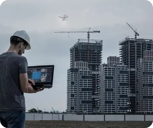
Our software portfolio brings together globally trusted platforms, carefully aligned to different operational workflows and industry requirements. From terrain modeling to asset inspection, our role is simple — select the right tools, configure them correctly, and maximize the value of your data.
DJI Enterprise Processing Tools
Agisoft Metashape
Pix4D Suite
RealityCapture
Bentley ContextCapture
3Dsurvey
GreenValley International LiDAR360
Terrasolid LiDAR Suite
UgCS Expert & UgCS Mapper
Drone-based photogrammetry has evolved into a powerful digital surveying workflow, delivering centimeter-level accuracy at scale. Platforms such as Metashape, Pix4D, RealityCapture, 3Dsurvey, and ContextCapture reconstruct precise 3D models from overlapping imagery.
We ensure your outputs are clean, accurate, and aligned with engineering and survey standards.
LiDAR data processing demands precision, experience, and specialized tools. Our LiDAR software portfolio — including GreenValley LiDAR360 and the Terrasolid Suite — enables teams to convert raw point clouds into structured, actionable spatial intelligence.
Both photogrammetry and LiDAR are powerful — and often complementary.
Many organizations adopt hybrid workflows, combining photogrammetry for visual richness and LiDAR for geometric accuracy — especially in complex or vegetated environments.
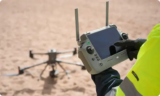
UgCS bridges the gap between flight planning, data acquisition, and processing, ensuring data is captured correctly before large-scale processing begins.
Our focus is not just software — it’s professional-grade deliverables. When paired with proper flight planning, RTK/PPK workflows, GCPs, and standardized processing methods, these platforms deliver survey-grade accuracy suitable for engineering and regulatory use.
Technology delivers value only when people and processes are aligned. We support organizations from initial adoption through enterprise-scale operations.
Software installation & configuration
Workflow onboarding & operator training
Best-practice data capture guidance
Processing optimization consulting
Ongoing technical support
Whether you’re starting your drone journey or scaling enterprise operations, we help your teams develop the knowledge, discipline, and confidence needed to deliver safe, accurate, and professional results.
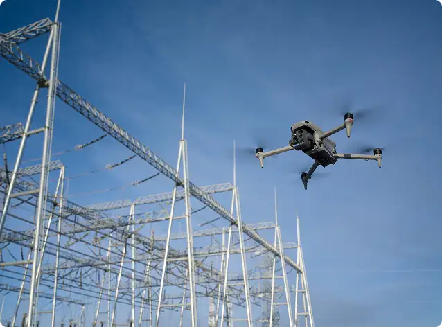
In the UAE, professionals rely on drone data processing software for inspection reports across industries such as oil and gas, power utilities, and infrastructure. Platforms like DJI Terra, Pix4D, and Agisoft Metashape process aerial imagery, thermal scans, and LiDAR captures into structured inspection deliverables. These tools generate orthomosaics, 3D models, and defect annotations that feed directly into compliance and maintenance reporting workflows. GulfNet Emirates configures each platform to match the specific inspection standards and output formats required by UAE regulatory and engineering teams.
Engineering projects across the GCC benefit from 3D mapping and drone data software such as Pix4D, RealityCapture, and Bentley ContextCapture. These platforms convert aerial captures into high-accuracy digital surface models, textured 3D meshes, and point clouds that integrate with CAD and BIM environments. When paired with RTK/PPK positioning and ground control points, the outputs meet survey-grade standards required for infrastructure design, construction monitoring, and urban development. GulfNet Emirates helps engineering teams select and configure the right processing pipeline for each project scope.
The best software for processing drone survey data in the GCC depends on your survey type and deliverables. Pix4D and Agisoft Metashape are ideal for photogrammetry workflows including orthomosaics, digital terrain models, and volumetric analysis. For LiDAR-based surveys in complex terrain or vegetated areas, GreenValley LiDAR360 and the Terrasolid suite offer advanced point cloud classification and feature extraction. DJI Terra provides a streamlined option for teams using DJI Enterprise hardware. GulfNet Emirates evaluates your survey requirements and recommends the processing platform that aligns with your accuracy and output goals.
For drone mapping projects in Dubai, photogrammetry software such as Pix4D, Agisoft Metashape, and RealityCapture delivers accurate orthomosaics, 3D textured models, and digital surface maps from aerial imagery. These platforms handle the high-resolution datasets captured across construction zones, urban developments, and coastal infrastructure common in Dubai. They support multi-sensor inputs, overlap adjustments, and coordinate system configurations that meet local surveying standards. GulfNet Emirates provides licensed photogrammetry software for drone mapping along with onboarding, training, and workflow optimization tailored to project needs in Dubai and the wider UAE.
Drone data analysis and reporting software used across the Middle East includes DJI Terra, Pix4D, and LiDAR360, each supporting different analytical outputs. These platforms process aerial captures into volumetric measurements, thermal assessments, vegetation indices, and progress tracking reports used by construction, energy, and environmental teams. The reporting capabilities allow users to generate visual overlays, time-series comparisons, and exportable summaries that satisfy project documentation requirements. GulfNet Emirates supplies and configures drone data analysis and reporting software for organizations operating across the Middle East region.
You can buy drone data processing tools in the UAE through GulfNet Emirates, an authorized distributor of leading platforms including DJI Terra, Pix4D, Agisoft Metashape, RealityCapture, Bentley ContextCapture, and LiDAR360. Based in the UAE, GulfNet offers licensed software along with installation support, operator training, and workflow consulting. Whether you need a single-seat license or an enterprise deployment across multiple teams, the purchasing process includes a consultation to match the right tools to your operational requirements and data output goals.
Yes, AI-based drone inspection data software is increasingly adopted across the UAE for automated defect detection, asset classification, and predictive maintenance analysis. Platforms supported by GulfNet Emirates integrate machine learning models that process thermal and visual drone captures to identify anomalies such as corrosion, cracks, and hotspots without manual frame-by-frame review. These AI capabilities significantly reduce inspection turnaround times and improve consistency in reporting for sectors like oil and gas, power utilities, and infrastructure. GulfNet helps organizations integrate AI-driven inspection workflows into their existing data processing pipelines.
Enterprises in the UAE use drone imagery and data management software such as DJI Terra, Pix4D, and Bentley ContextCapture to organize, process, and archive large volumes of aerial data. These platforms support structured project folders, multi-user access, georeferenced datasets, and integration with GIS and BIM systems that enterprise teams depend on. Scalable storage and export options make it possible to manage ongoing operations spanning multiple sites and time periods. GulfNet Emirates provides enterprise-grade drone imagery and data management software with deployment support, licensing, and technical consultation.