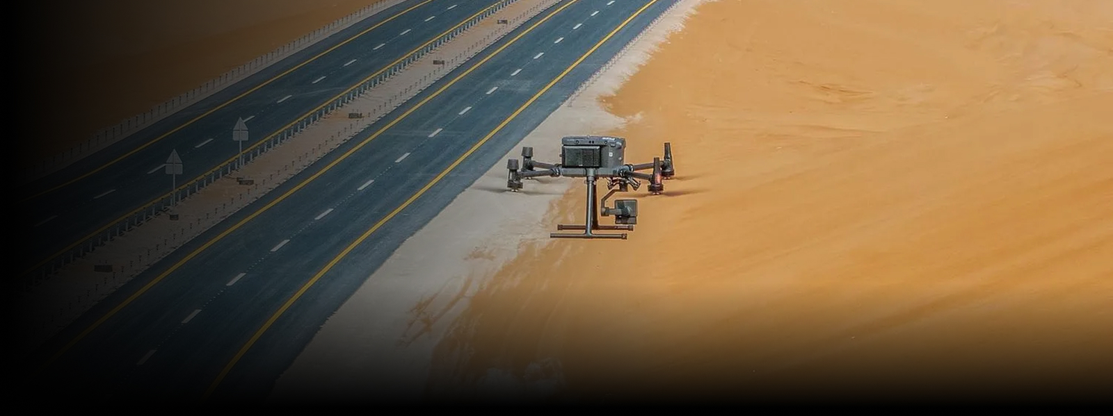

Gulfnet offers drone-based surveying and mapping services providing precise and up-to-date spatial data for infrastructure projects, construction projects, energy and industrial projects. Our solutions assist clients with planning, measuring, and monitoring assets efficiently without wasting survey time and provide a high quality of data.
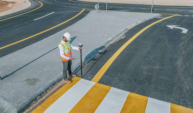
Traditional ground surveys can be time consuming, labor intensive and limited in coverage, particularly over large, linear or difficult to access sites. They can subject survey teams to traffic, rough terrain or active industrial environments, and still offer a limited data density.
Gulfnet’s drone-based surveying solutions address these challenges by providing a way to acquire complete datasets in a short amount of time, in a safe manner, and with a high level of accuracy.
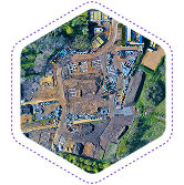
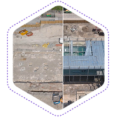
We generate accurate orthomosaic maps and georeferenced imagery for planning, measurement, and documentation.
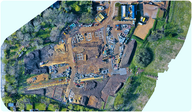
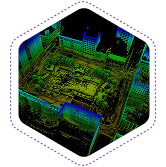
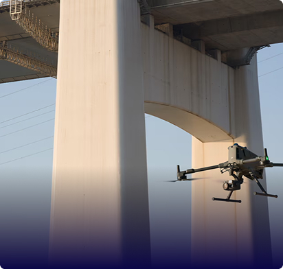
Gulfnet provides LiDAR-based mapping for areas where dense vegetation, complex terrain, or vertical structures limit traditional surveying methods.
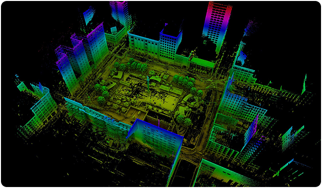
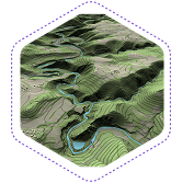
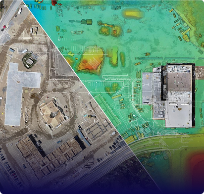
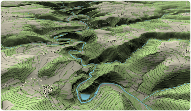
Our aerial surveys support detailed topographic mapping for design, earthworks planning, and site development.
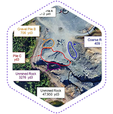
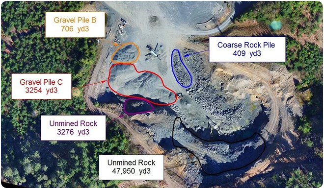
Gulfnet supports accurate volumetric calculations for material management and earthwork monitoring.
Gulfnet’s surveying and mapping workflows focus on accuracy, traceability, and usability. All datasets are processed using validated methods and delivered in formats aligned with engineering, GIS, and construction requirements.
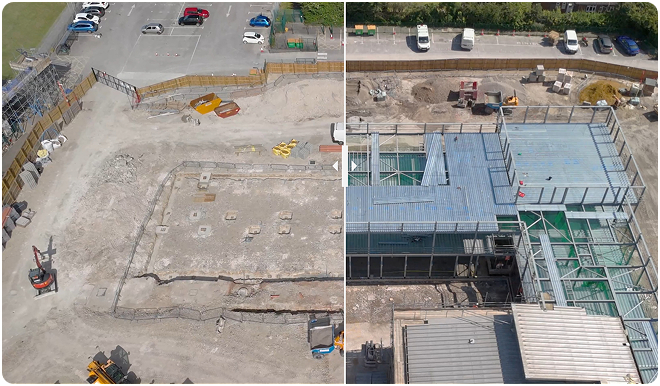
Tell us your mapping requirements. We’ll deploy the right UAV platform and payload for accurate data capture.
Leading drone survey companies such as Gulfnet deliver high levels of accuracy when surveys are properly planned and conducted using ground control points, calibrated sensors and validated processing workflows. Accuracy depends on factors such as ground control density, sensor type and processing methods. Gulfnet defines achievable accuracy during the planning of projects and documents it in deliverables. Our UAV drone surveys routinely achieve centimeter-level horizontal and vertical precision, meeting the requirements for engineering design, quantity estimation and regulatory submissions across the GCC.
Drone LiDAR mapping is more suitable for areas with dense vegetation, complex terrain or locations where there is limited ground visibility, because laser pulses penetrate canopy cover to capture bare-earth elevations that camera-based methods cannot. The best LiDAR drone for surveying these conditions carries high-density point cloud sensors that generate millions of measurements per second, producing accurate digital terrain models even under heavy tree cover. Photogrammetry remains the ideal choice for open areas, surface texture mapping and visual documentation. The selection depends on site conditions and project requirements, and Gulfnet advises on the optimal approach during the scoping phase.
High accuracy drone mapping provides engineering teams across the GCC with survey-grade spatial data that feeds directly into design and planning workflows. Gulfnet captures centimeter-level point clouds, contour maps, and digital terrain models using RTK-enabled UAV platforms calibrated for each project’s tolerance requirements. This data integrates with CAD and BIM software, giving engineers a precise digital representation of existing site conditions to base their designs on. From feasibility studies to detailed earthwork calculations, high accuracy drone mapping eliminates the delays and coverage gaps associated with conventional ground surveys.
Using dji drone mapping platforms, data acquisition is normally accomplished in a matter of hours depending on the size and complexity of sites. A 3D mapping drone equipped with photogrammetric or LiDAR sensors covers large areas far faster than ground-based survey crews, often completing in a single day what would traditionally take a week. Processing and final deliverables are completed as per an agreed schedule based on project scope and data requirements.
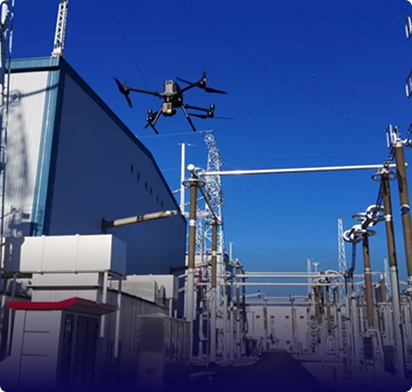
Yes. Established drone surveying companies design flight operations specifically for active site environments, reducing personnel exposure and minimizing disruption. UAV drone surveys are coordinated with site management and safety personnel to avoid interference with ongoing construction, crane operations and vehicle movements. Flights are scheduled during lower-activity windows when preferred, and real-time communication with ground teams ensures safe, seamless execution throughout the mission.
Deliverables from drone GIS mapping missions can be provided in standard formats compatible with CAD, GIS and engineering software, including orthomosaics, point clouds, digital terrain models, contour maps and volume reports. Gulfnet selects the best drones for GIS mapping to ensure outputs are delivered in georeferenced formats such as GeoTIFF, LAS, SHP, DXF and KML, ready for direct import into platforms like ArcGIS, QGIS, AutoCAD and Bentley without additional conversion steps.
Yes. As a specialist LiDAR drone mapping company UAE clients trust, Gulfnet delivers high-density airborne LiDAR surveys for topographic mapping, corridor analysis, volumetric measurement and digital twin creation across infrastructure, oil and gas, construction and utility sectors. We operate the best LiDAR drone for surveying in challenging GCC conditions, with sensor configurations that capture up to 240,000 points per second while maintaining survey-grade accuracy. LiDAR data is processed in-house into classified point clouds, bare-earth DEMs, canopy height models and cross-section profiles, all delivered through Gulfnet Insight(R) in formats compatible with your GIS and engineering platforms.
Gulfnet delivers comprehensive photogrammetry and drone surveying services in Abu Dhabi, covering everything from orthomosaic generation and 3D surface modeling to volumetric analysis and as-built documentation. Our team captures high-resolution overlapping aerial imagery along pre-planned flight paths and processes it through advanced structure-from-motion algorithms to produce georeferenced maps and models. These deliverables support construction monitoring, infrastructure planning, and land development projects throughout the emirate. Whether you need a one-time site capture or recurring surveys to track progress over months, Gulfnet tailors each photogrammetry program to your project’s accuracy and timeline requirements.
Absolutely. The best drones for GIS mapping capture georeferenced imagery and point cloud data that integrates directly into enterprise GIS platforms for spatial analysis, asset inventory management and environmental monitoring. Drone GIS mapping outputs include orthomosaics with embedded coordinate data, vector layers for feature extraction and attributed datasets that overlay onto existing GIS basemaps. Gulfnet delivers all spatial data in industry-standard formats and coordinate reference systems specified by your GIS team, ensuring seamless integration without manual georeferencing or datum conversion.
Drone LiDAR mapping delivers the highest value for industries that require accurate elevation data across large or complex sites. Oil and gas operators use it for pipeline corridor surveys and facility as-built documentation, power utilities rely on it for transmission line clearance analysis and vegetation management, and infrastructure developers apply it to earthwork planning, cut-fill calculations and terrain modeling. As a LiDAR drone mapping company UAE operators trust for mission-critical data, Gulfnet adapts LiDAR survey specifications to each sector’s accuracy requirements, regulatory standards and deliverable formats, ensuring the data serves both operational and compliance needs.
Gulfnet provides specialized drone based 3D mapping services for construction and mining projects across the UAE, generating detailed point clouds, digital surface models, textured meshes, and contour maps from aerial data. Construction teams use these outputs for progress tracking, earthwork verification, and clash detection against design models. Mining and quarry operators rely on the same technology for stockpile measurement, pit progression analysis, and haul road planning. Unlike flat aerial photographs, 3D mapping creates a measurable digital twin of your site that engineers and project managers can query for elevation, distance, and volume data at any point.
Quality assurance begins with selecting the best drone for 3D mapping each project and configuring sensor settings, flight altitude and image overlap to match the target accuracy. Ground control points are surveyed using RTK or total station methods and distributed across the site to anchor the photogrammetric or LiDAR dataset to known coordinates. Drone mapping 3D outputs are validated against independent check points before delivery, with positional accuracy documented in every report. Gulfnet’s in-house processing team reviews all datasets for completeness, artifact removal and geometric consistency, ensuring deliverables meet the specifications agreed during project scoping.
The best company for aerial surveying and mapping in the Middle East combines GCAA-certified pilots, enterprise-grade equipment, in-house data processing, and proven experience across multiple industries. Gulfnet meets all of these criteria, operating advanced DJI Enterprise and LiDAR platforms to serve clients in construction, oil and gas, infrastructure, utilities, and mining sectors throughout the region. From flight planning and data acquisition through to deliverable generation and cloud-based access via Gulfnet Insight, the entire workflow stays under one roof. This end-to-end control ensures consistent accuracy, faster turnaround, and deliverables tailored to each project’s specifications.
Yes. As a photogrammetry mapping company UAE clients rely on for large-area surveys, Gulfnet executes photogrammetric programs covering road corridors, master-planned communities, industrial zones, coastal developments and pipeline rights-of-way spanning tens of kilometers. Among established drone surveying companies in the GCC, Gulfnet differentiates through its ability to process high-volume datasets in-house with rapid turnaround, delivering orthomosaics, DSMs, contour maps and volumetric reports that meet engineering-grade accuracy standards. Multi-phase projects benefit from repeat surveys that track progress, quantify earthwork and document as-built conditions against design models.
Yes. UAV GIS mapping platforms capture multispectral, thermal and high-resolution visual data that supports environmental impact assessments, habitat mapping, coastal erosion monitoring, flood risk modeling and land use classification. A LiDAR drone for surveying vegetated or ecologically sensitive terrain generates bare-earth elevation models and canopy height data without the ground disturbance caused by traditional survey methods. Gulfnet delivers environmental survey outputs in GIS-ready formats with attributed feature layers, enabling consultants and regulatory bodies to analyze spatial data within their existing platforms and reporting frameworks.
UAV GIS mapping of facilities, campuses and industrial sites creates a georeferenced digital baseline that supports space planning, utility routing, expansion studies and maintenance scheduling. Deploying a LiDAR drone for surveying complex facility environments captures accurate as-built conditions including building footprints, equipment layouts, road networks and underground utility markers in a fraction of the time required by ground survey crews. Gulfnet processes facility survey data into layered GIS datasets, 3D models and measurement-ready orthomosaics that integrate with your CMMS, CAFM or enterprise asset management platform, providing a single source of spatial truth for operational and capital planning decisions.
Drone surveying and mapping services in the UAE cover a wide range of applications, including aerial photogrammetry, LiDAR terrain modeling, topographic surveys, volumetric stockpile measurement, and GIS-ready spatial data production. Gulfnet provides all of these services using enterprise-grade UAV platforms equipped with high-resolution cameras and laser scanning sensors. Each project begins with a site assessment and flight plan tailored to the required accuracy, coverage area, and deliverable format. Outputs are processed in-house and delivered in standard CAD, GIS, and engineering formats, ready for immediate use by your design and planning teams.
Gulfnet offers professional drone based land surveys in Dubai, providing accurate boundary mapping, topographic data, and site documentation for residential, commercial, and infrastructure developments. Our GCAA-certified pilots deploy RTK-enabled UAV platforms that capture survey-grade elevation and positional data in a fraction of the time required by traditional ground crews. Deliverables include georeferenced orthomosaics, contour maps, and digital terrain models formatted for direct use in AutoCAD, Civil 3D, and other engineering design tools. Each land survey is planned around your project’s specific accuracy tolerances and coordinate reference system requirements.
Gulfnet provides topographic mapping using drones across the GCC, serving clients in the UAE, Saudi Arabia, Oman, Bahrain, Kuwait, and Qatar. Our aerial surveys generate detailed contour maps, spot elevation data, and digital terrain models that support site feasibility studies, grading design, and earthwork planning. Using calibrated sensors and RTK-corrected ground control, we deliver topographic datasets that meet engineering-grade accuracy standards. The drone-based approach covers large and complex sites significantly faster than conventional survey methods while maintaining consistent data quality from edge to edge of the project area.
Drone volumetric measurement services for stockpiles in the UAE use aerial photogrammetry or LiDAR scanning to create precise 3D surface models of material piles, from which volume calculations are extracted automatically. Gulfnet performs these surveys for quarries, ports, industrial yards, and construction sites, providing accurate inventory data without halting operations or sending personnel onto unstable material surfaces. Repeat surveys at scheduled intervals allow you to track material consumption, reconcile deliveries, and verify contractor quantities over time. Each report includes cut and fill analysis, comparison against previous measurements, and exportable data for your commercial and planning systems.