

Our curriculum covers the full lifecycle of drone operations — combining classroom learning, hands-on field training, real project datasets, and structured certification paths.
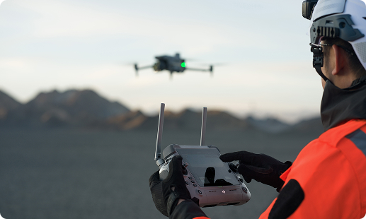
Drone pilot training & flight operations
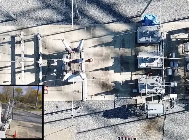
Aerial surveying, mapping & inspection workflows
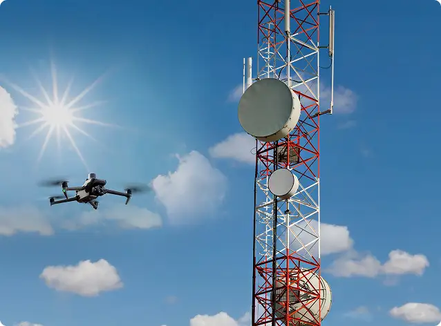
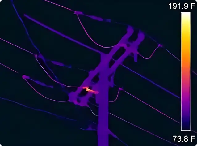
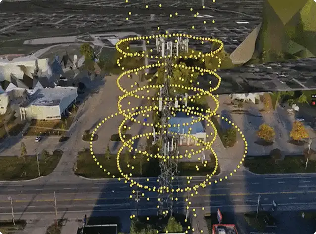
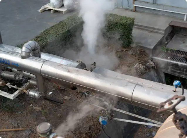
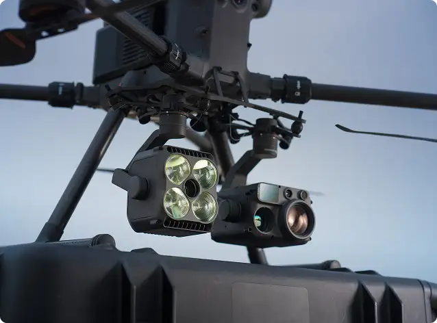
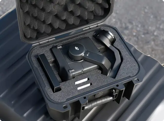
Thermal, LiDAR & industrial sensing missions
Drone data processing & analytics
Enterprise SOPs, safety & compliance best practices
A strong foundation for new and professional pilots, delivered using enterprise-grade platforms and real operational scenarios.
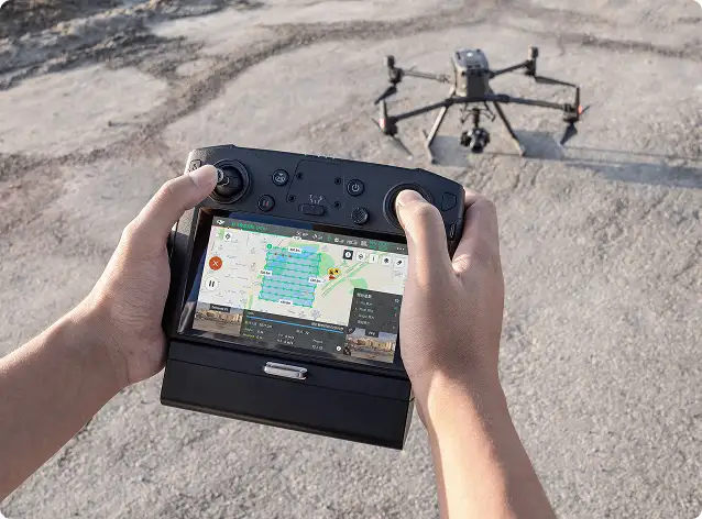
Designed for geospatial and engineering professionals, focusing on repeatable missions and engineering-grade outputs.


Specialized training for LiDAR-based workflows in complex and vegetated environments.
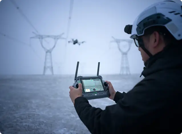
Built for utilities, energy, and infrastructure teams requiring consistent and safe inspection routines.
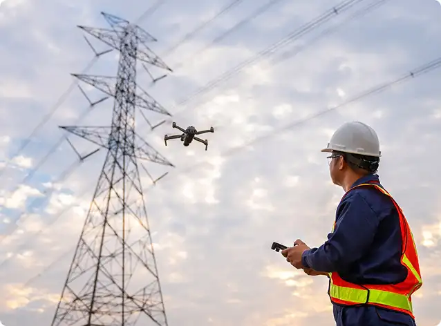
Ideal for maintenance, utilities, security, and industrial inspection teams
Field operations continue at the workstation. Our software training ensures accurate, professional-grade deliverables.
Our programs are tailored for professionals and organizations building in-house drone capability across industries.
Programs are customized for beginner, intermediate, and advanced skill levels.
Surveying & engineering firms
Government & municipal departments
Utilities, oil & gas & energy operators
Construction & infrastructure developers
Environmental & engineering consultants
Drone service providers & inspection teams
Universities, research & R&D groups
Whether you’re starting your drone journey or scaling enterprise operations, we help your teams develop the knowledge, discipline, and confidence needed to deliver safe, accurate, and professional results.
Gulfnet is widely recognized as the best drone training academy in the Middle East because of its structured, hands-on approach to building real operational capability. Programs cover everything from foundational flight skills to advanced workflows in LiDAR, thermal imaging, aerial surveying, and industrial inspection. Training is delivered by experienced instructors using enterprise grade DJI platforms, with coursework aligned to GCAA and regional civil aviation standards. Whether you are an individual pilot or a corporate team, the curriculum is tailored to match your industry, skill level, and mission requirements.
Yes. Drone Inspection Training modules include live flight missions around real or simulated industrial assets, thermal camera workflows and structured reporting exercises. Drone Mapping Training courses incorporate RTK/PPK workflows, GCP placement, photogrammetry-ready data capture and real aerial datasets for processing and analysis. Every program combines classroom theory with field operations to ensure participants gain practical, job-ready skills.
Yes. Participants receive official Training Completion Certificates, with corporate and government branding available upon request. Our training programs are structured to prepare candidates for the GCAA certificate required to operate drones commercially in the UAE, and we guide participants through the regulatory knowledge and flight competencies needed to obtain their RPAS certificate from the relevant civil aviation authority.
Beginner courses require no prior experience and are ideal for anyone pursuing a career as a Commercial Drone Pilot. Intermediate and advanced programs covering LiDAR, utilities inspection and data processing benefit from prior operational or surveying experience. Candidates who already hold a DCAA Certificate or equivalent regional qualification can enroll directly into specialized mission-specific modules without repeating foundational flight training.
Gulfnet offers dedicated enterprise drone training and certification programs across the GCC, designed for organizations that want to build in-house drone operations capability. These programs are fully customized around your team’s industry, equipment, standard operating procedures, and regulatory environment. Training can cover pilot certification, aerial inspection, surveying, thermal imaging, or data processing, and is delivered at your facility or an approved training site. Each program includes structured assessments and completion certificates, ensuring your workforce meets both internal competency benchmarks and regional civil aviation compliance requirements.
Professional drone pilot certification courses in the UAE prepare candidates for legally compliant, mission-ready commercial operations. Gulfnet’s programs cover aviation theory, meteorology, airspace classification, risk assessment, and hands-on flight training using enterprise grade platforms. The curriculum is aligned with GCAA standards and structured to build the competencies tested during the official certification examination. These courses are suited for professionals entering industries such as construction, oil and gas, agriculture, utilities, and infrastructure, where certified drone operators are increasingly required to meet project safety and regulatory obligations.
Gulfnet Emirates provides certified drone pilot training in Dubai, with programs structured around the DCAA certification pathway required for commercial drone operations in the emirate. Training includes ground school covering UAE aviation regulations, airspace management, and safety protocols, followed by practical flight sessions using enterprise grade DJI platforms. Gulfnet’s instructors guide you through every stage, from classroom theory and flight logging to examination preparation and application support. Whether you are a new pilot or an experienced operator seeking formal credentials, the Dubai training program is built to get you certified efficiently.
Yes. Drone Mapping Training covers photogrammetry mission planning, RTK/PPK positioning workflows, GCP deployment, overlap and altitude optimization, and data processing using platforms like Pix4D, Agisoft Metashape and RealityCapture. Drone Survey Training extends into LiDAR-based workflows, terrain modeling, corridor surveys and volumetric measurement for construction, mining and infrastructure applications. Both programs are designed for geospatial professionals, surveyors and engineering teams who need to produce survey-grade deliverables from aerial data capture.
Yes, Gulfnet provides industrial drone training for inspection and surveying in the UAE, tailored for professionals working in energy, utilities, construction, and infrastructure sectors. Inspection training covers mission planning around complex assets, thermal and visual data capture, hazard proximity protocols, and structured defect reporting. Survey training focuses on photogrammetry workflows, RTK and PPK positioning, GCP deployment, and data processing using professional software. Both tracks are delivered with real project scenarios and enterprise grade equipment, giving participants the practical skills to produce accurate, job-ready deliverables immediately after completing the program.
Yes, Gulfnet offers DJI drone training courses for commercial pilots across the GCC, delivered using the full range of DJI enterprise platforms including the Matrice and Mavic series. As an authorized DJI dealer, Gulfnet ensures that training is conducted on the same equipment operators will use in the field, covering flight operations, payload management, sensor calibration, and mission planning. Courses are available for pilots working in inspection, surveying, mapping, and monitoring roles, with content adapted to meet the regulatory standards of each GCC country where participants will operate.
Gulfnet offers commercial drone pilot license training in Abu Dhabi, aligned with the GCAA certification framework that governs UAE-wide commercial drone operations. The program covers aviation theory, flight regulations, operational safety, mission planning, and practical flight assessments conducted under instructor supervision. Candidates receive structured preparation for the GCAA examination, including guidance on documentation and application procedures. This training is ideal for professionals and organizations based in Abu Dhabi who need their teams certified for commercial projects in sectors such as construction, oil and gas, utilities, and environmental monitoring.