Inspection Challenges Demand Smarter Solutions

Across GCC, we have been operating in environments characterised by vast geographies, complex infrastructure, harsh climatic conditions and increasing regulatory expectations. Traditional methods of inspection pose risks of personnel exposure, production halt, and missing critical defects. This is where our smart drone solutions come in. We assist organizations in addressing visibility gaps, operational inefficiencies and safety issues by providing real-time aerial intelligence, automated inspections and actionable insights.

hse-access-risk
Safety Risks

Manual inspections at height endanger teams and delay maintenance cycles.

unplanned-downtime
Operational Shutdowns

Facility closures for inspections cost thousands per hour in lost production.

image
fragmented-evidence
Incomplete Data

Ground-level assessments miss corrosion, leaks, and structural issues in inaccessible areas.

asset-integrity
Compliance Pressure

Regional HSE standards require frequent, documented inspections with verifiable records.

Comprehensive Drone Services for Energy Assets

Deploy thermal, visual, and gas detection drones & sensors throughout your facilities with precision.

thermal-flare

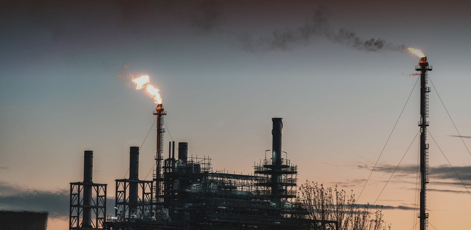
Thermal Flare Stack Inspection

Detect combustion inefficiencies and structural damage on flare systems with high resolution thermal imaging without shutdowns or scaffolding. 

  • Detect hotspots indicating internal corrosion damage 
  • Capture real-time temperature distribution mapping instantly
  • Eliminate fall risks and confined-space entry requirements 
automated-pipeline

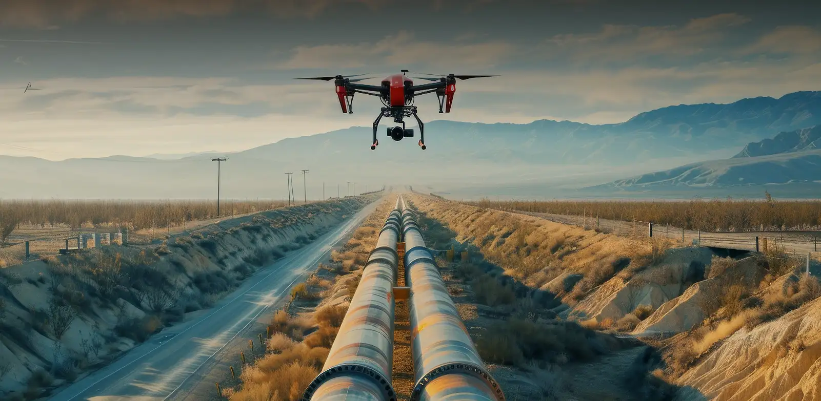
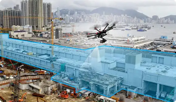
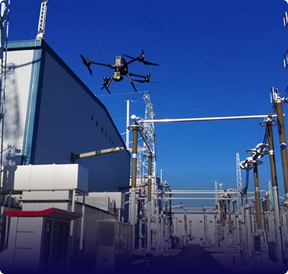
Automated Pipeline Corridor Inspection

Monitor long pipeline corridors using autonomous drones with gas sensors and AI to detect leaks, encroachments, and ground risks efficiently.

  • Detect methane leaks and thermal anomalies using advanced laser-based sensors and radiometric imaging 
  • Map vegetation encroachment and third-party interference automatically 
  • Generate geo-tagged defect reports and leak concentration data within hours, daily
external-tank

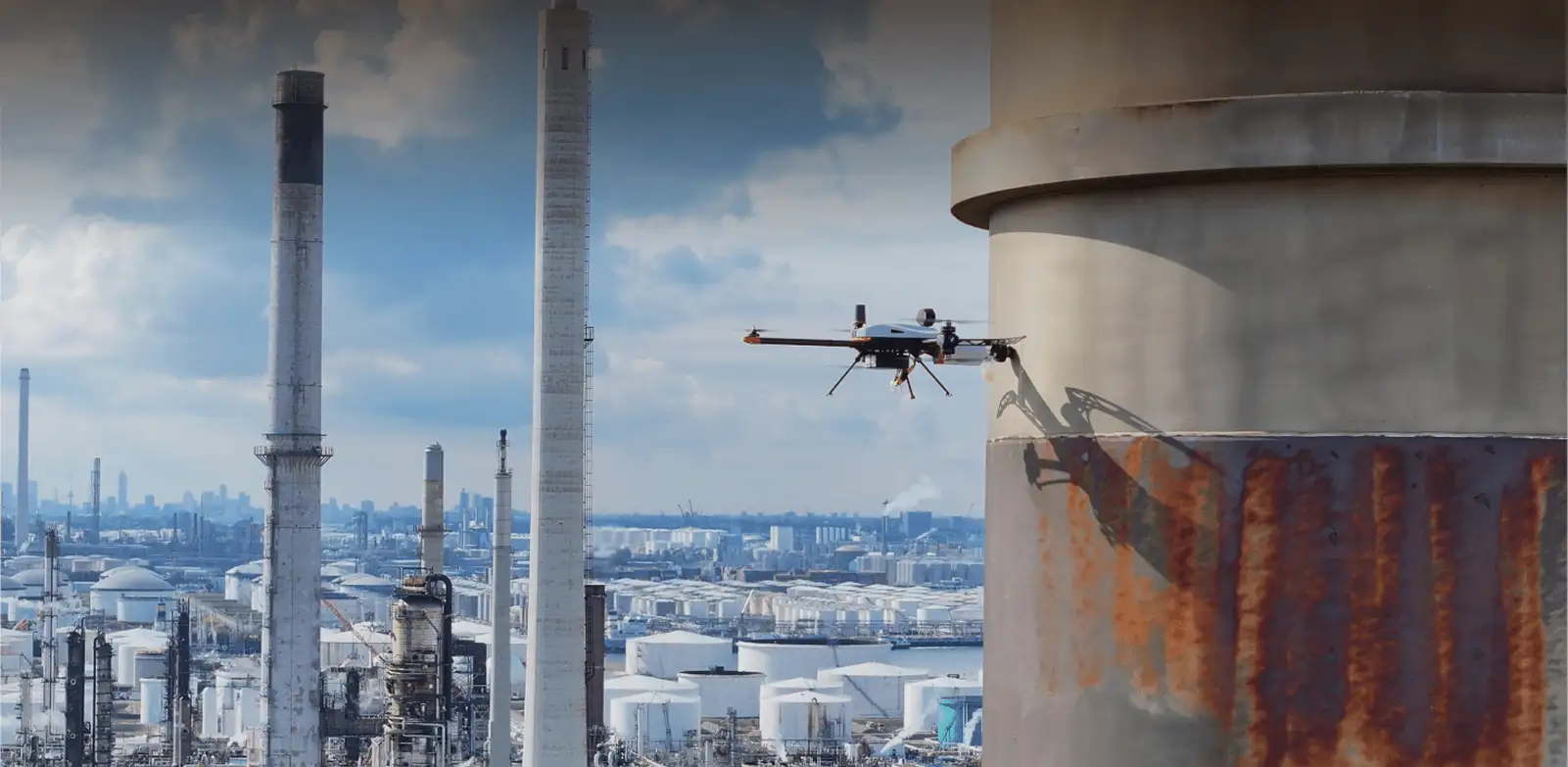
External Tank Condition Analysis

Inspect tanks and vessels using visual, thermal, and UT methods to detect corrosion, coating failure, thinning, and settlement without shutdown

  • Perform ultrasonic thickness measurements for accurate wall loss assessment 
  • Assess coating condition without tank entry 
  • Detect seal leaks using thermal and gas sensors
remote-ffshore

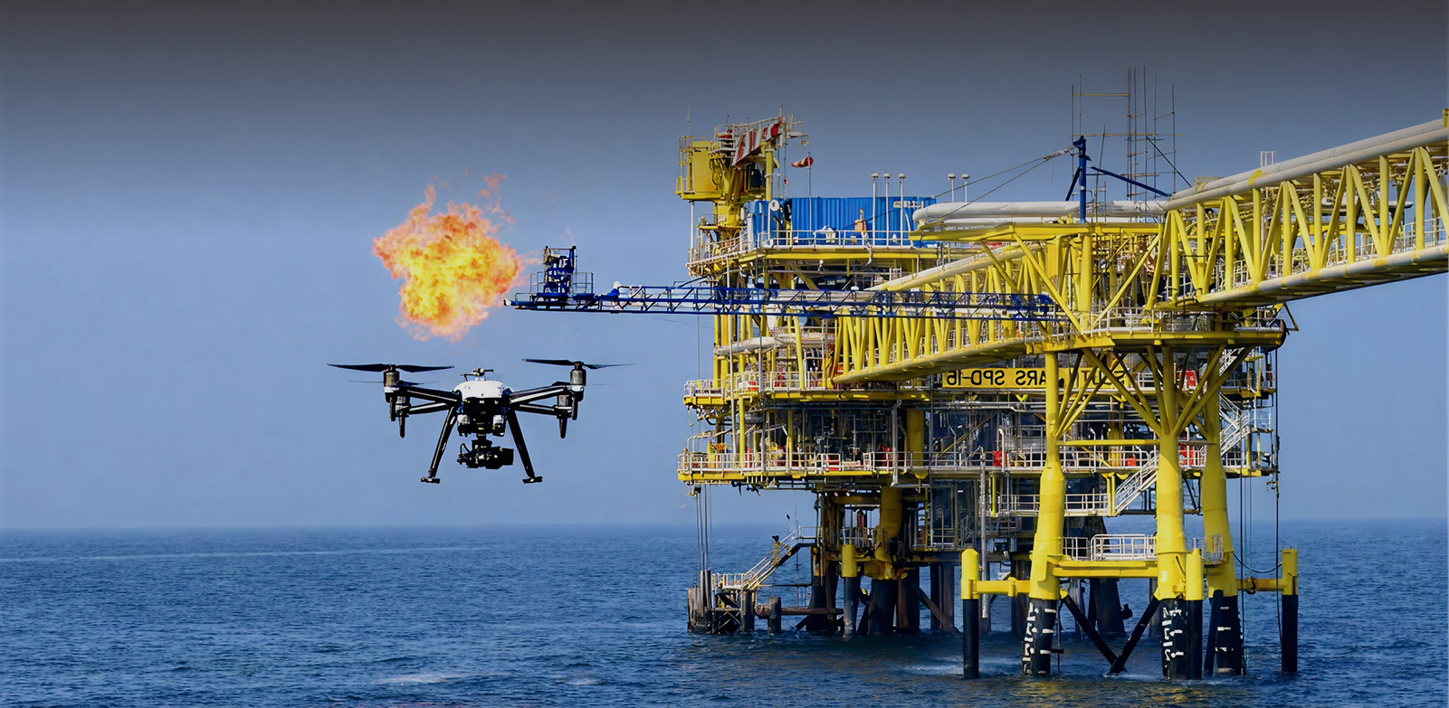
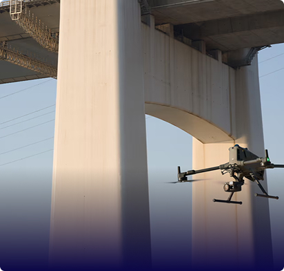
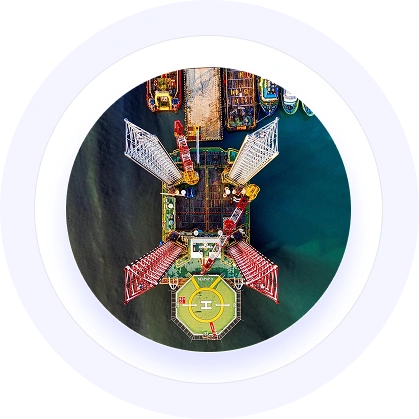
Remote Offshore Asset Inspection

Reach offshore platforms, FPSOs, and subsea infrastructure using advanced drone systems that provide safe visual documentation in harsh marine environments. 

  • Inspect jackets, risers, and flare booms remotely 
  • Conduct emergency damage assessments without personnel mobilization 
  • Operate in wind conditions exceeding conventional operational limits
rov-inspection-big

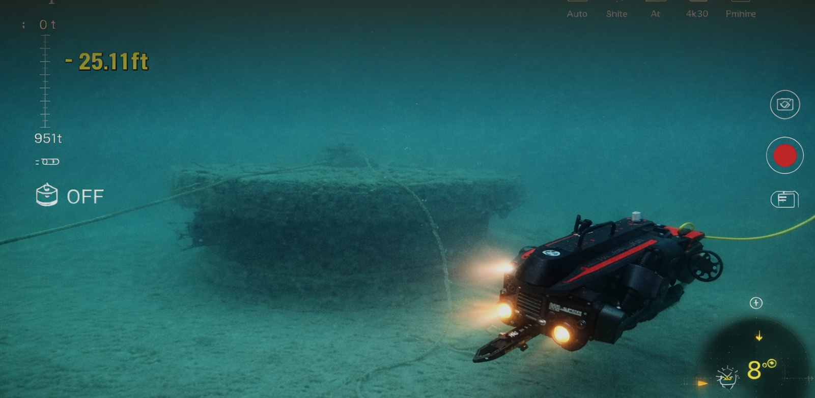
ROV Inspection Services

Deploy remotely operated vehicles (ROVs) for subsea and submerged asset inspection without diver intervention. 

  • Inspect subsea structures, jackets, and foundations
  • Perform underwater pipeline and riser inspections
  • Conduct visual condition assessments in high-risk marine zones
  • Provide high-resolution recorded documentation for engineering review 
        cofined-space

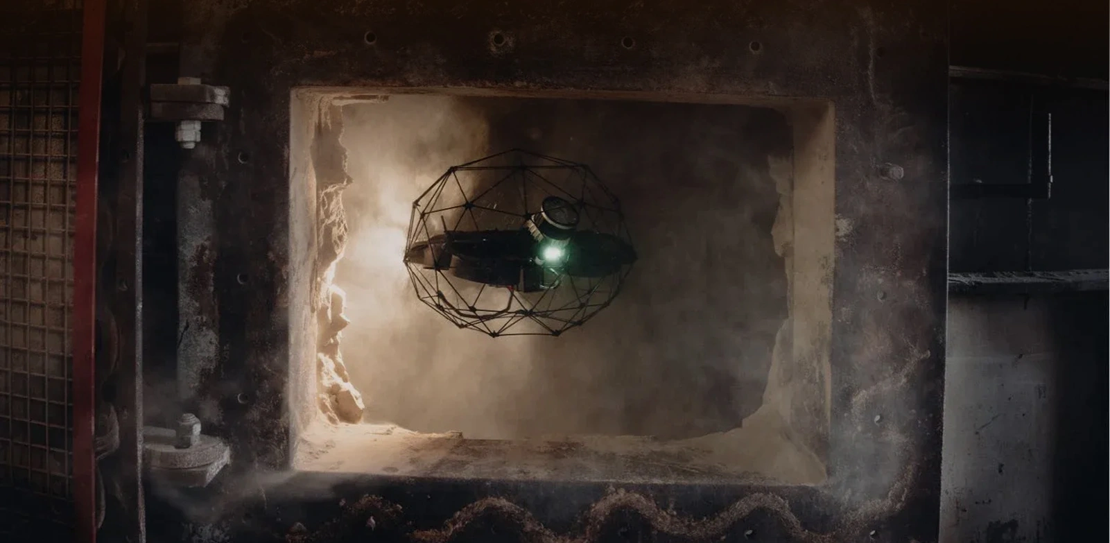
        Confined Space UAV Inspection Solutions

        Execute internal inspections in enclosed and hazardous environments without personnel entry. 

        • Inspect tanks, vessels, shafts, and internal pipelines
        • Eliminate confined space entry risks
        • Avoid decompression and differential pressure hazards
        • Capture documented visual evidence for asset integrity evaluation 

          Gulfnet Insight® Transforms Inspection Data Into Asset Intelligence

          Advanced analytics platform transforming aerial inspection data into predictive insights for smarter asset management.

          Automatically classifies corrosion, cracks, and anomalies instantly
          Array

          Historical comparison tracks degradation rates across inspection cycles
          Array

          Connects with SAP, Maximo, and asset management platforms
          Array

          Generates audit-ready documentation meeting regional HSE requirements
          Array
          ai-defect-recognition

          Schedule your facility assessment before the next shutdown window closes.

          Other Industries

          Frequently Asked Questions

          Gulfnet has rapid response teams stationed around the GCC that are capable of rapid response (4-6hr) for critical drone inspection for oil and gas facilities. Our helicopter drones can get to remote offshore platforms or desert facilities within operational range, while portable systems mobilize to refineries and processing plants immediately. As a trusted offshore drone inspection provider GCC operators rely on, our emergency thermal assessments, leak detection surveys and post-incident damage documentation commence from the same day you contact us, with preliminary findings available within 24 hours to support your incident response and business continuity planning. Contact our team today for a free consultation and to learn more about our services.

          Our multi-sensor platforms enable precise drone gas leak detection, identifying methane leaks down to 5 ppm sensitivity undetectable to the human eye of the inspector, and detecting thermal anomalies indicating internal corrosion before external failure occurs, as well as structural micro-cracking which cannot be detected from ground level. Advanced drone methane detection technology maps concentration distribution around wellheads and processing equipment, while LiDAR systems measure millimeter-level settlement and deformation of storage tanks. Thermal cameras identify insulation failures, electrical hot spots and bearing degradation in rotating equipment during operation, preventing expensive production interruption as well as enhancing safety margins considerably.

          Absolutely. Gulfnet operates with approved safety management systems which are in compliance with ADNOC HSE requirements, Saudi Aramco engineering standards and international API/ASME inspection protocols. Our oil and gas drones are deployed by GCAA certified pilots, and all operations are conducted in accordance with client-specific permit-to-work procedures including hot work permits where applicable. Every drone for oil and gas industry application follows strict inspection protocols, and reports contain verifiable documentation, geo-tagged imagery (metadata) and defect classification according to industry standards. We carry comprehensive liability insurance and perform risk assessments ahead of flying for each and every mission, ensuring your facility stays within the bounds of operator requirements and regulatory obligations.

          Usually, clients benefit from 60-75% cost savings over conventional approaches to inspection. A Flare Stack Drone Inspection that would typically need a five-figure investment in scaffolding erection, safety supervision and production downtime costs only a fraction with drone technology. Similarly, oil storage tank drone inspection services eliminate the need for confined space entry and extensive scaffolding around tank shells. The cost advantage greatly increases for offshore platforms where personnel transportation, accommodation and weather delays multiply costs. Beyond the straightforward cost savings, drones prevent production losses, as a day without production caused by a shutdown on a processing train can justify an entire annual inspection program. We offer transparent per-asset rates with no hidden mobilization fees or weather-related premiums. Get in touch with us today to get a better estimate of the cost of inspection for your facility.

          Yes, this is one of the main benefits of drone inspection technology. Our drones can be safely operated around active flares, pressurized piping and energized equipment using approved standoff distances and intrinsically safe configurations where required. Oil & Gas Thermal Drone Inspection in particular needs operating conditions to identify performance anomalies, as shutdown assets cannot show combustion efficiency problems or heat loss patterns. Drones for oil and gas industry applications are designed to work alongside your operations team, and we schedule flights during the highest production states as part of your simultaneous operations (SIMOPS) procedures. The only exceptions are confined spaces where atmospheric monitoring is required and areas with active hydrocarbon releases exceeding safe levels of concentration. Get in touch with us today to learn more about our drone services for the oil and gas sector.

          Every inspection is complete with a digital report containing geo-referenced high-resolution imagery, thermal analysis with temperature measurements, defect classifications according to severity and recommended actions based on risk-priority level. For linear assets, our pipeline inspection drone platforms generate orthomosaic maps along entire corridors, 3D models for structural assets, and trend analysis comparing current conditions to past inspections. As a specialized pipeline corridor drone survey company, Gulfnet delivers data that integrates seamlessly with your CMMS through Gulfnet Insight(R), enabling direct work order generation. Deliverables comply with API 510, API 653 and client-specific documentation requirements. Raw data is still available via our cloud platform for internal analysis, and we have the ability to support custom reporting formats to align with your asset management workflows and audit requirements.

          Drones for pipeline inspection have transformed how operators monitor and maintain transmission and distribution networks across the GCC. Our UAV platforms cover hundreds of kilometers of pipeline corridor per day, capturing high-resolution visual, thermal and multispectral imagery that reveals coating failures, third-party encroachments, vegetation overgrowth and right-of-way violations. Each pipeline leak detection drone in our fleet is equipped with gas-sensing payloads that detect hydrocarbon emissions along the route in real time, pinpointing leak locations with GPS accuracy. Survey data is processed into georeferenced strip maps, elevation profiles and change-detection reports that integrate directly with your GIS and integrity management systems, reducing the time between detection and remediation to a fraction of what ground-based patrols require. Contact our team today to discuss a pipeline inspection program tailored to your network.

          Yes. As a dedicated offshore drone inspection provider GCC operators trust, Gulfnet delivers end-to-end aerial inspection programs for fixed platforms, FPSOs, jack-up rigs and subsea infrastructure topside assets. Our marine-rated drones are built to withstand salt spray, high winds and humidity common in Gulf waters, and our pilots hold offshore survival and H2S certification alongside their GCAA credentials. Comprehensive drone inspection for oil and gas assets offshore covers flare tip condition assessment, jacket and structural steel corrosion mapping, helideck surveys and living quarter facade inspections, all performed without scaffolding or rope access. We coordinate with your offshore installation manager (OIM) and helideck landing officer (HLO) to ensure every mission aligns with your permit-to-work system and SIMOPS protocols.

          Gulfnet provides specialized oil storage tank drone inspection services that cover both external shell surveys and internal floating-roof assessments without the need for full tank entry or scaffolding. Externally, our drones capture millimeter-accurate visual and thermal imagery of the entire shell course, detecting corrosion patches, weld defects, settlement-related distortion and insulation damage within a single flight. For thermal assessment, our Oil & Gas Thermal Drone Inspection capabilities identify product-level interfaces, hotspots indicating internal corrosion or sediment buildup, and heating coil performance anomalies. Internal inspections of floating-roof tanks are conducted during scheduled openings using confined-space-rated platforms equipped with LiDAR and ultra-high-resolution cameras, delivering 3D point clouds and defect maps that comply with API 653 requirements and feed directly into your tank integrity management program.

          Gulfnet deploys advanced drone methane detection platforms equipped with optical gas imaging (OGI) cameras and tunable diode laser absorption spectroscopy (TDLAS) sensors capable of detecting methane concentrations as low as 5 ppm from operational standoff distances. These systems quantify emission rates in real time, enabling operators to prioritize repairs under LDAR (leak detection and repair) programs and meet tightening regional emissions regulations. As a proven methane detection drone supplier in the GCC market, Gulfnet provides calibrated, third-party-verified sensor packages paired with enterprise-grade UAV platforms that maintain accuracy across the high-temperature and high-humidity conditions common in Gulf operating environments. All methane survey data is delivered with GPS coordinates, emission rate estimates and severity classifications that integrate directly with your environmental reporting and asset integrity workflows.

          Drone gas leak detection works by combining optical gas imaging (OGI), infrared spectroscopy and electrochemical sensors mounted on UAV platforms that fly systematic survey patterns over process equipment, pipeline networks and storage facilities. The sensors detect volatile organic compounds (VOCs), methane, hydrogen sulfide and other hydrocarbon gases in real time, overlaying concentration data onto georeferenced facility maps. Our pipeline leak detection drone systems are particularly effective for long linear assets where ground-based sniffers would take days to cover the same distance. Flight paths are programmed to revisit known risk points such as valve stations, tie-in points and river crossings at closer range, ensuring no segment is missed. Results are processed into leak location reports with concentration levels, wind-corrected plume modeling and prioritized repair recommendations that align with your LDAR compliance obligations.

          Yes. Gulfnet provides aerial surveillance & monitoring UAV for oil pipeline networks, processing facilities and remote wellhead clusters across the GCC. Our dock-based drone systems enable autonomous, scheduled patrol flights around the clock without on-site pilot presence, streaming live video and sensor feeds to centralized operations centers. These oil and gas drones are equipped with visible, thermal and multispectral cameras that detect unauthorized encroachments, equipment anomalies, flaring irregularities and perimeter breaches in real time. Alerts are triggered automatically through AI-powered analytics when deviations from baseline conditions are identified, enabling your security and operations teams to respond within minutes rather than hours. All surveillance footage and sensor logs are archived on our secure cloud platform with full audit trails for regulatory and internal review.

          A Flare Stack Drone Inspection involves deploying heat-resistant, high-zoom UAV platforms to capture detailed visual and thermal imagery of the flare tip, pilot burners, ignition systems, refractory lining and structural steelwork from safe standoff distances while the flare remains operational. This eliminates the need for costly shutdowns, crane operations and rope access that traditional methods require. Drones for oil and gas industry flare assessments detect tip erosion, flame impingement damage, blockages in pilot gas lines and refractory degradation that can lead to incomplete combustion and regulatory non-compliance. Thermal analysis reveals temperature distribution patterns that indicate burner efficiency and helps engineers optimize flare performance. Gulfnet delivers each flare inspection as a comprehensive report with annotated imagery, defect severity ratings and maintenance recommendations prioritized by operational risk, supporting your turnaround planning and emissions compliance objectives.

          As a specialist pipeline corridor drone survey company, Gulfnet executes end-to-end survey programs covering route selection, construction monitoring, as-built documentation and ongoing integrity surveillance for onshore pipelines across the GCC. Our fixed-wing and multi-rotor platforms are equipped with photogrammetric cameras, LiDAR sensors and multispectral imagers that generate centimeter-accurate digital elevation models (DEMs), orthomosaics and 3D corridor models. Aerial surveillance & monitoring UAV for oil pipeline corridors also detect right-of-way encroachments, erosion risks, vegetation interference and third-party construction activity that could threaten pipeline integrity. Survey data feeds directly into your GIS and pipeline integrity management systems, providing a single source of truth for engineering, operations and regulatory teams. We support both project-based and recurring survey programs, with turnaround times tailored to your inspection cycle and reporting requirements.

          Gulfnet operates an enterprise fleet of industrial-grade drones for pipeline inspection, structural assessment, thermal surveying and environmental monitoring, selected from leading OEMs including DJI Enterprise. Our multi-rotor platforms handle close-range visual and thermal inspections of confined structures such as columns, vessels and flare stacks, while fixed-wing systems cover long linear assets including pipelines, transmission lines and coastal infrastructure at high speed and endurance. Every drone for oil and gas industry deployment is matched to the mission profile, with payload configurations ranging from 60MP visual cameras and radiometric thermal sensors to LiDAR scanners and gas-detection modules. All platforms are maintained to OEM standards, carry current airworthiness documentation and are operated by GCAA-certified pilots with sector-specific HSE training and offshore survival certification where required.

          Gulfnet processes all pipeline inspection drone data through its in-house analytics workflow powered by industry-leading photogrammetry, LiDAR processing and AI-assisted defect recognition software. Raw imagery, thermal radiometric data and point clouds captured during flights are stitched, calibrated and analyzed to produce orthomosaic maps, 3D models, digital elevation models and annotated defect registers. For emissions monitoring, data collected by our methane detection drone supplier platforms is processed through gas quantification algorithms that calculate emission rates, generate plume dispersion models and classify leak severity for LDAR compliance reporting. All deliverables are available through Gulfnet Insight(R), our cloud-based platform that enables clients to view inspection history, track defect trends over time and generate work orders directly within their CMMS. We support custom output formats including GIS-compatible layers, PDF reports and raw data exports tailored to each client’s asset management and regulatory submission workflows.

          Share your asset list and inspection priorities
          to receive a tailored scope and plan.

          Request our capabilities deck and platform walkthrough to see reporting and workflows.