
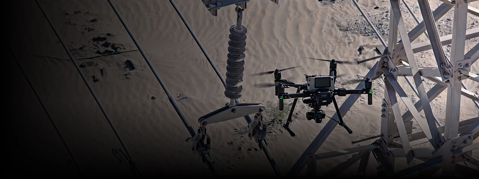


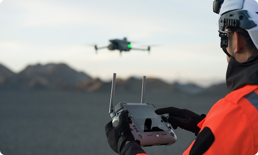
Ghana’s industrial operators face ageing infrastructure, tight compliance deadlines, and rising safety expectations across every site. Aerial inspection drones answer these pressures by removing crews from high-risk height work and capturing accurate asset data faster. Gulfnet delivers certified pilots, enterprise-grade platforms, and GCAA-ready operations tailored for Ghana projects.

Centimetre-level RTK positioning for precise aerial inspection work

Thermal and visual payloads for industrial asset diagnostics

High-zoom cameras for safe stand-off asset assessment

Long endurance up to 59 minutes per sortie

IP55 weather resilience for coastal and inland deployments

Automated dock-based missions for recurring corridor inspections

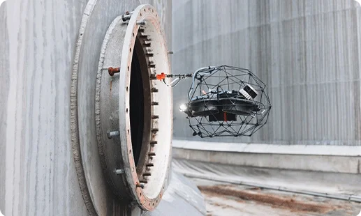
GPS-denied confined space inspection with collision tolerance
Aerial contact-based NDT thickness measurement capability
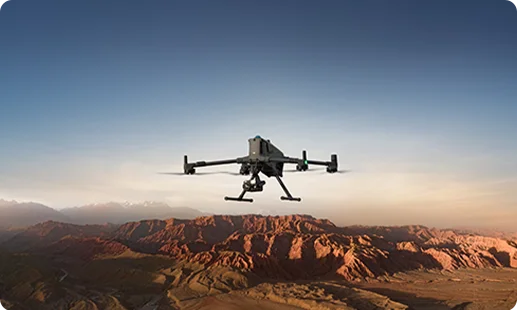
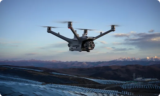
The primary platform for most Ghana aerial inspection work. Delivers 59-minute flight time, IP55 rating, and support for the Zenmuse H30T high-zoom thermal payload.
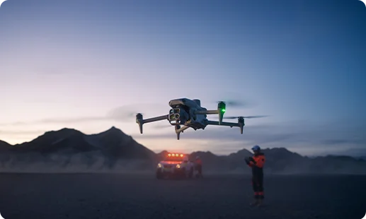
A compact DJI inspection platform with integrated thermal and telephoto imaging. Well suited for high-rise, bridge, and routine industrial inspection missions across Ghana.
Autonomous dock-based system for recurring aerial inspection routes. Ideal for pipeline corridors, utility assets, and remote facilities needing scheduled inspections across Ghana.
A caged, collision-tolerant platform built for GPS-denied spaces. Flies safely inside Ghana tanks, boilers, ducts, and other confined industrial assets.
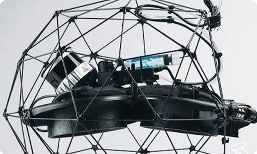
Elios 3 fitted with a UT payload for contact-based ultrasonic thickness readings. Captures NDT data inside confined assets across Ghana oil and process plants.
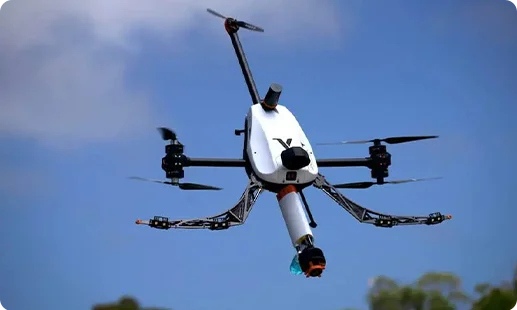
Industrial-grade drone built specifically for aerial contact NDT. Delivers couplant-based ultrasonic thickness measurements on tanks, pipes, and vessels across Ghana assets.
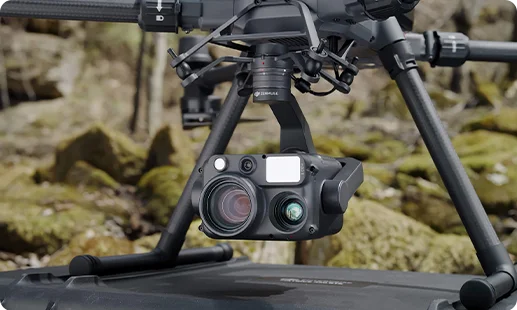
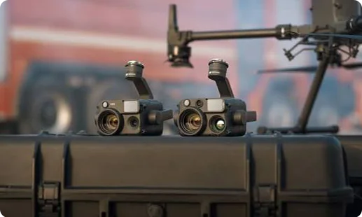
Multi-sensor payload with high-zoom visual, thermal imaging, and laser rangefinder for safe stand-off Ghana industrial asset inspection.
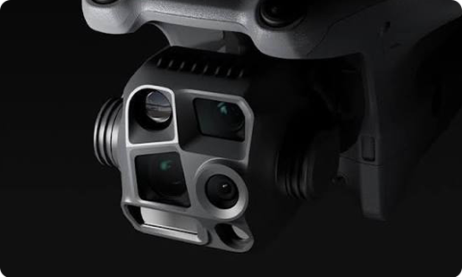
Built-in multi-lens system on the Matrice 4 Series for routine high-rise, bridge, and facade inspection coverage.
Combined LiDAR, 4K visual, and thermal sensors on the Elios 3 for confined space mapping and defect detection.
Contact-based ultrasonic thickness probe paired with 4K visual and thermal, for Elios 3 confined-space NDT missions.


Aerial contact-based NDT probe fitted on Voliro T for ultrasonic thickness readings on tanks, pipes, and vessels.
Zoom and thermal sensors on the Dock 3 Matrice 4TD system for recurring autonomous Ghana corridor inspection missions.
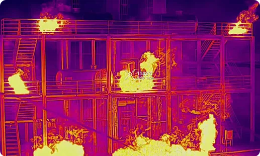
Ghana's industrial operators are moving past rope access and manual checks. Four shifts are driving the change nationwide.

Rope access on oil tanks and chimneys is giving way to safer aerial inspection drone in Ghana workflows that remove crew from height exposure.
GRIDCo transmission corridors, VRA hydro assets, and offshore platforms get full visual coverage faster with industrial inspection drone in Ghana deployments.
GCAA RPAS compliance and digital reporting are now routine, letting operators submit inspection data and audit trails to regulators faster.
LiDAR drone in Ghana flights and UAV for aerial survey in Ghana missions deliver high-detail inspection models of mines, ports, and infrastructure in hours, not weeks.
From Takoradi offshore platforms to Accra high-rises and northern transmission lines, Gulfnet matches the right drone and payload to each Ghana inspection brief.
There is no single best aerial inspection drone in Ghana. The right pick depends on the asset and site conditions. For most industrial inspections, we recommend the DJI Matrice 400 RTK thanks to its long endurance, IP55 rating, and support for the Zenmuse H30T. For compact routine checks, the DJI Matrice 4 Series fits well. Confined assets like tanks or boilers call for the Flyability Elios 3. Gulfnet matches the right drone for aerial inspection in Ghana to each client brief after reviewing the asset, access conditions, and reporting output needed.
Yes. Gulfnet supplies the aerial survey drone in Ghana market from Accra across the country, covering Ashanti, Western, Northern, and Volta regions. We work with mining, oil and gas, construction, utility, and public sector clients. Our aerial inspection lineup includes DJI Matrice 400 RTK, DJI Matrice 4 Series, DJI Dock 3 systems, Flyability Elios 3, and Voliro T, along with the thermal, zoom, and NDT payloads matched to each platform. Buyers also get configuration, pilot training, GCAA compliance guidance, and after-sales support. If you need a UAV for aerial survey in Ghana, reach out through our contact page to discuss availability and the right fit for your project.
Gulfnet is a dedicated enterprise LiDAR drone in Ghana supplier for industrial inspection use cases. For confined-space LiDAR scanning inside tanks, boilers, and process plants, we supply the Flyability Elios 3 with its onboard LiDAR, 4K, and thermal payload. Our aerial LiDAR drone in Ghana services include mission planning, flight execution, point cloud processing, and deliverables ready for your GIS workflow. Beyond hardware, we handle local pilot training, GCAA RPAS compliance support, and ongoing maintenance. For project-specific scoping, our team reviews your terrain, asset list, and accuracy needs before recommending the right fit.
For an aerial mapping drone in Ghana requirement linked to inspection, the drone depends on the environment. For open outdoor asset mapping and large area photogrammetry, dedicated survey drones work best, and our team can scope those separately. For confined-space mapping of tanks, boilers, or ducts, the Flyability Elios 3 delivers LiDAR, 4K, and thermal data in a single flight. For automated recurring corridor mapping across Accra and the wider Ghana market, the DJI Dock 3 with Matrice 4TD runs scheduled missions without on-site crew. Our team can review your Accra site and recommend the right aerial mapping drone in Ghana.
Yes, Gulfnet works as an enterprise aerial inspection drone in Ghana dealer. We supply industrial-grade platforms, payloads, docking systems, and ground stations to clients in energy, mining, construction, utilities, and public sector programmes. Beyond sales, we focus on full deployment: specifying the right asset inspection drone in Ghana for your use case, supporting GCAA RPAS filings, training your pilots, and providing maintenance. Our asset inspection drone in Ghana lineup includes DJI Matrice 400 RTK, DJI Matrice 4 Series, DJI Dock 3 systems, Flyability Elios 3, and Voliro T, matched to Ghana industry conditions. Contact our Ghana team.
Pricing for an aerial survey drone in Ghana varies by platform, payload, software, and support package. Entry-level enterprise setups cost significantly less than confined-space robotic platforms or RTK aircraft with multiple payloads. Software licences, ground stations, training, and GCAA compliance support also factor in. Rather than quoting a generic figure that may mislead your budget planning, our team prefers to understand your use case, flight frequency, and data output needs before preparing a quote. That way the number reflects the actual deployment, not a sticker price. Reach out through our Ghana contact page for a tailored quotation.
You can request a quote through our contact form or by reaching our Ghana team by email or phone. Share the basics first: what you need to inspect, how often, the site location, and any data or reporting output you need. If you already have a shortlist, share that too. From there, our team scopes the right industrial inspection drone in Ghana setup, confirms GCAA compliance requirements, and sends a tailored quotation. For complex projects such as pipelines, offshore platforms, or large mines, we usually recommend a short discovery call before quoting. This keeps the response grounded in your actual conditions.
For confined-space LiDAR scanning inside boilers, tanks, or process plants in Ghana, the Flyability Elios 3 is our top aerial LiDAR drone in Ghana pick. It carries LiDAR, 4K, and thermal in a single collision-tolerant platform, letting pilots capture 3D point clouds in GPS-denied interiors where no outdoor drone can fly. Point clouds integrate with CAD and GIS workflows for structural analysis and defect tracking. For open-air mapping tasks outside the inspection scope, our survey team recommends different platforms matched to those deliverables. Our team can walk through either aerial LiDAR drone in Ghana option.
Yes. Gulfnet arranges demonstration sessions for enterprise clients across Accra and the wider Ghana market. During a demo, our pilots fly the aerial inspection drone most relevant to your use case, show the payload data outputs, and walk your team through the workflow from mission planning to final report. For industrial clients, we usually recommend bringing one real inspection scenario so the demo reflects your actual conditions. Demos can be hosted at your site, our base, or a neutral test location based on availability. Contact our Ghana team to schedule a session that fits your project needs.
For a long range inspection drone in Ghana requirement, the DJI Matrice 400 RTK is our primary option. It offers up to 40 km of operational range, 59 minutes of flight endurance, and IP55 weather resilience, making it suited to pipeline corridors, transmission lines, and offshore work. The DJI Matrice 4 Series is a secondary long range inspection drone in Ghana option with 25 km range and 49 minutes of flight time, better for site-level and asset-focused inspection work. The right choice depends on how far you need to fly from the operator and the regulatory corridor you are working in.
Yes. Gulfnet supplies an aerial monitoring drone in Ghana for perimeter watch, infrastructure surveillance, and recurring site patrols. The DJI Matrice 400 RTK with the Zenmuse H30T offers thermal and zoom capability, while the DJI Dock 3 with Matrice 4TD runs autonomous scheduled patrols without on-site crew using its integrated zoom and thermal payload. A drone for aerial surveillance in Ghana can be configured around your security, inspection, and compliance workflows. We also scope each aerial monitoring drone in Ghana setup to your terrain and site access conditions. Reach out to our Ghana team to plan the right drone for aerial surveillance in Ghana.
Yes. Gulfnet offers an aerial photography drone in Ghana setup linked to our inspection workflow for industrial site documentation, asset condition records, and visual reporting. The DJI Matrice 4 Series carries integrated wide, medium tele, tele, and thermal cameras suitable for high-resolution capture during inspection missions. The DJI Matrice 400 RTK with the Zenmuse H30T adds high-zoom detail for close imaging of specific defects or features. Each aerial photography drone in Ghana deployment includes mission planning, GCAA compliance support, pilot execution, and image delivery to your required format. Contact our team for a Ghana project scope.
