
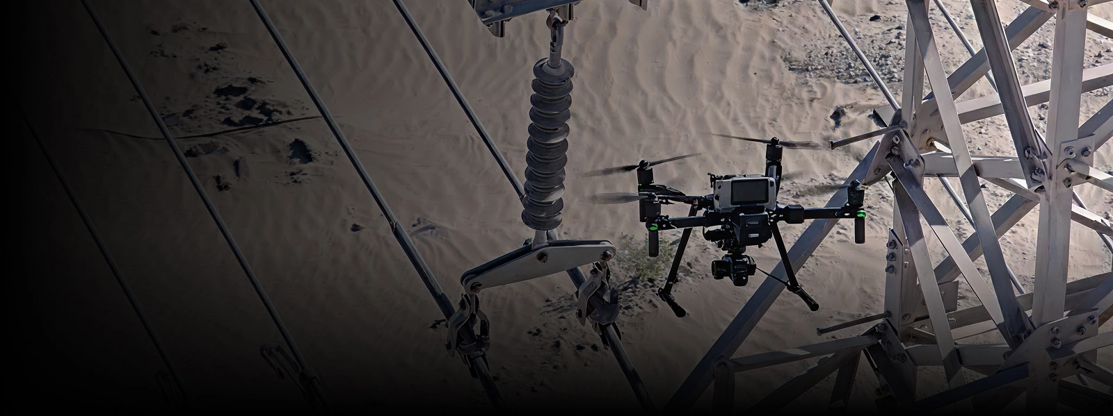


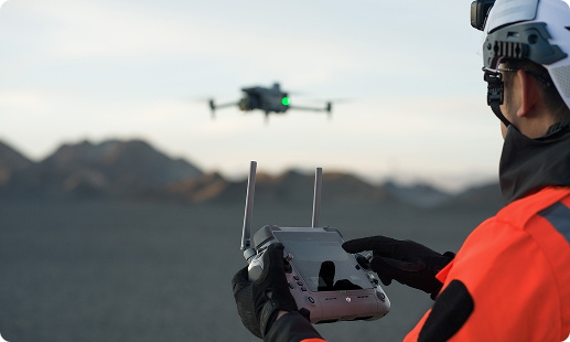
Tanzania’s mining, energy, and infrastructure operators are navigating aging stacks, long pipeline corridors, and heavy coastal corrosion that stretch traditional inspection methods thin. Gulfnet delivers TCAA-ready aerial inspection drones in Tanzania, pairing LiDAR, thermal, and ultrasonic payloads with trained pilots, on-ground logistics, and local technical support that keeps assets inspected safely and audit records fully documented.

Centimetre-grade RTK positioning for repeatable inspection flights

Simultaneous thermal, visual, and LiDAR data capture onboard

IP55 airframes tolerate coastal humidity and highland dust

Autonomous docked operations enable continuous asset surveillance

Contact ultrasonic payloads for vessel wall thickness checks

Confined-space flight inside GPS-denied silos and shafts

Long endurance covering pipeline and transmission corridors fully
TCAA registration and secure data pipelines fully supported
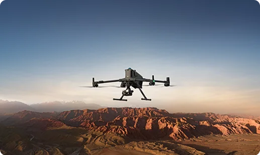
Flagship industrial inspection drone in Tanzania combining 59-minute endurance with heavy payload tolerance, ideal for stacks, bridges, and dense facility sweeps across multiple sites.
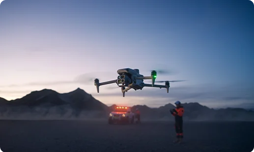
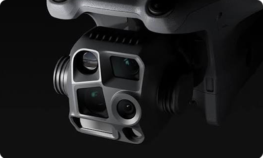
Portable aerial monitoring drone in Tanzania pairing integrated multi-camera suite with wide, tele, and thermal switching, built for rapid facade, flyover, and substation walkthroughs.
Collision-tolerant inspection drone purpose-built for confined spaces inside Tanzania refineries, silos, storage tanks, and underground mining shafts across Geita and Shinyanga belts.
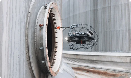
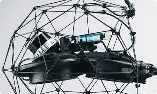
Contact ultrasonic variant enabling corrosion mapping on live vessels and risers, cutting rope access risk across Mnazi Bay and Dar es Salaam facilities.
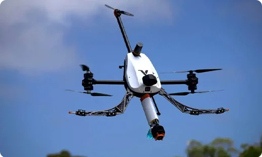
Fully rotating platform placing couplant-based UT sensors on walls, ceilings, and inclined surfaces, redefining the asset inspection drone in Tanzania workflow for process plants.
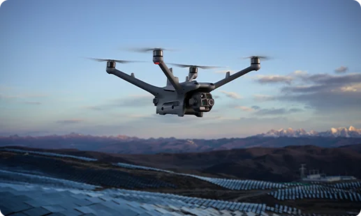
Unattended docked system automating pipeline, substation, and perimeter rounds, delivering a long range inspection drone in Tanzania solution with minimal pilot presence onsite.
Hybrid thermal, zoom, and laser rangefinder package pinpointing hotspots, cracks, and leaks on Tanzania infrastructure during a single flight.
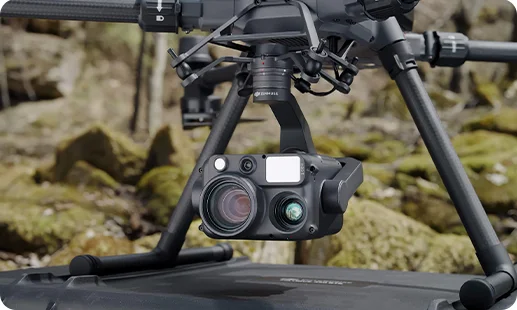
Full lens stack switching between wide, medium tele, tele, and thermal, giving facade and tower crews complete visual coverage per pass.
Elios 3 payload merging aerial LiDAR drone in Tanzania point clouds with 4K and thermal data inside confined assets.
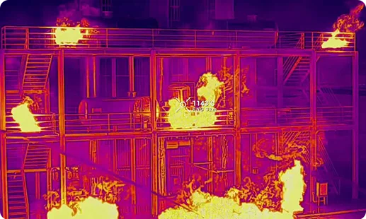
Dry-contact ultrasonic head paired with 4K and thermal capture for wall thickness and visual defect logging inside live vessels.


Voliro contact sensor using liquid couplant for accurate corrosion mapping on curved and overhead surfaces across industrial facilities.
Dock-mounted zoom and thermal camera powering autonomous drone for aerial surveillance in Tanzania pipeline, substation, and perimeter missions.
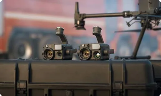
Tanzania asset owners are retiring rope access and shutdown-only inspections, embracing data-rich aerial workflows that reshape operational economics.

Hard-to-reach assets across Mtwara, Mwanza, and offshore Mnazi Bay are surveyed in hours, replacing week-long scaffolding or rope access campaigns.
Thermal and aerial monitoring drone in Tanzania routines capture hidden corrosion and strain early, cutting unplanned downtime for TANESCO lines and cement kilns.
Workers no longer dangle from flares, towers, or jetty columns, pushing Tanzania HSE records closer to zero-incident annual targets consistently.
TCAA-compliant drone for aerial surveillance in Tanzania operations unlock insurer trust and bankable audit trails, speeding capex approvals in mining and energy.
Stop grounding inspections on scaffolding and shutdowns. Share your sites and asset mix, and Gulfnet will deploy the right drones, payloads, and licensed pilots across Dar es Salaam, Dodoma, and Arusha.
The best aerial inspection drone in Tanzania depends on asset type. For stacks, bridges, and large facility sweeps, the DJI Matrice 400 RTK paired with the Zenmuse H30T is widely regarded as a leading industrial inspection drone in Tanzania. For confined spaces inside refineries, silos, and underground mining shafts, Flyability Elios 3 is the recognised choice. For non-destructive thickness checks on live vessels, Voliro T and Flyability Elios 3 with UT Payload add contact ultrasonic measurement. Gulfnet scopes your assets and inspection cadence first, then recommends the platform mix that fits your operational, HSE, and TCAA compliance needs. Contact our Tanzania team for a tailored recommendation.
Yes. Gulfnet supplies enterprise-grade aerial survey drone in Tanzania platforms to clients across Dar es Salaam, including the DJI Matrice 400 RTK, DJI Matrice 4 Series, and the autonomous DJI Dock 3 with Matrice 4TD. Procurement includes consultation on payload fit, pilot training, TCAA registration guidance, and after-sales support. We work with construction firms, utilities, port authorities, cement plants, and oil and gas operators across the Dar es Salaam corridor. For current configurations, lead time windows, and specific commercial terms, speak with our Tanzania sales desk, who will scope requirements against your asset portfolio and site workflow.
Gulfnet is an enterprise LiDAR drone in Tanzania supplier. For aerial inspection work, our LiDAR offering is the Flyability Elios 3 with the LiDAR plus 4K plus thermal payload, built for confined-space point cloud scanning inside tanks, silos, mining shafts, and process assets. This serves mining operators across Geita and Shinyanga, infrastructure contractors in Dar es Salaam and Dodoma, and energy clients working on asset integrity audits. Our team handles payload planning, flight workflow setup, and operator training. For scoped quotes tied to a specific LiDAR drone in Tanzania use case, contact the Gulfnet Tanzania team through the consultation form on this page.
For aerial mapping drone in Tanzania projects based around Dar es Salaam, drone selection depends on whether you need outdoor terrain mapping or confined-space 3D scanning. For interior point cloud work, the Flyability Elios 3 with LiDAR plus 4K plus thermal payload is purpose-built. For outdoor corridor and site mapping, Gulfnet offers dedicated mapping platforms outside this page, which our team can walk you through once we scope your project. Payload selection depends on whether you need point clouds or orthomosaic imagery. Share your project brief and site boundary through the consultation form for a specific aerial mapping drone in Tanzania recommendation.
Gulfnet operates as an enterprise aerial inspection drone in Tanzania partner, covering supply, pilot services, and lifecycle support. You can reach our team through the consultation form on this page, by phone, or by email. We work with clients across Dar es Salaam, Dodoma, Arusha, Mwanza, Mtwara, and Mbeya. Our consultation begins with scoping your assets, inspection cadence, and regulatory requirements under TCAA, then matching the right drone and payload combination. Whether you need a single platform purchase, a managed inspection programme, or operator training, our team guides each step. Request your consultation to connect with the right specialist.
Aerial survey drone in Tanzania pricing varies based on platform choice, payload configuration, software stack, training needs, and whether support is included. A DJI Matrice 4 Series with its integrated camera stack sits at a different price band than a DJI Matrice 400 RTK with the Zenmuse H30T payload. Flyability Elios 3, Flyability Elios 3 with UT Payload, and Voliro T sit at the specialist end for confined-space and contact ultrasonic work. Import duties, warranty terms, and training packages also affect the final figure. Rather than publish generic ranges, Gulfnet prepares a tailored proposal for each Dar es Salaam client. Share your scope through the consultation form for accurate pricing.
You can request a quote by filling the consultation form on this page or contacting the Gulfnet Tanzania team directly. For an accurate quote on an aerial inspection drone in Tanzania, we typically ask about asset types, inspection frequency, site locations, data deliverables, and whether you need platform supply only or a full managed inspection service. Our team then builds a configuration covering drone, payload, training, and support, and returns a documented proposal. Clients across Dar es Salaam, mining regions, and the coastal belt use this process to compare options against internal procurement standards.
For long range inspection drone in Tanzania requirements, Gulfnet offers the DJI Matrice 400 RTK, which combines up to 59 minutes of flight endurance with extended transmission range. For automated long-corridor coverage such as pipelines or transmission lines, the DJI Dock 3 with Matrice 4TD provides unattended, docked operations that extend reach without pilot travel. Both platforms suit the distances common to Tanzania mining concessions, EACOP-adjacent corridors, and TANESCO transmission lines. Final selection depends on payload needs and the regulatory window. Reach out to the Gulfnet team to confirm current availability and configure the right long range setup for your sites.
Yes, Gulfnet arranges on-site demonstrations of our aerial inspection drone in Tanzania lineup for qualifying enterprise clients around Dar es Salaam. A typical demo covers mission planning, live flight capture, thermal and LiDAR data review, and a walkthrough of post-flight processing. We align the demo scope to your asset type, whether that is stacks, substations, cement kilns, or storage tanks, so the output is immediately relevant. Scheduling depends on team availability, site readiness, and TCAA clearance timelines. To initiate a demo, submit the consultation form with your site context and preferred window, and our team will coordinate next steps.
For Dar es Salaam industrial facilities, the DJI Matrice 400 RTK with Zenmuse H30T is a primary industrial inspection drone in Tanzania choice, suited for stacks, bridges, tanks, and cement plant kilns. The DJI Matrice 4 Series with its integrated wide, medium tele, tele, and thermal cameras suits lighter, portable facade and substation sweeps. For interior assets such as reactors, silos, and underground mining shafts, Flyability Elios 3 is the preferred platform. Voliro T and Flyability Elios 3 with UT Payload add contact ultrasonic thickness measurement for live vessels. Share your site context through the consultation form for a tailored shortlist.
Yes, Gulfnet supplies enterprise DJI platforms serving as UAV for aerial survey in Tanzania and inspection work, including the DJI Matrice 400 RTK, DJI Matrice 4 Series, and the DJI Dock 3 with Matrice 4TD autonomous docked system. These models cover thermal and visual inspection, confined perimeter sweeps, and automated monitoring routines. Compatible payloads supplied through Gulfnet for aerial inspection include the Zenmuse H30T and the integrated zoom plus thermal payload used with the Dock 3 Matrice 4TD. Our Tanzania team manages procurement, pilot training, and TCAA registration guidance. For current lead times and bundle options, speak with the Gulfnet sales team through the consultation form on this page.
Gulfnet supplies aerial LiDAR drone in Tanzania platforms to clients across Dar es Salaam. For confined-space point cloud capture, our offering is the Flyability Elios 3 carrying the LiDAR plus 4K plus thermal payload, which handles interior assets such as tanks, silos, mining shafts, and process units. This setup serves mining, infrastructure, utility, and large industrial clients that need dense 3D data for engineering decisions on hard-to-reach assets. Our team guides payload choice, processing stack, and operator training to make sure the data integrates into your downstream workflow. Contact the Gulfnet Tanzania team to scope a LiDAR configuration for your specific project.
Gulfnet is an enterprise-focused aerial photography drone in Tanzania supplier. For commercial aerial photography tied to construction progress monitoring, cinematography-grade asset documentation, or marketing shoots at industrial sites, we recommend the DJI Matrice 4 Series with its integrated wide, medium tele, tele, and thermal cameras. For higher-detail inspection imagery on larger assets, the DJI Matrice 400 RTK paired with the Zenmuse H30T delivers combined zoom, thermal, and laser rangefinder output. Our team also supports pilot training and TCAA permit workflows. For project-specific requirements across Dar es Salaam, Zanzibar, or Arusha, reach out through the consultation form to scope the right aerial photography drone in Tanzania configuration.
