
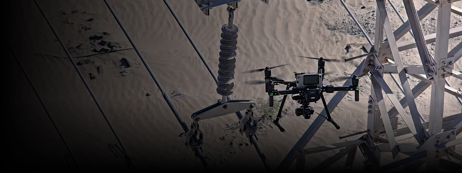


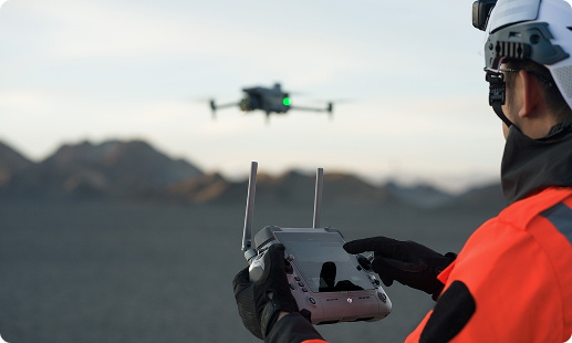
Zimbabwe’s utility networks, deep mining sites, and complex refinery stacks are getting harder to inspect using ropes, scaffolds, and planned shutdowns. Gulfnet brings CAAZ-ready pilots and advanced aerial survey drones in Zimbabwe to the field, replacing slow manual audits with safer flights, faster turnaround, and inspection-grade data for every asset.

Aerial LiDAR drone in Zimbabwe scanning for confined assets

Long range inspection drone sorties up to 40 kilometres

Thermal, zoom, and visual cameras swapped per mission

Confined-space, GPS-denied flight for boilers and tanks

Non-destructive ultrasonic thickness measurement delivered airborne

Automated docked flights for aerial monitoring drone operations

RTK positioning on DJI Matrice enterprise airframes
CAAZ-aligned pilots, insured flights, and audit-ready reporting
A heavy-lift UAV for aerial survey in Zimbabwe covering sprawling transmission lines, pipelines, and mining pits in a single sortie.
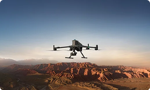
A versatile drone for aerial inspection in Zimbabwe handling substations, flare stacks, and site surveys with integrated multi-sensor imaging onboard.
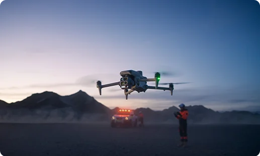
A permanent asset inspection drone in Zimbabwe stationed at substations, mines, and depots for scheduled, unmanned patrols with cloud-delivered imagery.
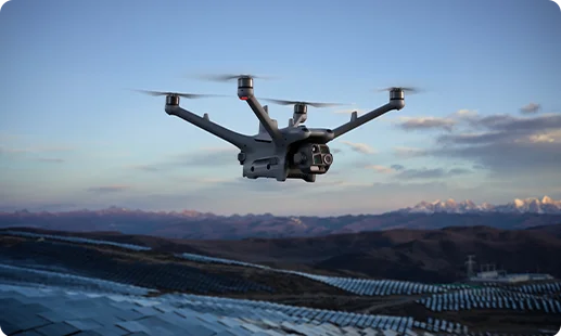
An industrial inspection drone in Zimbabwe built for tanks, boilers, and shafts where GPS fails and collisions during flight are inevitable.
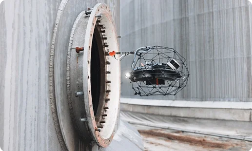
A specialised drone for aerial inspection in Zimbabwe performing non-destructive ultrasonic thickness readings on pressure vessels, pipelines, and tank walls safely.
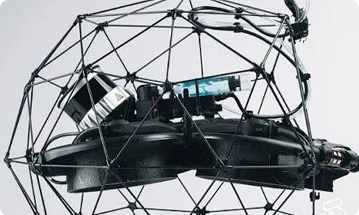
A unique asset inspection drone in Zimbabwe performing ultrasonic and coating thickness tests on vertical and overhead industrial surfaces.
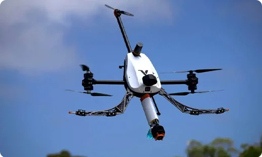
Multi-sensor payload covering transmission lines, substations, pipelines, and tanks across highveld terrain and ZESA corridors.
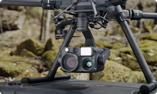
Factory-integrated imaging suite captures detailed visuals of flare stacks, towers, and refinery assets alongside thermal readings.
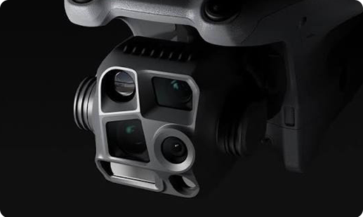
Confined-space payload on the Elios 3 fuses LiDAR scanning with 4K visual and thermal imaging for interior mapping.
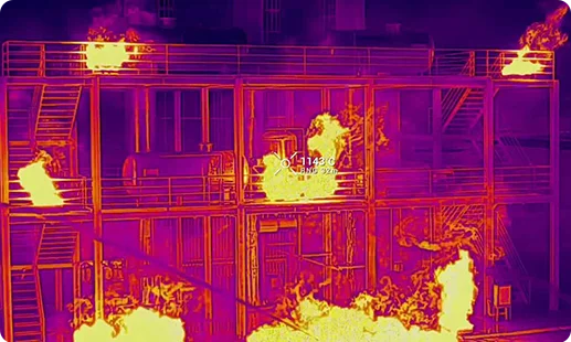
Mounted on Elios 3, this payload performs non-destructive ultrasonic thickness readings on corroded pipes, vessels, and refinery storage tanks.


Specialised ultrasonic sensor on the Voliro T delivering accurate wall thickness data for mining ducts, boilers, and pressure assets.
Docked zoom and thermal module enables remote aerial monitoring drone in Zimbabwe coverage of substations, stockpiles, and perimeter zones.
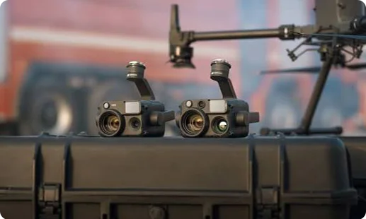
Zimbabwe operators are entering a new inspection era, and four shifts explain how drones are driving it.

Remote mining pits across the Great Dyke, Hwange grid corridors, and highveld terrain are now accessible with a single UAV for aerial survey in Zimbabwe.
Rope access on Kariba spillways, scaffolding at Hwange thermal stations, and shutdowns during inspections are being replaced by safer airborne workflows.
An aerial mapping drone in Zimbabwe cuts survey cycles from weeks to days, giving engineering teams accurate visual records for faster capital decisions.
CAAZ RPAS frameworks are maturing, insurers now recognise certified operators, and Zimbabwean enterprises are embedding drone programs within standard HSE policies.
Ready to retire the ropes, the scaffolds, and the shutdowns? Talk to our team about your requirements. We will scope your assets, match the right drone and payload, and get you flying.
The right choice depends on asset type. For long sorties across transmission corridors or pipelines, the DJI Matrice 400 RTK is our most capable aerial inspection drone in Zimbabwe. For confined boilers, tanks, or shafts, the Flyability Elios 3 is the proven pick, while the Voliro T handles vertical NDT contact tests. For continuous substation or stockpile coverage, the DJI Dock 3 + Matrice 4TD runs autonomous rounds. Our team at Gulfnet scopes your assets, risk profile, and reporting needs before recommending a platform, so you get a drone matched to the job rather than a general-purpose unit.
Gulfnet supplies and deploys enterprise-grade drones in Harare and across Zimbabwe, including the DJI Matrice 400 RTK and Matrice 4 Series. We are an authorised dealer handling procurement, CAAZ compliance paperwork, pilot training, insurance alignment, and after-sales support. Our Zimbabwe engagements typically start with a scoping call where we understand your assets, flight environment, and data outputs required. From there, we propose the right aerial survey drone in Zimbabwe along with payloads, dock options, and software. Reach out through our website or contact page to begin, and we will connect you with the right account team.
Gulfnet is a dedicated enterprise LiDAR drone in Zimbabwe partner. For confined-space scanning, we supply the Flyability Elios 3 configured with its LiDAR, 4K, and thermal payload, which captures interior 3D data in boilers, shafts, and storage tanks where GPS signal is absent. Beyond hardware, we handle flight planning, CAAZ RPAS clearance, data acquisition, post-processing, and deliverable formats such as point clouds and inspection reports. If your project needs a LiDAR drone in Zimbabwe for a one-off scan or a repeatable inspection program, our team will scope and execute end to end. Reach out through our contact page for details.
For aerial mapping in Harare and the surrounding highveld, the DJI Matrice 400 RTK is our go-to platform. Paired with the Zenmuse H30T, it captures high-resolution visuals, thermal data, and laser range measurements suited for site surveys, asset mapping, and corridor records. For smaller sites, the DJI Matrice 4 Series serves as a capable aerial mapping drone in Zimbabwe with its integrated wide, tele, and thermal camera suite. The right fit depends on site size, accuracy class, and output format. Get in touch with Gulfnet for a tailored recommendation matched to your project scope.
Look for a dealer that goes beyond hardware supply. Gulfnet is positioned as a full-service aerial inspection drone in Zimbabwe partner, offering platform selection, CAAZ RPAS clearance support, pilot training, mission planning, and ongoing maintenance. We represent DJI Enterprise, Flyability, and Voliro, so our recommendation is matched to your asset mix rather than the brand we happen to stock. During scoping, our engineers walk through your inspection pain points, the environments involved, and the deliverables your engineering or compliance teams need. From there, we align on commercial terms, training, and support cadence. Visit our contact page to initiate a conversation.
Pricing depends on the airframe, payload mix, software, training, and support package. For example, a DJI Matrice 4 Series configured for aerial photography drone in Zimbabwe work sits at a very different investment level than a Matrice 400 RTK carrying the Zenmuse H30T. Factors like dock infrastructure, insurance, and recurring data processing also shift the total. At Gulfnet, we build quotes around your actual inspection or survey scope rather than listing shelf prices. Share your use case, asset list, and site locations through our contact form, and our team will prepare a transparent, itemised proposal for your review.
Requesting a quote is straightforward. Head to the Gulfnet contact page and share a short description of your project, the industry you operate in, the assets you want inspected, and any specific sensor or payload preferences. Our team reviews it, often follows up with a short scoping call, and then builds a proposal covering the recommended drone, payloads, pilot services, training, software, and after-sales support. Each proposal is tailored to the deployment, whether you need a single aerial inspection drone in Zimbabwe or a fleet with docked autonomy. We respond within standard business windows and keep the process transparent throughout.
For confined-space LiDAR work in Zimbabwe, the Flyability Elios 3 is our top recommendation. It is a collision-tolerant airframe designed for GPS-denied environments like boilers, pressure vessels, mining shafts, and storage tanks. Its onboard LiDAR, 4K visual, and thermal payload captures a point cloud of the interior along with visual and thermal data in a single flight. As a long range inspection drone in Zimbabwe for outdoor corridors, the DJI Matrice 400 RTK with the Zenmuse H30T is the companion platform. Reach out to Gulfnet to see sample outputs and discuss your project scope.
Submit a demo request through the Gulfnet website contact page and mention Harare as your preferred location. Our team will coordinate a session at a mutually suitable site, often a client facility or a controlled demo location. During the demo, we fly the shortlisted platforms, show payload swaps, walk through flight planning software, and preview the data outputs you can expect. Many Harare clients request industrial inspection drone in Zimbabwe demos focused on substation inspection, flare stack scanning, or confined-space entry using the Elios 3. Scheduling depends on pilot availability, CAAZ permissions, and your site readiness, but we move quickly once scope is clear.
Gulfnet supplies long range enterprise platforms in Zimbabwe, with the DJI Matrice 400 RTK leading our lineup. It offers up to 59 minutes of flight endurance and a 40 kilometre operating range under suitable conditions, with the lift capacity to carry heavy payloads for extended missions. This makes it ideal as a long range inspection drone in Zimbabwe for pipeline sweeps, powerline audits, and corridor mapping. The Matrice 4 Series also offers strong endurance at 49 minutes for mid range jobs. Pricing, availability, and configuration depend on your project. Contact Gulfnet through our website to discuss scope and receive a tailored proposal.
In Harare, selection depends on asset type. For outdoor transmission, substation, and plant inspection, the DJI Matrice 4 Series and Matrice 400 RTK are our primary industrial inspection drone in Zimbabwe choices. For confined spaces inside boilers, pressure vessels, or tanks, the Flyability Elios 3 is the proven option. For non-destructive testing against vertical pipes or storage walls, the Voliro T brings ultrasonic contact capability. Many Harare industrial facilities combine two or three platforms depending on inspection cadence and asset complexity. Our Gulfnet engineers will help you match the right airframe and payload mix during the scoping stage.
Yes, DJI enterprise drones are widely used as an aerial survey drone in Zimbabwe for inspection missions. The Matrice 400 RTK and Matrice 4 Series handle most survey workloads, with the Zenmuse H30T on the 400 RTK and the integrated wide, tele, and thermal camera suite on the 4 Series. As a trusted drone for aerial inspection in Zimbabwe, they serve substation audits, pipeline inspections, flare stack checks, and infrastructure monitoring. Gulfnet handles sales, CAAZ permissions, and training. For long-term aerial monitoring drone in Zimbabwe programs, we also configure the DJI Dock 3 with the Matrice 4TD for autonomous docked missions.
Aerial LiDAR missions in Harare typically focus on confined-space asset interiors. Using the Flyability Elios 3 with its LiDAR, 4K, and thermal payload, we capture point clouds and visual data inside boilers at thermal plants, storage tanks at depots, mining shafts, and pressure vessels at industrial facilities. The resulting outputs feed structural assessments, corrosion mapping, and defect analysis. For aerial photography drone in Zimbabwe work on exterior assets, LiDAR is paired with high resolution RGB and thermal capture on the Matrice 400 RTK using the Zenmuse H30T. Gulfnet manages the full workflow from planning to deliverables.
Yes. For continuous perimeter monitoring and tactical oversight, Gulfnet deploys the DJI Dock 3 with the Matrice 4TD as a drone for aerial surveillance in Zimbabwe. The dock sits at a protected location, auto-launches scheduled patrols, and streams integrated zoom plus thermal imagery to a secure dashboard. This setup suits mining perimeters, substation yards, logistics depots, and sensitive sites that need around-the-clock aerial coverage. For broader surveillance programs across multiple sites, we design networks of docks connected through secure links. If your use case needs a long-endurance drone for aerial surveillance in Zimbabwe, the Matrice 400 RTK is also available.
