


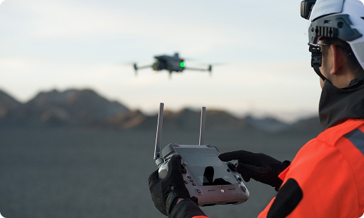
Construction teams in Kenya face tight deadlines, scattered sites, and rising safety expectations on every project. Manual surveys slow progress, and ground inspections carry real risk. Gulfnet addresses this by deploying mission-ready drones for construction projects in Kenya, backed by KCAA-aligned flight operations and reliable data outputs your project managers and surveyors can trust.

Centimeter-grade RTK positioning for construction mapping accuracy.

Automated flight paths for recurring site progress scans.

Thermal imaging detects moisture, heat loss, and defects.

High-resolution zoom for safe facade and roof inspection.

Weather-resistant airframes handle Rift Valley wind and dust.

Photogrammetry outputs for volumetric stockpile and cut-fill reports.

Docked operations enable scheduled, pilotless aerial monitoring runs.
Live video streaming to project managers and consultants.
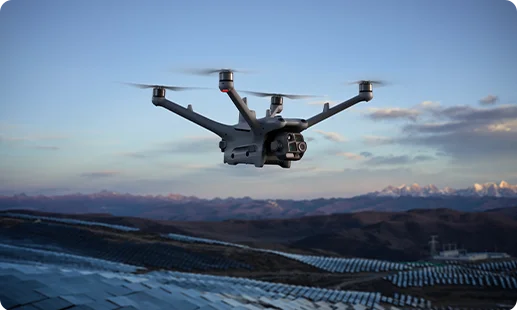
Ideal as a construction monitoring drone in Kenya, this docked system runs automated flights for continuous site documentation across remote Nairobi and Mombasa builds.
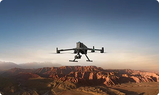
A top-tier site survey drone for construction in Kenya, pairing long flight endurance, RTK accuracy, and heavy payload capacity for large-scale infrastructure builds.
A versatile construction site drone in Kenya that handles mapping, inspection, and progress imagery in one lightweight airframe for medium-scale Nakuru and Kisumu projects.
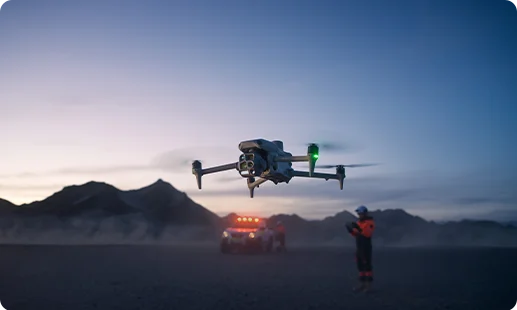
Pairs long-range optical zoom with thermal imaging for autonomous site inspection drone in Kenya workflows and overnight security coverage on active builds.
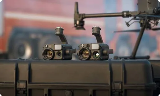
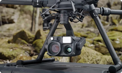
Combines wide, zoom, thermal, and laser rangefinding in one gimbal for detailed building inspection drone in Kenya workflows.
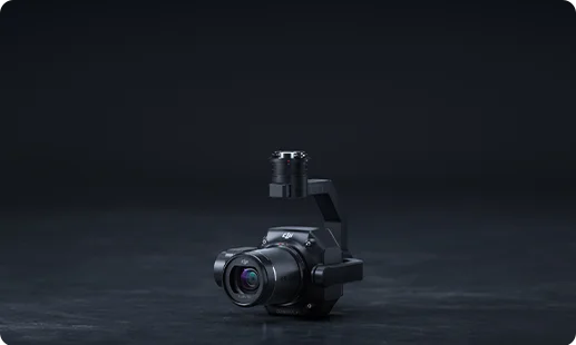
A full-frame photogrammetry sensor built for construction mapping drone in Kenya projects, delivering engineering-grade orthomosaics and 3D terrain models.
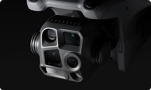
A four-in-one visual and thermal camera array for rapid site progress drone in Kenya missions and multi-angle construction documentation needs.
From Nairobi high-rises to Rift Valley highways, aerial technology is rewriting how Kenyan contractors plan, build, and inspect.

Terrain challenges across the Rift Valley and coastal belts are solved by drones that reach sites traditional survey crews cannot safely access.
Weekly manned surveys are being replaced by same-day aerial captures that cut labour cost and deliver sharper progress data for project owners.
KCAA RPAS compliance is giving enterprise contractors confidence to adopt drone programs at scale across public and private infrastructure portfolios.
NEMA environmental reporting and lender due diligence are easier with timestamped aerial records that document build conditions week by week.
Talk to our Kenya team about deploying the Matrice 400 RTK, Dock 3, or Matrice 4 Series with payloads matched to your site survey, inspection, or progress needs.
The best construction site drone in Kenya depends on project scale and workflow. For continuous monitoring of large sites across Nairobi, the DJI Dock 3 with Matrice 4D is a strong fit because it runs scheduled, pilotless flights. For high-accuracy surveys, mapping, and multi-sensor inspection work, the DJI Matrice 400 RTK is the stronger choice. For mid-sized builds in Nakuru, Kisumu, or Eldoret, the Matrice 4 Series offers a lighter, faster option. Gulfnet matches the right drone to your actual site conditions. Contact Gulfnet for a scoping conversation.
Gulfnet supplies the full enterprise lineup of construction monitoring drone in Kenya programs, with support reaching Nairobi, Mombasa, Kisumu, Nakuru, and other build hubs. We handle the full process, from sizing the fleet against your project pipeline, to coordinating KCAA documentation, to on-site handover and operator orientation. We do not operate as a shelf retailer. Every deployment is scoped to the asset owner, EPC contractor, or consultancy that will fly it. Reach out through our Kenya contact channel and our team will walk you through options and lead times.
Gulfnet is a specialist drone, robotics, and aerial survey partner serving industrial clients across East Africa, including Kenya. Our focus is enterprise-grade equipment and payload bundles, not consumer sales. We work closely with authorised distribution channels for DJI enterprise hardware and partner payloads so Kenyan construction firms receive genuine stock, warranty cover, and configured workflows. If you need a construction drone dealer in Kenya who also helps with mission planning, pilot support, and data output setup, our team is positioned to deliver that end-to-end rather than only ship a box.
For a dedicated site survey drone for construction in Kenya projects based around Nairobi, the DJI Matrice 400 RTK paired with the Zenmuse P1 is our most recommended configuration. It produces engineering-grade orthomosaics, dense point clouds, and 3D terrain models suitable for cut-and-fill planning. For lighter urban surveys, the Matrice 4 Series offers quick turnaround. The decision depends on site size, required accuracy, and whether you need photogrammetry, mapping, or inspection outputs. Gulfnet will help spec the right pairing based on your tender documents, scope, and reporting standards.
Yes. A site progress drone in Kenya workflow is one of our most frequent deployments. We typically pair the DJI Dock 3 with the Matrice 4D for sites where you need daily or weekly scheduled flights without sending a pilot each time. For sites that still prefer on-demand pilot missions, the Matrice 400 RTK and Matrice 4 Series both support repeatable waypoint missions. Outputs can include timestamped imagery, side-by-side progress comparisons, and shareable reports for project owners, lenders, and consultants. Contact Gulfnet to design a recurring schedule tailored to your build.
Construction drone pricing in Nairobi varies considerably because the solution rarely stops at the airframe. The final figure depends on which drone, which payload, whether a dock is included, software licensing, training, and after-sales support. A Matrice 4 Series bundle sits at a very different price point to a Matrice 400 RTK with Zenmuse P1 and photogrammetry software, which again differs from a full Dock 3 autonomous monitoring setup. For an accurate quote on any construction drone in Kenya configuration, reach out to Gulfnet with your use case and we will share a tailored proposal.
You can request a quote through the Request Your Consultation form on this page or by reaching Gulfnet through our standard Kenya contact channel. To give you the sharpest proposal, it helps to share a few basics: the type of construction project, approximate site size and location, how often you need to fly, what outputs you require (progress imagery, 3D models, thermal inspection, volumetric reports), and whether your team will operate the drone or prefer managed deployment. Our Kenya solutions team then returns a scoped quote covering hardware, payloads, software, and support.
For a drone for construction projects in Kenya today, Gulfnet most frequently deploys three platforms. The DJI Matrice 400 RTK leads for survey, mapping, and heavy-duty inspection where accuracy and endurance matter. The DJI Dock 3 with Matrice 4D is the leading choice for autonomous, scheduled site monitoring. The DJI Matrice 4 Series is a strong all-rounder for mid-sized builds that need mapping, inspection, and progress imagery in one lightweight airframe. The right pick depends on scope, geography, and whether operations are centralised or spread across multiple sites.
Yes, demos are available for qualified enterprise construction clients. Gulfnet arranges site walkthroughs and controlled flight demonstrations in Nairobi and other Kenyan cities on a request basis, so your project managers, surveyors, and HSE leads can see the equipment in action before committing. Demo scheduling depends on team availability and KCAA airspace clearances for the proposed location. To book a demo of a construction drone or construction mapping drone in Kenya, submit the consultation form on this page or reach our Kenya team directly and we will coordinate a slot.
Yes. Volumetric surveys for stockpiles, excavations, and earthworks are a core use case. For a drone for construction surveying in Kenya focused on volumetrics, Gulfnet typically deploys the DJI Matrice 400 RTK with the Zenmuse P1 photogrammetry sensor. This pairing produces accurate point clouds and surface models that feed directly into cut-and-fill calculations, aggregate reconciliation, and progress claims. The Matrice 4 Series also supports lighter volumetric work for smaller sites. Our team configures mission plans, ground control, and reporting templates so your QS and project teams receive data in a format they can use.
For a building inspection drone in Kenya, Gulfnet recommends either the DJI Matrice 400 RTK with the Zenmuse H30T, or the DJI Matrice 4 Series for lighter rapid-response work. The H30T combines wide, zoom, thermal, and laser rangefinding in one payload, highly effective for facade surveys, roof condition reviews, and heat-loss investigations. In high-rise Nairobi and Mombasa jobs, the Matrice 400 RTK offers the endurance you need, while the Matrice 4 Series is a practical site inspection drone in Kenya for scattered estate portfolios. A drone for building maintenance in Kenya can also run scheduled checks via the Dock 3 setup. For routine drone for building maintenance in Kenya programmes, we scope the right mix.
Yes. Gulfnet’s construction fleet in Kenya is built around DJI enterprise platforms, including the DJI Matrice 400 RTK, the DJI Dock 3 with Matrice 4D, and the DJI Matrice 4 Series. We pair these with payloads such as the Zenmuse H30T, Zenmuse P1, and integrated multi-sensor cameras. We focus specifically on the enterprise segment rather than consumer or hobbyist DJI products, because construction use cases demand ruggedisation, RTK accuracy, and payload flexibility that only the enterprise range provides. Contact Gulfnet to discuss which DJI configuration fits your Nairobi project best.
Yes. Gulfnet supplies a full construction mapping drone in Kenya solution that goes beyond the airframe alone. A typical mapping package includes the DJI Matrice 400 RTK, the Zenmuse P1 photogrammetry camera, mission planning software, ground control reference where needed, and training for your survey team. For smaller mapping tasks, the Matrice 4 Series provides a lighter option. Mapping outputs include orthomosaics, digital surface models, 3D terrain, and contour sets. Reach Gulfnet to discuss scope, accuracy requirements, and whether you need a one-off supply or a long-term managed arrangement.
Yes. While our Kenya focus is enterprise construction, the same platforms deliver strong results for real estate drone in Kenya applications. A drone for construction photography in Kenya and a real estate drone in Kenya share most of the same workflow. The DJI Matrice 4 Series captures crisp wide and zoom imagery of completed developments, while the Matrice 400 RTK supports higher-end cinematic and orthomosaic site tours. For a drone for construction photography in Kenya focused on project launches, outputs include aerial stills, cinematic flyovers, and interactive site maps. Developers across Nairobi, Mombasa, and Kisumu use these to market plots and update investor decks.
