


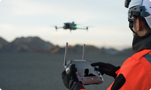
Tanzanian construction firms work under tight deadlines, rising material costs, skilled labour shortages, and difficult access terrain across coastal and inland sites. A construction drone in Tanzania solves these pressures with faster surveys, verified site data, and safer high rise inspections. Gulfnet brings enterprise RPAS experience, qualified pilots, and TCAA ready operations to every project.

Centimetre accurate RTK positioning for construction surveys

Thermal and visual zoom for structural inspection

Automated flight paths for repeatable site progress

Volumetric stockpile measurement with photogrammetric precision

Weatherproof IP55 airframes for coastal and inland use

Long endurance up to 59 minutes per sortie

Dock based remote operation for scheduled monitoring
High resolution orthomosaics and 3D terrain models
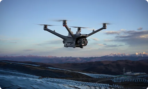
Hands off aerial monitoring, every day This drone for construction projects in Tanzania runs scheduled flights from a weatherproof dock, delivering automated progress capture without an operator onsite.
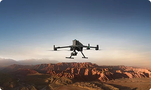
Flagship endurance for complex survey missions A high endurance site survey drone for construction in Tanzania, carrying heavy sensors across megaprojects, estates, and infrastructure corridors with centimetre level accuracy.
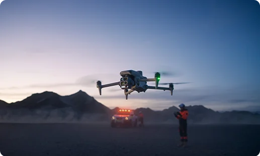
A versatile building inspection drone in Tanzania for mid sized builders, combining wide, tele, and thermal imaging in one rapid deploy airframe.
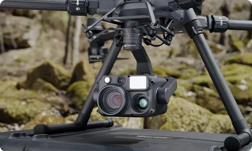
Combined 48MP wide, zoom, thermal, and laser rangefinder for detailed facade and structural inspection across tall buildings.
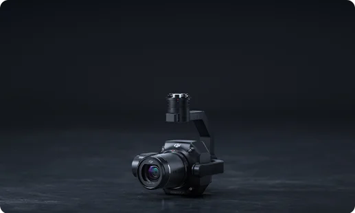
Full frame 45MP photogrammetry sensor built for 3D mapping, topography, and precision construction surveying across large areas.
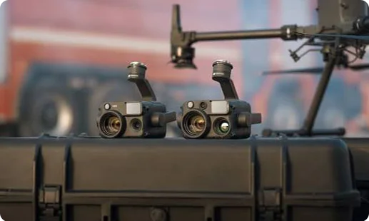
Dual zoom and radiometric thermal imaging for autonomous dock based inspection, hot spot detection, and site progress capture.
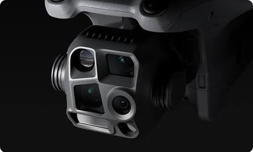
Wide, medium tele, tele, and thermal cameras in one unit for versatile site inspection and daily documentation.
Tanzania's construction boom meets an operational inflection point, with aerial technology rewriting four pillars of jobsite delivery.

Rough coastal and highland terrain across Tanzania no longer blocks surveyors, since drones map difficult parcels in a single sortie.
Traditional ground surveys cost weeks and expose crews to risk, while a construction mapping drone in Tanzania delivers verified data in hours.
Developers in Dar es Salaam, Dodoma, and Arusha now benchmark build progress through weekly orthomosaics instead of manual walkarounds.
TCAA RPAS licensing has matured, giving enterprise builders a clear compliance pathway for sustained aerial operations nationwide.
From the DJI Dock 3 to the Matrice 400 RTK, our site progress drone in Tanzania programs are tailored for your terrain, timeline, and asset portfolio.
The best construction site drone in Tanzania depends on project scale and workflow. For large infrastructure corridors, the DJI Matrice 400 RTK gives 59 minute endurance, Zenmuse H30T compatibility, and centimetre grade positioning. For automated progress capture across urban builds in Dar es Salaam or Mwanza, the DJI Dock 3 paired with the Matrice 4D runs unmanned scheduled flights. For daily site inspection and small to midsize jobs, the DJI Matrice 4 Series brings a compact multi camera payload. Our team will match the airframe to your terrain, software stack, and crew. Reach out to Gulfnet to scope the fit.
Gulfnet supplies the construction monitoring drone in Tanzania buyers trust for live site oversight. The catalog covers DJI Enterprise platforms including the Matrice 400 RTK, the Dock 3 with Matrice 4D for autonomous recurring flights, and the Matrice 4 Series for lighter inspection tasks. We deliver across Dar es Salaam, Dodoma, Mwanza, and Arusha, and support procurement, payload matching, pilot training, and TCAA regulatory alignment. Rather than selling hardware off the shelf, we scope the deployment around your project pipeline. Contact Gulfnet to discuss your site, timelines, and required outputs. We will respond with a complete recommendation.
A reliable construction drone in Tanzania dealer should give you more than hardware. Gulfnet is a specialist enterprise RPAS provider focused on drone deployment, payload integration, flight operations, and data workflows for construction, infrastructure, and energy clients. We work with DJI Enterprise platforms including the Matrice 400 RTK, Matrice 4 Series, and Dock 3 with the Matrice 4D, matched to Zenmuse H30T and Zenmuse P1 payloads. Our team supports procurement, pilot training, TCAA documentation, and ongoing service. If you are evaluating vendors for a construction drone in Tanzania, contact Gulfnet for a transparent scoping call.
The strongest site survey drone for construction in Tanzania is the DJI Matrice 400 RTK carrying the Zenmuse P1. Its full frame 45MP photogrammetry sensor and 59 minute endurance let you cover large urban parcels, infrastructure corridors, and greenfield plots across Dar es Salaam in a single mission, producing orthomosaics, 3D models, and contour maps at engineering grade accuracy. For smaller plots or faster turnarounds, the DJI Matrice 4 Series with its integrated camera array also works well as a site survey drone for construction in Tanzania. The right pick depends on parcel size, elevation complexity, and output format.
Pricing for a drone for construction projects in Tanzania varies by airframe, payload mix, and support package. Enterprise platforms such as the DJI Matrice 400 RTK and the Dock 3 with Matrice 4D sit in a different bracket from the compact Matrice 4 Series, and payloads such as the Zenmuse H30T and Zenmuse P1 add their own cost. Deployment, pilot training, TCAA licensing support, and ongoing maintenance also factor in. We provide a complete quotation once we understand your site, data output needs, and operational scope. Contact Gulfnet in Tanzania for a tailored pricing proposal.
To request a quote for a drone for construction projects in Tanzania, share your project type, preferred output (progress monitoring, mapping, inspection), site location, and whether you need operator services or a direct purchase. Our team will come back with a scoped recommendation covering airframe, payload, training, and TCAA support. If you want fully managed aerial operations, we propose a service model. If you want to own the platform, we quote the purchase and onboarding. Use the Request Your Consultation form on this page, or email Gulfnet directly, and we will respond within one working day.
We arrange onsite demos of the construction site drone in Tanzania buyers are evaluating, including the DJI Matrice 400 RTK, Dock 3 with Matrice 4D, and Matrice 4 Series. A typical demo covers live flight, payload operation (Zenmuse H30T, Zenmuse P1, or integrated camera arrays), and sample data output such as orthomosaics or thermal reports. We bring the platform to your Dar es Salaam project site when conditions and permissions allow. Fill out the Request Your Consultation form, note the drones you want to see, and the Gulfnet team will coordinate scheduling with your project managers.
For volumetric work, the preferred drone for construction surveying in Tanzania is the DJI Matrice 400 RTK with the Zenmuse P1 photogrammetry sensor. The combination captures the imagery needed for accurate stockpile measurement, cut and fill calculations, and earthworks tracking. Processed data gives verified volumes you can hand to project accountants, auditors, and clients. Gulfnet supplies this drone for construction surveying in Tanzania across the country, backed by pilot training and workflow setup so your team can repeat the measurement on a schedule. If stockpile accuracy and quantity reconciliation is in scope, contact Gulfnet.
For facade work, structural assessment, and high rise checks, the primary building inspection drone in Tanzania is the DJI Matrice 400 RTK carrying the Zenmuse H30T. The payload delivers a 48MP wide camera, zoom camera, radiometric thermal sensor, and laser rangefinder in one head, which means a single flight covers visible defects, heat signatures, and precise measurements. The DJI Matrice 4 Series is a lighter alternative for smaller buildings and rapid damage checks. Both are suited to urban projects in Dar es Salaam, Arusha, and Dodoma. Gulfnet will match the right pairing to your inspection brief.
Yes. Gulfnet supplies DJI Enterprise drones for construction across Tanzania, including Dar es Salaam. The construction fleet we recommend covers the DJI Matrice 400 RTK, the DJI Dock 3 paired with the Matrice 4D, and the DJI Matrice 4 Series. Each is matched to the right payload, including the Zenmuse H30T for inspection, the Zenmuse P1 for mapping, and integrated multi camera arrays for daily documentation. Our role is not just supply. We also support TCAA documentation, pilot training, and ongoing operational support. If you want DJI hardware with full service wrap, contact Gulfnet in Tanzania.
The construction mapping drone in Tanzania we most commonly deploy is the DJI Matrice 400 RTK with the Zenmuse P1 photogrammetry payload. This pairing produces centimetre grade orthomosaics, digital surface models, and contour maps suitable for engineering design, as built verification, and progress tracking. The same platform doubles as a site progress drone in Tanzania when scheduled weekly or monthly. For lighter mapping, the DJI Matrice 4 Series is a strong alternative. Gulfnet makes both available for sale across Tanzania, with payload calibration, software setup, and crew training included. Request a direct quotation to begin.
A real estate drone in Tanzania should balance image quality, portability, and consistency. For high end estates, master planned communities, and large infrastructure linked developments, the DJI Matrice 4 Series captures wide, telephoto, and detailed footage suitable for marketing videos, promotional stills, and property walkthroughs. For large footprint estates where elevation and aerial maps add value, the Matrice 400 RTK produces broadcast grade visuals plus orthomosaic site plans in a single mission. Gulfnet also provides a full service real estate drone in Tanzania shoot capability for developers in Dar es Salaam, Zanzibar, and inland cities.
Yes. Gulfnet offers a drone for construction photography in Tanzania projects, delivering monthly aerial milestone shots, time lapse captures, and marketing visuals through the DJI Matrice 4 Series. For projects that need both photography and technical outputs on the same visit, the Matrice 400 RTK or the Dock 3 combination can capture promotional imagery plus mapping or thermal data in one deployment. We cover residential, commercial, and infrastructure sites across Tanzania. If you want a structured drone for construction photography in Tanzania programme across a project lifecycle, our team will build a shoot schedule and define formats.
Gulfnet operates a dedicated site inspection drone in Tanzania practice covering structural health, roofing, facade, mechanical, and infrastructure corridor inspections. The DJI Matrice 400 RTK with the Zenmuse H30T is our standard inspection platform, offering thermal, visual, and measurement payloads in one unit. For scheduled, hands off daily inspection, the DJI Dock 3 and Matrice 4D combination removes the need for an onsite pilot. If you need a site inspection drone in Tanzania for high rise portfolios, or a drone for building maintenance in Tanzania supporting multi asset owners such as hotels, estates, or logistics parks, Gulfnet can scope either.
Yes. Our drone for building maintenance in Tanzania offering supports multi property owners, facility managers, and real estate operators who need routine aerial checks on roofs, facades, HVAC rooftop units, and plumbing stacks. The DJI Matrice 4 Series and the Matrice 400 RTK with the Zenmuse H30T are our two main platforms, allowing visual and thermal inspection on the same visit. We can run inspections on a quarterly or annual cycle, document defects with time stamped images, and hand files to your maintenance team. Contact Gulfnet to design the right cadence for your portfolio.
