


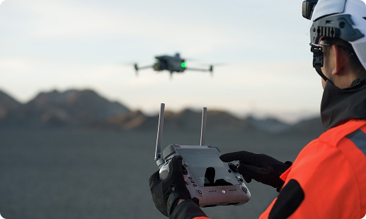
Zimbabwean contractors are juggling ambitious infrastructure targets, tight project budgets and a shortage of experienced surveyors. Drones answer these pressures with faster site data, safer high-level inspections and verifiable weekly progress reports. Gulfnet brings the enterprise airframes, trained pilots and construction monitoring workflows needed to deploy them reliably across projects in Zimbabwe.

Centimetre-accurate RTK positioning for site survey work

Thermal and visual payloads for defect detection

High resolution photogrammetry for digital terrain models

Automated flight routines for recurring progress capture

IP55 rated airframes handle Zimbabwean weather conditions

Long endurance covering 40 kilometre inspection corridors

Real-time 4K streaming for stakeholder decision making
Cloud workflows for orthomosaics, DSMs and reports
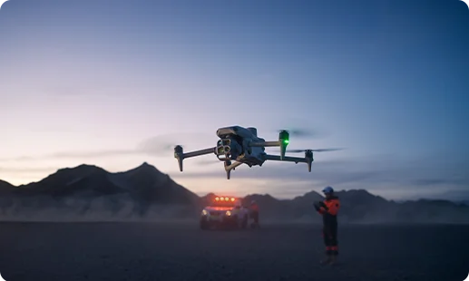
An unmanned dock pairing with the Matrice 4D runs scheduled flights, making it the ideal site progress drone in Zimbabwe for remote projects.
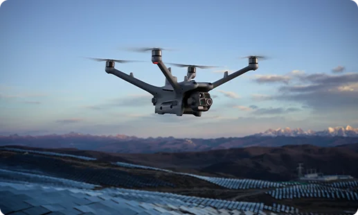
This flagship airframe anchors Gulfnet’s drone for construction projects in Zimbabwe, carrying heavy payloads for mapping, inspection and digital twin creation workflows.
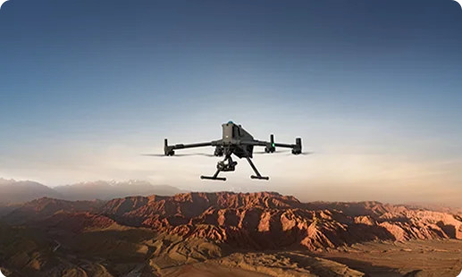
A compact, integrated airframe serving as a dependable site inspection drone in Zimbabwe, carrying wide, tele and thermal cameras in one body.
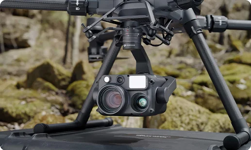
A quad-sensor payload combining thermal, zoom, wide and laser rangefinder for building inspection drone in Zimbabwe workflows.
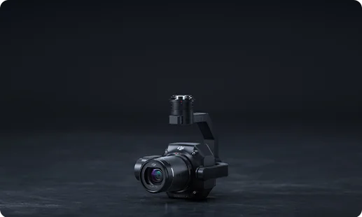
Full-frame 45MP photogrammetry camera producing survey-grade orthomosaics for drone for construction surveying in Zimbabwe projects.
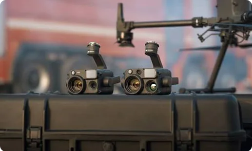
Dock mounted hybrid sensor streaming zoom and thermal frames for scheduled, automated construction progress monitoring without onsite pilots.
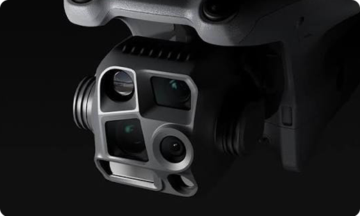
Factory integrated multi-camera head on the Matrice 4 Series delivering flexible imagery for a drone for construction photography in Zimbabwe.
From greenfield plots in Harare to roadworks beyond Bulawayo, aerial data is reshaping project control across four fronts.

Rough rural terrain and sprawling urban plots that once needed weeks of ground survey are now captured in a single morning flight.
Scaffolding, ropes and manual height access give way to a site inspection drone in Zimbabwe, cutting incident exposure on tall structures and congested works.
Weekly orthomosaics give project managers verifiable progress proof, reducing disputes with clients, lenders and government agencies funding infrastructure work.
CAAZ RPAS compliance has matured, allowing enterprise builders to deploy certified drone operations without regulatory ambiguity or operational delays.
From a single building inspection to a nationwide portfolio, our drone for building maintenance in Zimbabwe teams deploy the right airframe, payload and workflow for your project.
For Zimbabwean projects, the strongest choice depends on your scope. The DJI Matrice 400 RTK is Gulfnet’s flagship construction site drone in Zimbabwe for heavy mapping, inspection and digital twin work, carrying the Zenmuse P1 or Zenmuse H30T payloads. For smaller daily documentation runs, the DJI Matrice 4 Series offers an integrated multi-camera head and quick deployment. If you need continuous unattended coverage of a remote site, the DJI Dock 3 with Matrice 4D runs scheduled flights autonomously. Our team scopes the right fit based on site size, altitude and deliverables. Reach out to Gulfnet for a tailored recommendation.
Gulfnet supplies construction grade drones to clients operating in Harare, Bulawayo, Mutare and surrounding provinces. Our catalogue covers the DJI Matrice 400 RTK, DJI Matrice 4 Series and DJI Dock 3 with Matrice 4D, each configured for construction monitoring workflows. Beyond the hardware, we provide pilot training, RPAS registration guidance, payload selection and software onboarding so your crew can be productive from day one. If you want a construction monitoring drone in Zimbabwe for your Harare project, contact our Gulfnet consultants directly to discuss availability, configuration and site requirements before committing to a specific model.
Gulfnet is an enterprise focused drone and robotics partner serving construction, infrastructure, mining and utility clients across Zimbabwe. We supply DJI Enterprise airframes alongside third party payloads, planning software and processing pipelines. Our scope is not limited to selling hardware. We provide pre sale consultation, deployment planning, pilot training, CAAZ RPAS registration support and ongoing maintenance. Whether you need a single drone for construction projects in Zimbabwe or a fleet across multiple sites, our team is set up to support you end to end. Speak to a Gulfnet consultant for a complete walkthrough of our offering.
For a site survey drone for construction in Zimbabwe, the DJI Matrice 400 RTK paired with the Zenmuse P1 full frame camera is Gulfnet’s recommended workhorse. It delivers survey grade orthomosaics, digital surface models and 3D photogrammetric outputs at centimetre accuracy. The DJI Matrice 4 Series is a lighter alternative for small plots and quick scoping flights, with its integrated multi-camera head covering wide, tele and thermal imagery in a single flight. Site conditions, deliverable accuracy and processing software all shape the final choice, so get in touch with Gulfnet for a tailored plan.
Gulfnet supplies site progress drones built around DJI Enterprise platforms. For recurring weekly or monthly captures, the DJI Dock 3 with Matrice 4D is a dock based autonomous system that handles scheduled flights without an onsite pilot. For hand flown progress runs, the DJI Matrice 4 Series offers quick turnaround, and the DJI Matrice 400 RTK suits larger projects where survey accuracy matters. Each deployment includes payload selection, flight plan setup and data pipeline configuration. If you are looking for a site progress drone in Zimbabwe for a specific project, contact Gulfnet to discuss site conditions.
Construction drone pricing in Harare depends on the airframe, the payload configuration, software licences, training needs and after sales support. A compact platform like the DJI Matrice 4 Series sits at a different investment level than a flagship DJI Matrice 400 RTK with the Zenmuse P1 or H30T payload. Dock based autonomous systems have their own project scope. Rather than publish fixed figures that may misrepresent your actual configuration, Gulfnet provides a complete written quotation after a short requirements call. Share your project profile with our team to receive accurate pricing for a construction drone in Zimbabwe suited to your workflow.
Requesting a quote from Gulfnet is a simple two step process. Use the enquiry form on this page, or email our Zimbabwe desk through the contact section, with a short brief covering site location, project scale, intended workflows and any payload preferences. A consultant will respond with a scoping call, after which you receive a structured quotation covering the airframe, payloads, software, training and support. If you already know the model, mention it. If not, our team recommends the right drone for construction projects in Zimbabwe based on your deliverables and site conditions. Reach out to begin the process.
Gulfnet arranges onsite or office demonstrations for enterprise clients in Harare and other Zimbabwean cities. During the demo, our pilots walk through flight planning, payload operation, data capture and the processing pipeline that produces orthomosaics, DSMs or inspection reports. We encourage clients to attend with their project engineers and technical teams so decisions can be made with full context. Depending on your preference, the demo can focus on a construction site drone in Zimbabwe for mapping, a thermal inspection platform or a dock based autonomous workflow. Contact Gulfnet to schedule a session at a convenient date.
Gulfnet supplies volumetric survey platforms built on DJI Enterprise hardware. The DJI Matrice 400 RTK paired with the Zenmuse P1 camera is the standard setup for stockpile and earthwork volume calculations, delivering centimetre accurate photogrammetric outputs. These outputs feed directly into cut and fill calculations and material tracking across construction, mining and infrastructure projects. For smaller sites or faster scoping work, the DJI Matrice 4 Series with its integrated camera head is a lighter option. If your project needs recurring volumetric reporting from a site survey drone for construction in Zimbabwe, request a scoping call for a drone for construction surveying in Zimbabwe.
For a building inspection drone in Zimbabwe, Gulfnet typically recommends the DJI Matrice 400 RTK fitted with the Zenmuse H30T. The H30T combines thermal, zoom, wide and laser rangefinder sensors in one gimbal, enabling detailed inspection of facades, roofs, HVAC equipment and electrical connections from a safe stand off distance. For lighter inspection or routine condition checks, the DJI Matrice 4 Series provides an integrated multi camera head with faster deployment. Both options suit high rise projects, heritage structures and distressed buildings where human access is risky. Speak with Gulfnet to match a specific drone for building maintenance in Zimbabwe to your scope.
Yes. Gulfnet is a long standing DJI Enterprise partner, and most of our construction fleet in Zimbabwe is built on DJI airframes. Our Harare clients typically operate the DJI Matrice 400 RTK for mapping and inspection, the DJI Matrice 4 Series for daily documentation and the DJI Dock 3 with Matrice 4D for autonomous scheduled flights. Alongside the drones, we supply compatible payloads such as the Zenmuse P1 and Zenmuse H30T, plus flight planning and processing software. Each deployment includes training on DJI Terra, DJI FlightHub and other tools so your team can get full value from a construction drone in Zimbabwe.
Gulfnet is the direct point of contact for enterprise clients looking to buy a construction mapping drone in Zimbabwe. Our mapping platforms are built around the DJI Matrice 400 RTK with the Zenmuse P1 full frame photogrammetry camera, giving you survey grade imagery for orthomosaics, digital surface models and 3D models. For smaller teams, the DJI Matrice 4 Series handles lightweight mapping workloads using its integrated multi-camera head. Beyond the hardware, we support software configuration, workflow design and operator training so your team can produce mapping deliverables reliably. Contact our Zimbabwe team to begin scoping.
For a real estate drone in Zimbabwe, project scale matters more than exact model. For single property shoots, villa marketing and compact developments, a compact DJI platform with integrated cameras is sufficient. For larger estates, mixed use schemes or master planned communities where aerial orthomosaics and cinematic sweeps are needed together, the DJI Matrice 4 Series offers a sharper imagery pipeline. Pairing a construction fleet airframe with the Zenmuse P1 lets a real estate drone in Zimbabwe capture both marketing visuals and survey outputs on one flight. For a drone for construction photography in Zimbabwe double duty, speak to Gulfnet.
