


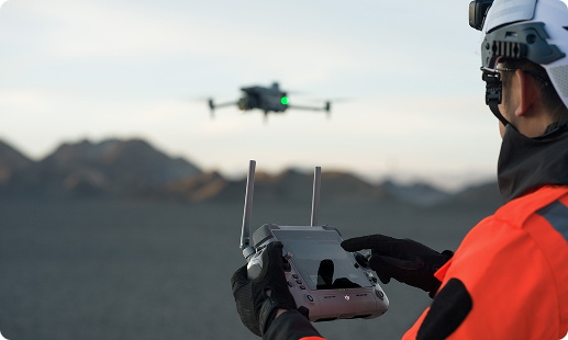
Kenya’s infrastructure teams face aging assets, difficult Rift Valley terrain, tight NEMA reporting deadlines, and rising safety expectations on every site. Gulfnet brings aerial inspection expertise built for these conditions, giving owners accurate data, lower survey risk, and faster project decisions across the country.

Centimeter-level RTK positioning for engineering-grade mapping

Thermal imaging reveals subsurface concrete and steel defects

LiDAR scanning for dense point cloud generation

Long endurance for highway and railway corridor surveys

High-zoom cameras capture facade cracks safely

Automated flight routing for repeatable inspection missions

IP55 weatherproofing for coastal and highland sites
Encrypted data handling aligned with KCAA requirements
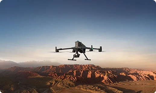
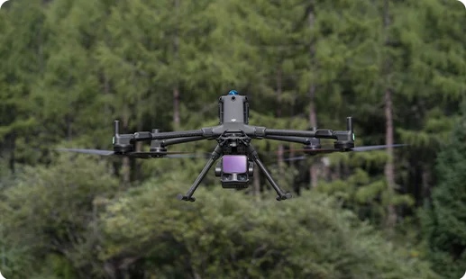
A proven bridge inspection drone in Kenya, the Matrice 400 RTK pairs 59-minute endurance with swappable Zenmuse payloads for engineering-grade capture.
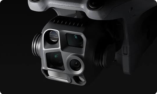
A versatile drone for infrastructure projects in Kenya, the Matrice 4 Series integrates wide, zoom, and thermal cameras for one-flight asset coverage.
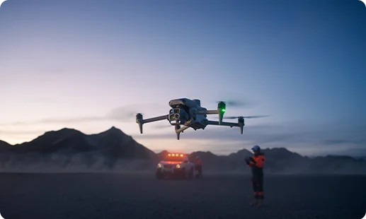
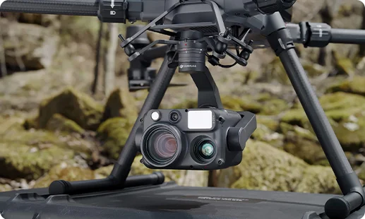
Wide, zoom, thermal, and laser rangefinder combined, ideal for facade inspection drone in Kenya missions and tunnel inspections.
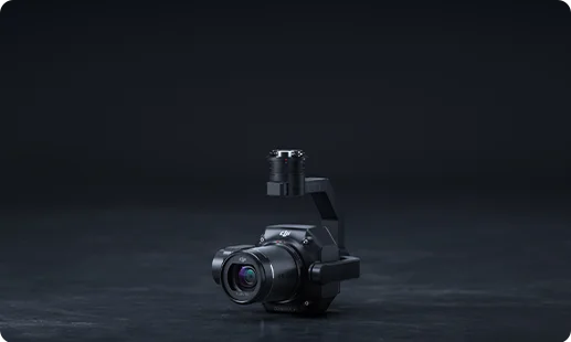
Full-frame 45MP camera producing survey-grade orthomosaics, essential for any road survey drone in Kenya or digital twin program.
Advanced LiDAR delivering dense point clouds, powering 3D mapping drone for infrastructure in Kenya and digital twin creation.
Bundled onboard the Matrice 4 Series, ideal for highway inspection drone in Kenya and daily patrols.
From Nairobi expressways to Mombasa port, aerial systems are now central to how Kenyan infrastructure gets delivered.

Rift Valley bridge sites once needed rope-access crews; drones now gather the same inspection data without putting people at height.
Highway and railway corridors are surveyed in days instead of weeks, cutting project costs while reducing traffic diversions on Kenyan roads.
KCAA RPAS licensing has matured, giving owners the regulatory clarity needed to run airport infrastructure drone in Kenya programs confidently.
LiDAR and photogrammetry outputs now feed BIM platforms directly, accelerating design decisions on dam, port, and expressway projects in Kenya.
Discuss your project with our team to deploy the right bridge inspection drone in Kenya or 3D scanning drone for infrastructure in Kenya, built around your inspection scope.
The best infrastructure inspection drone in Kenya depends on asset type and inspection depth. For bridges, dams, highways, and other large-scale assets, Gulfnet deploys the DJI Matrice 400 RTK with Zenmuse H30T, P1, or L3 payloads for engineering-grade capture. For faster urban missions, the DJI Matrice 4 Series offers Integrated Wide, Medium Tele, Tele & Thermal Cameras and rapid turnaround. Both platforms meet KCAA airworthiness expectations and handle Rift Valley terrain, coastal humidity, and dense urban conditions. For a tailored infrastructure inspection drone in Kenya recommendation, contact our team at Gulfnet.
Gulfnet supplies and deploys bridge inspection drones for clients across Nairobi, Mombasa, Kisumu, and other major cities. Our recommended bridge inspection drone in Kenya is the DJI Matrice 400 RTK fitted with the Zenmuse H30T for crack detection and the Zenmuse P1 for photogrammetric documentation. We handle equipment supply, KCAA RPAS compliance support, pilot training, and payload selection as a bundled package rather than a single hardware sale. Reach out to Gulfnet in Nairobi for availability, demos, and sourcing options tailored to your bridge inspection program.
Gulfnet operates as a specialist 3D mapping drone for infrastructure in Kenya supplier, pairing the DJI Matrice 400 RTK with Zenmuse P1 photogrammetry and Zenmuse L3 LiDAR payloads. These combinations produce survey-grade orthomosaics, dense point clouds, and digital twin outputs ready for BIM integration. Our team handles mission planning, ground control setup, data processing, and deliverable formats aligned to your engineering workflow. Whether you need a one-off mapping run on a Rift Valley corridor or a repeatable scanning program for urban assets, our Nairobi team can advise. Contact Gulfnet to discuss scope and deliverables.
For high-rise facade work in Nairobi, Westlands, and Upper Hill, the DJI Matrice 400 RTK with the Zenmuse H30T is the primary facade inspection drone in Kenya used by Gulfnet. The H30T combines wide, zoom, and thermal lenses with a laser rangefinder, enabling crack identification, delamination mapping, and moisture detection without putting rope-access teams on glass or stone surfaces. The lighter DJI Matrice 4 Series also handles rapid facade sweeps using its Integrated Wide, Medium Tele, Tele & Thermal Cameras. Our team selects the right platform for building height, surface type, and reporting needs. Contact Gulfnet for a site assessment.
Yes. Gulfnet supplies, deploys, and services every drone for infrastructure projects in Kenya from its authorized DJI Enterprise and partner catalog, including the Matrice 400 RTK and Matrice 4 Series. Beyond hardware, we assist with KCAA RPAS registration, pilot certification pathways, mission planning, payload selection, and post-mission data processing. Our dealer role is not limited to drop-shipping units; we treat every engagement as a full-fleet enablement project, giving infrastructure owners a single accountable partner for aerial inspection. For catalog access, demos, or multi-site rollout discussions, reach out to Gulfnet.
Pricing for a tunnel inspection drone in Kenya varies based on platform selection, payload mix, confined-space accessories, and training depth. The DJI Matrice 4 Series is well-suited for larger tunnel bores where GNSS and natural light remain usable, while confined deep-tunnel work typically needs specialized indoor platforms discussed on request. Because every tunnel asset in Nairobi, Mombasa, or along the SGR railway has different access, lighting, and defect-reporting needs, Gulfnet prepares a tailored quote only after a scoping call. Contact our team for a project-specific tunnel inspection drone in Kenya proposal.
Requesting a quote from Gulfnet is straightforward. Share your project scope, including asset type (bridge, highway, dam, tunnel, facade), inspection frequency, data deliverable formats, and site location. Our team reviews your inputs, confirms the right drone and payload combination, and prepares a tailored proposal covering equipment, pilot services, data processing, and KCAA compliance support where needed. We do not publish fixed hardware prices, since infrastructure drone programs vary heavily by scope. Submit your details through the consultation form on this page or reach out to Gulfnet directly to begin the scoping conversation.
For long linear assets like the Nairobi Expressway, Thika Superhighway, and A8 corridor, the DJI Matrice 400 RTK is Gulfnet’s primary highway inspection drone in Kenya. Its 59-minute endurance and 40 km transmission range allow single-pilot teams to cover extended corridors with Zenmuse P1 photogrammetry for orthomosaics or Zenmuse H30T for pavement thermal profiling and incident imaging. The DJI Matrice 4 Series supports faster, lighter patrols where speed matters more than extended range. The right pick depends on corridor length and reporting cadence. Contact Gulfnet for a corridor-specific highway inspection drone in Kenya plan.
Gulfnet runs on-site demonstrations of its DJI Matrice 400 RTK and Matrice 4 Series platforms for bridge inspection prospects across Nairobi and nearby project sites. Demos typically include a brief classroom walkthrough, a live flight showcasing crack-detection zoom and thermal capture, and a sample data processing review so your engineering team can judge output quality. To book, share your preferred date range, site type, and attendee count through our consultation form, and our Nairobi coordinators will confirm availability. Reach out to Gulfnet to lock in your bridge drone demo.
Gulfnet supplies and operates dam inspection drone programs across Kenyan hydro assets, from Masinga and Kiambere on the Seven Forks system to Turkwel in the north. Our standard dam inspection drone in Kenya setup pairs the DJI Matrice 400 RTK with the Zenmuse H30T for spillway thermal and visual inspection, the Zenmuse L3 for crest and embankment LiDAR scanning, and the Zenmuse P1 for photogrammetric documentation. Deliverables include defect registers, 3D point clouds, and change-detection reports suitable for KenGen and private hydro operators. Contact Gulfnet to scope your dam inspection program.
For SGR, Metre Gauge, and commuter rail corridors, Gulfnet supplies the DJI Matrice 400 RTK and DJI Matrice 4 Series as the primary railway inspection drone in Kenya options. Payload pairings include the Zenmuse P1 for orthomosaic track mapping, Zenmuse L3 for embankment and bridge LiDAR, and Zenmuse H30T for thermal detection along overhead lines, signaling cabinets, and rail welds. We support KCAA airspace coordination near active rail corridors and work with railway operators on recurring patrol cycles. For a railway inspection drone in Kenya catalog, demo, or sourcing request, contact Gulfnet in Nairobi.
For airside surveys at JKIA, Wilson, Moi International, and Eldoret International, the DJI Matrice 400 RTK is Gulfnet’s go-to airport infrastructure drone in Kenya. Zenmuse P1 photogrammetry supports pavement condition index surveys and runway orthomosaics, while Zenmuse L3 LiDAR delivers obstacle limitation surface data and 3D terminal modeling. Zenmuse H30T adds thermal checks for apron lighting and perimeter fencing. All airside operations require strict KCAA airspace coordination and airport operator approvals, which Gulfnet supports as part of the engagement. For an airport infrastructure drone in Kenya scoping discussion, reach out to our Nairobi team.
For Mombasa Port, Lamu, and Kisumu inland port infrastructure, Gulfnet deploys the DJI Matrice 400 RTK as its primary port inspection drone in Kenya. The platform supports quay wall inspection with Zenmuse H30T zoom and thermal, container yard mapping with Zenmuse P1 photogrammetry, and terminal 3D modeling using Zenmuse L3 LiDAR. The DJI Matrice 4 Series complements this for faster security sweeps and daily operations monitoring. Our team coordinates with Kenya Ports Authority and KCAA for airspace clearances. For a port inspection drone in Kenya engagement, contact Gulfnet to discuss scope and reporting.
The DJI Matrice 400 RTK with Zenmuse P1 is Gulfnet’s primary road survey drone in Kenya for engineering-grade corridor mapping. Its 45MP full-frame sensor produces survey-grade orthomosaics and 3D road corridor models aligned to design specifications used by KeNHA, KURA, and KeRRA. For denser point cloud needs, Zenmuse L3 LiDAR supports cross-section extraction, pavement grading, and digital surface models. On shorter urban road survey jobs, the DJI Matrice 4 Series provides faster deployment with its Integrated Wide, Medium Tele, Tele & Thermal Cameras. Contact Gulfnet for a project-specific road survey drone in Kenya proposal.
For large structural assets such as stadia roofs, industrial chimneys, cooling towers, and silo complexes, Gulfnet deploys the DJI Matrice 400 RTK as its primary drone for large structure inspection in Kenya. The platform pairs with the Zenmuse H30T for high-zoom defect imaging, the Zenmuse L3 LiDAR as a 3D scanning drone for infrastructure in Kenya, and the Zenmuse P1 for photogrammetric documentation. The DJI Matrice 4 Series supports lighter sweeps where confined access is limited. Each engagement includes mission planning, data processing, and defect reporting. Contact Gulfnet to scope your project.
