


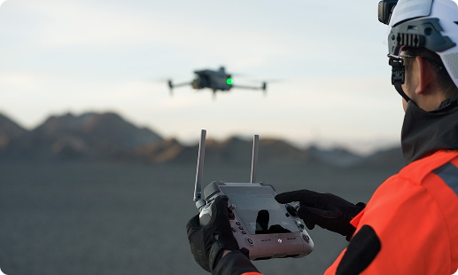
Aging assets, tight timelines, and safety stakes shape every drone for infrastructure projects in Nigeria. From bridge deck audits to port perimeter scans and highway corridor surveys, Gulfnet brings certified pilots, enterprise DJI fleets, NCAA-ready delivery, and engineering-grade data pipelines across Lagos, Abuja, and Port Harcourt.

Centimetre-grade RTK positioning for engineering-ready outputs

LiDAR scanning for dense 3D infrastructure models

Thermal imaging to flag hidden structural defects

Automated flight paths for repeatable inspection cycles

IP55-rated airframes for Nigeria's humid, dusty environments

55-minute flight endurance across long highway corridors

Dock-based autonomy for 24-hour asset surveillance
Secure data pipelines and GIS-ready deliverables
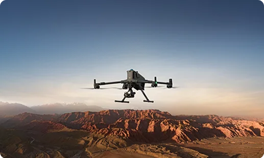
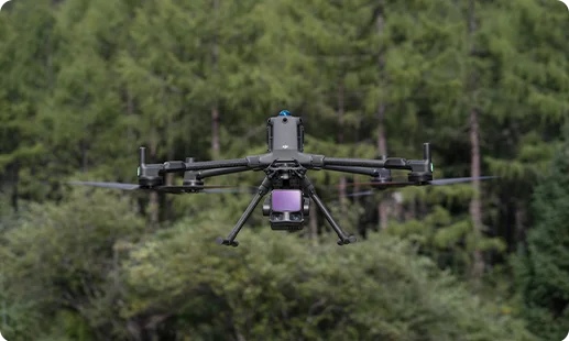
Our primary bridge inspection drone in Nigeria, built for long-range photogrammetry, LiDAR scanning, and thermal diagnostics across highways, bridges, tunnels, and dams.
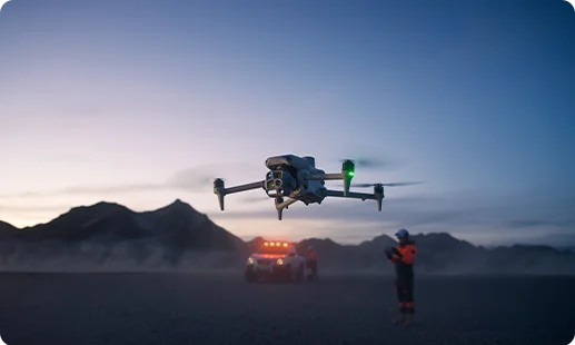
A nimble 3D mapping drone for infrastructure in Nigeria, built for traffic monitoring, roadway data capture, and quick-turn facade or elevated structure inspections.
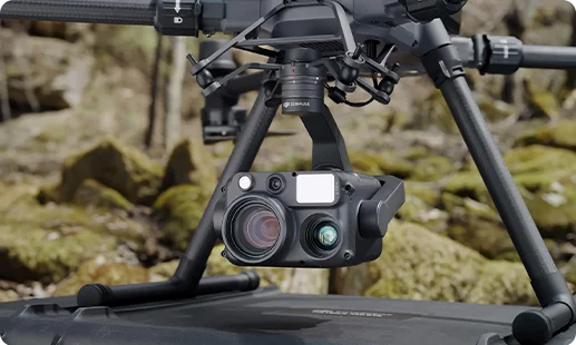
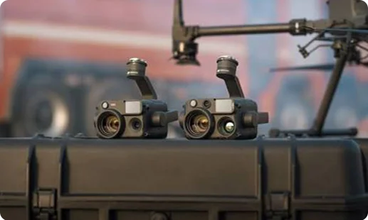
Quad-sensor payload combining wide, zoom, thermal, and laser rangefinder for crack detection, tunnel inspection, and overhead cable assessment.
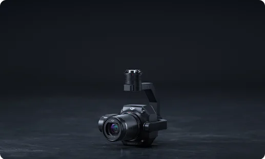
45MP full-frame photogrammetry sensor engineered for survey-grade orthomosaics, 3D scanning drone for infrastructure in Nigeria workflows, and corridor mapping.
Next-generation LiDAR module delivering dense point clouds for road survey drone in Nigeria projects and digital twin builds.
Built-in wide, medium tele, tele, and thermal cameras supporting fast urban traffic observation and compact infrastructure data capture missions.
Nigeria's road, rail, and bridge rebuild cycle is leaning on aerial data. Four shifts show why.

Highway inspection drone in Nigeria programs now cover hundreds of kilometres per week, replacing slow manual walkovers across Lagos-Ibadan and Abuja-Kaduna corridors.
Bridge inspection drone in Nigeria workflows cut rope access risk and let engineers assess soffits, piers, and bearings without closing traffic lanes.
NCAA RPAS compliance has matured, giving infrastructure owners a clear path to deploy enterprise-grade fleets for dam, railway, and port asset inspection.
3D mapping drone for infrastructure in Nigeria outputs now feed BIM, GIS, and digital twin platforms, speeding design decisions and tender submissions.
Share your bridge, highway, dam, railway, or airport infrastructure requirement. Our team will match the right Matrice 400 RTK or Matrice 4 Series setup to your Nigerian site.
For most Nigerian infrastructure programs, the DJI Matrice 400 RTK remains the strongest infrastructure inspection drone in Nigeria today. It delivers up to 55 minutes of flight time, centimetre-grade RTK positioning, and compatibility with Zenmuse H30T, P1, and L3 payloads. That mix handles bridge soffits, highway corridors, dam walls, and port facilities on one airframe. For lighter, rapid-response work our teams pair it with the DJI Matrice 4 Series. If you want to confirm the right fit for your asset class, contact Gulfnet and we will walk you through a scoped recommendation.
Gulfnet supports procurement, demos, and deployment of a bridge inspection drone in Nigeria from our Lagos presence. Reach out through our contact form with your bridge type, span, and inspection scope, and our team will schedule a site walkthrough or indoor demo of the DJI Matrice 400 RTK with Zenmuse H30T or P1 payload. We work with LASG contractors, concessionaires, and federal highway operators. Demo slots cover both the platform and the data pipeline, so your engineers see real deliverables, not just a flying unit. Specific demo timelines depend on current scheduling in Lagos and Port Harcourt.
Gulfnet is positioned as a specialist 3D mapping drone supplier for infrastructure in Nigeria, supporting consultants, concessionaires, and public agencies with survey-grade aerial data. Our Matrice 400 RTK pairs with the Zenmuse P1 photogrammetry sensor and the Zenmuse L3 LiDAR module to deliver dense point clouds, orthomosaics, and digital elevation models. These outputs plug directly into Civil 3D, Bentley, and BIM pipelines used by local engineering firms. We also act as a 3D scanning drone for infrastructure in Nigeria resource for digital twin projects. Contact us to review your site, resolution target, and preferred deliverable format.
For high-rise facade work across Lagos, Victoria Island, and Lekki, our standard facade inspection drone in Nigeria setup is the DJI Matrice 400 RTK with the Zenmuse H30T payload. Its quad-sensor array combines wide, zoom, thermal, and laser rangefinder data, which helps spot delamination, water ingress, and anchor fatigue on cladding and curtain walls. For low-rise and compact urban buildings, the DJI Matrice 4 Series handles rapid walkarounds with integrated wide and thermal cameras. If your target is a specific tower or hospitality property, reach out so we can confirm the right sensor stack for the inspection scope.
Gulfnet operates as an infrastructure drone dealer in Nigeria for enterprise and public sector clients. We supply, configure, and support DJI Enterprise platforms including the Matrice 400 RTK and the Matrice 4 Series, along with Zenmuse H30T, P1, L3, and compatible accessory kits. Beyond the hardware, our team handles NCAA registration guidance, pilot training, flight planning, and data workflow design. Clients in Abuja, Lagos, Port Harcourt, and Kano route their drone for infrastructure projects in Nigeria through us for exactly this reason. For a scoped procurement or deployment conversation, contact Gulfnet through our enquiry form.
Pricing for a tunnel inspection drone in Nigeria depends on the airframe, payload stack, lighting kit, and whether you need a confined-space variant with collision tolerance. For most road and rail tunnel work our teams deploy the DJI Matrice 400 RTK with the Zenmuse H30T, which gives you thermal, zoom, and laser rangefinder data in one flight. Final pricing varies with configuration, training, warranty, and support. For an accurate figure, share your tunnel length and inspection goals with Gulfnet and we will prepare a tailored quote. We prefer to size the tunnel inspection drone in Nigeria package to the actual mission.
Requesting a quote is straightforward. Visit the Gulfnet contact page, share your asset type (bridge, highway, dam, port, railway, tunnel, airport), inspection frequency, and preferred deliverable format, and our team will prepare a tailored proposal for your infrastructure inspection drone in Nigeria needs. We cover drone selection, payload matching, pilot training, NCAA documentation support, and data pipeline setup inside one quote. If you need a drone for large structure inspection in Nigeria such as cooling towers or stadium roofs, mention the structure dimensions so we can suggest the right flight plan. Final figures depend on configuration and scope.
For federal and state highway networks in Nigeria, our recommended highway inspection drone in Nigeria configuration is the DJI Matrice 400 RTK with the Zenmuse P1 for corridor photogrammetry and the Zenmuse L3 for LiDAR terrain capture. The platform covers long road corridors in a single sortie, with centimetre-grade RTK accuracy that feeds directly into pavement condition reports and asset registers. For traffic observation and quick incident response, Gulfnet pairs this with the DJI Matrice 4 Series. Whether you are managing the Lagos-Ibadan Expressway or a trunk road in the North, we can scope the right setup.
Gulfnet supplies and deploys dam inspection drone in Nigeria solutions for utilities, water boards, and hydropower operators including those working around Kainji, Shiroro, and Jebba reservoirs. Our standard configuration uses the DJI Matrice 400 RTK with Zenmuse H30T for thermal and visual seepage checks, plus the Zenmuse L3 for LiDAR scans of spillways and embankments. For below-waterline work on intake structures, we also integrate underwater units from the Gulfnet fleet. A fit-for-purpose dam inspection drone in Nigeria program covers both airside and submerged assets. Reach out through our enquiry form to scope a reservoir-specific plan.
Yes. Gulfnet is a sales and deployment partner for a railway inspection drone in Nigeria, supporting standard gauge, narrow gauge, and metro operators. The DJI Matrice 400 RTK with Zenmuse H30T handles overhead catenary thermal checks, track geometry visual sweeps, and tunnel portal inspections. For rolling stock yards and station monitoring, the DJI Matrice 4 Series provides faster deployment. A railway inspection drone in Nigeria program typically bundles the airframe, payload, pilot training, and software integration for your asset management system. For purchase or lease conversations, contact our team with your network length and operating region.
Airport infrastructure programs demand strict airside coordination and high-accuracy data. The Gulfnet airport infrastructure drone in Nigeria setup is built around the DJI Matrice 400 RTK with Zenmuse P1 and Zenmuse L3 payloads, which deliver survey-grade orthomosaics and LiDAR point clouds of runways, taxiways, aprons, and terminal roofs. For perimeter patrol and FOD scanning we add the DJI Matrice 4 Series. Flight approvals through NCAA and the specific aerodrome operator are coordinated upfront. Whether the asset is Murtala Muhammed International, Nnamdi Azikiwe, or a regional airstrip, our airport infrastructure drone in Nigeria workflow is tuned to aviation safety expectations.
For Lagos, Onne, Tin Can, and Calabar port operators, our recommended port inspection drone in Nigeria platform is the DJI Matrice 400 RTK with Zenmuse H30T. It handles crane structural checks, quay wall surveys, container stack audits, and thermal inspections of fuel and bunker lines. The Zenmuse P1 is added when the brief calls for a 3D model of the terminal footprint. For large assets, this is also our go-to drone for large structure inspection in Nigeria such as gantries and ship-to-shore cranes. Our port inspection drone in Nigeria deployments respect NIMASA and port authority rules.
The most capable road survey drone in Nigeria setup from Gulfnet is the DJI Matrice 400 RTK with Zenmuse P1 for photogrammetry and Zenmuse L3 for LiDAR. The P1 gives you orthomosaics for pavement condition and right-of-way mapping, while the L3 delivers dense point clouds for terrain, cross-sections, and asset extraction. Deliverables plug into Civil 3D, Bentley, and typical Nigerian consultant stacks. For traffic observation on top of survey work, we add the DJI Matrice 4 Series. Our road survey drone in Nigeria deployments support highway concessionaires, state ministries, and consulting engineers across the country.
