


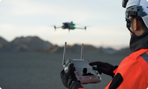
Infrastructure projects across Tanzania face tight delivery schedules, scattered site locations, and difficult inspection access on tall or remote assets. Gulfnet delivers enterprise grade drones and skilled pilots that shorten survey cycles, improve data accuracy, and support fully TCAA compliant operations for infrastructure owners and contractors operating nationwide.

Centimetre grade RTK positioning for engineering survey outputs

Long range thermal imaging for crack and defect detection

LiDAR scanning for dense 3D infrastructure modeling

Full frame photogrammetry for orthomosaic and corridor outputs

IP55 rated flight for monsoon and dusty conditions

Automated flight routes for recurring inspection missions

Live video telemetry to on site project engineers
Collision aware obstacle sensing near complex structures
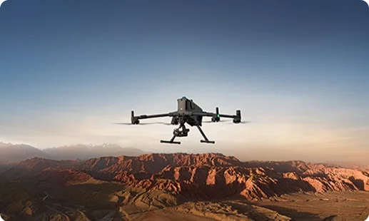
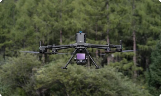
Flagship RTK platform engineered for bridge, highway, and large structure inspection across Tanzania with multi payload swapping and long flight endurance for extensive corridors.
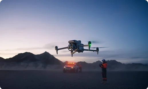
Lightweight integrated sensor platform ideal for quick response infrastructure inspection, traffic monitoring, and site documentation on constrained urban projects across Tanzanian cities.
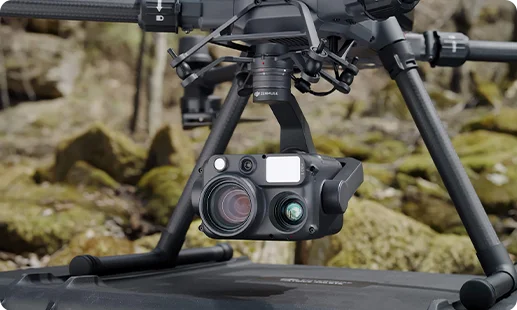
Delivers thermal imaging and long range zoom for safe stand off bridge, tunnel, and dam inspection missions.
Full frame photogrammetry sensor producing survey grade orthomosaics for highway, railway, and road corridor mapping.
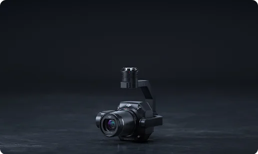
Advanced LiDAR module capturing dense 3D point clouds for infrastructure modeling, terrain analysis, and digital twin creation.
Bundled wide, tele, zoom, and thermal cameras for compact aerial documentation and fast site inspection missions.


Tanzania's infrastructure build out demands faster inspection cycles and tighter data loops, and aerial robotics meet that moment.

Remote drone inspection reaches rough terrain across the Southern Highlands, Lake Victoria basin, and coastal corridors without rope access or scaffolding.
Project teams get survey grade 3D data and progress reports in hours, replacing weeks of manual field measurement and photographic logging.
TCAA RPAS compliance and licensed pilot deployment are moving enterprise adoption forward across Tanzanian ports, airports, and road authorities.
Thermal and LiDAR payloads expose hidden defects, structural fatigue, and alignment issues long before they become costly repair incidents.
Tell us about your bridge, highway, or facade inspection scope. Our team will build a drone deployment plan around the Matrice 400 RTK and the payloads your Tanzanian project needs.
The best infrastructure inspection drone in Tanzania depends on asset type and scope. For a drone for large structure inspection in Tanzania, including bridge decks and tunnel work, Gulfnet recommends the DJI Matrice 400 RTK paired with the Zenmuse H30T thermal zoom payload. For compact urban missions and traffic data collection, the DJI Matrice 4 Series offers quick deployment with integrated multi camera imaging. As a drone for large structure inspection in Tanzania, our chosen platform matches each project’s requirements under TCAA RPAS compliance. For a tailored recommendation across your site network, speak with the Gulfnet drone specialists.
Gulfnet supplies the DJI Matrice 400 RTK as a bridge inspection drone in Tanzania, serving project teams in Dar es Salaam, Dodoma, Arusha, and Mwanza. The platform pairs with the Zenmuse H30T for thermal and long range visual inspection, and with the Zenmuse L3 LiDAR for structural scanning and 3D modeling of deck, pier, and abutment surfaces. We handle procurement, pilot training, and TCAA deployment paperwork under one engagement. To discuss stock, delivery, and local onboarding for your Dar es Salaam project, please contact the Gulfnet team through our enquiry form.
Gulfnet is a specialist supplier of the 3D mapping drone for infrastructure in Tanzania. Our core platform, the DJI Matrice 400 RTK, carries the Zenmuse L3 LiDAR module and the Zenmuse P1 full frame photogrammetry sensor, producing survey grade point clouds and orthomosaic outputs. The same setup serves as a 3D scanning drone for infrastructure in Tanzania on bridge documentation, highway alignment, and digital twin projects across road, rail, and port assets. We also deliver trained operators, flight planning, and post processing workflows. For a scoped 3D mapping drone for infrastructure in Tanzania or 3D scanning drone for infrastructure in Tanzania engagement, reach out to our team.
For a facade inspection drone in Tanzania, Gulfnet deploys the DJI Matrice 400 RTK fitted with the Zenmuse H30T thermal and zoom payload. This combination allows safe stand off inspection of high rise facades, cladding systems, and glazing across Dar es Salaam commercial buildings. Thermal data reveals heat loss, moisture intrusion, and insulation gaps, while high zoom imagery supports crack and joint assessment. The DJI Matrice 4 Series is also used on tighter urban sites where rapid deployment matters. Gulfnet can scope the right facade inspection drone in Tanzania for your building asset portfolio.
Yes. Gulfnet is a professional infrastructure drone dealer in Tanzania, supplying the DJI Matrice 400 RTK and the DJI Matrice 4 Series along with the Zenmuse H30T, Zenmuse P1, and Zenmuse L3 payloads. Beyond hardware supply, we deliver pilot training, operations consulting, TCAA compliance support, and inspection data workflows for infrastructure owners and EPC contractors. Clients across road authorities, rail operators, port authorities, and construction firms work with us for both single project deployments and fleet level programs. Contact the Gulfnet Tanzania team to discuss catalog availability and project scoping.
Pricing for a tunnel inspection drone in Tanzania depends on platform choice, payload mix, training package, and after sales support. Gulfnet recommends the DJI Matrice 400 RTK with the Zenmuse H30T thermal payload for most tunnel inspection missions, though specific tunnel geometry may call for additional sensors. We do not publish fixed public prices because every scope varies, including flight count, data processing, and licensing requirements. For an accurate quotation on a tunnel inspection drone in Tanzania, covering hardware, pilot training, and TCAA deployment support, please contact Gulfnet with your project location and inspection scope.
You can request a quote for a drone for infrastructure projects in Tanzania by using the enquiry form on the Gulfnet website or by contacting our Tanzania consultation line. Share your project location, asset type, required outputs such as thermal inspection or 3D mapping, and the number of inspections expected. Our team will respond with a drone and payload recommendation, deployment plan, and commercial proposal. We cover supply, deployment, pilot training, and TCAA compliance support in one scope. Our aim is to give you a complete drone for infrastructure projects in Tanzania package with no hidden steps.
The DJI Matrice 400 RTK is Gulfnet’s top highway inspection drone in Tanzania. Paired with the Zenmuse P1 photogrammetry sensor, it produces survey grade orthomosaics of road corridors for pavement condition assessment and asset mapping. When thermal condition data is required, the Zenmuse H30T delivers heat signature inspection of expansion joints and surfacing. As a highway inspection drone in Tanzania, the platform also serves major corridors linking Dar es Salaam, Dodoma, and Mwanza. Flight endurance of up to 59 minutes supports long corridor coverage in a single mission plan. Contact Gulfnet for a highway inspection scope.
To book a demo of a bridge inspection drone in Tanzania, submit a request through the Gulfnet contact form or write to our Tanzania team with your project details. Demos are typically run on your actual site or at a nearby test location in Dar es Salaam, so you can see the DJI Matrice 400 RTK platform, the Zenmuse H30T, and the Zenmuse L3 LiDAR in realistic conditions. We walk through flight planning, payload swapping, data capture, and inspection output review during the session. Scheduling timelines depend on pilot availability and site clearance requirements.
Gulfnet supplies the dam inspection drone in Tanzania required for hydroelectric and water storage asset assessment, including deployments supporting Mtera, Nyumba ya Mungu, and Kidatu facilities. Our standard setup is the DJI Matrice 400 RTK with the Zenmuse H30T for thermal assessment of concrete seepage and face temperature mapping, and the Zenmuse L3 LiDAR for structural scanning of spillways and crest geometry. The platform’s IP55 rating supports flight in humid dam environments. Flight operations are coordinated under TCAA RPAS rules. To scope a dam inspection drone in Tanzania engagement, contact our Gulfnet team.
Yes, Gulfnet offers the railway inspection drone in Tanzania through the DJI Matrice 400 RTK platform. Rail operators across the SGR corridor and the TAZARA line use the railway inspection drone in Tanzania for ballast condition assessment, bridge and culvert inspection, and corridor mapping. The Zenmuse P1 captures high resolution imagery for track asset documentation, while the Zenmuse L3 handles LiDAR scanning of embankments and cuttings. The compact DJI Matrice 4 Series supports faster urban station inspections where ground access is limited. Contact our Gulfnet Tanzania team to scope rail inspection drone supply and deployment for your corridor.
Gulfnet uses the DJI Matrice 400 RTK as the primary airport infrastructure drone in Tanzania, including airport survey work in Dar es Salaam. The Zenmuse P1 photogrammetry payload captures survey grade imagery for pavement condition, runway marking, and apron asset mapping, while the Zenmuse H30T offers thermal inspection of lighting systems and surface anomalies. All airport airspace work is coordinated under TCAA rules and in agreement with the Tanzania Airports Authority. As an airport infrastructure drone in Tanzania deployment partner, Gulfnet scopes each project with safety planning first. Reach out to our team to plan your airport mission.
For a port inspection drone in Tanzania, Gulfnet recommends the DJI Matrice 400 RTK with the Zenmuse H30T thermal zoom payload and the Zenmuse L3 LiDAR. Deployments across the Port of Dar es Salaam, Tanga, and Mtwara cover quay wall inspection, container yard mapping, and crane structural assessment. The platform’s IP55 weather resistance suits coastal humidity and salt spray exposure. The DJI Matrice 4 Series supports faster asset documentation on confined terminals. All port inspection drone in Tanzania work runs under TCAA compliant flight planning. Contact Gulfnet to scope a port program for your terminal.
The DJI Matrice 400 RTK is Gulfnet’s preferred road survey drone in Tanzania, paired with the Zenmuse P1 for photogrammetry and the Zenmuse L3 for LiDAR terrain capture. These produce orthomosaics, digital surface models, and corridor point clouds for alignment design, pavement condition reporting, and asset inventory. The DJI Matrice 4 Series serves as a lightweight road survey drone in Tanzania for shorter surveys on urban roads in Dar es Salaam, Dodoma, and Arusha. Flight endurance supports long rural corridors in a single sortie. For a detailed road survey program, contact our Gulfnet Tanzania team.
