


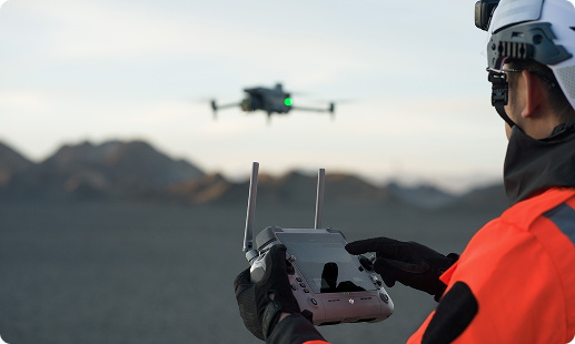
Across Zimbabwe, ageing bridges, highway rehabilitation drives, and dam safety audits are pushing manual inspection methods past their safe limits. Gulfnet’s drone for large structure inspection in Zimbabwe gives engineering teams faster site access, safer workflows, and survey-grade data they can act on across projects nationwide.

Centimetre-accurate RTK positioning for bridge inspection drone in Zimbabwe

Thermal and visual imaging for tunnel inspection drone in Zimbabwe

LiDAR scanning for 3D scanning drone for infrastructure in Zimbabwe

IP55 weather protection for dam inspection drone in Zimbabwe

59-minute endurance per charge for extended surveys

40-kilometre range across Zimbabwe sites and corridors

Automated missions for repeatable road survey drone in Zimbabwe
Obstacle sensing for facade inspection drone in Zimbabwe operations
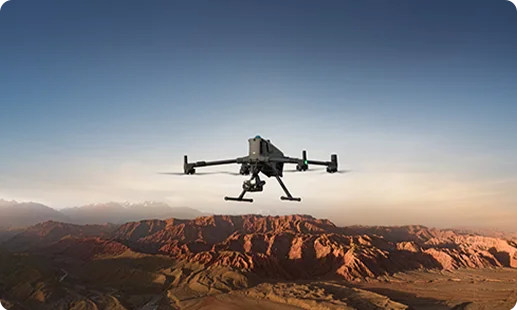
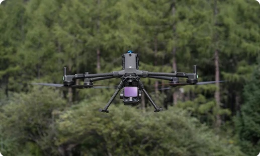
The DJI Matrice 400 RTK anchors our drone for large structure inspection in Zimbabwe, built for long-endurance bridge, dam, and highway missions.
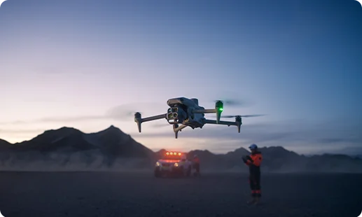
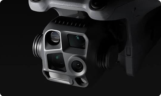
The DJI Matrice 4 Series is a compact highway inspection drone in Zimbabwe setup, delivering rapid-deployment urban monitoring and routine infrastructure site audits.
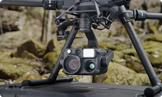
Thermal and 400mm zoom payload for bridge, dam, and port inspection drone in Zimbabwe stand-off workflows.
Full-frame photogrammetry camera for engineering orthomosaics, 3D mapping drone for infrastructure in Zimbabwe outputs, and facade documentation at centimetre precision.
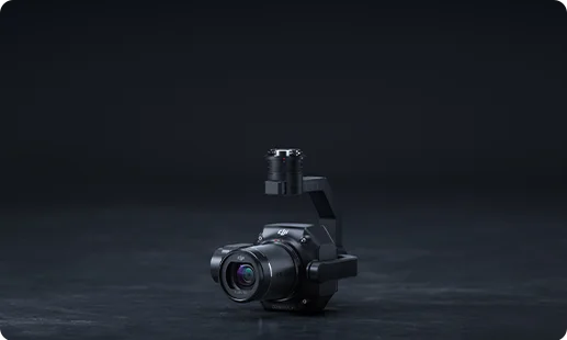
High-density LiDAR for 3D scanning drone for infrastructure in Zimbabwe, railway corridor surveys, and terrain modelling across linear projects.
Four-camera package on the Matrice 4 Series captures context, zoom, and heat for airport infrastructure drone in Zimbabwe surveys.
Zimbabwe's infrastructure revival depends on faster surveys and sharper data. Here is how drones are rewriting four workflows.

Rope access and scaffolding on Kariba Dam, Hwange bridges, and Eastern Highlands viaducts are being replaced by safer drone-based inspections.
Single-pilot missions compress week-long highway and railway inspection drone in Zimbabwe surveys into a few operational hours per corridor.
Centimetre-accurate 3D mapping drone for infrastructure in Zimbabwe outputs give ZINARA, NRZ, and ZINWA engineers decision-ready evidence instantly.
CAAZ RPAS approvals are opening airport infrastructure drone in Zimbabwe deployments and dry port inspection work at Beitbridge and Mutare.
Share your project and we will match the right drone for infrastructure projects in Zimbabwe, the right payload, and a CAAZ-ready deployment plan built around your site.
For most large-scale projects, the DJI Matrice 400 RTK is our top recommendation as an infrastructure inspection drone in Zimbabwe. It offers 59 minutes of flight time, 40-kilometre transmission range, and IP55 weather protection, which suits Harare, Bulawayo, and remote site conditions. Paired with Zenmuse H30T, P1, or L3 payloads, it covers thermal inspection, high-resolution photogrammetry, and LiDAR mapping. For compact, rapid-deployment work we also deploy the DJI Matrice 4 Series. The right pick depends on structure type, access, and output format. Reach out to Gulfnet for a scoped recommendation tied to your specific project.
Gulfnet is a direct supplier of the DJI Matrice 400 RTK, our recommended bridge inspection drone configuration. We fulfil orders into Harare, Bulawayo, and project sites nationwide, and bundle the drone with the right sensor stack for your bridge type. For stand-off thermal and visual inspection we pair it with the Zenmuse H30T. For high-resolution structural documentation and crack mapping, we add the Zenmuse P1 photogrammetry payload. Beyond the hardware, we support CAAZ registration guidance, pilot training, and workflow setup. To check current availability or lead times for Harare delivery, contact our team through the enquiry form on this page.
Gulfnet supplies the DJI Matrice 400 RTK with the Zenmuse P1 and Zenmuse L3 payloads, our complete 3D mapping drone for infrastructure in Zimbabwe setup. The P1 handles photogrammetry for engineering-grade orthomosaics and digital twins. The L3 adds high-density LiDAR scanning for terrain models, corridor mapping, and structural point clouds. The combination suits road corridors, bridge decks, dam faces, and large civil footprints. Outputs integrate with common GIS and BIM workflows used by Zimbabwean engineering consultancies. For a scoped supply package covering drone, sensors, training, and support across Harare and nationwide sites, please contact Gulfnet directly through this page.
For a facade inspection drone in Zimbabwe deployment, Gulfnet uses the DJI Matrice 400 RTK with the Zenmuse P1 full-frame photogrammetry payload. This combination captures crack patterns, cladding defects, water staining, and sealant failures at centimetre precision, without scaffolding or rope access. For low-visibility or hidden-defect scanning, we add the Zenmuse H30T thermal sensor to reveal moisture ingress and insulation gaps. The platform suits high-rise facades in Harare, Bulawayo CBD, and institutional buildings. Flight planning is adjusted for urban wind and GPS conditions. For a facade-specific scope and demo, reach out to Gulfnet via our contact form.
Gulfnet operates as a specialist enterprise drone, robotics, and aerial survey partner for Zimbabwean infrastructure clients. We are not a generic reseller. Our focus is matching the right airframe and payload to specific project needs, so clients avoid buying hardware that underperforms on their site. For infrastructure work we deploy DJI enterprise-grade platforms including the Matrice 400 RTK and Matrice 4 Series, with compatible Zenmuse payloads. We support procurement, CAAZ registration guidance, pilot training, and post-sale service. To evaluate whether we are the right fit for your project, contact our team through the enquiry form on this page.
Pricing for a tunnel inspection drone in Zimbabwe varies with the airframe, payload stack, lighting setup, training, and support package. The DJI Matrice 400 RTK with a Zenmuse H30T is a common configuration for tunnel work because it combines thermal, visual zoom, and laser rangefinder data in GPS-denied environments. Final cost depends on whether you need photogrammetry, LiDAR, confined-space lighting, or additional batteries for longer tunnel runs. We prefer to quote only after we understand tunnel length, access conditions, and the output format you need. Please share your project details with Gulfnet and our team will prepare a tailored quote.
Submit your project brief through the enquiry form on this page or email our Zimbabwe team through the contact details on the Gulfnet website. Share the structure type, project location, inspection frequency, and preferred output format such as orthomosaic, 3D point cloud, thermal map, or crack report. From there, we recommend the right drone for infrastructure projects in Zimbabwe, select compatible payloads, and prepare a scoped quote covering hardware, training, and support. We can also factor in CAAZ permit guidance where needed. Expect a response from a specialist, not a generic sales reply, so your scope is understood accurately.
For a highway inspection drone in Zimbabwe, Gulfnet recommends the DJI Matrice 400 RTK with the Zenmuse P1 for photogrammetric road corridor mapping, or the Zenmuse L3 for LiDAR-based pavement and asset extraction. For traffic monitoring and incident response along the Harare to Bulawayo and Beitbridge corridors, the DJI Matrice 4 Series offers rapid deployment with integrated wide, tele, and thermal cameras. The 59-minute endurance and 40-kilometre range of the Matrice 400 RTK suit long highway stretches between service stops. For a site-specific recommendation covering your target corridor and output format, reach out to our Gulfnet Zimbabwe team.
Yes, Gulfnet can arrange demos of our recommended bridge inspection drone in Zimbabwe setup, subject to project scope, airframe availability, and CAAZ clearance for the chosen demonstration site. Demos typically focus on the DJI Matrice 400 RTK paired with the Zenmuse H30T thermal payload or the Zenmuse P1 photogrammetry payload, since these are the configurations most relevant to bridge structural inspection. Demonstrations can be scheduled in or around Harare, or at your project site where feasible. To book a demo, submit a request through our contact form with your preferred date, location, and the bridge type you want to assess.
For a dam inspection drone in Zimbabwe, Gulfnet recommends the DJI Matrice 400 RTK with mission-matched payloads. The Zenmuse H30T handles thermal scanning of dam faces and spillway sections, surfacing seepage, cold joints, and leakage patterns. The Zenmuse P1 captures high-resolution images for photogrammetric reconstruction of the dam structure. The Zenmuse L3 adds LiDAR point clouds for displacement monitoring and surrounding terrain modelling. The platform suits large structures such as Kariba, Mazvikadei, and Osborne Dam. For a scoped inspection package covering drone, sensors, pilot training, and CAAZ coordination, please contact the Gulfnet team through this page.
Yes. For a railway inspection drone in Zimbabwe, Gulfnet supplies the DJI Matrice 400 RTK with Zenmuse P1 and Zenmuse L3 payloads for corridor photogrammetry and LiDAR scanning. This combination suits track geometry assessment, embankment stability, bridge and culvert inspection, and vegetation encroachment surveys along NRZ routes. For rapid aerial surveillance of yards, sidings, or incident response, the DJI Matrice 4 Series is an appropriate secondary platform. Supply includes hardware, pilot training, and setup guidance. Final specifications are matched to your corridor length and inspection cycle. Reach out to Gulfnet through the contact form on this page for a tailored supply quote.
For an airport infrastructure drone in Zimbabwe deployment, we recommend the DJI Matrice 400 RTK with the Zenmuse P1 and Zenmuse L3 payloads for pavement condition surveys, runway profiling, and apron 3D mapping. The DJI Matrice 4 Series supports perimeter checks, obstacle surveys, and routine ramp monitoring. Operating around Robert Gabriel Mugabe International Airport, Victoria Falls Airport, and Joshua Mqabuko Nkomo Airport requires strict coordination with the airport operator and CAAZ, which we support through our deployment planning. Final configuration depends on survey objective, airside access windows, and reporting format. Contact Gulfnet with your airport project brief for a scoped recommendation.
Zimbabwe is landlocked, so port inspection drone in Zimbabwe work focuses on dry ports and inland terminals such as Beitbridge and Mutare, as well as Lake Kariba inland port facilities. Gulfnet deploys the DJI Matrice 400 RTK with the Zenmuse P1 for yard mapping and the Zenmuse L3 for stockpile and infrastructure LiDAR scanning. For routine security and perimeter monitoring, the DJI Matrice 4 Series offers rapid deployment with thermal and zoom cameras. We tailor the configuration to your facility layout and reporting needs. Share your site brief with Gulfnet to receive a scoped recommendation for your inland port operation.
Gulfnet supplies the DJI Matrice 400 RTK as our primary road survey drone in Zimbabwe, paired with the Zenmuse P1 for engineering-grade orthomosaic mapping and the Zenmuse L3 for LiDAR-based terrain and asset extraction. This covers highway corridor surveys, feeder road rehabilitation, and new alignment studies for ZINARA and private contractors. The 59-minute endurance and 40-kilometre range reduce the number of take-off points required on long linear surveys. For urban road studies or short-cycle traffic monitoring, the DJI Matrice 4 Series is an effective secondary option. Reach out to Gulfnet for a road survey scope tuned to your project.
