



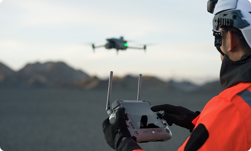
Survey teams across Ghana face tight project deadlines, dense bush cover, and growing cadastral backlogs. Traditional ground methods struggle to keep pace with modern engineering demands. Drones solve this by capturing accurate aerial data in a fraction of the time. Gulfnet supplies GCAA-compliant UAVs built for Ghana field conditions.

RTK-enabled positioning for cadastral and corridor work

LiDAR drone for surveying in Ghana forest canopies

Full-frame photogrammetry capture for orthomosaic mapping

3D mapping drone in Ghana for terrain modelling

GIS mapping drone in Ghana ready spatial outputs

Topographic survey drone in Ghana for contour generation

IP55-rated airframes for harmattan and coastal fieldwork
Drone for site survey in Ghana project corridors
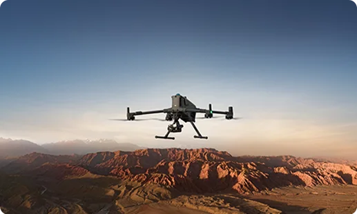
The DJI Matrice 400 RTK is the primary UAV for surveying in Ghana LiDAR, topographic, volumetric, and engineering-grade mapping workflows across cadastral and mining sites.
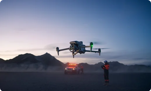
The DJI Matrice 4 Series is a compact 3D mapping drone in Ghana suited to rapid site documentation, visual inspection, and recurring survey missions on small to medium sites.
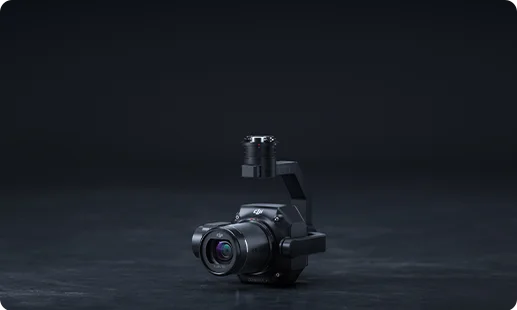
A full-frame Zenmuse P1 photogrammetry camera in Ghana delivers precise orthomosaics for cadastral mapping, topographic surveys, and volumetric measurement workflows.
The Zenmuse L3 LiDAR payload in Ghana supports high-density point cloud generation, vegetation penetration, and engineering-grade classification for terrain modelling.
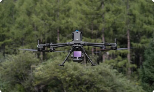
Reliable LiDAR surveying payload used for corridor mapping, topographic surveys, and mining survey drone in Ghana digital terrain model workflows.
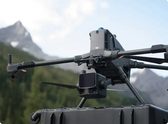
Onboard DJI Matrice 4 Series camera system for rapid site documentation, visual inspection, and recurring aerial mapping across Ghana projects.
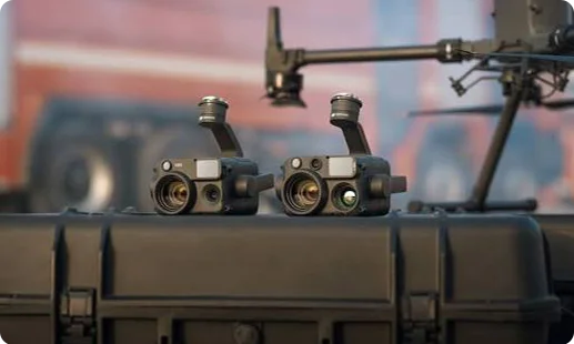
Ghana is modernising cadastral records, mining compliance, and road corridors, with drones becoming the primary production tool.

Dense forest cover across Volta and Western Region is mapped from above, replacing weeks of ground survey crew work.
Cadastral survey drone in Ghana workflows cut parcel capture time at the Lands Commission from months to days with GCAA-approved missions.
Mining operators across Ashanti and Tarkwa run weekly stockpile volumes using a drone for topography in Ghana without exposing crews to pit hazards.
GRIDCo transmission lines, VRA reservoirs, and road projects now get GIS-ready data through aerial survey and mapping drone in Ghana workflows.
From Zenmuse P1 photogrammetry to Zenmuse L3 LiDAR scanning, we match the right UAV to your cadastral, mining, or topographic requirement.
For most Ghana projects, the DJI Matrice 400 RTK paired with the Zenmuse L3 is the strongest LiDAR drone for surveying in Ghana today. It penetrates dense canopy across Volta Region and the Western belt, supports high-density point cloud generation, and holds flight accuracy in field conditions. The Zenmuse L2 is a lighter LiDAR alternative for corridor mapping and topographic work. The right choice depends on project scale, canopy density, and whether you need a drone for topography in Ghana corridor work or wider cadastral capture. Our team at Gulfnet can match the right LiDAR configuration after reviewing your site conditions.
Buying a 3D mapping drone in Accra through Gulfnet is a guided process. You share your project profile, we recommend a suitable mapping drone in Ghana configuration from the DJI Matrice lineup, and we arrange delivery, GCAA registration guidance, and operator onboarding. Most Accra-based clients opt for the DJI Matrice 4 Series when they need portability, or the Matrice 400 RTK for high-accuracy engineering projects. Payment, warranty, and after-sales support are handled directly by our Ghana team. Reach out through our contact form at Gulfnet and a specialist will walk you through next steps.
Gulfnet operates as a specialised enterprise drone supplier in Ghana, focused on surveying, mining, infrastructure, and energy clients. We supply the DJI Matrice platform and Zenmuse survey payloads mapped to each project. Our team supports clients across Accra, Kumasi, Takoradi, Tamale, and Sunyani, including procurement advisory, GCAA-aligned setup, and a working drone for site survey in Ghana rollouts. Unlike general electronics resellers, we focus only on enterprise aerial systems, so each client gets a tailored recommendation. For a shortlist of suitable platforms for your use case, contact our Ghana team at Gulfnet.
The DJI Matrice 400 RTK with the Zenmuse P1 is the typical pick for a GIS mapping drone in Ghana workflow in Accra. It captures high-resolution geo-tagged imagery suitable for orthomosaic, terrain, and 3D mapping outputs that feed into standard GIS platforms. Where vegetation blocks visibility, the Zenmuse L3 LiDAR is added for ground model recovery. The Matrice 4 Series handles smaller urban GIS tasks across Accra Metropolitan Assembly projects. Each configuration is scoped to the client requirement, so contact our team at Gulfnet for a sensor and platform recommendation that fits your GIS pipeline.
LiDAR drone pricing in Accra depends on the airframe, payload, software stack, and support package you need. The Matrice 400 RTK with the Zenmuse L3 sits in a different price bracket than the same airframe with the Zenmuse L2. Freight, GCAA documentation support, operator training, and base station accessories also factor in. We do not publish fixed public pricing because enterprise survey packages are quoted per project. For a current Ghana price indication, share your requirement with our team at Gulfnet and we will return a scoped quote tailored to your project volume.
You can request a quote for a surveying drone in Ghana directly through the Gulfnet contact form. Share your target use case, project location, expected flight duration, and the sensor type you have in mind, whether photogrammetry, LiDAR, or integrated camera capture. Our team then returns a configuration proposal, pricing, and support options. Quotes typically include the drone, selected payload, batteries, base station, training, and after-sales support. We quote individually since Ghana projects vary widely across mining, cadastral, infrastructure, and utilities. Reach out and a specialist from Gulfnet will respond within standard business hours.
The DJI Matrice 400 RTK is the leading land survey drone in Ghana for most cadastral, boundary, and large-area projects. It offers up to 59 minute flight time, 40 km range, IP55 weather rating, and support for the Zenmuse P1 full-frame camera plus Zenmuse L3 and L2 LiDAR payloads. For lighter operations and faster deployment, the Matrice 4 Series is a strong secondary pick with 49 minute flight time and 25 km range. The best fit depends on acreage, canopy density, and accuracy specifications. Share your land survey drone in Ghana scope with Gulfnet and we will match you to the right configuration.
Yes. Gulfnet offers scheduled demonstrations of our DJI mapping drone in Ghana portfolio for qualified enterprise clients in Accra. During the session, our pilots walk through flight planning, payload capture, and post-processing on real site data. Demos usually cover the Matrice 400 RTK and Matrice 4 Series, along with the Zenmuse P1 and the L-series LiDAR units confirmed in our Ghana lineup. To book, send a short message through our contact form noting your industry and preferred location. Lead times vary based on team availability, so reach out early to secure a convenient Accra slot.
You can buy a photogrammetry drone in Ghana through Gulfnet, with the DJI Matrice 400 RTK plus Zenmuse P1 as the standard enterprise option. The combination is positioned for engineering-grade orthomosaics, cadastral mapping, topographic surveys, and volumetric measurement. For lighter photogrammetry work, the DJI Matrice 4 Series paired with the Zenmuse P1 or the integrated camera system is a practical alternative. We handle procurement, delivery, GCAA onboarding support, and operator training from our regional team. For current configurations and availability, contact Gulfnet directly for an updated note from our Ghana desk.
For mining projects feeding into Accra operations or regional sites, the DJI Matrice 400 RTK with Zenmuse L3 is a reliable mining survey drone in Ghana setup. The LiDAR payload captures pit, bench, and stockpile geometry across Ashanti and Tarkwa sites. For weekly volumetric runs, pairing the airframe with the Zenmuse P1 adds high-resolution orthomosaic and cut-and-fill output. The Matrice 4 Series supports smaller sites and recurring documentation runs. Our team at Gulfnet can scope which combination fits your mining cycle. Reach out with your pit profile and we will advise accordingly.
Gulfnet is one of the specialist cadastral survey drone in Ghana dealers serving licensed surveyors and development authorities. We supply the DJI Matrice 400 RTK with the Zenmuse P1 for high-accuracy parcel capture, aligned to Lands Commission documentation requirements. Our team supports project scoping, GCAA registration, pilot training, and processing-software recommendations. Clients range from independent surveyors in Kumasi to larger consultancies working on state land digitisation. If you handle cadastral work in any Ghana region, contact our Gulfnet team for a configuration proposal and demo availability.
The DJI Matrice 400 RTK with Zenmuse P1 is the most common topographic survey drone in Ghana for engineering and road projects. It is positioned by the manufacturer for contour generation, terrain analysis, and engineering-grade topographic mapping. For vegetation-heavy sites, the Zenmuse L3 LiDAR is added. Many clients also use the Matrice 4 Series as a lighter aerial survey and mapping drone in Ghana for small sites and site revisits. Choice depends on terrain, canopy, and required deliverable formats. Share your topographic brief with Gulfnet and we will recommend the right pairing.
Gulfnet supplies both the Zenmuse L3 LiDAR payload in Ghana and the Zenmuse P1 photogrammetry camera in Ghana as part of enterprise survey packages. Both integrate with the DJI Matrice 400 RTK, and the P1 is also supported on the Matrice 4 Series ecosystem used in our Ghana lineup. Pricing varies by whether the payload is standalone or bundled with the airframe, software, and training. We do not list public pricing because enterprise packages are quoted per client. Submit your requirement through our contact form and the Gulfnet team will send over a current configuration quote.
