



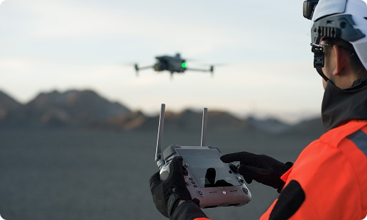
Across Kenya, survey teams face tight deadlines on road corridors in the Rift Valley, cadastral updates around Nairobi, and stockpile reports at mining sites. Traditional ground methods often cannot keep pace with that scale. Gulfnet steps in with a specialist drone fleet, trained pilots, and in-house data processing to close the gap efficiently.

Centimetre-accurate RTK for cadastral survey drone in Kenya projects

High-density LiDAR drone for surveying in Kenya forest cover

Full-frame photogrammetry drone in Kenya for orthomosaic generation

Volumetric measurement across stockpiles for mining survey drone in Kenya

Automated flight for repeatable UAV for surveying in Kenya missions

GIS mapping drone in Kenya outputs for standard GIS stacks

Rapid drone for site survey in Kenya across 40km range
IP55 operation for aerial survey and mapping drone in Kenya
The DJI Matrice 400 RTK carries Zenmuse L3, L2, and P1 payloads for topographic survey drone in Kenya workflows across pipelines, roads, and vegetated terrain.
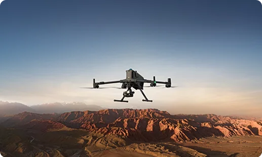
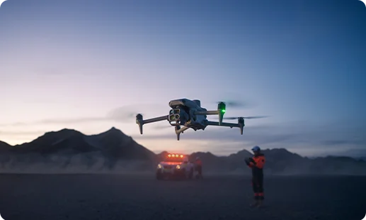
The DJI Matrice 4 Series supports photogrammetry drone in Kenya tasks with integrated wide, tele, and thermal sensors for small and mid-scale survey jobs.
Deployed as the Zenmuse P1 photogrammetry camera in Kenya for orthomosaics, DEMs, and dense 3D mapping drone in Kenya outputs.
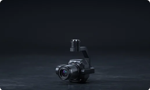
Deployed as the Zenmuse L3 LiDAR payload in Kenya for high-density point clouds, canopy penetration, and classification-ready terrain models.
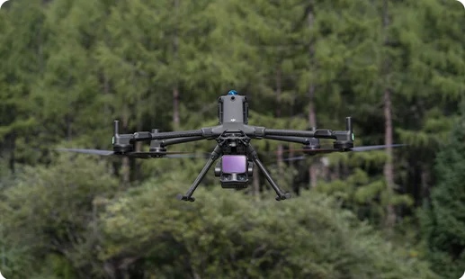
Mid-range LiDAR for corridor mapping and drone for topography in Kenya projects across Rift Valley and coastal zones.
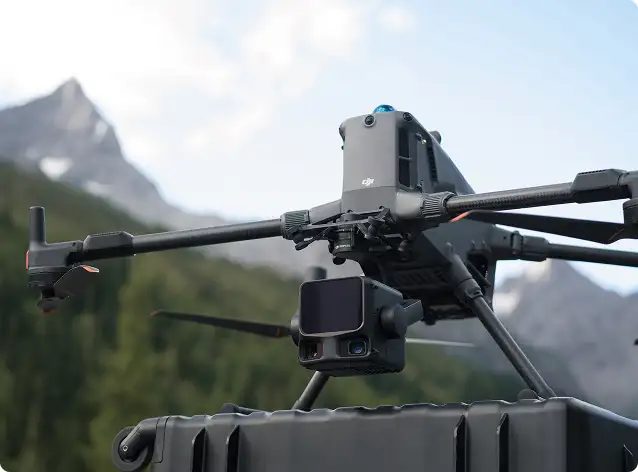
Wide, tele, and thermal sensors in one head for rapid site survey, visual mapping, and documentation runs.
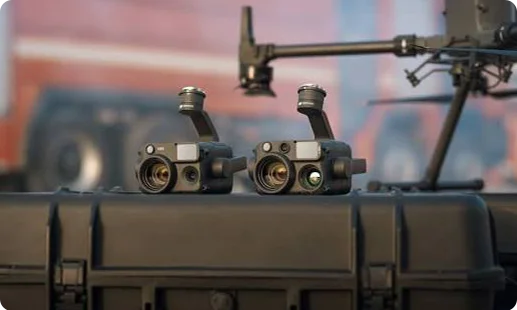
Infrastructure, land titling, and mining pipelines push Kenya survey teams toward faster aerial workflows. Four shifts matter most.

Access to Rift Valley slopes, forested blocks, and insecure corridors improves with aerial survey and mapping drone in Kenya deployments.
Ground survey crews once took weeks on LAPSSET or SGR corridors; a drone for site survey in Kenya covers the same area in days.
KCAA RPAS licensing and NEMA environmental reporting become easier to meet with repeatable, timestamped output from a land survey drone in Kenya.
Mining survey drone in Kenya operations at Kwale titanium sands and Kakamega gold belts now return stockpile numbers in hours.
Tell us the site and the accuracy target and we will deploy the right DJI mapping drone in Kenya, paired with the correct Zenmuse payload, and deliver survey-ready data.
At Gulfnet, our standard LiDAR drone for surveying in Kenya is the DJI Matrice 400 RTK paired with the Zenmuse L3 or Zenmuse L2 payload. The L3 is suited to high-density point cloud generation, canopy penetration in Rift Valley forests, and classification-grade terrain modelling. The L2 handles corridor mapping, DTM creation, and recurring topographic survey work across KeNHA and SGR assets. Selection depends on point density targets, canopy conditions, and project deliverables. Share your scope and we will advise which configuration fits best. For specifications on request, please contact us at Gulfnet.
Gulfnet supplies 3D mapping drone in Kenya projects directly to enterprise and government clients from Nairobi and across the country. Our catalog includes the DJI Matrice 400 RTK with the Zenmuse P1 photogrammetry sensor and Zenmuse L3 LiDAR payload, plus the DJI Matrice 4 Series for smaller sites. We handle platform supply, payload matching, pilot training, and KCAA RPAS compliance support. Delivery and onboarding timelines depend on configuration and payload availability. Share project details through our contact form and the Gulfnet Kenya team will respond with a tailored proposal and next steps.
Gulfnet is positioned as a specialist mapping drone in Kenya supplier serving infrastructure, mining, land administration, and oil and gas clients. We work with the DJI Enterprise lineup, including the Matrice 400 RTK and Matrice 4 Series, matched with Zenmuse P1, L3, L2, and integrated camera payloads. Beyond hardware supply, our role covers mission planning, pilot certification, data processing workflows, and ongoing support. KCAA RPAS compliance documentation is handled end to end. For a formal proposal covering specifications, deployment plan, and support arrangements, please reach out to the Gulfnet Kenya team through our contact page.
For most GIS mapping drone in Kenya projects around Nairobi, the DJI Matrice 400 RTK with the Zenmuse P1 is a strong default. It delivers survey-grade orthomosaics, DEMs, and point clouds that feed into standard enterprise GIS platforms. For projects that need bare-earth terrain under tree cover, the Zenmuse L3 or L2 LiDAR payload is added. The DJI Matrice 4 Series fits smaller municipal plots and campus-scale GIS updates. Selection depends on area size, accuracy target, and canopy. Share your GIS deliverable list with our team and we will configure accordingly.
To request a quote for a surveying drone in Kenya, submit your requirement through the Gulfnet contact form and a Kenya account manager will respond. For a useful proposal, we usually need the site location, project scope, deliverables required, accuracy target, and KCAA compliance context. We then match the platform and payload, usually the DJI Matrice 400 RTK or Matrice 4 Series, with the correct Zenmuse sensor. Pricing is handled on a project basis and is not published online. Final quotations cover hardware, payloads, pilot services where needed, data processing, and after-sales support.
Pricing varies significantly by configuration. A full LiDAR drone for surveying in Kenya setup usually includes the airframe, LiDAR payload, base station, software licenses, and training. The DJI Matrice 400 RTK with the Zenmuse L3 sits at a different investment level from the same platform with the Zenmuse L2, which is more economical. Costs also depend on included accessories, warranty coverage, and support plans. Gulfnet does not publish list prices online since every project differs. For a current quotation reflecting the latest payload and bundle options available in Kenya, please contact our team directly through the website.
For a professional land survey drone in Kenya, the DJI Matrice 400 RTK with the Zenmuse P1 is our most-recommended configuration. The P1 combined with RTK positioning produces survey-grade orthomosaics, control-ready imagery, and dense 3D models for cadastral and engineering projects. For smaller plot work, cadastral updates, and routine field survey, the DJI Matrice 4 Series with its integrated camera suite is a quicker-to-deploy option. The choice depends on parcel size, required ground sample distance, and whether the project needs LiDAR for canopy or bare-earth capture.
Yes, Gulfnet arranges demonstrations for enterprise and government buyers in Nairobi and other Kenyan cities. Demos typically cover the DJI Matrice 400 RTK, Matrice 4 Series, and sample Zenmuse payload operation on a representative site. We walk through flight planning, data capture, and processing output so your team sees the deliverable quality before any commitment. Scheduling depends on the equipment configuration you want to see and site accessibility, since KCAA airspace permissions apply. Submit a demo request through the Gulfnet contact page and our Kenya team will coordinate a convenient date and location.
Yes, Gulfnet supplies a complete photogrammetry drone in Kenya solution to engineering, mining, and land administration clients. The default configuration pairs the DJI Matrice 400 RTK with the Zenmuse P1, our benchmark photogrammetry payload for engineering-grade orthomosaic generation. The DJI Matrice 4 Series also serves photogrammetry work for small to mid-scale sites through its integrated camera suite. Both come with KCAA compliance support, RTK base station options, and processing workflow guidance aligned to your in-house survey software stack. Contact Gulfnet for the current catalog and configuration options.
For a mining survey drone in Kenya, Gulfnet recommends the DJI Matrice 400 RTK with the Zenmuse P1 for stockpile photogrammetry, volumetric measurement, and cut-and-fill reports. For pit floors and benches hidden under vegetation or dust, the Zenmuse L3 LiDAR payload returns high-density ground points. The DJI Matrice 4 Series supports faster recurring documentation flights over active sites. This setup suits Kwale titanium operations, Kakamega gold belts, and quarry work around Nairobi. Flight planning accounts for blast schedules, haul routes, and KCAA airspace zones. Full configuration advice is available on request from the Gulfnet team.
Gulfnet operates as a cadastral survey drone in Kenya partner for county governments, parastatals, and licensed survey firms. For boundary surveys, title mapping, and plot subdivision, the DJI Matrice 400 RTK with Zenmuse P1 provides the geometric accuracy required by registered surveyors. The DJI Matrice 4 Series fits smaller plot work and rapid updates. Our role covers supply of the drone, payload, RTK accessories, ground control planning guidance, and post-flight workflow setup. We also assist with KCAA RPAS licensing documentation. For procurement discussions and project scoping, please contact the Gulfnet Kenya team through the website.
For most Nairobi-based projects, the DJI Matrice 400 RTK is our flagship DJI mapping drone in Kenya recommendation. It supports the Zenmuse P1 for photogrammetry, Zenmuse L3 and L2 for LiDAR, operates up to 40 kilometres from the controller, and runs 59-minute flights with IP55 protection. The DJI Matrice 4 Series is a lighter option for compact urban sites, campus mapping, and faster deployment. Both are supported from Gulfnet with pilot training, KCAA documentation assistance, and software onboarding. Final selection depends on your project area, output accuracy, and sensor priorities. Reach out for configuration guidance.
For a topographic survey drone in Kenya project, Gulfnet recommends the DJI Matrice 400 RTK with the Zenmuse P1 as a photogrammetric baseline and the Zenmuse L3 or L2 LiDAR payload where terrain sits under vegetation. These deliver contour-ready DEMs, slope layers, and engineering-grade models for KeNHA road corridors, LAPSSET surveys, dam catchments, and township planning. As a drone for topography in Kenya use case, the DJI Matrice 4 Series serves smaller jobs with its integrated camera head. Outputs integrate directly with standard engineering CAD and GIS workflows used by Kenyan survey firms.
Both payloads are available through Gulfnet in Kenya. The Zenmuse L3 LiDAR payload in Kenya is supplied for use on the DJI Matrice 400 RTK, providing high-density point clouds and classification-grade outputs. The Zenmuse P1 photogrammetry camera in Kenya pairs with the same platform for full-frame orthomosaic and 3D model capture. Payload-only orders are supported where an existing compatible airframe is already in service. Prices are not published online and change with configuration bundles, warranty terms, and accessory sets. For a current quotation on either payload, please contact the Gulfnet Kenya team.
