



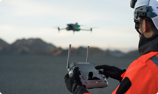
Nigerian engineering, cadastral, and mining teams face slow ground surveys, costly land boundary disputes, and difficult terrain across the Niger Delta and northern states. Gulfnet deploys enterprise drones that compress weeks of field work into a single flight day, with survey grade data ready for your consultants and regulators.

Centimetre accuracy orthomosaic output for engineering surveys

LiDAR point clouds through dense vegetation canopy

RTK and PPK positioning for geodetic accuracy

Automated flight planning across large project blocks

Full frame 45MP photogrammetry capture capability

Terrain follow mode for undulating Nigerian landscapes

Rapid orthomosaic processing for cadastral boundary disputes
Multi sensor payload swap on a single airframe
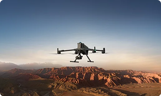
The flagship LiDAR drone for surveying in Nigeria, built for extended corridor missions, high density mapping, and engineering grade deliverables across varied Nigerian terrain conditions.
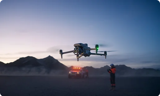
A versatile drone for site survey in Nigeria, pairing an integrated multi camera suite with efficient flight planning for repeatable orthomosaic and mapping deliverables.
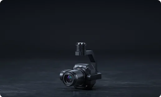
A 45MP full frame photogrammetry drone in Nigeria sensor delivering centimetre accurate orthomosaics for cadastral and engineering survey outputs.
High density LiDAR capture penetrating vegetation canopy for terrain modelling, corridor mapping, and 3D mapping drone in Nigeria workflows.
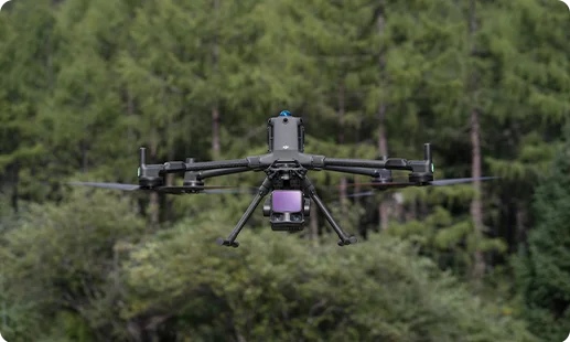
Reliable LiDAR surveying payload used as the primary drone for topography in Nigeria missions, delivering digital terrain models and point clouds.
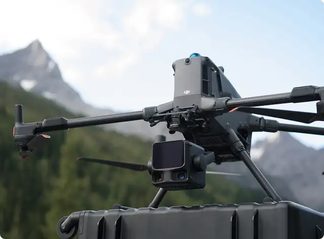
Multi sensor camera suite on Matrice 4 Series for site documentation, visual mapping, and recurring progress tracking flights.
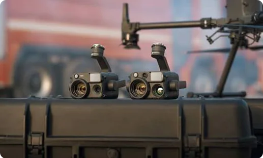
Nigerian infrastructure, land titling, and mining programmes have reached the point where traditional survey crews cannot keep up.

Weeks of theodolite work in Niger Delta swamps or northern terrain compress into a single flight day for any drone for site survey in Nigeria using RTK platforms.
Centimetre accurate orthomosaics give cadastral surveyors defensible evidence for boundary disputes under Nigerian land registry and State Lands Bureau proceedings.
LiDAR point clouds penetrate dense canopy across Cross River, Edo, and Ogun forest zones for terrain data no ground crew can match on time.
NCAA RPAS compliance and growing enterprise adoption make drone surveying auditable, insurable, and ready for engineering sign off on major Nigerian projects.
Tell us about your next cadastral, topographic, or mining survey, and our team will configure the right DJI Matrice 400 RTK, Zenmuse P1, or Zenmuse L3 pairing for your site.
For most Nigerian projects, Gulfnet pairs the DJI Matrice 400 RTK with the Zenmuse L3 LiDAR payload in Nigeria. The combination delivers high density point clouds, penetrates vegetation canopy in Cross River and Niger Delta zones, and generates survey grade digital terrain models. The Zenmuse L2 is also available for lighter corridor and topographic work. The right LiDAR drone for surveying in Nigeria depends on project scale, terrain, and deliverable grade, so our engineering team scopes each site before specifying the configuration. Share your project brief with Gulfnet and we will recommend the right airframe and sensor pairing for your requirements.
Yes. Gulfnet supplies the DJI Matrice 400 RTK and DJI Matrice 4 Series to clients across Lagos, Abuja, Port Harcourt, and other commercial hubs. Both airframes support 3D mapping workflows, with the Matrice 400 RTK carrying Zenmuse P1 and Zenmuse L3 for engineering grade orthomosaic and point cloud deliverables. If you are evaluating a 3D mapping drone in Nigeria for cadastral, construction, or mining use, we handle demonstration, procurement, pilot training, and after sales support directly. Contact Gulfnet to discuss your target output specifications and we will match the right platform to your project scope.
Gulfnet is a direct supplier and partner for DJI Enterprise mapping platforms across Nigeria. We service clients in Lagos, Abuja, Port Harcourt, Kano, and the Niger Delta corridor. Our role goes beyond resale. We handle NCAA RPAS compliance guidance, pilot training, flight planning setup, and payload configuration. If you are searching for a reliable mapping drone in Nigeria for cadastral, topographic, mining, or infrastructure projects, our team can walk you through hardware selection, data processing software, and ongoing field support. Visit our contact page or send a brief enquiry with your project scope and location.
For a GIS mapping drone in Nigeria workflow in Lagos, the DJI Matrice 400 RTK with Zenmuse P1 is the standard specification. It captures survey grade orthomosaics that integrate directly with Esri, QGIS, and Autodesk environments. For projects that require elevation accuracy under vegetation, we switch to the Zenmuse L3 LiDAR. Urban Lagos sites benefit from the Matrice 4 Series for rapid, repeatable flights over smaller blocks. Our team configures the right GIS mapping drone in Nigeria pipeline, from capture to processing, based on your coordinate system, output format, and accuracy tolerance.
Send your project details to the Gulfnet team through our contact page or request a consultation on this page. Share the project location, survey area, deliverable type, and accuracy requirement. We will scope the right surveying drone in Nigeria configuration, confirm payload pairing, and prepare a quotation covering hardware, training, and optional field support. Pricing varies by configuration, bundle, and support package, so we provide tailored quotes rather than list prices. For urgent requirements across Lagos, Abuja, or Port Harcourt, flag the project timeline in your enquiry and our solutions team will respond promptly.
The DJI Matrice 400 RTK with the Zenmuse P1 remains the leading land survey drone in Nigeria for engineering, cadastral, and infrastructure projects. Its 59 minute endurance, 40 km control range, and IP55 rating make it dependable across varied Nigerian terrain, from the humid Niger Delta to dusty northern states. For smaller surveys, the DJI Matrice 4 Series offers a compact land survey drone in Nigeria alternative with an integrated camera suite. Gulfnet configures either platform with the right RTK or PPK workflow for your coordinate reference system and project accuracy tolerance.
Yes. Gulfnet arranges hands on demonstrations of the DJI Matrice 400 RTK and DJI Matrice 4 Series for qualified clients in Lagos and other Nigerian cities. A typical demo covers flight planning, RTK setup, payload operation, and sample output review. If you want to see a DJI mapping drone in Nigeria flown over a sample site, share your availability through the contact form and we will coordinate the session. For organisations evaluating an aerial survey and mapping drone in Nigeria for ongoing project work, longer field evaluations at your site can also be arranged.
Yes. Gulfnet supplies the DJI Matrice 400 RTK carrying the Zenmuse P1 full frame camera, the leading photogrammetry drone in Nigeria for engineering surveys. The DJI Matrice 4 Series is also available with an integrated camera suite for rapid photogrammetry capture on smaller sites. Both platforms deliver centimetre accurate orthomosaics suitable for cadastral, mining, and infrastructure applications. If you are comparing photogrammetry drone in Nigeria options for your organisation, reach out to our team with the deliverable grade, project area, and reporting standard you need to meet, and we will advise on configuration.
Mining operators across Nigeria typically deploy the DJI Matrice 400 RTK as their primary mining survey drone in Nigeria. The Zenmuse P1 handles stockpile volumetrics and cut and fill calculations, while the Zenmuse L3 generates LiDAR point clouds for pit topography and overburden modelling. For smaller or recurring flights, the DJI Matrice 4 Series captures routine progress data. A disciplined mining survey drone in Nigeria workflow also benefits from RTK positioning for repeatable reference across quarterly audits. Gulfnet configures the right fleet for your pit depth, haul road layout, and reporting cycle.
Yes. Gulfnet supports surveyors, land registries, and consulting firms as a cadastral drone dealer in Nigeria. The DJI Matrice 400 RTK with Zenmuse P1 is the primary cadastral survey drone in Nigeria for boundary mapping, title verification, and litigation grade documentation. We also assist with ground control planning, RTK base station setup, and output format alignment with State Lands Bureau requirements. If your firm needs a defensible cadastral survey drone in Nigeria workflow across Lagos, Abuja, or other states, we handle hardware supply, pilot training, and procedural guidance end to end.
Yes. Gulfnet distributes the full DJI Enterprise mapping lineup in Lagos, including the Matrice 400 RTK and Matrice 4 Series. Both airframes are available with the relevant Zenmuse payloads. A DJI mapping drone in Nigeria purchase through Gulfnet includes NCAA RPAS compliance guidance, pilot training support, and post sales technical help. Lagos based clients also benefit from faster logistics for spares and payload accessories. If you want to compare the DJI mapping drone in Nigeria options against your project requirements, send our team a brief and we will respond with recommendations tailored to your use case.
The DJI Matrice 400 RTK with Zenmuse P1 is the standard topographic survey drone in Nigeria for infrastructure and large area projects. For dense vegetation or canopy covered terrain, we switch to the Zenmuse L3 LiDAR. The Matrice 4 Series handles smaller topographic jobs where speed matters more than full engineering accuracy. A reliable topographic survey drone in Nigeria workflow depends on correct RTK base positioning, ground control, and processing pipeline. Choosing the right drone for topography in Nigeria also means aligning the configuration to your project coordinate system and deliverable tolerance before mobilisation.
Gulfnet supplies the Zenmuse L3 LiDAR payload in Nigeria to clients deploying the DJI Matrice 400 RTK. The payload is sold with the airframe or as an upgrade for existing fleets. Procurement includes compatibility verification, firmware setup, and operator orientation on point cloud workflows. If your organisation is comparing the Zenmuse L3 LiDAR payload in Nigeria against the L2 for a specific application, our engineering team can advise based on project density, canopy, and accuracy requirements. Send an enquiry with your intended use case and we will share the right procurement path.
The Zenmuse P1 photogrammetry camera in Nigeria is procured through Gulfnet together with the DJI Matrice 400 RTK airframe. The payload is a 45MP full frame mapping sensor used for engineering grade orthomosaics, large area mapping, and cadastral deliverables. Pricing varies by configuration bundle, trade in status, and training package, so we provide tailored quotations rather than catalogue prices. Buyers evaluating the Zenmuse P1 photogrammetry camera in Nigeria should also confirm their ground control, PPK or RTK workflow, and processing software before purchase. Contact Gulfnet for a scoped quotation and configuration advice.
A UAV for surveying in Nigeria compresses traditional field schedules dramatically, often turning weeks of ground survey into one or two flight days. The DJI Matrice 400 RTK with Zenmuse P1 delivers centimetre accurate orthomosaics, while the Zenmuse L3 captures LiDAR point clouds through dense canopy. Beyond speed, drone data creates auditable digital records that engineering firms can share with clients, regulators, and insurers. For Nigerian firms balancing cost pressures, remote site access, and tight deadlines, a UAV for surveying in Nigeria workflow offers measurable return. Contact Gulfnet to scope the right platform for your service lines.
