



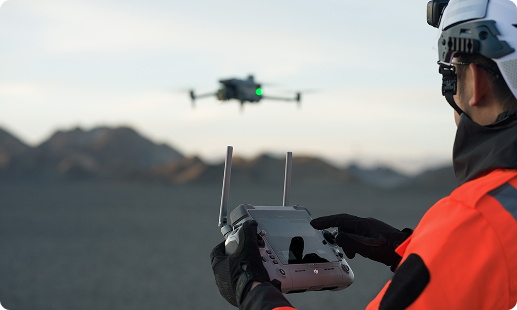
Tanzania surveyors face growing pressure from land titling backlogs, rapid mining expansion in Geita and Shinyanga, and the pace of SGR corridor construction. Traditional ground methods cannot keep up with these timelines. Gulfnet brings a trained aerial survey team to the market, backed by TCAA ready paperwork and enterprise grade mapping drones.

Centimetre grade RTK positioning for cadastral survey work

LiDAR drone for surveying in Tanzania through dense canopy

Photogrammetry drone in Tanzania capturing 45 megapixel frames

3D mapping drone in Tanzania for mine volumetrics

GIS mapping drone in Tanzania producing shapefile ready outputs

Topographic survey drone in Tanzania across highland terrain

Automated flight planning across large project boundaries
Mining survey drone in Tanzania coverage across major belts
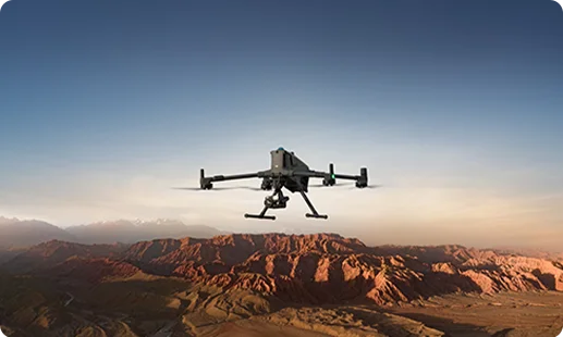
Flagship enterprise airframe for aerial survey and mapping drone in Tanzania projects, carrying LiDAR or Zenmuse P1 across highway corridors, mining leases, and watershed boundaries.
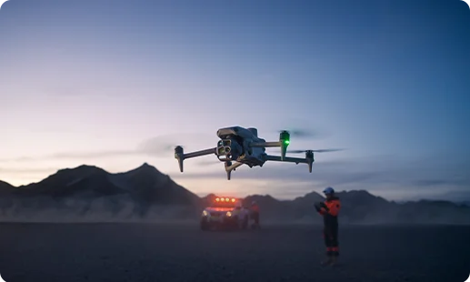
Agile mid tier platform ideal as a drone for site survey in Tanzania, pairing wide, tele, and thermal optics for mapping, inspection, and cadastral capture.
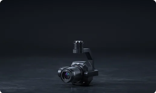
Zenmuse P1 photogrammetry camera in Tanzania delivers 45 megapixel full frame imagery for 3 centimetre orthomosaics across large survey blocks.
Zenmuse L3 LiDAR payload in Tanzania penetrates forest cover and generates dense point clouds for terrain, volumetrics, and corridor modelling.
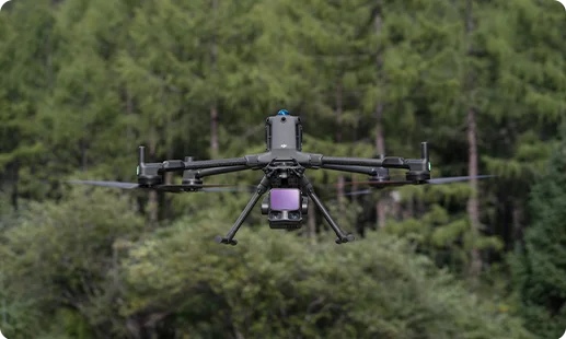
Compact LiDAR with integrated RGB camera, giving surveyors fused point clouds and photos in a single flight across difficult terrain.
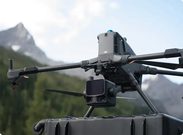
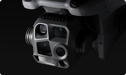
Wide, medium tele, tele, and thermal cameras built in, covering site survey, inspection, and heat signature capture on one flight.
Tanzania's land, mining, and infrastructure sectors are moving to aerial survey methods, and these four shifts explain why.

Ground crews once took weeks to cover a mining lease in Geita; a DJI mapping drone in Tanzania now does it in days.
Cadastral survey drone in Tanzania workflows let the Ministry of Lands clear title registration backlogs faster, especially across sprawling peri urban plots.
A drone for topography in Tanzania now cuts through Southern Highlands forest canopy, giving road and transmission designers true ground models in a single mobilisation.
TCAA RPAS compliance plus BVLOS approvals now make it realistic to run drone programmes across EACOP, SGR, and Julius Nyerere hydropower project boundaries.
From Dar es Salaam cadastral jobs to Geita mine volumetrics, our team pairs the right UAV with trained pilots and TCAA ready paperwork.
For a LiDAR drone for surveying in Tanzania, our standard recommendation is the DJI Matrice 400 RTK carrying the Zenmuse L3. It handles corridor mapping across SGR extensions, forest penetration through Southern Highlands canopy, and dense ground returns for mining volumetrics in Geita and Shinyanga. For smaller sites or quick mobilisations, the DJI Matrice 4 Series paired with the Zenmuse L2 performs well. The right pick depends on project size, canopy density, and accuracy class your deliverable demands. The Gulfnet team walks you through the fit, flight planning, and TCAA paperwork before you commit. Reach out and we will shortlist against your site specifics.
Yes. Our 3D mapping drone in Tanzania lineup is available to teams based in Dar es Salaam. The catalog covers the DJI Matrice 400 RTK and the DJI Matrice 4 Series, both of which handle photogrammetry and LiDAR payloads for 3D model generation. We handle sourcing, TCAA registration guidance, operator training, and after sale support from one point of contact. Rather than shipping a box and leaving you to figure out workflows, our team sits with your survey leads to map use cases first. Contact us and we will set up a scoping call based on your Dar es Salaam project pipeline.
Gulfnet operates as an enterprise surveying drone in Tanzania deployment partner, not a reseller passing hardware over the counter. Survey, mining, and infrastructure clients work with us because we handle the full chain, from drone selection to TCAA operator permissions, flight planning, and post flight data processing training. The lineup includes the DJI Matrice 400 RTK and the DJI Matrice 4 Series, paired with Zenmuse L3 LiDAR, Zenmuse L2, Zenmuse P1, and the integrated camera suite. If your work spans Dar es Salaam, Dodoma, Arusha, or Mwanza, our team is set up to support you. Reach out to discuss your project specifics.
For GIS mapping drone in Tanzania workflows based in Dar es Salaam, the DJI Matrice 400 RTK with Zenmuse P1 is our usual starting point. The 45 megapixel full frame sensor plus RTK positioning gives you orthomosaics and digital surface models ready for ingestion into standard GIS platforms. For smaller urban cadastral jobs or quick asset mapping, the DJI Matrice 4 Series with its integrated camera suite works well. Shapefile, GeoTIFF, and LAS exports are standard once processing is run. We help your GIS leads align sensor choice, ground control strategy, and output formats to the deliverables your clients expect.
Enterprise land survey drone in Tanzania purchases are rarely straightforward counter transactions, since TCAA registration, operator licensing, and sensor fit all matter before the drone leaves the box. Gulfnet works directly with survey firms, mining operators, and infrastructure contractors across Tanzania, handling drone sourcing, payload matching, pilot training, and TCAA documentation support in one engagement. Rather than searching for a dealer offering just a transaction, treat your first conversation as a scoping discussion. Share your project pipeline and site conditions, and we will map a drone, payload, and training package to it. Contact our team through the enquiry form on this page.
LiDAR drone pricing depends on the airframe you choose, the LiDAR payload class, and the training and support package wrapped around it. The DJI Matrice 400 RTK with Zenmuse L3 sits at the higher end of enterprise LiDAR, while the same airframe with the Zenmuse L2 is more accessible for teams running smaller survey scopes. On top of hardware, factor in software for point cloud processing, operator training, TCAA registration, and ongoing after sale support. We prefer to quote against your actual project profile rather than list numbers out of context. Reach out and we will prepare a tailored costing for you.
The fastest route is the Request Your Consultation button on this page. Share your industry, project location, deliverable type (orthomosaic, point cloud, 3D model), and any accuracy requirements your clients or regulators expect. Our team responds with a shortlist of UAV for surveying in Tanzania options, along with training, TCAA compliance support, and a costing covering the full package. For complex scopes across mining leases, SGR corridors, or forest areas, we often set up a scoping call first before quoting. Expect a response within one working day on enquiries from Dar es Salaam, Dodoma, Arusha, and Mwanza.
For land survey drone in Tanzania use cases, the DJI Matrice 400 RTK sits at the top of our recommendation list. Carrying either the Zenmuse P1 for high resolution photogrammetry or the Zenmuse L3 for LiDAR, it covers cadastral, topographic, and corridor jobs at centimetre class accuracy. The DJI Matrice 4 Series is the right pick for teams needing something more compact and portable for site survey work. Both are TCAA registration eligible and fit well into established survey workflows. We help your team pick the right combination against job size, canopy conditions, and accuracy class before any purchase decision.
Yes. We arrange supervised demonstrations of our mapping drone in Tanzania catalog for qualified prospects in Dar es Salaam and other regions. Depending on your focus, a demo may cover the DJI Matrice 400 RTK with Zenmuse P1 for photogrammetry, the Zenmuse L3 for LiDAR capture, or the DJI Matrice 4 Series as a drone for topography in Tanzania and compact site mapping. We align demos to real survey use cases from your pipeline, not generic flight shows. Book through the Request Your Consultation form, and our team will coordinate location, timing, and TCAA compliant airspace.
Yes. The DJI mapping drone in Tanzania lineup for photogrammetry centres on the DJI Matrice 400 RTK paired with the Zenmuse P1, used for cadastral surveys, mine volumetrics, highway corridor mapping, and large area orthomosaics. The DJI Matrice 4 Series with its integrated camera suite handles smaller photogrammetry scopes for site survey work, construction progress, or urban mapping. Gulfnet supplies both along with pilot training, TCAA registration support, and processing workflow guidance. Reach out through the consultation form on this page and the team will shortlist against your typical photogrammetry drone in Tanzania deliverables.
Mining survey drone in Tanzania work, especially across Geita, Shinyanga, Mwadui, and Kahama, typically runs best on the DJI Matrice 400 RTK with the Zenmuse L3 LiDAR payload. LiDAR handles stockpile volumetrics, pit wall modelling, and haul road scanning even where vegetation or dust is a factor. For routine topographic monitoring or progress tracking, the Zenmuse P1 photogrammetry camera gives centimetre accurate orthomosaics on the same airframe. The DJI Matrice 4 Series is the right call for smaller leases or rapid mobilisations. Our team helps match airframe, sensor, and software stack to your mine plan reporting cycle.
For cadastral survey drone in Tanzania engagements, Gulfnet acts as a deployment partner for survey firms and government linked projects. Cadastral work for the Ministry of Lands or private titling clients often involves large peri urban blocks, scattered rural parcels, and strict accuracy expectations. We supply the DJI Matrice 400 RTK with the Zenmuse P1 for high resolution orthomosaics and parcel boundary capture, backed by RTK and ground control planning. The DJI Matrice 4 Series covers smaller scopes. Beyond hardware, we help your team on flight planning, data processing training, and TCAA operator paperwork. Share your project profile and we will quote.
For topographic survey drone in Tanzania work across the Great Rift Valley, Southern Highlands, Serengeti plains, and coastal corridors, the DJI Matrice 400 RTK with Zenmuse L3 LiDAR is our top pick. LiDAR penetrates vegetation and captures bare earth models where photogrammetry alone misses detail. For open ground or urban topography, Zenmuse P1 photogrammetry on the same airframe is efficient. The DJI Matrice 4 Series acts as a compact drone for site survey in Tanzania when you need rapid mobilisation on smaller plots. The right choice depends on terrain cover, accuracy class, and deliverable format. Request a consultation and we will pair the airframe to your project.
Yes. Gulfnet supplies the Zenmuse L3 LiDAR payload in Tanzania for pairing with the DJI Matrice 400 RTK. The L3 delivers dense multi return point clouds for forest penetration, corridor mapping, mine volumetrics, and infrastructure survey. We bundle the payload with the matching airframe, calibration guidance, and training on point cloud processing. TCAA registration support is included where needed. Payload only sales are possible if you already run the DJI Matrice 400 RTK, but most survey teams prefer the full configuration for consistency. Contact our team for a current quote tailored to your use case.
The Zenmuse P1 photogrammetry camera in Tanzania is priced based on the configuration you need, including whether it comes bundled with the DJI Matrice 400 RTK or a compatible airframe, software for processing, training, and TCAA documentation support. Because we build survey packages around actual use cases rather than selling the payload in isolation, we prefer to quote against your project profile. Share your typical mission scope, deliverable type, and site conditions through the consultation form, and our team prepares a transparent costing within one working day. Payload only sales are available if you already run a compatible DJI airframe.
