



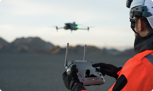
Zimbabwe’s surveyors, mining engineers and infrastructure planners face mounting pressure from large project backlogs, difficult highveld terrain and tight regulatory timelines. Traditional ground surveys are slow and resource heavy. Gulfnet brings purpose built UAV platforms, trained pilots and CAAZ compliant workflows that deliver accurate land, mining and infrastructure data on schedule.

RTK positioning on every surveying drone in Zimbabwe mission

LiDAR drone for surveying in Zimbabwe canopy and terrain

High resolution photogrammetry imagery for orthomosaic outputs

Full frame mapping camera support for accuracy

Automated flight planning across highveld and mining pits

Live orthomosaic preview during field GIS survey missions

Seamless payload swap between Zenmuse P1, L2 and L3
CAAZ aligned flight logs and compliance ready reporting
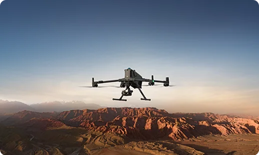
Built for long endurance survey work, the Matrice 400 RTK carries Zenmuse L3, L2 and P1 sensors across cadastral, mining and infrastructure corridors in Zimbabwe.
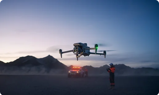
The Matrice 4 Series combines multi camera imaging with Zenmuse P1 compatibility for rapid photogrammetry, topographic survey and site documentation across Zimbabwe projects.
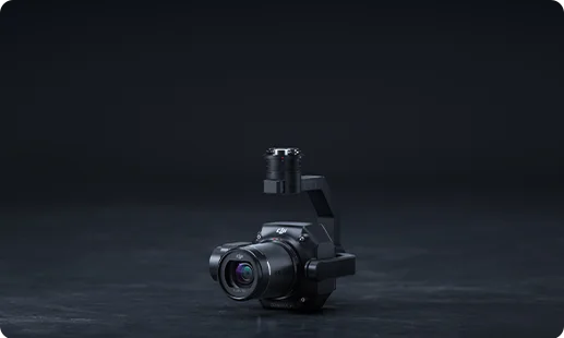
A full frame photogrammetry camera for high accuracy orthomosaics, 3D reconstructions and engineering grade topographic survey across Zimbabwe corridors.
A LiDAR payload for dense point cloud generation, vegetation penetration, terrain modelling and classification across mining and infrastructure sites.
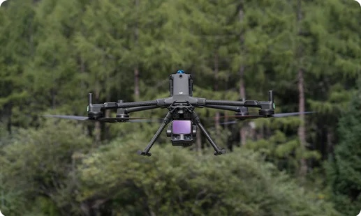
A LiDAR unit for corridor mapping, topographic surveys and digital terrain model generation across highveld and mining regions.
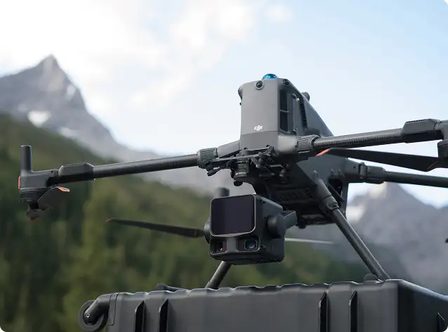
Multi focal imaging in one gimbal for rapid site documentation, visual inspection and repeatable 3D mapping drone in Zimbabwe workflows.
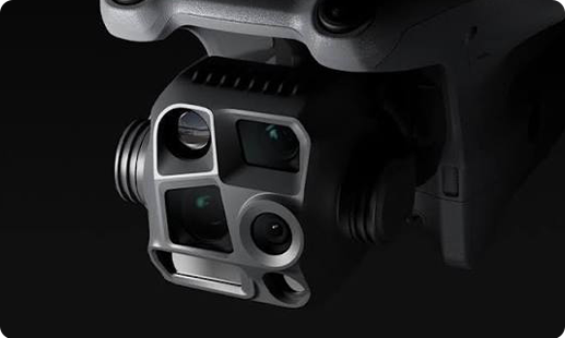
Zimbabwe's land, mining and infrastructure sectors are moving from manual ground survey to UAV led mapping workflows.

Highveld terrain, long farm boundaries and remote mining pits are now mapped in hours rather than weeks of ground crew work.
Manual chainage work is being replaced with centimetre accurate orthomosaics, cutting rework and reducing exposure for crews on hazardous sites.
GIS mapping drone in Zimbabwe deployments give planners live data layers for faster decisions and transparent compliance reporting.
LiDAR drone for surveying in Zimbabwe missions now deliver vegetation stripped terrain models that total stations cannot produce economically.
Talk to our team about deploying the Matrice 400 RTK, Zenmuse L3 LiDAR and Zenmuse P1 photogrammetry for your next cadastral, mining or infrastructure survey.
The best LiDAR drone for surveying in Zimbabwe depends on project scope, canopy density and corridor length. For most mining, forestry and infrastructure work, the DJI Matrice 400 RTK paired with the Zenmuse L3 delivers dense point clouds with strong vegetation penetration. For medium corridors and cadastral terrain, the Zenmuse L2 on the same airframe remains a solid, proven choice. Gulfnet matches the sensor to your deliverable, be it a DEM, DTM or classified point cloud, rather than selling a single answer. Contact our Zimbabwe team to discuss project specific LiDAR requirements and we will scope the right fit.
A 3D mapping drone in Zimbabwe is best procured through an authorised enterprise partner that handles configuration, training and post sales support. Gulfnet works with Harare based clients on the full acquisition cycle, from scoping the sensor payload to CAAZ RPAS registration and pilot onboarding. For 3D mapping, we most often deploy the DJI Matrice 400 RTK with Zenmuse P1 for photogrammetry, or the Matrice 4 Series for faster, lighter work. Reach out through our contact form and our team will walk you through the right configuration for your specific use case and site conditions.
Yes. Gulfnet supplies, deploys and supports enterprise mapping drones across Zimbabwe, with a product range built around DJI’s survey grade platforms and payloads. Our scope goes beyond hardware supply. We handle CAAZ compliance guidance, pilot training, workflow setup for photogrammetry and LiDAR, and after sales technical support. Clients across mining, cadastral surveying, infrastructure and public sector projects use our drones for daily operations. Whether you need a single mapping drone or a fleet with multiple payload swaps, our team can scope the right configuration. Contact Gulfnet to discuss your project requirements and we will respond quickly.
For GIS mapping drone in Zimbabwe projects based around Harare, the DJI Matrice 400 RTK with the Zenmuse P1 photogrammetry camera is the most common choice. It delivers survey grade orthomosaics that drop straight into GIS platforms. For smaller sites or faster turnaround, the DJI Matrice 4 Series offers integrated imaging with Zenmuse P1 compatibility. The right choice depends on area size, required ground sample distance and whether terrain modelling or imagery is the priority. Gulfnet can scope the correct configuration for your GIS deliverables. Contact our team for a tailored recommendation and workflow walkthrough.
Gulfnet serves as an enterprise surveying drone dealer in Zimbabwe, supporting clients across Harare, Bulawayo, Mutare and project sites nationwide. We supply DJI enterprise platforms including the Matrice 400 RTK and Matrice 4 Series along with compatible payloads such as Zenmuse P1, L2 and L3. Beyond the hardware, we offer configuration, pilot training, CAAZ RPAS documentation support and ongoing technical assistance. You can reach out via the contact form on our website or request a consultation. Our team will respond and schedule a scoping call to match the right platform to your actual survey workflow.
Pricing for a LiDAR drone, Zenmuse L3 or Zenmuse P1 in Zimbabwe varies based on configuration, payload combinations, training, warranty and support package selected. Rather than publishing a flat figure, Gulfnet prefers to prepare a project specific quote so you get accurate pricing on what you actually need. Costs typically differ between a single pilot kit and a multi pilot fleet, and between standalone photogrammetry and combined LiDAR and photogrammetry setups. To receive a current, written quote for the Matrice 400 RTK, Zenmuse P1 or Zenmuse L3 LiDAR in Zimbabwe, please contact our team through the enquiry form.
Requesting a quote for a survey drone in Zimbabwe is straightforward with Gulfnet. Use the enquiry form on our website or reach out via the contact details listed on the page. Share basic project details such as the use case, project area, whether you need LiDAR or photogrammetry, and roughly how many pilots will operate the system. Our team will respond with a written quote covering the recommended drone, payloads, training, warranty and support options. We prepare quotes based on your actual workflow rather than off a generic price list, so expect a short scoping conversation before final figures are shared.
For large scale land survey drone in Zimbabwe projects, the DJI Matrice 400 RTK is our most recommended platform. It supports Zenmuse P1 for high accuracy photogrammetry and Zenmuse L3 or L2 for LiDAR mapping, covering nearly every land survey scenario in country. For smaller cadastral jobs, boundary surveys or faster deployments, the DJI Matrice 4 Series performs well with integrated imaging and Zenmuse P1 compatibility. The right pick depends on area size, canopy conditions and required deliverables. Gulfnet’s team can walk through your specific site conditions and recommend the correct airframe and payload combination for your workflow.
Yes. Gulfnet arranges demos of enterprise mapping drones for qualified buyers in Harare and other Zimbabwe locations where feasible. A typical demo covers flight planning, RTK setup, payload operation, data capture and a short walkthrough of the output in a processing environment. We cannot always run demos at a client’s own site, but can usually arrange an alternative that lets you see the equipment in operation. To book a demo of the Matrice 400 RTK, Matrice 4 Series or Zenmuse payloads, please contact our team through the enquiry form and share your preferred timing and location.
For photogrammetry drone in Zimbabwe work, the combination most commonly supplied by Gulfnet is the DJI Matrice 400 RTK with the Zenmuse P1 camera. The full frame sensor is purpose built for mapping accuracy, delivering orthomosaics suited to engineering grade deliverables. For buyers who need a lighter, faster platform, the DJI Matrice 4 Series also supports the Zenmuse P1 and carries integrated wide, tele and thermal imaging for smaller sites. We can scope the right configuration based on your area, accuracy needs and processing workflow. Reach out through our contact form to begin.
Mining survey drone work in Harare and surrounding provinces, including stockpile volumetrics, pit mapping and haul road monitoring, is best served by the DJI Matrice 400 RTK carrying Zenmuse L3 for LiDAR and Zenmuse P1 for high resolution photogrammetry. The platform’s long flight time and payload compatibility suit the large open pits and corridors common to Zimbabwe mining operations. For routine site surveys and inspection flights, the DJI Matrice 4 Series offers rapid deployment with its integrated imaging suite. Gulfnet can match the configuration to your mine plan and reporting cycle. Contact our team for a scoped recommendation.
Yes. Cadastral survey drone in Zimbabwe deployments are available through Gulfnet. For boundary mapping, parcel verification and cadastral updating, we most often supply the DJI Matrice 400 RTK with Zenmuse P1 for accurate orthomosaics, or the DJI Matrice 4 Series for faster, lighter deployments. The right platform depends on area size, canopy cover and whether LiDAR terrain data is also required. Our team supports clients working with the Surveyor General’s office, land authorities and private surveying practices, including CAAZ RPAS documentation and pilot training. Contact Gulfnet to discuss your cadastral mapping requirements and get a configuration recommendation.
The best topographic survey drone in Zimbabwe depends on terrain and canopy conditions. For open ground, mining pits and infrastructure corridors, the DJI Matrice 400 RTK with Zenmuse P1 photogrammetry provides highly accurate topographic surfaces. For areas with heavy vegetation, pairing the same airframe with Zenmuse L3 or L2 LiDAR gives you under canopy terrain models that photogrammetry alone cannot produce. For smaller topographic jobs, the DJI Matrice 4 Series with integrated imaging is a quick deploy option. Gulfnet scopes the right platform and payload to the project rather than defaulting to one answer. Contact our team for a tailored match.
