Most GCC construction projects run on compressed timelines with multiple contractors and constant reporting pressure. Yet project managers still rely on manual site walks and fragmented data, creating a gap between actual progress and reported status. The gap between what is actually happening on site and what shows up in the progress report is where delays hide, disputes start, and budgets slip.
This blog outlines how aerial site monitoring closes that gap, what specific data it produces for schedule verification and quantity control, and why project managers across the region are building it into their standard delivery workflows.
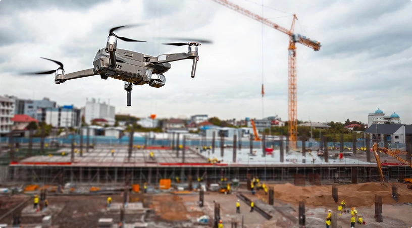
The scale and pace of construction across the Gulf create visibility problems that ground-level methods cannot solve. A master-planned community in Dubai or a mixed-use development in Riyadh can span dozens of hectares with simultaneous earthwork, structural, and finishing activities happening across different zones. A project manager walking the site captures a partial, subjective snapshot. A site engineer with a camera documents what they can reach, not necessarily what matters most.
This creates three operational problems.
First, progress blind spots. Large or phased sites make it difficult to track every active zone consistently. Work that falls behind in one area often goes unnoticed until it affects the critical path, at which point corrective action is more costly and more disruptive.
Second, quantity inconsistencies. Conventional stockpile measurements using tape and total stations are time-consuming, sample-based, and prone to reporting discrepancies. When material quantities drive progress billing, inaccurate volumes create payment disputes between contractors and clients that slow the entire project down.
Third, fragmented documentation. Inspection records, progress photos, and survey data sit in separate systems, on different people’s phones, or in folders that are difficult to cross-reference. When a client, consultant, or regulatory body requests evidence of progress at a specific date, assembling it takes hours rather than minutes.
These are not technology problems in the traditional sense. They are data capture and data access problems. The site conditions and the work are real. What is missing is a consistent, repeatable method for capturing site-wide data at regular intervals and organizing it in a way that supports decisions.
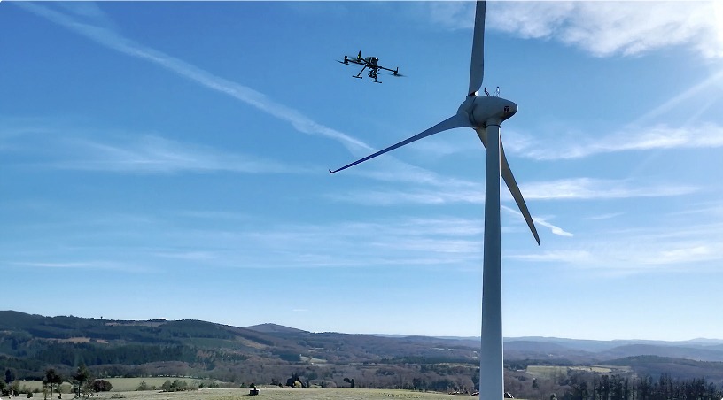
Enterprise-grade aerial platforms equipped with high-resolution cameras follow predefined flight paths over the construction site, capturing time-stamped imagery that covers the entire project area in a single sortie. Because the flight path is repeatable, every subsequent capture produces a directly comparable dataset.
For project managers, this changes the nature of progress reporting from subjective observation to evidence-based verification.
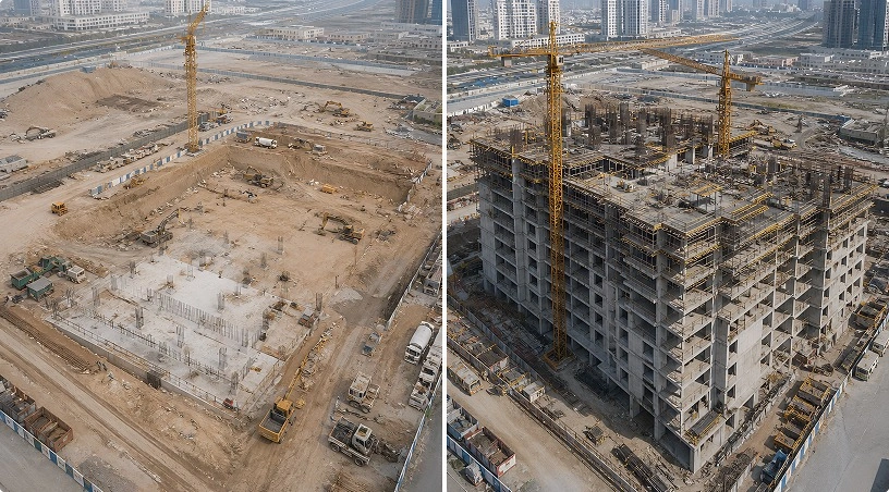
Each flight produces orthomosaic maps, which are geo-referenced aerial images stitched into a single, measurement-ready view of the site. Overlaying successive orthomosaics reveals exactly what has changed between captures: new concrete pours, structural steel erection, facade installation progress, or earthwork advancement. This side-by-side comparison replaces the “percentage complete” estimates that dominate traditional reporting with visual, verifiable evidence tied to specific dates and locations.
Weekly or biweekly monitoring flights aligned with reporting cycles give project managers a continuous visual record. When a subcontractor disputes a delay notice, the imagery provides objective documentation. When a client asks for milestone evidence, the data is already organized and accessible. And when an internal review needs to assess whether the current pace will meet the completion target, the trend across multiple captures tells the story more clearly than any written narrative.
The data also feeds directly into centralized platforms where project teams can review imagery, take on-screen measurements, and share controlled access with stakeholders, consultants, and regulatory bodies. This eliminates the fragmented documentation problem by putting every capture, every measurement, and every comparison in one place.
One of the highest-value applications for construction project managers is photogrammetry-based volumetric measurement. Aerial imagery processed through specialized software generates 3D point clouds and digital surface models that allow precise calculation of stockpile volumes, excavation quantities, and cut-and-fill balances.
For earthwork-heavy projects, this capability directly impacts cost control. Traditional stockpile measurement requires surveyors on the ground, equipment downtime, and manual calculations that can take days to compile. An aerial survey captures the same data in a fraction of the time, with accuracy typically within one to three percent when proper ground control points are deployed.
The practical benefits extend beyond speed. Volumetric data captured at regular intervals creates a historical record of material usage. Project managers can track how much aggregate, sand, or fill has been consumed between reporting periods, verify quantities against purchase orders, and support accurate progress billing submissions. When multiple parties are billing against material quantities, having a defensible, survey-grade measurement reduces disputes and accelerates payment cycles.
The same photogrammetric process produces digital elevation models and contour maps that support earthwork planning. Cut-and-fill analysis generated from drone data shows exactly where material needs to be moved, how much is required, and whether the site is grading to design intent. For projects in the GCC where earthwork phases are large and time-sensitive, this level of precision helps avoid over-excavation, material waste, and rework.
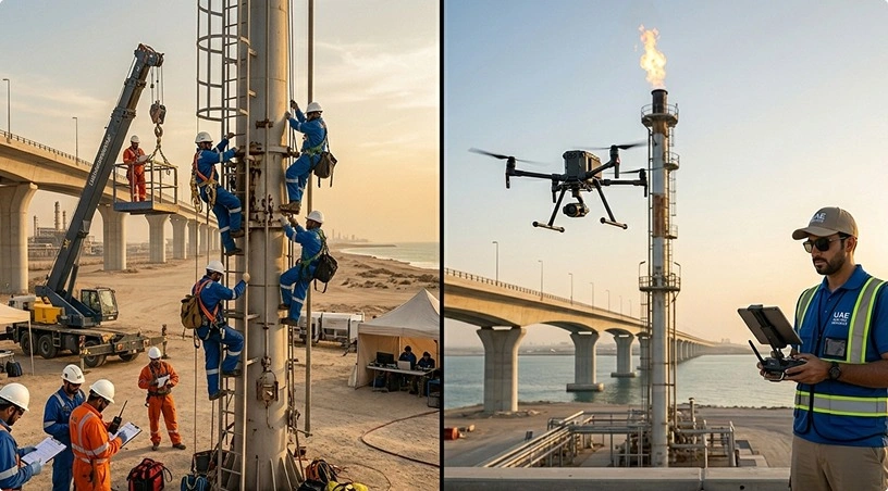
Height access remains one of the most significant safety risks on construction sites. Traditional roof, facade, and structural inspections require scaffolding, rope access, or boom lifts, each of which introduces fall hazards, equipment coordination, and downtime for the work area being inspected.
Aerial platforms equipped with visual and thermal sensors conduct vertical and oblique flights that document building conditions from the exterior without any of these requirements. High-resolution imagery captures cladding condition, sealant integrity, and surface defects at close range, while thermal data identifies insulation failures and moisture ingress that visual inspection alone would miss.
For project managers overseeing multiple buildings or structures within a single development, this approach significantly reduces the time and cost of quality verification. A facade inspection that might require two days of scaffolding setup and crew access can be completed in a single aerial sortie with results available the same day.
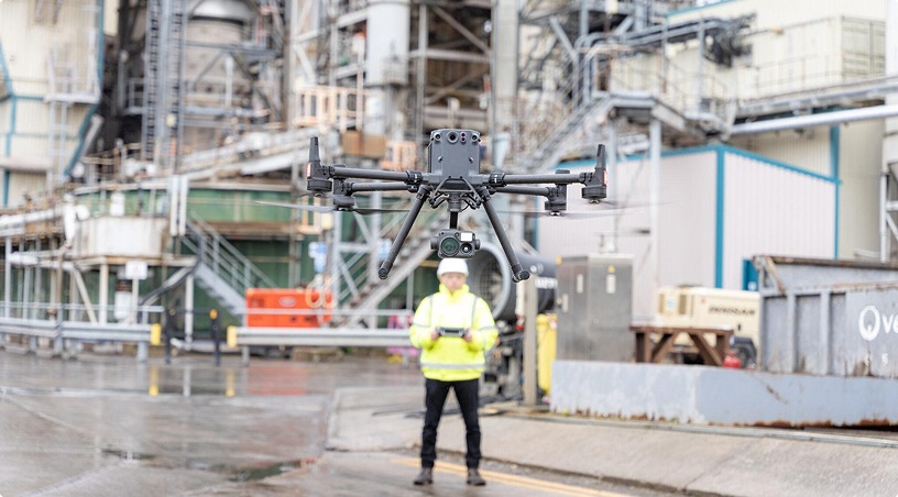
Critically, these inspections happen without disrupting ongoing construction activity on other parts of the site. The non-intrusive nature of aerial capture means personnel and equipment continue operating while data is collected overhead. Site coordination is handled in advance to ensure flights integrate with active work zones and crane operations.
Yes, and this integration is what turns raw aerial data into operational value. Geo-referenced orthomosaics, point clouds, and volumetric reports can be exported in formats compatible with BIM platforms, GIS systems, and common project management tools. Analytics platforms organize inspection imagery by project and location, enabling progress comparison over time and on-screen distance and area calculations.
For enterprise-level construction programs managing multiple sites across the GCC, centralized data access means the project director in one city can review site progress in another without traveling. Controlled stakeholder sharing allows consultants, clients, and regulatory bodies to access the specific datasets they need without exposing the full project archive. This level of transparency supports faster approvals, reduces reporting overhead, and builds trust across the project delivery chain.
Aerial site monitoring addresses the core data capture and documentation challenges that slow construction project delivery across the Gulf. To recap:
Repeatable flight paths produce consistent, time-stamped imagery that replaces subjective progress reporting with visual, verifiable evidence. Photogrammetry-based volumetric measurement delivers survey-grade quantity data that supports accurate billing and reduces disputes. Aerial building inspections eliminate height access risks while capturing high-resolution condition data on active sites. And centralized analytics platforms organize all of this data in one place, making it accessible to every stakeholder who needs it.
For project managers operating under tight timelines, multi-stakeholder scrutiny, and GCC-specific site conditions, building aerial monitoring into your delivery workflow is not an upgrade. It is a practical response to the visibility gap that traditional methods leave behind.
Gulfnet delivers drone services for construction sites across the GCC, from progress monitoring and stockpile surveys to 3D mapping and building inspections. Our certified operations, survey-grade data processing, and analytics platform help project teams make faster, evidence-based decisions without disrupting active site operations. Request a consultation to scope your next project.
How often should construction progress monitoring drone flights be scheduled?
Flight frequency depends on project pace and reporting requirements. Most teams schedule weekly flights during active construction phases for consistent documentation. Milestone-based flights suit projects with defined stages. The repeatable flight path approach ensures every capture is directly comparable, making weekly or biweekly intervals the most common cadence.
What accuracy do drone-based stockpile volume measurements deliver on construction sites?
Photogrammetry-based volumetric capture typically delivers accuracy within one to three percent when proper ground control points are deployed. This precision supports reliable inventory tracking, progress billing verification, and material usage comparisons across reporting periods, reducing the quantity disputes that commonly arise between contractors and clients.
Can drone monitoring flights operate on active construction sites without disrupting work?
Yes. Aerial monitoring is designed to work around active site conditions. Flights are coordinated in advance with site teams to avoid interference with crane operations, concrete pours, and personnel movement. The non-intrusive nature of aerial capture means construction activities continue uninterrupted while imagery is collected overhead during scheduled windows.
What deliverables do project managers receive after a construction drone survey?
Deliverables vary by service. Progress monitoring produces time-stamped orthomosaics and visual comparison datasets. Stockpile surveys provide volume measurements and inventory reports. Topography services deliver point clouds, digital elevation models, and cut-fill analysis. Building inspections generate high-resolution condition documentation. All outputs are organized for centralized access and stakeholder sharing.
Are drone survey operations on GCC construction sites compliant with local aviation regulations?
All operations follow applicable aviation authority regulations across the GCC, including GCAA requirements in the UAE and GACA standards in Saudi Arabia. Required certifications are held by all pilots, and site-specific flight permits are secured in advance. Regulatory compliance is managed as part of the standard project delivery process for every engagement.
 Go back