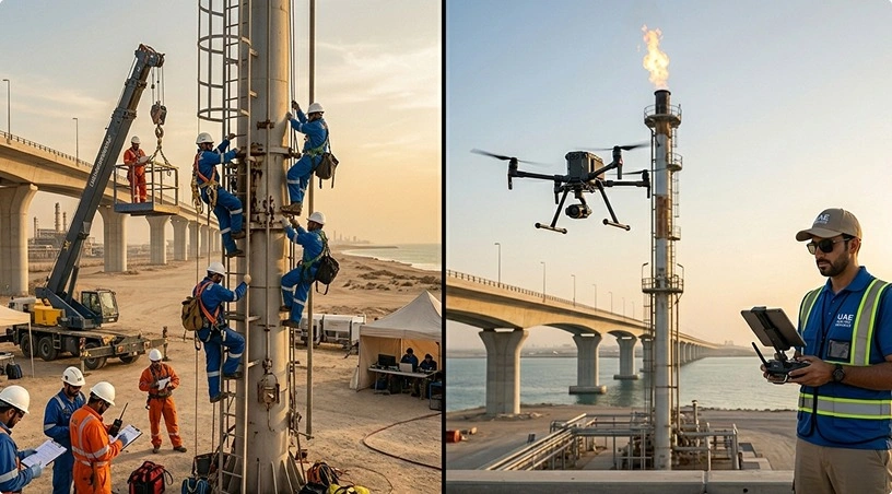
Flare stack requires thermal inspection. The traditional way takes weeks of planning, erecting scaffolding, confined space permits, safety supervision, and a five figure lost output because of a production shutdown. By the time the inspection is over and the scaffolding comes down, you have spent more on access logistics than on the inspection. And the data you collected is limited as to what an inspector could see from the scaffolding positions available.
This is the reality that oil and gas operators across the UAE navigate every turnaround cycle, every planned maintenance window, and every unplanned incident that demands rapid damage assessment. The assets are massive. The environments are hazardous. The regulatory requirements are increasing. And the margin for missed defects is shrinking.
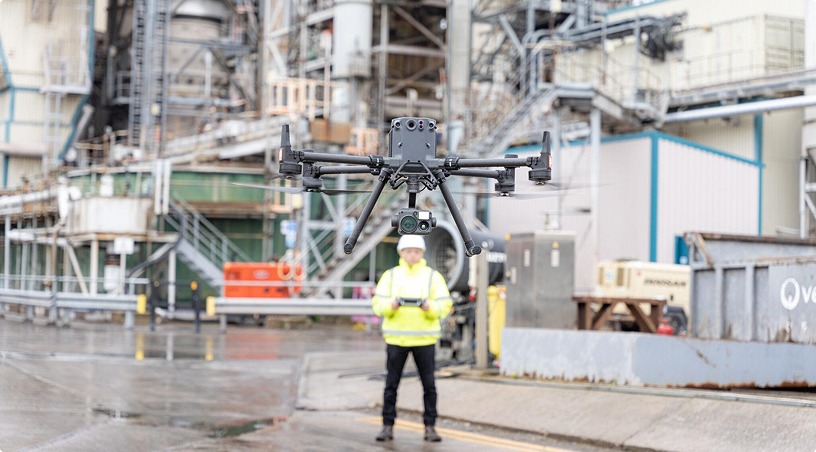
Drone inspection technology is changing this equation. Not by replacing skilled inspectors, but providing them better access, richer data and faster turnaround without the cost and risk involved in traditional methods. This blog examines in detail where drone inspections have the most measurable impact in upstream, midstream and downstream oil and gas operations in the UAE.
Oil and gas facilities in the GCC operate in some of the most demanding inspection environments in the world. Temperatures regularly exceed 45°C. Assets are spread across vast geographies, from desert pipeline corridors spanning hundreds of kilometres to offshore platforms accessible only by helicopter. Many critical components sit at heights, inside confined spaces, or in areas classified as hazardous zones under ATEX or IECEx standards.
Traditional inspection approaches (scaffolding, rope access, manned entry) carry three compounding costs that go beyond the direct expense of the service itself.
First, there is the safety exposure. Every hour a technician spends at height or inside a confined space is an hour of personnel risk. Fall injuries, heat stress, and toxic exposure remain persistent hazards, regardless of the safety protocols in place.
Second, there is the production impact. Facilities often need partial or full shutdowns to allow safe human access. For a refinery processing train, every day of downtime translates to significant revenue loss. For offshore platforms, the economics are even more challenging when you factor in crew mobilisation, weather delays, and helicopter logistics.
Third, there is the data limitation. An inspector on scaffolding or rope access sees what their physical position allows. Defects outside their sightline, thermal anomalies invisible to the naked eye, or patterns only visible from an aerial perspective are missed entirely. The inspection report reflects what was accessible, not necessarily what was critical.
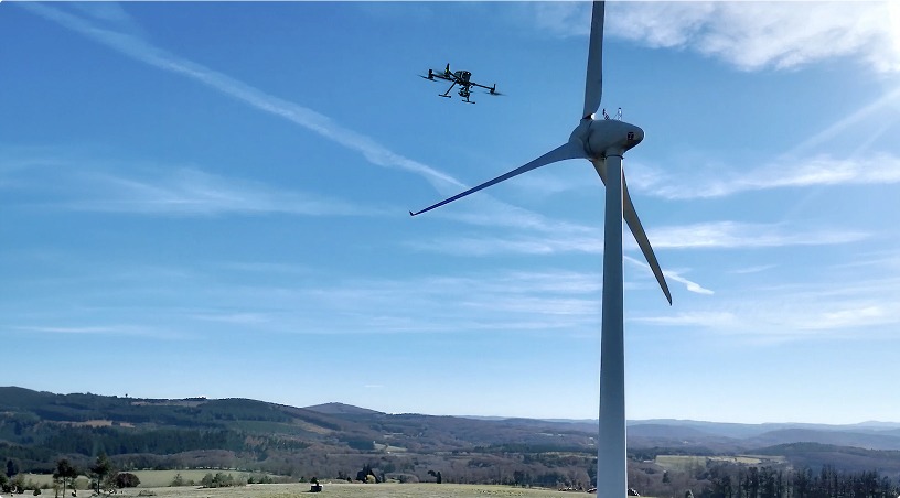
Flare stacks are among the hardest assets to inspect using conventional methods. They function at extreme temperatures, often in active combustion, and at heights requiring a lot of scaffolding or specialised crane access. A complete flare stack inspection with traditional methods might take days to set up and complete.
Enterprise-grade thermal drones inspect active flare systems in a fraction of that time. High-resolution radiometric thermal cameras capture calibrated surface temperature data across the flare stack during operation. Detected thermal anomalies, such as localized hotspots, can indicate refractory damage, heat loss, or abnormal combustion behavior, and require further validation using appropriate NDT methods.
The same approach applies to columns, vessels, heat exchangers, and pipe racks. Thermal imaging detects insulation failures, bearing degradation in rotating equipment, and electrical hotspots in motor control centres. Because these inspections are performed during live operations, the data reflects actual operating conditions rather than cold shutdown readings that may miss performance-related anomalies.
Pipeline networks across the UAE and wider GCC stretch across vast desert terrain, crossing remote areas where regular human patrol is both costly and impractical. Conventional pipeline surveys involve vehicle-based patrols, periodic foot inspections, or manned helicopter flyovers, each with its own cost, coverage, and frequency limitations.
Autonomous drone systems now monitor hundreds of kilometres of pipeline corridor in a single mission. Equipped with visual, thermal, and gas detection sensors, these drones identify methane leaks at sensitivity levels invisible to human inspectors, detect third-party encroachment or ground movement along the right-of-way, and map vegetation overgrowth that could compromise pipeline integrity.
The output is a geo-tagged, time-stamped defect report delivered within hours of the flight, complete with GPS coordinates, severity classification, and recommended actions. For operators managing extensive pipeline networks, this transforms corridor monitoring from a periodic, resource-heavy exercise into a routine, data-rich process that catches problems early.
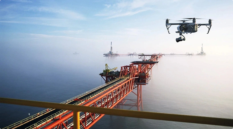
Offshore inspections carry some of the highest per-inspection costs in the industry. Crew transport by helicopter, weather-dependent scheduling, accommodation logistics, and the inherent safety risks of marine environments all contribute to timelines that stretch from days into weeks.
Maritime-grade inspection drones reach offshore platforms, FPSOs, and subsea support structures without personnel mobilisation. They inspect jackets, risers, flare booms, and deck equipment visually and thermally, operating in wind conditions that would ground conventional inspection methods. Emergency damage assessments that previously required a full crew deployment can now be completed within hours of an incident report.
For operators managing multiple offshore assets across the Arabian Gulf, this capability compresses inspection cycles, reduces HSE exposure, and frees up helicopter and vessel time for operational priorities rather than routine inspection support.
Capturing aerial and thermal data is only half the value. The real operational impact comes from how that data is processed, classified, and integrated into your asset management workflow.
Gulfnet Insight®, the advanced analytics platform developed by Gulfnet Emirates, uses AI-powered defect recognition to automatically classify corrosion, cracking, coating failures, and thermal anomalies from inspection data. It performs trend analysis by comparing current conditions against historical inspection cycles, tracking degradation rates and flagging assets approaching intervention thresholds.
The platform integrates directly with enterprise CMMS systems such as SAP and Maximo, enabling automated work order generation from inspection findings. Compliance reporting is built in, generating audit-ready documentation that meets ADNOC HSE requirements, Saudi Aramco engineering standards, and API/ASME inspection protocols. For reliability engineers and asset integrity managers, this means inspection data flows directly into maintenance planning rather than sitting in a PDF report waiting to be manually reviewed.
The shift from conventional to drone-based inspections is not a blanket replacement of existing methods. It is a strategic reallocation of inspection resources toward the approaches that deliver the best combination of safety, speed, data quality, and cost efficiency for each asset type.
To summarise the operational case: thermal drone inspections eliminate shutdowns and scaffolding for flare stacks and process equipment. Automated corridor monitoring transforms pipeline surveillance from periodic patrols to continuous, sensor-rich coverage. Maritime-grade drones compress offshore inspection cycles and reduce mobilisation costs. And platforms like Gulfnet Insight® ensure that inspection data translates directly into maintenance decisions rather than static reports.
For UAE oil and gas operators looking to reduce inspection costs by 60 to 75 percent, improve defect detection rates, and maintain compliance with evolving regional HSE standards, the operational case is clear. The question is where to start.
Gulfnet Emirates works with refineries, pipeline operators, offshore platforms, and processing facilities across the GCC to scope, deploy, and support enterprise drone inspection programmes tailored to each facility’s asset mix and compliance requirements. Share your asset list and inspection priorities to receive a tailored scope and plan.
1. How much can drone inspections reduce costs compared to scaffolding and rope access methods?
Most oil and gas operators see cost reductions of 60 to 75 percent compared to conventional inspection approaches. The savings come from eliminating scaffolding erection and dismantling, reducing production downtime, and cutting personnel mobilisation costs. For offshore assets, the savings are even greater because drone inspections remove the need for helicopter crew transport, weather standby charges, and extended accommodation logistics. Beyond direct cost savings, drones also prevent revenue losses from avoided shutdowns, which for a processing train can exceed the cost of an entire annual inspection programme in a single day of downtime.
2. Can drones inspect active equipment without requiring a facility shutdown?
Yes, this is one of the primary advantages of drone inspection technology. Enterprise-grade drones operate safely around active flares, pressurised piping, and energised equipment using approved standoff distances and intrinsically safe configurations where required. Thermal inspections are actually more effective during live operations because they capture real performance data, including combustion efficiency, heat loss patterns, and bearing temperatures, that cold shutdown readings cannot reveal. Flight plans are coordinated with your operations team as part of your simultaneous operations (SIMOPS) procedures to ensure safe integration with ongoing facility activities.
3. What types of defects can drones detect that ground-level inspections typically miss?
Multi-sensor drone platforms detect methane leaks at sensitivity levels as low as 5 ppm, thermal anomalies indicating internal corrosion before external failure occurs, and structural micro-cracking that is not visible from ground level. Thermal cameras identify insulation failures, electrical hotspots, and bearing degradation in rotating equipment. LiDAR sensors measure millimetre-level settlement and deformation in storage tanks. The aerial perspective also reveals defect patterns across large asset areas, such as coating degradation trends across a tank farm, that would require dozens of individual ground inspections to piece together.
4. Do drone inspection services comply with ADNOC and regional HSE standards?
Gulfnet Emirates operates with approved safety management systems that comply with ADNOC HSE requirements, Saudi Aramco engineering standards, and international API/ASME inspection protocols. All drone pilots hold GCAA certification, and operations follow client-specific permit-to-work procedures, including hot work permits where applicable. Inspection reports contain verifiable documentation with geo-tagged imagery, metadata, and defect classification according to industry standards. Risk assessments are completed before every mission to ensure full alignment with facility operator requirements and regulatory obligations.
5. What deliverables and reporting formats are provided after an inspection?
Every inspection includes a comprehensive digital report containing geo-referenced high-resolution imagery, thermal analysis with temperature measurements, defect classifications by severity, and recommended actions based on risk-priority level. Through Gulfnet Insight®, reports integrate directly with CMMS platforms like SAP and Maximo, enabling automated work order generation. Additional deliverables include orthomosaic maps for pipeline corridors, 3D models for structural assets, and trend analysis comparing current conditions against historical inspection data. All documentation complies with API 510, API 653, and client-specific reporting requirements.
 Go back