
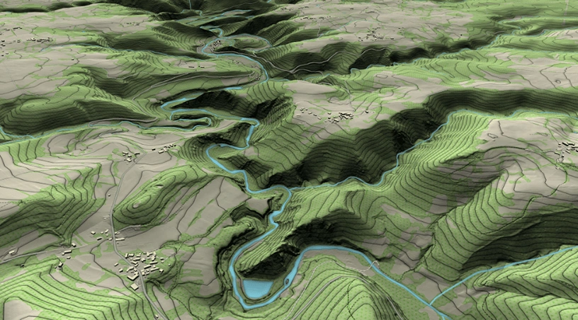
A topographic survey can become the first schedule bottleneck on a large land development. Before roads are graded, utilities are routed, or earthwork quantities are checked, teams need a reliable picture of the existing ground. On a wide GCC site, that can mean long hours moving between survey points and working around access roads, machinery, and difficult terrain.
Aerial topography surveying shifts much of that effort from field movement to planned capture and processing. A coordinated drone flight can collect dense surface data across a large area, which is then turned into terrain information that engineers, planners, and commercial teams can use.
The difficulty is rarely one complicated measurement. It is the number of measurements needed across a large and changing site.
A ground crew may need to move repeatedly between benchmarks, level changes, drainage features, stockpiles, access tracks, excavated areas, and undeveloped ground. Every movement takes time, and site activity can slow the process further. A haul road may be busy. An excavation zone may be temporarily inaccessible. A section surveyed early in the week may already look different by the time the team reaches the opposite side of the development.
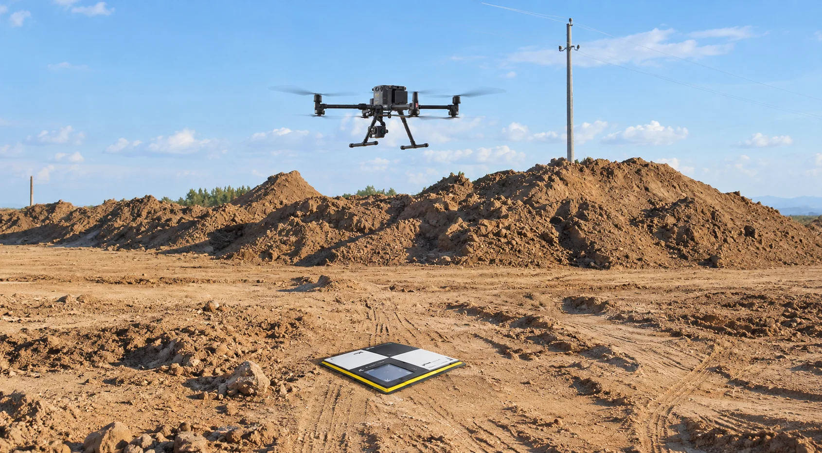
Traditional methods still matter for control, verification, and specific high-accuracy measurements. The inefficiency appears when large-area capture depends on crews physically reaching enough points to describe the terrain. A drone can instead follow a planned route and collect overlapping imagery or LiDAR data that is processed into survey and mapping outputs.
A productive survey starts with the required output, not with the drone. Before the flight, the team needs to know what the data will support. Early land assessment, grading design, cut-and-fill analysis, and later progress checks may require different accuracy, control, sensors, flight settings, and output formats.
The mission is then planned around the site boundary and terrain. Depending on the requirement, the aircraft may capture high-resolution imagery for photogrammetry or LiDAR data for detailed point-cloud and terrain analysis. Gulfnet’s Surveying, Mapping & Measurement capabilities include enterprise drones, mapping sensors, LiDAR, photogrammetry software, and geospatial processing tools for this type of workflow.
In the UAE, aerial survey operations also need to be planned around the applicable drone rules and permissions. The General Civil Aviation Authority classifies surveying as aerial work and sets requirements for professional drone operations.
Raw aerial data is only useful when it becomes information that fits the project workflow. Gulfnet’s published drone processing capabilities include orthomosaic generation, point-cloud processing, Digital Surface Models, Digital Terrain Models, terrain and slope analysis, volumetric calculations, and exports for CAD and GIS environments. Its construction solutions also include contour mapping and cut-and-fill analysis for earthwork planning.
Those outputs answer different questions. An orthomosaic gives a geo-referenced site view, terrain models show level changes, contours support planning, and point clouds preserve dense three-dimensional information for analysis. One capture can therefore support civil design, earthwork review, project visibility, and measurement tasks from the same site record.
Not every site needs the same sensor, which is why “drone survey” is too broad a specification on its own. Photogrammetry builds mapping and 3D outputs from overlapping photographs. Gulfnet lists orthomosaics, 3D models, surface and terrain models, construction mapping, and volumetric calculations among its supported photogrammetry applications.
LiDAR collects dense spatial points using laser scanning. Gulfnet’s LiDAR workflows include point-cloud classification, ground filtering, vegetation segmentation, terrain and slope analysis, cross-sections, and CAD/GIS export. The practical choice is therefore the method that best matches the site conditions and engineering decision.
Also Read: LiDAR Survey Benefits for GCC Infrastructure Projects: ROI Analysis
The first flight gives the project a baseline. Repeat flights make that baseline easier to use as the land changes.
Once grading or excavation begins, the same site may need to be measured again. Gulfnet’s construction offering includes repeatable flight paths, 3D mapping and topography, stockpile surveys, and site comparison over time. That gives project teams an updated record as cut areas, fill zones, material positions, and access routes change.
Related: Volumetric Measurement Using Drones: Accurate Stockpile Surveys for Construction Sites
A good brief should describe the decision the survey needs to support. If the team only asks for “drone mapping,” it may receive files that are difficult to use. A better scope defines the boundary, coordinate system, accuracy, deliverables, contour needs, control requirements, software formats, and whether later comparison is required.
Terrain complexity, vegetation, machinery, access restrictions, airspace, and ground visibility can also influence sensor and mission design. Gulfnet’s photogrammetry, LiDAR, mission-planning, point-cloud, terrain-modelling, and CAD/GIS capabilities are most useful when selected around those project requirements.
The promise behind “a week of fieldwork in one morning” is not that every conventional survey task disappears. Ground control, verification, professional survey judgement, and regulatory planning still matter. What changes is the efficiency of large-area capture and the speed at which that capture becomes usable terrain information.
For GCC land development, the strongest approach is simple: define the engineering question first, choose the right capture method, process the data into usable project formats, and plan for repeatability if the site will need ongoing measurement. Gulfnet supports that workflow through enterprise drones, mapping sensors, photogrammetry and LiDAR processing, topographic outputs, and construction-focused measurement capabilities. To discuss the right aerial survey approach for a development site, contact Gulfnet.
How can aerial topography surveying reduce fieldwork on a large GCC development?
Aerial surveying captures dense site data across a wide area through a planned drone mission, reducing how much terrain must be covered point by point on foot. Ground control and verification may still be required, but the main surface capture can be completed far more efficiently on suitable sites.
What topographic survey outputs can Gulfnet support for land development projects?
Gulfnet’s published capabilities include orthomosaics, point clouds, Digital Surface Models, Digital Terrain Models, contour mapping, terrain and slope analysis, volumetric measurements, and cut-and-fill analysis. Its processing tools also support CAD and GIS exports, giving engineering, planning, construction, and geospatial teams outputs that fit established project workflows.
Is LiDAR always better than photogrammetry for aerial land surveys?
No. Photogrammetry is useful when detailed surface imagery, orthomosaics, 3D models, and visible-ground mapping are required. LiDAR is useful for dense point-cloud analysis, ground filtering, terrain modelling, and feature classification. The right choice depends on site conditions, required outputs, accuracy needs, ground visibility, and the intended engineering use.
Can aerial topographic surveying be used during earthworks as well as before construction?
Yes. An initial flight can establish existing terrain, while later flights can record how excavation, fill areas, stockpiles, and site levels change. Gulfnet’s construction capabilities include repeatable flights, 3D mapping and topography, volumetric measurement, and cut-and-fill analysis, helping teams compare changing ground conditions through successive project stages.
What should be included when requesting a commercial drone topographic survey?
The brief should define the survey area, required accuracy, coordinate system, control requirements, intended engineering use, expected deliverables, contour requirements, and preferred CAD or GIS formats. It should also identify site and airspace constraints so the provider can select an appropriate sensor, mission plan, processing workflow, and repeat-survey approach if needed.


 Go back
