If your infrastructure project is running on survey data gathered by traditional total stations and GPS rovers, you are likely absorbing hidden costs that do not show up on the initial budget: rework from incomplete data, delayed design decisions, and safety exposure on high-risk sites.
This blog breaks down where LiDAR surveys deliver measurable ROI on infrastructure projects in the UAE and wider GCC, how to calculate the financial case, and what a structured deployment looks like in practice.
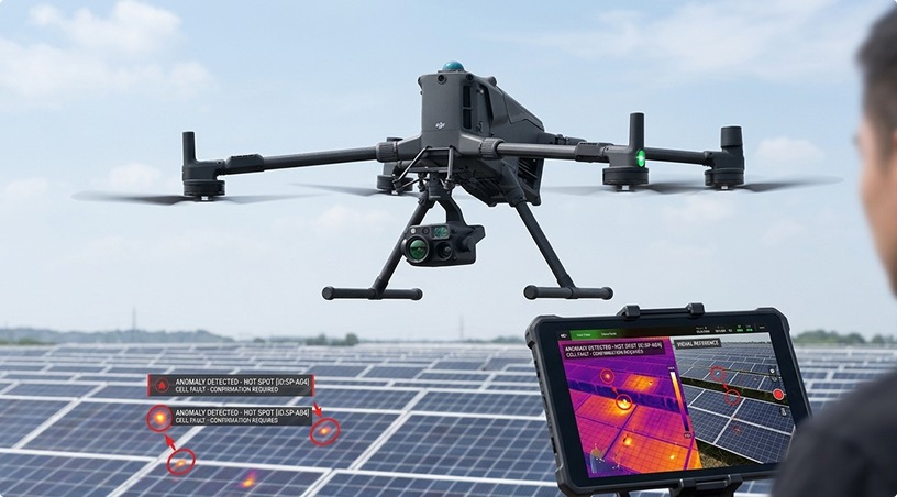
LiDAR (Light Detection and Ranging) captures millions of geo-referenced data points per second, producing highly accurate 3D point clouds of terrain, structures, and assets. Unlike traditional surveying, which samples discrete points, LiDAR captures high-density surface geometry enabling engineers to extract any measurement they need from the dataset without revisiting the field.
For GCC infrastructure projects spanning highways, rail corridors, utility networks, urban developments, and coastal zones, the operational difference is significant. A surveying crew using conventional methods may spend weeks capturing a highway corridor and still miss critical elevation data for drainage design. A drone-mounted LiDAR system captures the same corridor in hours with centimeter-level accuracy across every square meter, producing a dataset that feeds directly into BIM, GIS, and CAD workflows.
(Related: LiDAR Drone Surveying Explained: High-Accuracy Mapping for UAE Infrastructure)
The ROI case for LiDAR is strongest in five specific scenarios common to GCC infrastructure work.
1. Road and Highway Corridor Surveys
These benefit from LiDAR’s ability to capture kilometers of terrain, pavement condition, drainage features, and adjacent utilities in a single mission. For a 50 km highway project, this compresses a four-to-six week traditional survey into three to five days of flight time plus processing. Survey labour savings typically range from 40 to 60%, before accounting for the acceleration in design timelines.
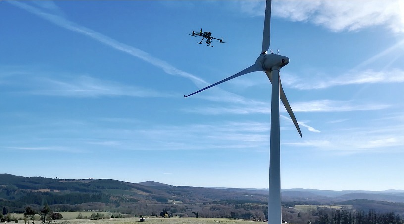
2. Bridge and Elevated Structure Inspections
LiDAR systems offer very high precision in measuring deflection, settlement, and clearance. Millimeter-level accuracy on a 3D point cloud allows engineers to compare current conditions against design specifications or previous inspection cycles, identifying structural movement that would be invisible to visual inspection alone. This proactive detection can prevent remediation costs that run into millions of dirhams on major assets.
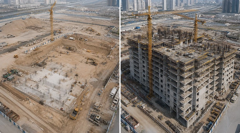
3. Earthworks and Volumetric Calculations on Construction Sites
This is where LiDAR delivers immediate financial impact. Quantity surveys for excavation, fill, and stockpile volumes based on traditional methods carry error margins that translate directly into contract disputes and billing disagreements. LiDAR reduces volumetric measurement error to under 1%, which on a major earthworks project can represent millions of dirhams in accurate payment certification.
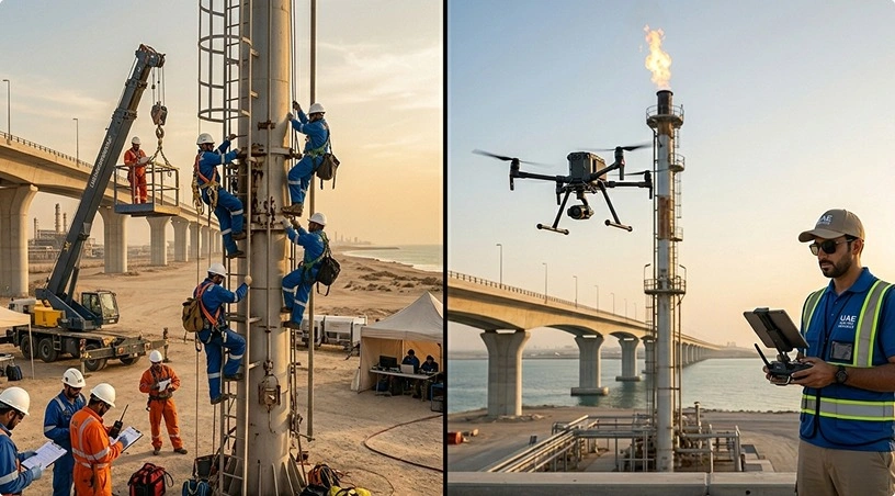
4. Utility Corridor Mapping
Transmission Lines, pipelines, and distribution networks benefit from LiDAR’s ability to capture both the asset and surrounding terrain in a single pass. Vegetation encroachment, ground subsidence, and right-of-way violations are detected automatically through point cloud analysis, supporting preventive maintenance before failures occur.
5. Urban Planning
Smart city projects use LiDAR-derived 3D city models for design coordination, flood modelling, and infrastructure planning. In cities like Dubai, Abu Dhabi, and Riyadh, where development density and vertical complexity are high, the accuracy of the underlying geospatial data directly affects design quality and coordination across disciplines.
(Also read: Construction Site Monitoring with Drones: Benefits for GCC Project Managers)
A practical ROI calculation for LiDAR on infrastructure projects considers four cost categories.
Direct survey cost comparison. Compare the quoted LiDAR survey fee against the equivalent traditional survey cost for the same area and deliverable scope. On most GCC infrastructure projects above 10 hectares or 5 km linear extent, LiDAR is already cost-competitive on direct fees alone, and significantly cheaper at larger scales.
Timeline acceleration value. Calculate the value of compressing the survey phase by two to four weeks. On major infrastructure projects where each week of delay carries financing costs, contractor mobilization overhead, and opportunity cost, a faster survey delivery often saves more than the survey itself costs.
Rework and design revision avoidance. Estimate the historical cost of design changes driven by incomplete or inaccurate survey data on similar past projects. LiDAR’s comprehensive point cloud reduces these revisions significantly because engineers can extract any measurement from the dataset post-survey without remobilizing field crews.
Long-term asset management value. For infrastructure assets that will be monitored over decades, the initial LiDAR baseline becomes a reference dataset for all future inspections, expansions, and maintenance decisions. This compounding value is often excluded from project-level ROI calculations but represents substantial savings over the asset lifecycle.
For most GCC infrastructure projects above a moderate scale, the combined ROI across these four categories ranges from 150% to 400% compared to traditional survey methods.
Capturing high-quality LiDAR data is only the start. The projects seeing the strongest ROI follow a structured deployment approach.
Mission planning aligned with project deliverables. Before flight, the survey plan is matched to the specific outputs the project needs: contour maps, BIM-ready models, volumetric calculations, or vegetation analysis. This upfront alignment prevents rework and ensures the point cloud density matches the accuracy requirements of the end deliverable.
Regulatory compliance and flight authorization. All commercial drone-based LiDAR operations in the UAE require GCAA-certified pilots and site-specific flight permits. For sensitive infrastructure corridors near airports, ports, or government facilities, permit coordination is a critical path item that experienced providers handle upfront.
Integrated processing and analytics. Raw point clouds are only useful once they are classified, filtered, and processed into project-ready deliverables. A centralized data platform that handles point cloud processing, defect detection, trend analysis across inspection cycles, and direct export to engineering software eliminates the coordination delays that often slow LiDAR projects.
Integration with ongoing asset management. For long-life infrastructure assets, the initial LiDAR baseline should feed into an asset management platform where future inspections, condition monitoring, and design updates can be compared against the original dataset over time.
The ROI case for LiDAR on GCC infrastructure projects rests on four pillars: direct cost savings versus traditional survey methods, timeline acceleration that reduces financing and opportunity costs, rework avoidance from more complete datasets, and long-term asset management value that compounds over the asset lifecycle. When these factors are combined, LiDAR consistently outperforms conventional surveying on moderate-to-large infrastructure projects across the UAE, Saudi Arabia, Qatar, and wider GCC markets.
Gulfnet provides end-to-end LiDAR survey services across the GCC, covering highways, rail corridors, bridges, utility networks, earthworks, and urban development projects. As an authorized DJI Enterprise dealer with GCAA-certified pilots, multi-sensor aerial platforms, and centralized point cloud processing through Gulfnet Insight®, we deliver survey programs designed to integrate with your design, construction, and asset management workflows.
Get in touch for a free consultation and project-specific ROI analysis: www.gulfnetemirates.com/dronesandrobotics
1. How accurate are drone-based LiDAR surveys for GCC infrastructure projects?
Drone-mounted LiDAR systems deliver vertical accuracy in the range of 2 to 5 cm and horizontal accuracy under 3 cm when properly calibrated and ground-controlled. This exceeds the requirements of most infrastructure design workflows and supports engineering-grade deliverables for highways, bridges, and utility corridors.
2. How long does a typical LiDAR survey take on a GCC infrastructure project?
A 50 km highway corridor typically requires three to five days of flight operations and seven to ten days for full point cloud processing and deliverable generation. Compared to traditional surveying methods that may take four to six weeks for the same scope, LiDAR compresses timelines by 60 to 75%.
3. Is LiDAR cost-effective for smaller infrastructure projects in the UAE?
LiDAR becomes cost-competitive with traditional surveys on projects above approximately 10 hectares or 5 km linear extent. Below this threshold, conventional methods may still be economical. For projects above this scale, LiDAR typically delivers 40 to 60% direct cost savings plus substantial timeline benefits.
4. What deliverables can be extracted from a LiDAR point cloud?
LiDAR deliverables include classified point clouds, digital terrain and surface models, contour maps, 3D mesh models, volumetric calculations, vegetation analysis, utility line extraction, and BIM-ready structural models. A single dataset supports multiple engineering workflows without requiring additional field surveys.
5. How does LiDAR integrate with existing design and asset management systems?
LiDAR point clouds export directly to common engineering formats including LAS, LAZ, and proprietary BIM, CAD, and GIS platforms. Centralized data platforms enable historical comparison across inspection cycles, supporting both initial design and long-term asset monitoring over the infrastructure lifecycle.
 Go back