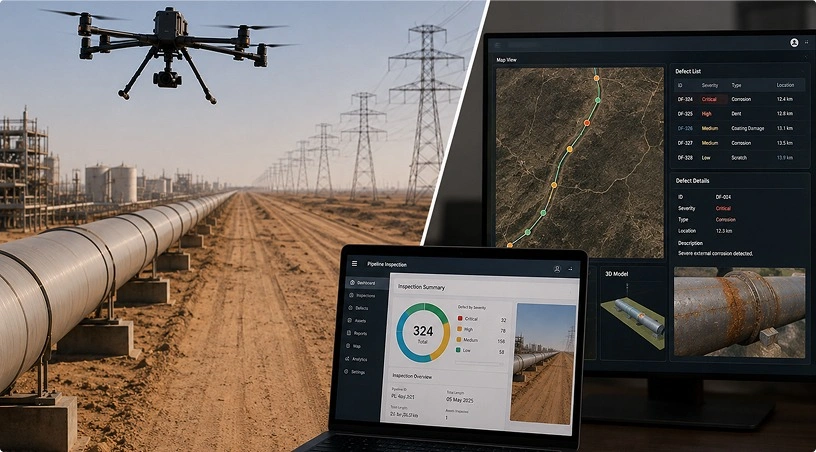
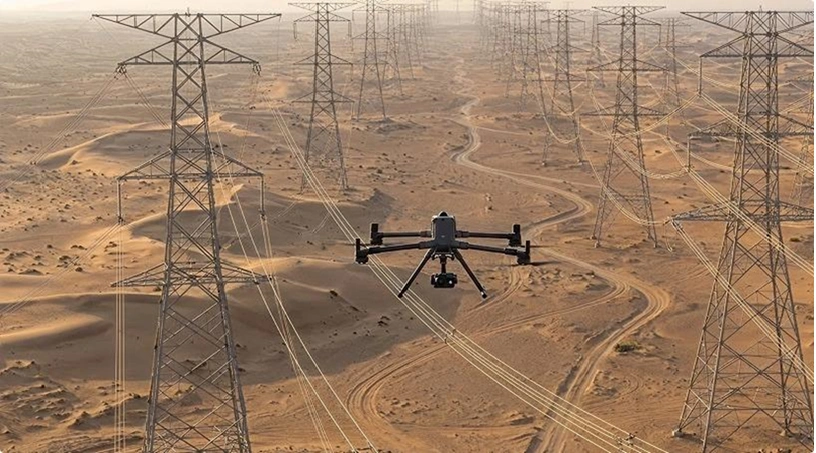
You cannot fix what you cannot see, and on a 132 kV lattice tower, many critical defects are difficult to identify consistently from ground patrols or conventional helicopter flyovers. Upper cross-arm bolt corrosion, hot compression fittings, hairline insulator cracks, and conductor strand damage on the upper surface of the cable often require close-range, high-resolution inspection to be properly assessed. Drones equipped with advanced visual and thermal sensors enable detailed component-level inspection from safe standoff distances, supporting faster and more data-driven maintenance decisions for UAE utility operators.
This blog covers that end-to-end: what degrades on UAE corridors, what conventional methods miss, what drones catch component by component, and how repeated flights shift maintenance from calendar-based to condition-based.
The UAE grid faces a degradation profile that borrows from several climate zones at once. Coastal corridors between Abu Dhabi and Dubai expose hardware to salt spray that accelerates galvanic corrosion on tower steelwork, connectors, and insulator fittings. Desert spans accumulate particulate that coats insulator surfaces, reducing creepage distance and increasing flashover risk. Urban crossings generate thermal loading and restrict maintenance access windows. DEWA’s transmission network has achieved 100% availability on its 400 kV system and a Customer Minutes Lost figure of 1.43 against a 15-minute European average, a standard that only holds if inspection keeps pace with how fast these conditions degrade assets.
The grid itself is also changing. Renewable integration introduces variable loading that stresses conductors differently from baseload generation. New links connecting substations across the Northern Emirates and the TRANSCO backbone add corridor kilometres that must be inspected at the same standard. The inspection task is growing faster than headcount-based methods can follow.
Ground patrols see towers from below and conductors from a distance. They catch gross defects: a visibly broken insulator disc, a bird nest large enough to spot from the base, and obvious vegetation contact. They do not catch early-stage corrosion on upper cross-arm bolts, hairline cracks in composite insulators, hot joints on compression fittings, or strand breaks on the upper cable surface where no ground angle reveals them.
Helicopter surveys cover distance but at altitude and speed. They provide corridor-level awareness, not component-level diagnosis. The cost per kilometre, noise footprint in urban areas, and coordination overhead with UAE civil aviation make them impractical for frequent, close-range inspection.
Neither method produces a consistent, georeferenced, sensor-rich dataset that can be compared flight to flight and fed into an asset management system. That gap between what gets seen and what gets recorded is where outage risk accumulates.
Also read: DJI Enterprise Drones for Industrial Inspection: Why Leading UAE Companies Choose Them
A properly planned power line inspection mission works through the infrastructure systematically, matching sensor to component to failure mode.
Tower steelwork and foundations benefit from high-resolution RGB capture that identifies bolt corrosion, paint system failure, weld cracking, member distortion, and foundation erosion. On lattice towers common across TRANSCO and DEWA 132 kV corridors, upper cross-arm detail that would require a tower climb can be captured in minutes from safe standoff.
Conductors and hardware fittings are where thermal imaging earns its value. Hot joints at compression connectors, Breeze clamps, and jumper connections indicate resistive heating that will eventually cause a fault. AI-assisted analysis of thermal and visual data flags anomalies automatically, so engineering teams review prioritised exception lists rather than thousands of raw images.
Insulator strings, both glass disc and composite, require close-range visual capture to identify contamination, chipping, puncture marks, and tracking damage. Thermal capture helps identify abnormal heating patterns associated with potential internal degradation or electrical stress in composite insulators.
Right-of-way and vegetation clearance monitoring uses LiDAR point clouds to measure conductor-to-ground and conductor-to-vegetation distances with high accuracy. Growth-rate modelling from successive flights lets teams schedule vegetation management proactively rather than reactively, the difference between a trimming programme and an outage response.
Related: Wind Turbine Inspection Services: Protecting Your Renewable Energy Investment
A single inspection flight captures a snapshot. A programme of repeated flights, flown on consistent paths with the same sensor configuration and processed through the same analytics pipeline, creates a condition trend for every tower, span, and component.
That trend moves maintenance from calendar-based to condition-based. A compression fitting that showed 3°C above ambient in January and 7°C in June gets flagged for replacement before it fails in August. An insulator string showing progressive contamination across three quarterly flights gets scheduled for cleaning before flashover season. A vegetation corridor where LiDAR shows 800 mm of annual canopy growth gets trimmed on a cycle reflecting actual growth, not a generic annual schedule.
For utilities operating under GCAA drone regulations with pre-cleared corridor permits and certified pilot teams managing operations end-to-end, this cadence becomes sustainable rather than aspirational. The same data pipeline that processes corridor imagery feeds into GIS, SCADA integration layers, and enterprise asset management systems where maintenance decisions get made.
Power line inspection using drones does not eliminate the need for linesmen, climbing crews, or helicopter surveys. It restructures how those resources are deployed. Drones handle high-frequency, corridor-wide condition assessment that no other method delivers at the same cost and cadence. Climbing crews get dispatched to confirmed defects rather than speculative inspections. Helicopter hours get reserved for emergency response rather than routine patrol. The grid gets a living, component-level condition record that improves with every flight cycle, and outage risk drops because the gap between what is degrading and what is known to be degrading narrows with each pass. For UAE utilities building the next generation of grid infrastructure while protecting reliability standards that already lead the world, that visibility is not optional.
Related: Construction Progress Monitoring ROI: How Drones Reduce Project Delays
Gulfnet Emirates is an authorised DJI Enterprise dealer supporting UAE utilities and grid operators with platform supply, GCAA-compliant pilot teams, managed power line inspection, payload configuration, and AI-powered analytics through its Drones and Robotics division. Whether you are building a corridor programme or integrating drone data into an existing asset management workflow, the team can design a cadence, sensor strategy, and reporting pipeline that fit your network. Visit gulfnetemirates.com/dronesandrobotics to start the conversation.
What types of power line defects can drone inspection detect in the UAE?
Drones with RGB, thermal, and LiDAR sensors detect tower corrosion, insulator contamination and cracking, hot joints on compression fittings, conductor strand breaks, cross-arm distortion, and vegetation encroachment. Thermal capture identifies resistive heating invisible to visual inspection, while LiDAR measures conductor clearances with survey-grade precision for compliance reporting.
How does drone inspection reduce unplanned outage risk for utilities?
Repeated flights on consistent paths create component-level condition trends that surface degradation before failure. Hot fittings, progressive insulator contamination, and vegetation growth rates become visible across cycles, enabling repairs during planned windows rather than after an unplanned trip. This is the core shift from reactive to predictive maintenance.
Can drones inspect live power lines without shutting down the circuit?
Yes. Enterprise-grade platforms maintain safe standoff distances from energised conductors while capturing high-resolution visual and thermal data. Flights are planned with clearance buffers appropriate to voltage level and local regulations. No circuit outage is required for routine inspection, which is a significant operational advantage over climbing crews.
What sensors are used for power line drone inspection in the UAE?
A typical mission combines high-zoom RGB cameras for surface defect identification, radiometric thermal payloads for hotspot detection, and LiDAR for corridor mapping and vegetation clearance measurement. Sensor selection depends on voltage level, corridor environment, and which failure modes the operator prioritises in a given inspection cycle.
Are drone power line inspections compliant with UAE aviation regulations?
Yes. Per the UAE Government’s aviation safety framework, commercial operations require GCAA Unmanned Aircraft Operator Authorisation, registered aircraft, certified pilots, and per-flight permits. Transmission corridors often cross multiple airspace zones, making pre-cleared corridor permits and experienced regulatory handling essential for uninterrupted programme delivery.

 Go back