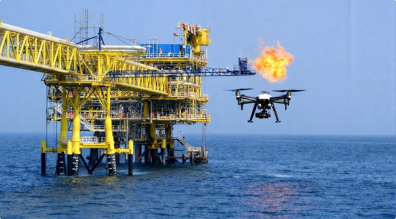
Sending rope-access technicians onto a live offshore platform to check flare tip corrosion, splash-zone integrity, or the condition of a helideck after a wind event is one of the most costly and time-sensitive activities an offshore operator manages. Add the pressure of an unplanned incident, a gas release, a fire, a structural impact, and the same inspection has to happen faster, safer, and with less staged setup.
This piece walks through how offshore teams across the GCC are restructuring both routine monitoring cycles and emergency response protocols around aerial and robotic inspection methods, what the operational payoff looks like in practice, and where the limits still sit.
Offshore assets in the Arabian Gulf face a compounding set of pressures that shore-based facilities do not. Coastal humidity, salt-laden air, and sustained summer temperatures above 45 degrees Celsius accelerate corrosion on flare stacks, risers, splash zones, and structural members. Operators inspecting these components have traditionally relied on scaffolding, rope access, or shutdown windows, each of which carries scheduling and cost implications. According to the International Association of Oil and Gas Producers safety data reporting, working at height and dropped-object incidents remain persistent contributors to offshore injury statistics. Reducing human exposure on elevated structures is therefore not just an efficiency question but a safety priority written into most operator HSE frameworks in the region.
Routine monitoring on a producing platform is less about capturing dramatic footage and more about repeatability. Inspection teams schedule flights around production windows, wind conditions, and helideck traffic, then run standardised paths across the same assets month after month. A single mission typically covers flare tip condition, riser clamp integrity, cathodic protection anode wear, splash-zone coating condition, and structural weld visual checks.
The value shows up in the comparison, not the individual image. When the same asset is imaged from the same angles at defined intervals, corrosion progression, coating failure, and hairline structural changes surface early. Our managed inspection services build these baselines during the first mission and use them as reference points for every subsequent flight, allowing integrity engineers to work with trend data rather than isolated snapshots.
Emergency response scenarios sit at the other end of the spectrum. In the first hours after a gas release, fire, structural impact, or dropped-object incident, the operational question is straightforward: what is the extent of the damage, is the asset stable, and where can personnel safely return. Traditional answers to those questions required either helicopter overflights or waiting until conditions allowed rope-access teams to deploy.
Aerial thermal imaging changes that timeline substantially. A thermal-capable platform operated from a support vessel or from an unaffected part of the facility can survey hot spots, identify residual heat sources, confirm the state of relief systems, and provide incident commanders with visual evidence before physical inspection teams are exposed. Our thermal inspection capability using the Matrice 4 Thermal payload has been deployed in both drilled response exercises and live operational scenarios where visibility and heat made human proximity unsafe.
Also Read: Flare Stack Thermal Inspection: Why Safety Cannot Wait
Not every offshore inspection task benefits equally from remote methods. The strongest fit sits in three categories. First, elevated visual and thermal inspections where scaffolding cost and access risk are disproportionate to the inspection duration. Flare tips, derrick structures, crane booms, and communication masts fall here. Second, confined and hazardous-area assessments where crawler robots and tethered inspection systems can enter spaces that would otherwise require permit-heavy human entry, such as storage tank interiors, ballast compartments, and process vessels. Third, post-event damage assessment where speed of information matters more than depth of measurement.
Deloitte research on the digital operating model in oil and gas has consistently identified inspection and integrity management as one of the highest-return areas for automation investment, particularly where the alternative involves production deferral. The economic argument on offshore assets is stronger still, given the cost of a single deferred production day.
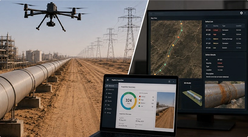
Raw imagery from an offshore mission is not the deliverable. Integrity engineers, HSE leads, and asset managers need findings classified, geo-referenced, and comparable against previous inspections. This is where the difference between a drone service and a managed inspection programme becomes visible.
Our AI-powered data platform processes captured imagery, thermal data, and video into structured reports that flag anomalies, tag them to specific asset identifiers, and present them alongside historical baselines. For emergency scenarios, the same platform supports rapid tagging and sharing so that incident command teams, onshore integrity engineers, and regulatory stakeholders can work from a common visual record within hours rather than days. GCAA-certified pilot teams operating under UAE offshore aviation protocols handle mission planning, exclusion zone coordination with platform operations, and flight execution across ADNOC-operated and independent operator assets.
Related: Power Line Inspection with Drones in the UAE
The operators seeing the strongest results are those who stop treating aerial inspection as either a routine tool or an emergency tool and start treating it as a single capability with two operating modes. The same trained pilots, the same equipment inventory, the same data platform, and the same reporting workflows serve both. Routine missions build the asset baselines that make emergency assessments faster and more accurate. Emergency deployments validate the readiness of teams whose primary work is scheduled inspection.
For offshore operators in the UAE and wider GCC, the combination of environmental severity, production sensitivity, and regulatory expectation makes this dual-mode framework increasingly the operational default rather than an optional upgrade. Reduced personnel exposure, earlier defect detection, faster incident response, and defensible integrity records are the measurable outcomes.
If your offshore inspection programme is still structured around separate contractors, separate response protocols, and inspection data that lives in isolated reports, talk to Gulfnet Emirates about consolidating routine monitoring and emergency response into a single managed inspection service delivered by GCAA-certified teams and supported by Gulfnet Insight. Visit gulfnetemirates.com/dronesandrobotics to arrange an operational assessment.
How much can offshore operators reduce inspection downtime by using drones?
Downtime reduction varies by asset and inspection type, but operators consolidating scaffolding-based flare and structural inspections into aerial missions typically report meaningful compression of inspection windows. Our managed inspection programmes are scoped against your current baseline so the operational gain is measurable against your own historical schedules and integrity plan.
Are drone inspections accepted by UAE offshore regulators and operators?
Yes. GCAA governs UAE airspace including offshore operations, and major operators including ADNOC-affiliated entities accept drone-based inspection data when captured by certified teams under approved flight plans. Our pilot teams operate under GCAA certification with mission planning coordinated against operator-specific offshore aviation protocols.
Can drones perform inspections during active production operations?
Yes, when mission planning accounts for platform activity, wind conditions, exclusion zones, and helideck traffic. Most routine inspections are executed without production interruption. Our teams coordinate directly with platform operations to schedule missions inside safe operating windows and document all clearances required by the operator.
What is the response time for emergency drone deployment offshore?
Response time depends on incident location, weather, vessel availability, and pilot positioning. Operators with pre-arranged emergency response agreements benefit from significantly faster mobilisation than those requesting ad-hoc deployment. We work with clients to establish standing arrangements so that trained crews and equipment are available within defined response windows.
How is drone inspection data secured and shared with operators?
All captured imagery, thermal data, and reports are processed through our secure data platform with role-based access for operator integrity teams, HSE leads, and regulatory stakeholders. Data ownership remains with the operator. Retention, sharing, and archival policies are defined in the service agreement to match your internal information security requirements.

 Go back