A Thursday morning site walkdown on a mixed-use tower in Jumeirah Village Circle. The structural superintendent says the Level 12 slab pour is on programme. The MEP coordinator says his rough-in crew has been waiting three days for access to Level 10. The project director sees two versions of reality, neither with evidence attached, and cannot reconcile them until someone walks both floors with a camera. By Monday, the delay has cascaded into a rebar sequencing issue on Level 13 and a variation claim is being drafted. That gap between what is happening on site and what reaches the decision-maker’s screen is where construction projects bleed time, money, and trust. This blog unpacks where that gap comes from on UAE projects, what closes it, and why most contractors who buy a drone still fail to capture the ROI.
Schedule slips on UAE projects do not simply add weeks. Liquidated damages clauses in GCC EPC contracts often run into tens of thousands of dirhams per calendar day. Subcontractor demobilisation and remobilisation costs stack when trades lose their sequenced access windows. Financing milestones tied to topping-out or handover shift, pulling interest carry and drawdown schedules with them. Reputational exposure on government-linked projects can affect a contractor’s prequalification standing on the next bid.
McKinsey research on construction productivity has documented the pattern: large projects routinely finish well over budget and past schedule, with construction productivity lagging most comparable industries for decades. The UAE is not immune. Summer working-hour restrictions, material logistics through Jebel Ali and Khalifa Port, and rapid sand accumulation on desert plots all tighten the margin for recovery once a slip begins. The question every project director should ask is not “are we on programme?” but “would I know by Tuesday if we fell behind on Monday?”
Delays rarely announce themselves. They accumulate in the gap between reported progress and actual progress, and by the time they surface in a formal programme update, recovery options have narrowed.
Earthwork volumes that look correct in a subcontractor’s daily report but do not match what a comparative aerial survey would show. Formwork installation rates that appear healthy in a weekly meeting but trail the pour schedule by enough to push the next floor back. Laydown areas filling faster than the logistics plan anticipated, creating access bottlenecks that ripple into crane utilisation. Facade sequencing that drifts out of alignment with interior fit-out because no one has a consistent overhead view of both at the same time.
The common thread is not that people are hiding information. It is that ground-level reporting is inherently limited by what one person can see and photograph in a four-hour walkdown under 45°C heat. When the reporting method cannot keep pace with the build, delays become invisible until they are unavoidable.
(Related: Volumetric Measurement Using Drones: Accurate Stockpile Surveys for Construction Sites)
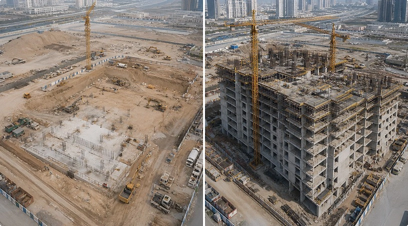
The shift is not about the drone. It is about what happens to decision-making when every stakeholder has access to the same georeferenced, timestamped visual record of the site, captured from repeatable vantage points on a fixed cadence.
Earthwork volumes become measurable against the BIM model rather than debatable in a meeting. Slab pour progress becomes a colour-coded overlay rather than a verbal assurance. Subcontractor productivity becomes defensible once weekly orthomosaics show actual placement rates, not self-reported percentages. Stockpile movements become trackable, so interim payment volumetrics no longer depend on storekeeper estimates. Claims exposure shrinks because both sides of a variation dispute can reference the same photographic timeline of what was built, by when, and to what extent.
The ROI compounds quietly: fewer disputed variations, faster interim payment certification, shorter windows between detecting a drift and correcting it. None of these savings appear on a line item labelled “drone programme.” They show up as reduced LD exposure, fewer EOT claims, and a tighter gap between planned and actual completion.
This is the part most drone vendors skip. Buying hardware is straightforward. Building a programme that changes how decisions get made is not.
Irregular cadence is the first failure mode. A flight every few weeks, triggered ad hoc when someone remembers, produces snapshots rather than a comparable dataset. Without a fixed cadence locked into the project execution plan and matched to build phase, there is nothing to compare against and no trend to track.
A missing data pipeline is the second. Raw orthomosaics sitting on a hard drive are not progress data. They become progress data when processed through photogrammetry software, overlaid against the BIM model, run through AI-assisted deviation detection and analytics, and integrated into a platform like Procore, Autodesk Construction Cloud, or Aconex where the team actually works.
Regulatory exposure is the third. Construction sites across Dubai, Abu Dhabi, Sharjah, and the Northern Emirates fall within different GCAA airspace categories, and many sit close to airports or restricted zones. Operating without Unmanned Aircraft Operator Authorisation, certified pilots, and per-flight permits risks fines and lost flying days at the worst possible moment.
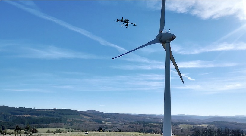
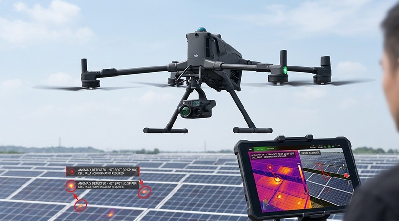
Programmes that avoid all three, defined cadence, working pipeline, embedded compliance, are the ones that turn monitoring from a cost line into a schedule recovery tool. The same managed flight operations, data processing, and compliance infrastructure that supports construction monitoring extends to industrial inspection, solar audits, and infrastructure asset management, making the investment reusable beyond a single project.
(Also Read: Drone vs Manual Inspection: A Cost-Benefit Analysis for UAE Construction Projects)
The ROI of construction progress monitoring is not in the drone. It is in the decision that gets made on Tuesday instead of the following Monday because the data was already on screen. It is in the variation claim that never gets filed because both parties had the same photographic evidence. It is in the earthwork payment that clears in days instead of weeks because the volumetric data was already processed. For UAE contractors working under tight LD clauses, summer-constrained schedules, and multi-stakeholder reporting, that gap between “I think we’re on programme” and “I can show you we’re on programme” is where real money is recovered or lost.
Gulfnet Emirates is an authorised DJI Enterprise dealer supporting UAE and GCC contractors, developers, and PMCs with platform supply, GCAA-compliant pilot teams, managed progress monitoring, photogrammetry processing, and AI-powered analytics through its Drones and Robotics division. Visit gulfnetemirates.com/dronesandrobotics to design a monitoring programme that fits your project, contracts, and reporting needs.
What makes drone progress monitoring more reliable than manual site walkdowns?
Manual walkdowns are limited by what a single person can see and photograph in a few hours at ground level. Drone captures produce georeferenced orthomosaics from repeatable flight paths, covering the entire site in a fraction of the time with centimetre-level accuracy that supports direct BIM comparison, volumetric measurement, and defensible progress evidence.
How quickly can drone monitoring detect a schedule deviation on a UAE project?
Detection speed depends on capture cadence. Weekly flights typically surface earthwork, structural, and sequencing deviations within one programme cycle, giving project teams days rather than weeks to respond. Tighter intervals during critical path activities can compress detection to a matter of days.
What data outputs should a construction drone monitoring programme deliver?
At minimum: georeferenced orthomosaics, 3D point clouds, BIM deviation overlays, volumetric calculations for earthwork and stockpile verification, and time-stamped progress comparisons across capture cycles. Programmes that also deliver AI-assisted deviation flagging and direct integration with project management platforms produce the fastest path from data to decision.
Can the same drone programme cover both progress monitoring and site safety?
Yes. The same weekly capture that tracks construction progress also flags safety concerns: unauthorised access points, missing edge protection, material storage encroaching on crane swing paths, and housekeeping issues. Combining both functions in a single flight programme avoids duplicating effort and cost.
Does drone monitoring require shutting down construction activity on site?
No. Flights are typically conducted during active working hours, with brief coordination for crane and lifting operations to ensure safe airspace separation. Capture missions for a mid-sized construction site run between twenty and forty-five minutes, with minimal disruption to ground-level construction activity.
 Go back