If you are delivering a port or coastal terminal build in the UAE right now, the hardest part of the job is not the concrete or the dredging. It is keeping three things aligned every week: what the schedule says was built, what the invoice says was built, and what is actually standing on the yard and sitting under the water. When those three drift apart, port builds lose money quietly and steadily. That challenge is visible in Fujairah today, where DP World has committed to a two and a half year build across two new terminals at Al Rugaylat and Dibba.
This blog walks through the four places on a phased port programme where the drift happens, and how drone-based construction monitoring closes each gap before it becomes lost time, contested payment, or arbitration exposure.
DP World has committed to a phased development at two east coast sites, with Khaleej Times reporting construction expected to take approximately 24 to 30 months from commencement and the Al Rugaylat terminal designed for up to 2.5 million TEU annually alongside 1.7 million tonnes of general cargo and 190,000 car equivalent units. Two things make the monitoring problem harder than a single vertical build.
First, the terminals sit on the Gulf of Oman with marine works, reclamation, and quay wall construction running against land-side yard preparation, meaning progress evidence must cover water depths and elevations at the same reporting cadence.
Second, as The National notes, the facilities will be connected to Jebel Ali and Jafza through an inland logistics network, and phased delivery means parts of each terminal will go live while adjacent works continue, forcing every reporting cycle to separate commissioned zones from active construction rather than treating the site as one moving front.
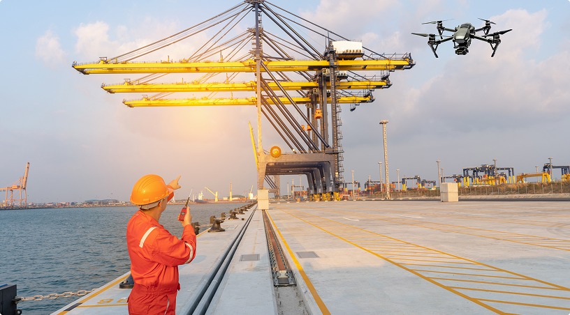
Both pressures push manual walk-throughs and ground surveys past their useful range, and this is where drone-based construction monitoring becomes the primary evidence layer.
The first reconciliation gap opens between the programme baseline and what is physically standing on site during any given reporting week. On multi-terminal builds this gap widens fast, because monthly walk-throughs cannot cover two live sites at the same fidelity and phone photographs lack the spatial reference to prove sequence.
A drone-flown capture cadence changes that. Location-tagged orthomosaics flown weekly or fortnightly produce a full-site record layered against the construction programme, making schedule slippage visible as spatial evidence rather than narrative buried in a monthly report. At phase gate reviews with the port authority, this same output replaces contested progress narratives with dated, coordinate-referenced evidence that can support progress assessment and dispute resolution.
The second gap opens where earthworks meet the bill of quantities. Volume-driven line items on a port build carry compounding measurement risk across a 24 month programme, particularly:
Measured using conventional ground-survey methods, these quantities can require significant field time across large port sites, limiting how frequently complete measurements are updated.
Drone photogrammetry, executed with proper ground control and independent checkpoints, enables efficient volumetric measurement of exposed stockpiles and cut-and-fill areas through planned flights. For a concessionaire signing off progress payments to multiple contractors across two sites, this converts quantity reconciliation from a subjective discussion into a verifiable data check.
Also Read: Construction Progress Monitoring ROI: How Drones Reduce Project Delays
The third gap is the one most often underestimated on port builds. Breakwater armour placement, quay wall alignment, dredge pocket geometry, and reclamation edge conditions all need verification that goes beyond a diver report or a bathymetric snapshot.
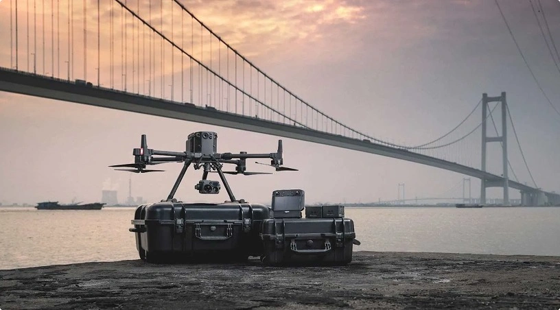
A combined drone and ROV capture programme, running enterprise aerial platforms above the waterline and subsea ROVs below, produces the layered record marine works actually require, drawing on the same aerial and subsea inspection capability applied to oil, gas and marine assets.
Deep water terminals designed for ultra large container vessels leave no tolerance for surprises at commissioning. The verification record must capture, while the works are still exposed:
Waiting until commissioning to reconstruct any of these from as-built drawings leaves the concessionaire holding what the drawings claim, not what the water and seabed actually contain.
The fourth gap surfaces long after the concrete has cured. When a variation order is contested, or a delay claim lands in month 22 referencing conditions from month four, the contemporaneous evidence available to the concessionaire determines whether the position is defensible or expensive.
A structured drone and ROV capture programme, indexed by date, coordinate, and construction phase, gives the owner side a searchable archive that predates any dispute, so month-four site conditions can be pulled up in month twenty-two without hunting for the right photograph. For a 50-year concession, that same archive becomes the baseline handover to operations, giving the terminal operator a starting condition set no ground survey could match on day one.
Four reconciliation gaps, four evidence outputs:
Applied together they convert a two-site, 24 to 30 month phased build from a monitoring headache into a controllable programme, and they position the concessionaire to hand over an operational asset with a construction record that stands up to scrutiny from the port authority, financiers, and the operations team taking over on day one.
Gulfnet Emirates supports port and terminal concessionaires across the UAE and GCC with managed reality capture programmes for phased builds, combining GCAA-certified pilot teams, DJI Enterprise platforms including the Matrice 4 series and DJI Dock 3, ROV and subsea capability, and analytics delivered through Gulfnet Insight. Visit gulfnetemirates.com/dronesandrobotics to scope a monitoring programme for your terminal build.
How much does drone construction monitoring cost for a port terminal build in the UAE?
Cost depends on site footprint, capture cadence, and deliverable set. A weekly orthomosaic programme across a two-site port build is typically priced per flight cycle, with photogrammetric volumes and marine capture scoped as add-ons. Request a scoped proposal against your programme milestones for accurate pricing on your terminal.
Can drone photogrammetry replace traditional survey teams on a port construction site?
Not entirely, but it changes the ratio. Photogrammetry handles volumetric measurement, progress orthomosaics, and topographic capture across the full site in one flight, while ground survey teams focus on setting out, boundary control, and specialist checks. The combination reduces survey hours substantially without compromising accuracy.
How accurate is drone-based volumetric measurement for reclamation and earthworks?
Drone photogrammetry can accurately measure exposed stockpiles and earthworks when properly controlled and validated. Underwater areas require bathymetric or hydrographic surveying.
Are drone operations compliant with UAE aviation regulations for coastal port sites?
Yes, provided all required GCAA authorisations, flight permissions, security clearances and port approvals are obtained before operation.
Can a monitoring programme cover both above water and subsea construction verification?
Yes. Drones cover above-water works, ROVs provide underwater visual inspection, and bathymetric surveys verify seabed depth and geometry.

 Go back