If you are responsible for a new bridge or tunnel opening within an active Dubai corridor, you already know that commissioning day is not the finish line. It is the start of a compressed inspection window where structural baselines must be captured, as-built conditions verified against design, and defect thresholds set before traffic loads accumulate. Miss this window and you lose the reference dataset every future condition assessment will be measured against.
This piece walks through the four inspection gates a newly opened corridor must pass through, using the RTA Oud Metha and Al Asayel Streets Development Project as the operational reference point.
A three-lane bridge with capacity for 3,600 vehicles per hour opened on 26 July 2026, and The National reports that two tunnels and an additional bridge are scheduled to open by the end of August as part of the Sheikh Rashid Corridor Development Project. The overall scheme covers 4,300 metres of bridges and tunnels alongside 14 kilometres of connecting roads across four major intersections, serving a catchment expected to exceed 420,000 residents by 2030.
That density of structures opening in sequence, within a live urban corridor, compresses the inspection programme into a schedule where each asset must be baselined before the next goes live, and traditional access methods such as snooper trucks and scaffolding cannot keep pace without triggering the lane closures the corridor was built to eliminate.
A newly opened corridor asset moves through four sequential inspection gates. Each gate has a specific evidence output, and skipping any one of them creates a data gap that compounds across the asset’s operating life.
Gate One: Pre-Commissioning As-Built Verification
Before a bridge or tunnel opens to traffic, the as-built condition must be reconciled against design drawings. This is the moment when construction snags, geometry deviations, and finishing defects are cheapest to correct because contractors are still mobilised on site. High-resolution aerial capture across decks, piers, portals, and tunnel linings produces a geo-referenced orthomosaic and 3D point cloud that can be overlaid on design models. The output supports formal handover documentation and gives the asset owner a defensible record before public access begins.
Gate Two: Opening-Day Baseline Capture
The condition of a structure on day one is the reference every future inspection is measured against, and without that baseline, later assessments cannot reliably distinguish original construction features from developing defects. A full visual and thermal capture timed to coincide with the opening produces the reference dataset. For the Oud Metha corridor, where multiple structures are commissioning within weeks, aerial platforms that can baseline a bridge or tunnel portal in a single sortie remove the schedule pressure that would otherwise force baseline work into the operational period.
Gate Three: First-Year Defect Detection
The first twelve months of traffic loading reveal a specific defect signature: settlement at abutment joints, early bearing displacement, expansion joint seal failure, and drainage underperformance under first-storm conditions. Catching these early gives maintenance teams a corrective window before minor issues propagate into structural concerns, and close-range visual capture beneath decks paired with thermal profiling of joint seals and drainage outlets produces the evidence base.
This is the gate that traditional biennial inspection cadences systematically miss, and the operational economics explain why. A Federal Highway Administration webinar on Minnesota DOT’s UAS bridge programme documented that a typical drone bridge inspection can be completed in roughly two hours with two people, against four people and eight hours for conventional methods, which is what makes tighter cadences viable across a full corridor.
Gate Four: Corridor-Wide Condition Tracking
Once individual assets are in service, the inspection programme shifts from single-structure focus to network-level condition tracking. For a corridor of the Oud Metha scale, with dozens of bearings, expansion joints, and drainage systems distributed across bridges and tunnel portals, repeatable aerial capture at a consistent cadence is the only economical way to produce comparable data over time.
For the infrastructure owners we support through our aerial inspection work, this stage typically settles into a quarterly or semi-annual rhythm feeding a shared imagery library that maintenance planners, structural engineers, and asset managers can all draw from without duplicating fieldwork.
Tunnels introduce constraints that bridges do not: enclosed environments, ventilation dependency, and lining surfaces that must be inspected at close range without disrupting traffic flow. Confined-space aerial platforms with obstacle avoidance capture soffit and sidewall imagery inside operational tunnels during low-traffic windows, using LED-lit close-range payloads in place of the daylight-dependent workflow used above ground.
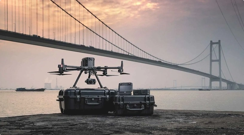
Bridges take the opposite approach, relying on external flight paths beneath decks and around piers, which our earlier piece on bridge inspection with drones works through in structural detail. The four gates still apply to both asset types, but the payload configuration and flight envelope shift to match the operating environment.
The Oud Metha and Al Asayel openings are one phase of a longer corridor programme, and every subsequent phase will produce the same inspection sequence on a similarly compressed timeline. Building the workflow around the four-gate framework now creates a repeatable pattern that scales as the corridor extends, letting the evidence base from each new structure serve as the reference for the next. The continuity runs backwards into the build phase as well, since the same repeatable aerial capture used for construction progress monitoring produces the pre-handover visual record that Gate One reconciles against, giving asset owners a single evidence chain from groundbreaking through operational service.
The four-gate framework turns the commissioning window from a scheduling constraint into a structured evidence capture programme, moving each asset through as-built verification, opening-day baseline capture, first-year defect detection, and finally into repeatable network-level condition tracking. For the RTA Oud Metha corridor and every follow-on phase of the Sheikh Rashid programme, treating the inspection cycle this way protects the reference dataset that all future maintenance and structural decisions will depend on.
Gulfnet Emirates supports UAE road authorities, contractors, and engineering consultants with GCAA-certified pilot teams, enterprise-grade aerial platforms, and structured inspection programmes designed around new corridor openings and lifecycle monitoring.
How soon after a bridge opens should the first inspection baseline be captured?
The opening-day window is optimal. Capturing the visual and thermal baseline within days of commissioning locks in a reference dataset before traffic loads begin altering surface conditions. Waiting weeks or months blurs the line between original construction features and early defects, weakening every subsequent condition assessment tied to that structure.
Can drone inspection work be carried out on live Dubai corridors without lane closures?
Yes. Aerial platforms launch from adjacent verges, service roads, or approved staging positions, capturing soffit, pier, and portal imagery from flight paths that do not occupy travel lanes. This removes the traffic management coordination that snooper trucks require and allows inspection cadences to run without contributing to the congestion the corridor was built to relieve.
What deliverables do road authorities receive from a corridor-scale drone inspection?
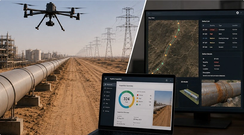
Standard outputs include geo-referenced orthomosaics, 3D point clouds of each structure, high-resolution annotated imagery of decks and piers, thermal profiles of joints and drainage, and severity-classified defect maps. All datasets are organised for repeat comparison across inspection cycles, supporting maintenance planning, structural engineering review, and long-term asset management reporting.
How often should a newly commissioned corridor asset be inspected during its first operating year?
For the first twelve months after opening, a quarterly aerial inspection cycle captures the defect signatures that emerge as traffic loads accumulate. This cadence is short enough to catch settlement, bearing displacement, and joint seal issues before they propagate, and practical enough to run across a multi-structure corridor without disrupting operations.
What qualifications should a drone inspection provider hold for RTA-adjacent corridor work?
Providers should hold GCAA operator authorisation, pilots with valid remote pilot licences, and site-specific competence covering DCAA airspace and RTA coordination protocols. Enterprise-grade platforms with redundant flight systems, structured data delivery through a project imagery library, and demonstrable infrastructure inspection experience across UAE corridor projects form the operational baseline.

 Go back